Spring Valley is a home rule-class city in Jefferson County, Kentucky, United States. Spring Valley Estates, begun in 1964, remained an unincorporated area until September, 1983. At that time, the City of Spring Valley was established to provide services. The current mayor is Gerri Willis. The population was 654 at the 2010 census. Population has increased to 837 based on the 2020 census.
| Name: | Spring Valley city |
|---|---|
| LSAD Code: | 25 |
| LSAD Description: | city (suffix) |
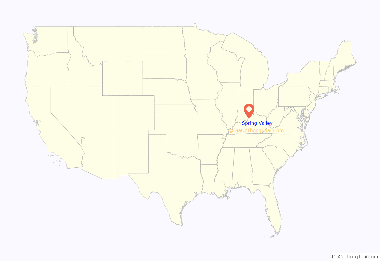
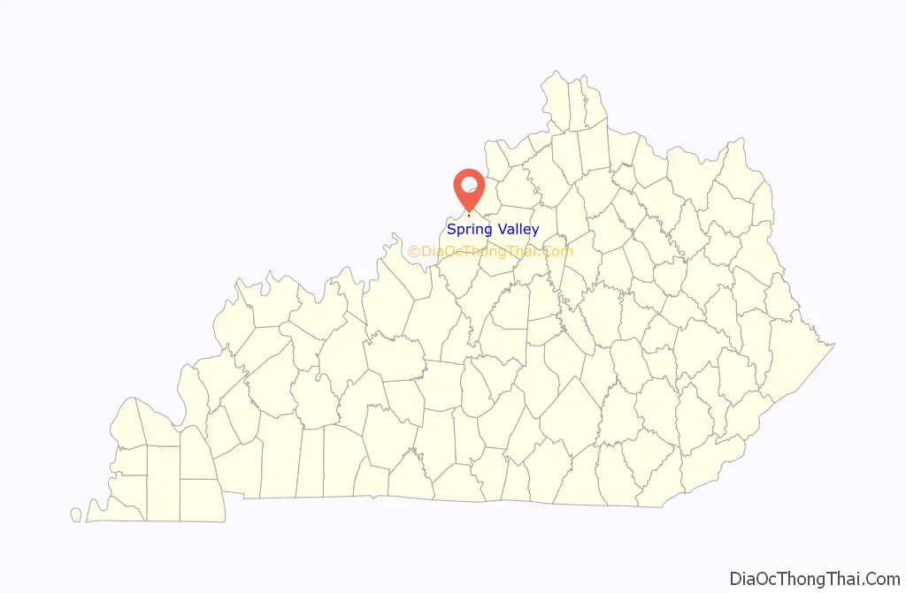
| State: | Kentucky |
| County: | Jefferson County |
| Elevation: | 620 ft (190 m) |
| Total Area: | 0.20 sq mi (0.51 km²) |
| Land Area: | 0.20 sq mi (0.51 km²) |
| Water Area: | 0.00 sq mi (0.00 km²) |
| Total Population: | 675 |
| Population Density: | 3,409.09/sq mi (1,318.90/km²) |
| ZIP code: | 40241 |
| FIPS code: | 2172790 |
| GNISfeature ID: | 1669521 |
Online Interactive Map
Click on ![]() to view map in "full screen" mode.
to view map in "full screen" mode.
Spring Valley location map. Where is Spring Valley city?
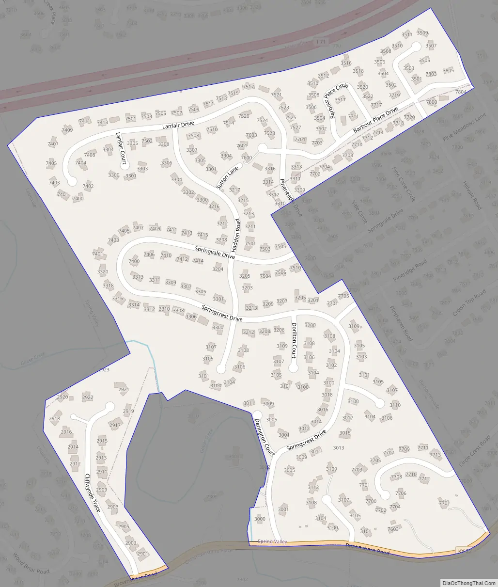
Spring Valley Road Map
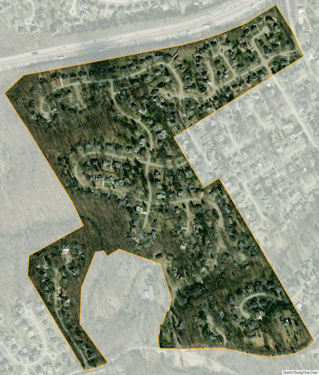
Spring Valley city Satellite Map
Geography
Spring Valley is located in northeastern Jefferson County at 38°17′49″N 85°36′36″W / 38.29694°N 85.61000°W / 38.29694; -85.61000 (38.297046, -85.609951). It is bordered to the east by Barbourmeade, to the south by Old Brownsboro Place, and otherwise by consolidated Louisville/Jefferson County. Brownsboro Road (Kentucky Route 22) forms the southern boundary of the city. Downtown Louisville is 9 miles (14 km) to the southwest.
According to the United States Census Bureau, Spring Valley has a total area of 0.20 square miles (0.51 km), of which 0.5 acres (1,863 m), or 0.36%, are water.
See also
Map of Kentucky State and its subdivision:- Adair
- Allen
- Anderson
- Ballard
- Barren
- Bath
- Bell
- Boone
- Bourbon
- Boyd
- Boyle
- Bracken
- Breathitt
- Breckinridge
- Bullitt
- Butler
- Caldwell
- Calloway
- Campbell
- Carlisle
- Carroll
- Carter
- Casey
- Christian
- Clark
- Clay
- Clinton
- Crittenden
- Cumberland
- Daviess
- Edmonson
- Elliott
- Estill
- Fayette
- Fleming
- Floyd
- Franklin
- Fulton
- Gallatin
- Garrard
- Grant
- Graves
- Grayson
- Green
- Greenup
- Hancock
- Hardin
- Harlan
- Harrison
- Hart
- Henderson
- Henry
- Hickman
- Hopkins
- Jackson
- Jefferson
- Jessamine
- Johnson
- Kenton
- Knott
- Knox
- Larue
- Laurel
- Lawrence
- Lee
- Leslie
- Letcher
- Lewis
- Lincoln
- Livingston
- Logan
- Lyon
- Madison
- Magoffin
- Marion
- Marshall
- Martin
- Mason
- McCracken
- McCreary
- McLean
- Meade
- Menifee
- Mercer
- Metcalfe
- Monroe
- Montgomery
- Morgan
- Muhlenberg
- Nelson
- Nicholas
- Ohio
- Oldham
- Owen
- Owsley
- Pendleton
- Perry
- Pike
- Powell
- Pulaski
- Robertson
- Rockcastle
- Rowan
- Russell
- Scott
- Shelby
- Simpson
- Spencer
- Taylor
- Todd
- Trigg
- Trimble
- Union
- Warren
- Washington
- Wayne
- Webster
- Whitley
- Wolfe
- Woodford
- Alabama
- Alaska
- Arizona
- Arkansas
- California
- Colorado
- Connecticut
- Delaware
- District of Columbia
- Florida
- Georgia
- Hawaii
- Idaho
- Illinois
- Indiana
- Iowa
- Kansas
- Kentucky
- Louisiana
- Maine
- Maryland
- Massachusetts
- Michigan
- Minnesota
- Mississippi
- Missouri
- Montana
- Nebraska
- Nevada
- New Hampshire
- New Jersey
- New Mexico
- New York
- North Carolina
- North Dakota
- Ohio
- Oklahoma
- Oregon
- Pennsylvania
- Rhode Island
- South Carolina
- South Dakota
- Tennessee
- Texas
- Utah
- Vermont
- Virginia
- Washington
- West Virginia
- Wisconsin
- Wyoming


