Cochran is a city in Bleckley County, Georgia, United States. As of the 2020 census, the city had a population of 5,026. The city is the county seat of Bleckley County.
Cochran is named for Judge Arthur E. Cochran and was incorporated on March 19, 1869. Judge Cochran was largely instrumental in developing this section of Georgia through his work as president of the Macon and Brunswick Railroad, now the Southern Railway (a component of Norfolk Southern Railway). Once known as Dykesboro, Cochran was settled by B. B. Dykes, who owned the site on which the town is built. The earliest settlers located here to work in the turpentine industry.
Cochran is home to Bleckley County High School and Middle Georgia State University. Three properties in Cochran are listed on the National Register of Historic Places: the Bleckley County Courthouse in Courthouse Square, the Cochran Municipal Building and School at the junction of Dykes and Second streets, and Hillcrest at 706 Beech Street.
| Name: | Cochran city |
|---|---|
| LSAD Code: | 25 |
| LSAD Description: | city (suffix) |
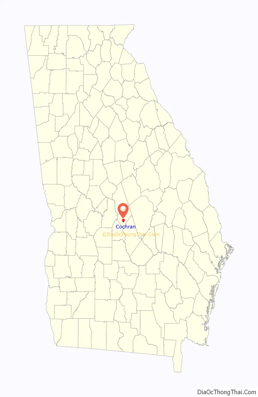
| State: | Georgia |
| County: | Bleckley County |
| Elevation: | 341 ft (104 m) |
| Total Area: | 4.86 sq mi (12.58 km²) |
| Land Area: | 4.69 sq mi (12.14 km²) |
| Water Area: | 0.17 sq mi (0.44 km²) |
| Total Population: | 5,026 |
| Population Density: | 1,072.56/sq mi (414.16/km²) |
| ZIP code: | 31014 |
| Area code: | 478 |
| FIPS code: | 1317328 |
| GNISfeature ID: | 0355210 |
| Website: | www.cityofcochran.com |
Online Interactive Map
Click on ![]() to view map in "full screen" mode.
to view map in "full screen" mode.
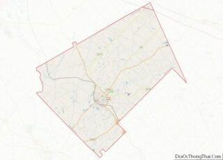
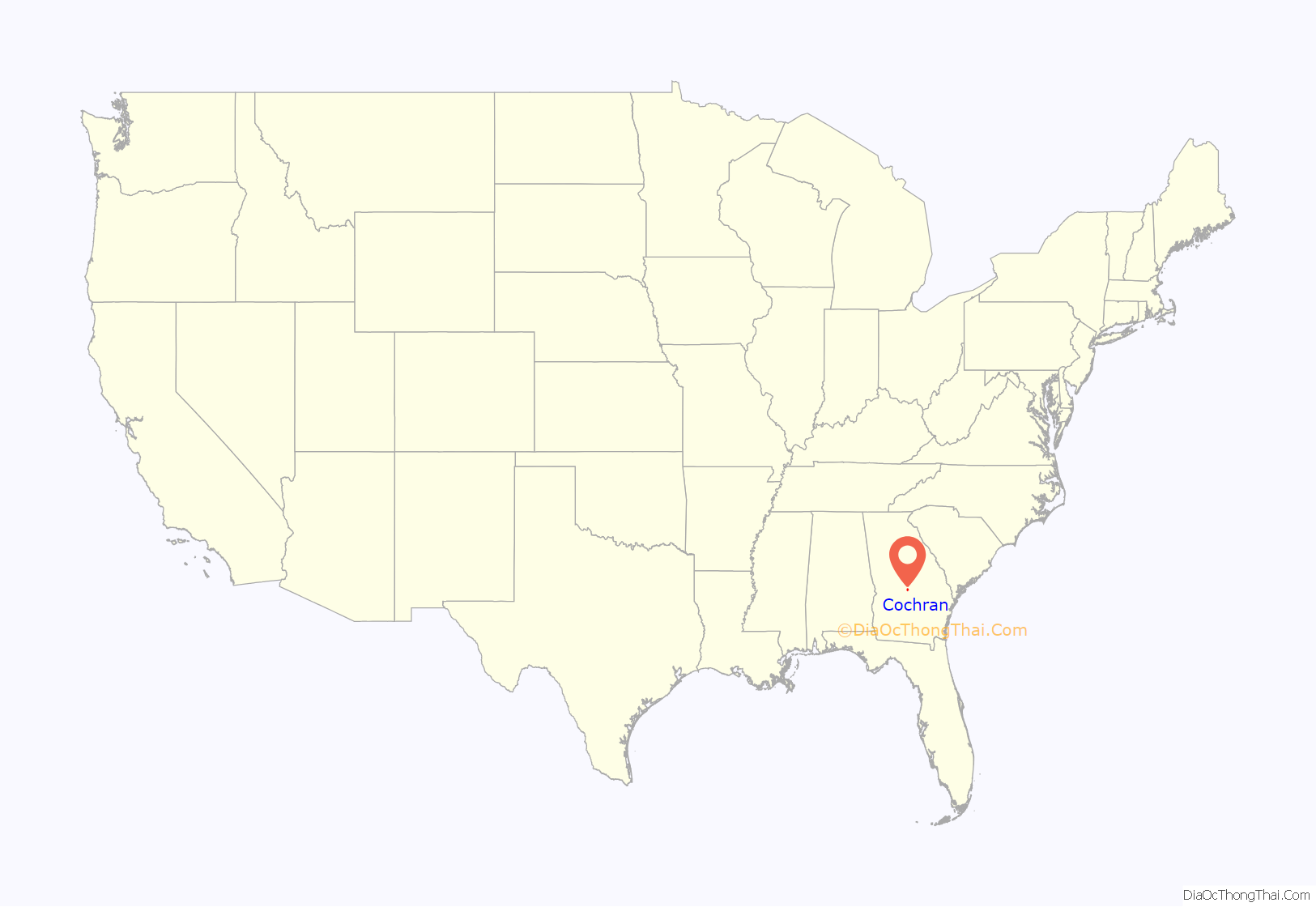
Cochran location map. Where is Cochran city?
History
Cochran, originally known as Dykesboro, was settled in the 1850s by B. B. Dykes. It was renamed Cochran in 1869 after Arthur Cochran, a railroad official who brought the Macon and Brunswick Railroad to town. In 1912, Cochran was designated seat of the newly formed Bleckley County.
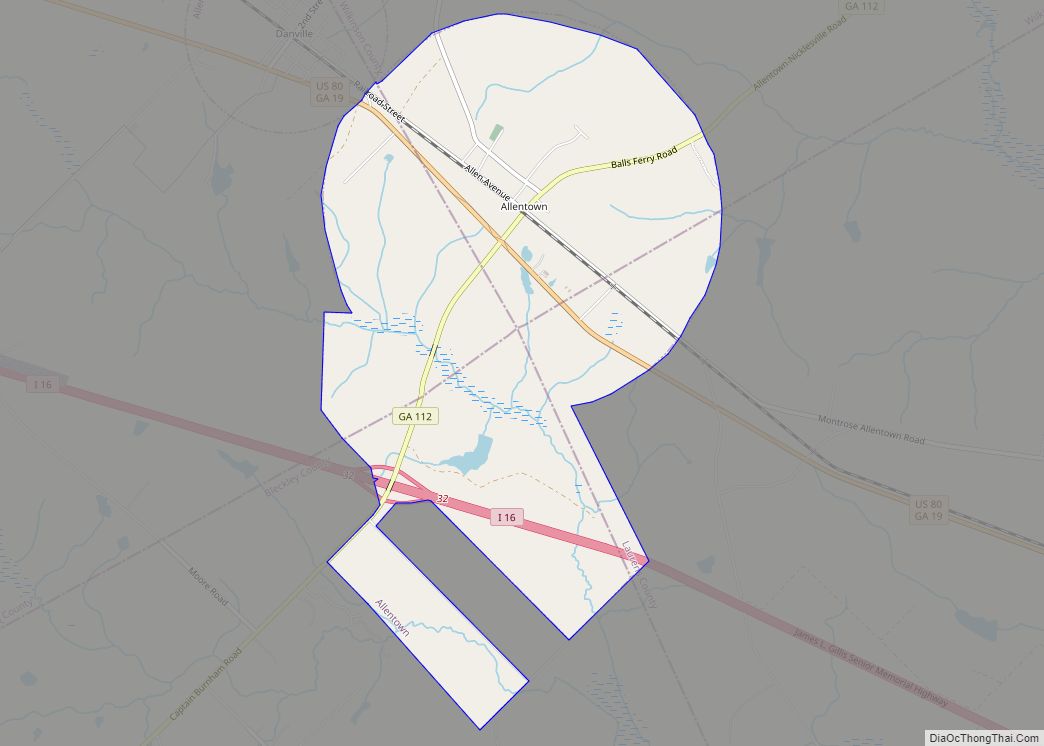
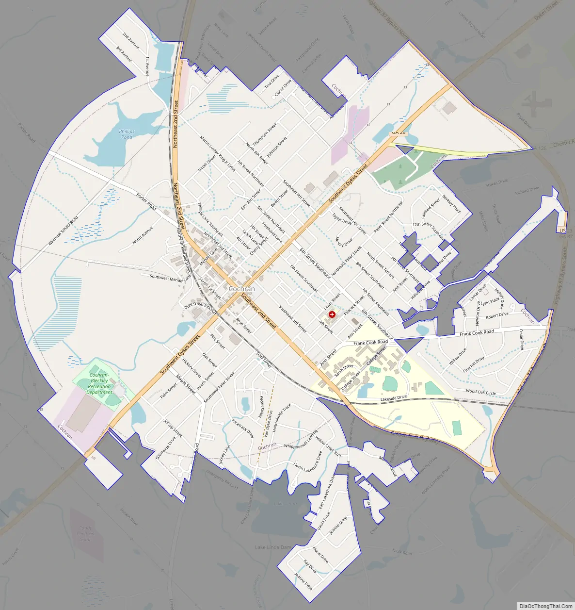
Cochran Road Map
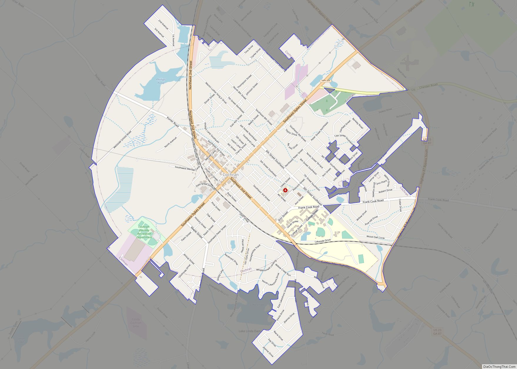
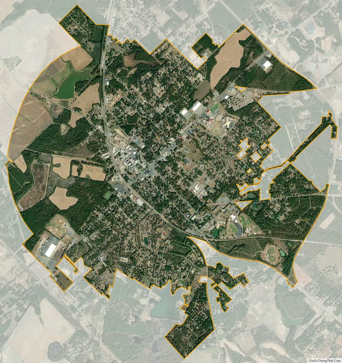
Cochran city Satellite Map
Geography
Cochran is located at 32°23′12″N 83°21′2″W / 32.38667°N 83.35056°W / 32.38667; -83.35056 (32.386646, -83.350684).
The city is located in the central part of the state along U.S. Route 23, which runs from southeast to northwest to the northeast of downtown, leading northwest 40 mi (64 km) to Macon and southeast 18 mi (29 km) to Eastman. Georgia State Route 26 runs from southwest to northeast through the center of the city, leading northeast 21 mi (34 km) to Dudley (after meeting U.S. Route 80), and southwest 11 mi (18 km) to Hawkinsville, concurrent with U.S. Route 129 Alternate.
According to the United States Census Bureau, the city has a total area of 4.7 square miles (12.3 km), of which 4.6 square miles (11.9 km) is land and 0.15 square miles (0.4 km), or 3.63%, is water.
See also
Map of Georgia State and its subdivision:- Appling
- Atkinson
- Bacon
- Baker
- Baldwin
- Banks
- Barrow
- Bartow
- Ben Hill
- Berrien
- Bibb
- Bleckley
- Brantley
- Brooks
- Bryan
- Bulloch
- Burke
- Butts
- Calhoun
- Camden
- Candler
- Carroll
- Catoosa
- Charlton
- Chatham
- Chattahoochee
- Chattooga
- Cherokee
- Clarke
- Clay
- Clayton
- Clinch
- Cobb
- Coffee
- Colquitt
- Columbia
- Cook
- Coweta
- Crawford
- Crisp
- Dade
- Dawson
- Decatur
- DeKalb
- Dodge
- Dooly
- Dougherty
- Douglas
- Early
- Echols
- Effingham
- Elbert
- Emanuel
- Evans
- Fannin
- Fayette
- Floyd
- Forsyth
- Franklin
- Fulton
- Gilmer
- Glascock
- Glynn
- Gordon
- Grady
- Greene
- Gwinnett
- Habersham
- Hall
- Hancock
- Haralson
- Harris
- Hart
- Heard
- Henry
- Houston
- Irwin
- Jackson
- Jasper
- Jeff Davis
- Jefferson
- Jenkins
- Johnson
- Jones
- Lamar
- Lanier
- Laurens
- Lee
- Liberty
- Lincoln
- Long
- Lowndes
- Lumpkin
- Macon
- Madison
- Marion
- McDuffie
- McIntosh
- Meriwether
- Miller
- Mitchell
- Monroe
- Montgomery
- Morgan
- Murray
- Muscogee
- Newton
- Oconee
- Oglethorpe
- Paulding
- Peach
- Pickens
- Pierce
- Pike
- Polk
- Pulaski
- Putnam
- Quitman
- Rabun
- Randolph
- Richmond
- Rockdale
- Schley
- Screven
- Seminole
- Spalding
- Stephens
- Stewart
- Sumter
- Talbot
- Taliaferro
- Tattnall
- Taylor
- Telfair
- Terrell
- Thomas
- Tift
- Toombs
- Towns
- Treutlen
- Troup
- Turner
- Twiggs
- Union
- Upson
- Walker
- Walton
- Ware
- Warren
- Washington
- Wayne
- Webster
- Wheeler
- White
- Whitfield
- Wilcox
- Wilkes
- Wilkinson
- Worth
- Alabama
- Alaska
- Arizona
- Arkansas
- California
- Colorado
- Connecticut
- Delaware
- District of Columbia
- Florida
- Georgia
- Hawaii
- Idaho
- Illinois
- Indiana
- Iowa
- Kansas
- Kentucky
- Louisiana
- Maine
- Maryland
- Massachusetts
- Michigan
- Minnesota
- Mississippi
- Missouri
- Montana
- Nebraska
- Nevada
- New Hampshire
- New Jersey
- New Mexico
- New York
- North Carolina
- North Dakota
- Ohio
- Oklahoma
- Oregon
- Pennsylvania
- Rhode Island
- South Carolina
- South Dakota
- Tennessee
- Texas
- Utah
- Vermont
- Virginia
- Washington
- West Virginia
- Wisconsin
- Wyoming