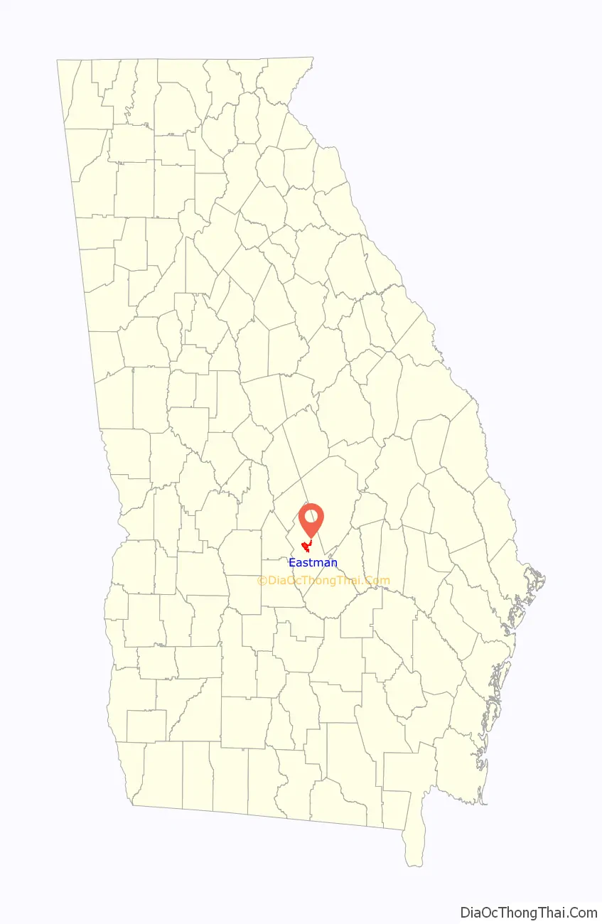
Eastman is a city in Dodge County, Georgia, United States. The population was 4,962 at the 2010 census. The city was named after William Pitt Eastman, a native of Massachusetts who purchased a large tract of land along the Macon to Brunswick Railroad, and settled a city on the site.
In the 19th century, this was a center of the timber and sawmill industry. During the Great Depression in 1937, the first Stuckey’s Pecan Shoppe, once well-known along roadways throughout the United States, was founded in Eastman.
| Name: | Eastman city |
|---|---|
| LSAD Code: | 25 |
| LSAD Description: | city (suffix) |
| State: | Georgia |
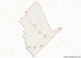
| County: | Dodge County |
| Elevation: | 390 ft (119 m) |
| Total Area: | 6.53 sq mi (16.90 km²) |
| Land Area: | 6.47 sq mi (16.75 km²) |
| Water Area: | 0.06 sq mi (0.16 km²) |
| Total Population: | 5,658 |
| Population Density: | 875.04/sq mi (337.84/km²) |
| ZIP code: | 31023 |
| Area code: | 478 |
| FIPS code: | 1325552 |
| GNISfeature ID: | 0355610 |
| Website: | cityofeastman.com |
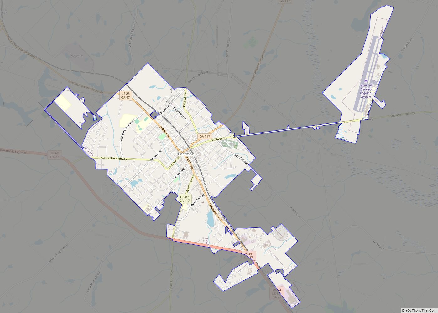
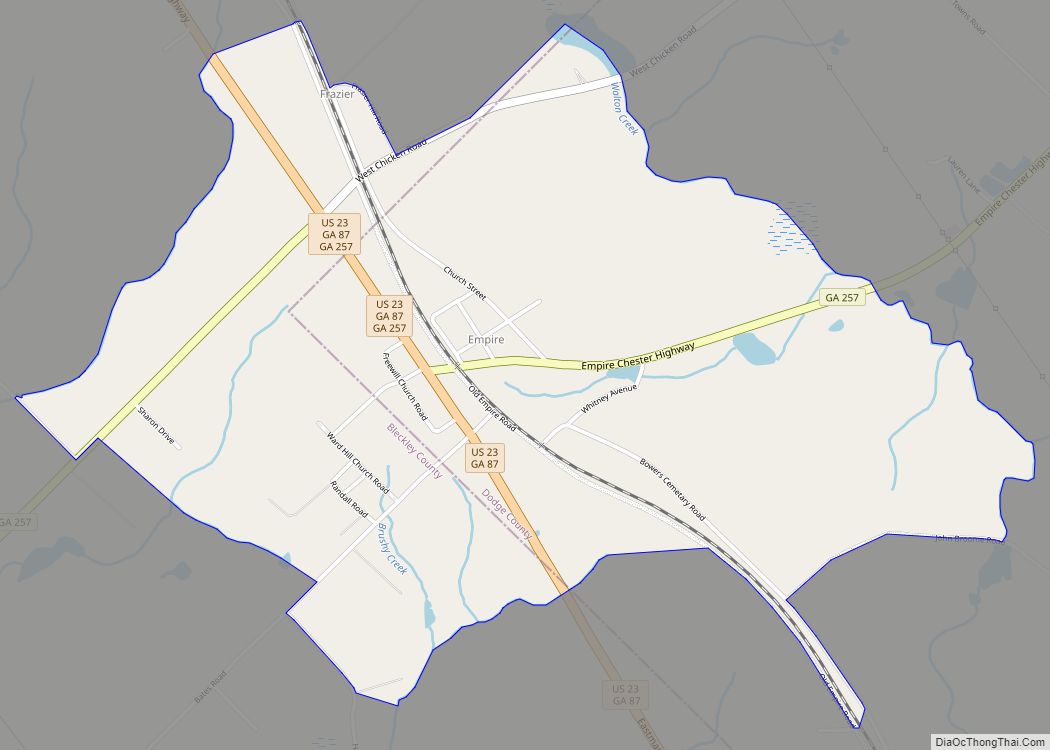
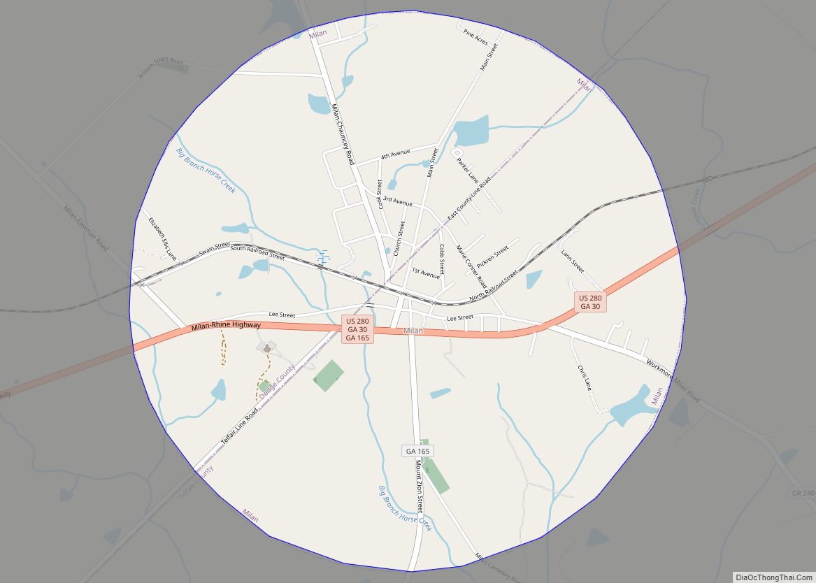
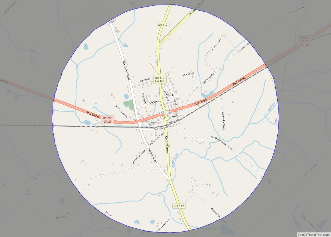
Online Interactive Map
Click on ![]() to view map in "full screen" mode.
to view map in "full screen" mode.
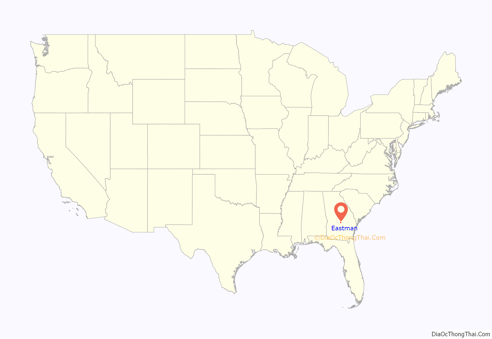
Eastman location map. Where is Eastman city?
History
The first permanent settlement of the area took place in 1840. The population continued to grow when, in 1869, a station was built for the newly constructed Macon and Brunswick Railroad which passed through the area, stimulating an economic boom. The settlement was originally named Levison and was renamed Eastman by December 1869. Eastman was designated as the seat of newly formed Dodge County in 1871. It was incorporated as a town in 1873 and as a city in 1905. Eastman is named for W. P. Eastman, who, with W. E. Dodge, presented the county with a courthouse.
During that same time period, Ira Roe Foster, former Quartermaster General of Georgia, operated a sawmill in Dodge County. In 1869, Foster built a residence in what would become Eastman. Foster was one of many who came to the area to participate in the timber and sawmill boom.
During the boom, it was estimated that, on average, there was one mill every two miles along the industrial corridor created by the Macon and Brunswick Railroad. Unlike earlier eras, when timber was transported downstream in large river rafts, sawmills along the industrial corridor shipped their timber by rail. In his book The New South Comes to Wiregrass Georgia 1860-1910, author Mark V. Wetherington states: “Ira R. Foster shipped lumber to Brunswick, where it was loaded onto timber schooners and transported to international markets like Liverpool, Rio de Janeiro, and Havana.” When Eastman was incorporated in 1872, Foster served as its first mayor.
In the early years of the 20th century, racial tensions increased between the white and black communities in and about Eastman, resulting in a number of documented lynchings. In one instance, a man misidentified as the rapist Ed Claus was murdered before the real Claus was identified, apprehended, and lynched. In 1919, rumors that local blacks were intending to rise up and exterminate white residents, led to the murder of Eli Cooper and the burning of several black churches, which were believed to be the focal point of the uprising.
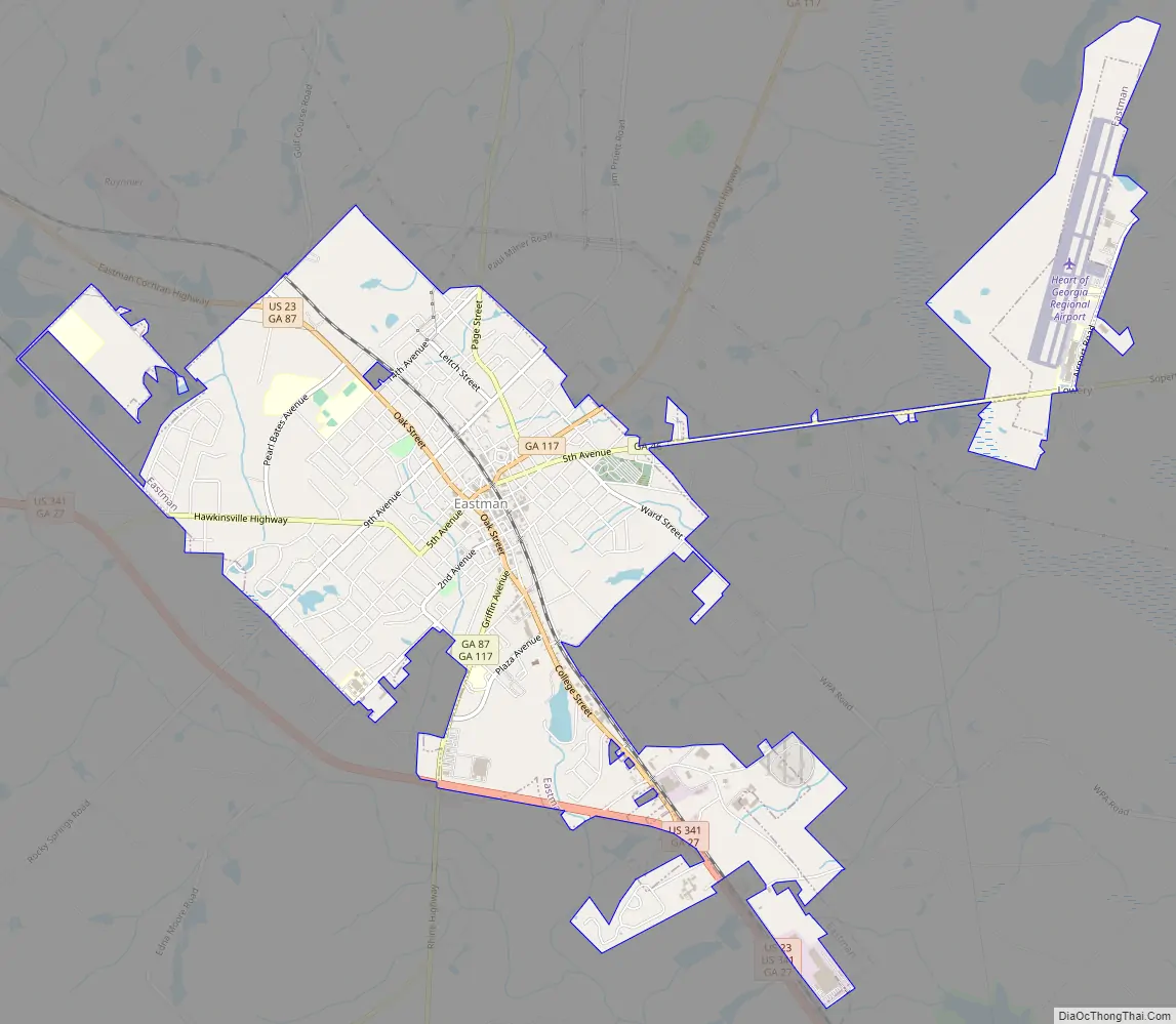
Eastman Road Map
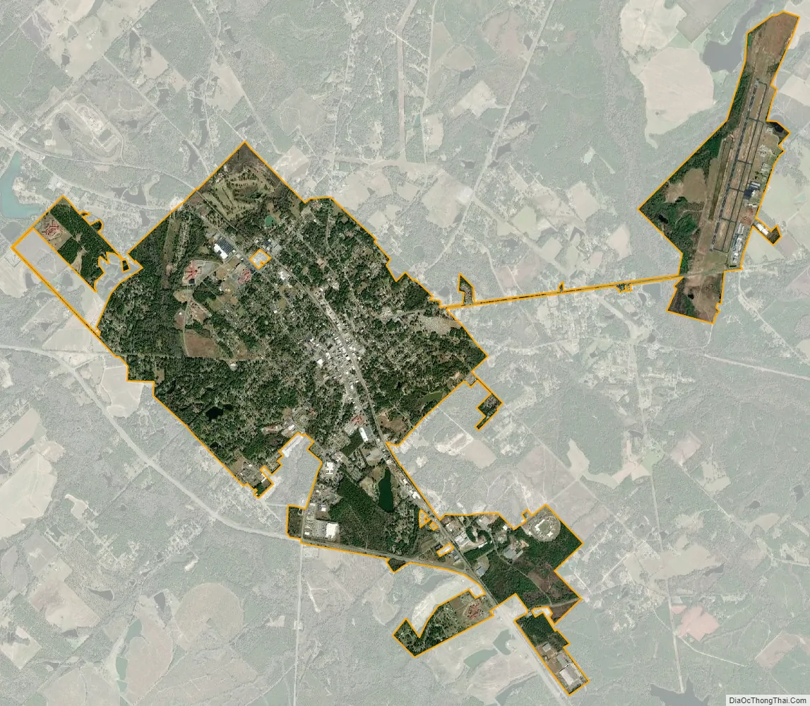
Eastman city Satellite Map
Geography
Eastman is located in the center of Dodge County at 32°11′52″N 83°10′45″W / 32.19778°N 83.17917°W / 32.19778; -83.17917 (32.197760, -83.179271). U.S. Route 23 passes through the center of town, leading northwest 17 miles (27 km) to Cochran and southeast 20 miles (32 km) to McRae-Helena. U.S. Route 341 bypasses the city on the southwest, leading west 20 miles (32 km) to Hawkinsville and southeast with US 23 to McRae-Helena. Sugar Creek runs to the southwest of the city.
According to the United States Census Bureau, Eastman has a total area of 5.5 square miles (14.2 km), of which 5.4 square miles (14.0 km) is land and 0.04 square miles (0.1 km), or 0.93%, is water.
See also
Map of Georgia State and its subdivision:- Appling
- Atkinson
- Bacon
- Baker
- Baldwin
- Banks
- Barrow
- Bartow
- Ben Hill
- Berrien
- Bibb
- Bleckley
- Brantley
- Brooks
- Bryan
- Bulloch
- Burke
- Butts
- Calhoun
- Camden
- Candler
- Carroll
- Catoosa
- Charlton
- Chatham
- Chattahoochee
- Chattooga
- Cherokee
- Clarke
- Clay
- Clayton
- Clinch
- Cobb
- Coffee
- Colquitt
- Columbia
- Cook
- Coweta
- Crawford
- Crisp
- Dade
- Dawson
- Decatur
- DeKalb
- Dodge
- Dooly
- Dougherty
- Douglas
- Early
- Echols
- Effingham
- Elbert
- Emanuel
- Evans
- Fannin
- Fayette
- Floyd
- Forsyth
- Franklin
- Fulton
- Gilmer
- Glascock
- Glynn
- Gordon
- Grady
- Greene
- Gwinnett
- Habersham
- Hall
- Hancock
- Haralson
- Harris
- Hart
- Heard
- Henry
- Houston
- Irwin
- Jackson
- Jasper
- Jeff Davis
- Jefferson
- Jenkins
- Johnson
- Jones
- Lamar
- Lanier
- Laurens
- Lee
- Liberty
- Lincoln
- Long
- Lowndes
- Lumpkin
- Macon
- Madison
- Marion
- McDuffie
- McIntosh
- Meriwether
- Miller
- Mitchell
- Monroe
- Montgomery
- Morgan
- Murray
- Muscogee
- Newton
- Oconee
- Oglethorpe
- Paulding
- Peach
- Pickens
- Pierce
- Pike
- Polk
- Pulaski
- Putnam
- Quitman
- Rabun
- Randolph
- Richmond
- Rockdale
- Schley
- Screven
- Seminole
- Spalding
- Stephens
- Stewart
- Sumter
- Talbot
- Taliaferro
- Tattnall
- Taylor
- Telfair
- Terrell
- Thomas
- Tift
- Toombs
- Towns
- Treutlen
- Troup
- Turner
- Twiggs
- Union
- Upson
- Walker
- Walton
- Ware
- Warren
- Washington
- Wayne
- Webster
- Wheeler
- White
- Whitfield
- Wilcox
- Wilkes
- Wilkinson
- Worth
- Alabama
- Alaska
- Arizona
- Arkansas
- California
- Colorado
- Connecticut
- Delaware
- District of Columbia
- Florida
- Georgia
- Hawaii
- Idaho
- Illinois
- Indiana
- Iowa
- Kansas
- Kentucky
- Louisiana
- Maine
- Maryland
- Massachusetts
- Michigan
- Minnesota
- Mississippi
- Missouri
- Montana
- Nebraska
- Nevada
- New Hampshire
- New Jersey
- New Mexico
- New York
- North Carolina
- North Dakota
- Ohio
- Oklahoma
- Oregon
- Pennsylvania
- Rhode Island
- South Carolina
- South Dakota
- Tennessee
- Texas
- Utah
- Vermont
- Virginia
- Washington
- West Virginia
- Wisconsin
- Wyoming