Jasper is a city in Pickens County, Georgia, United States. The population was 3,684 at the 2010 census. The city is the county seat of Pickens County.
| Name: | Jasper city |
|---|---|
| LSAD Code: | 25 |
| LSAD Description: | city (suffix) |
| State: | Georgia |
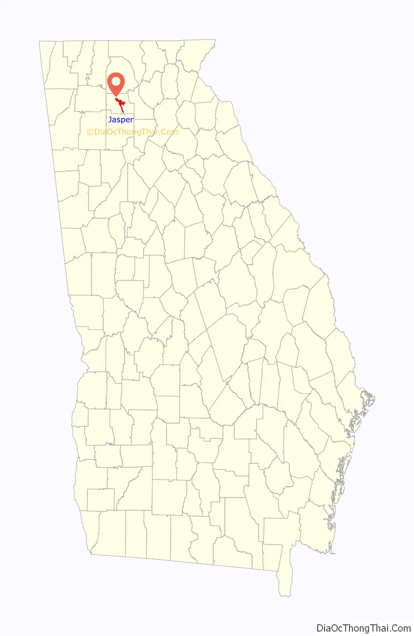
| County: | Pickens County |
| Elevation: | 1,463 ft (446 m) |
| Total Area: | 8.56 sq mi (22.16 km²) |
| Land Area: | 8.56 sq mi (22.16 km²) |
| Water Area: | 0.00 sq mi (0.00 km²) |
| Total Population: | 4,084 |
| Population Density: | 477.27/sq mi (184.28/km²) |
| ZIP code: | 30143 |
| Area code: | 706 |
| FIPS code: | 1341932 |
| GNISfeature ID: | 0316056 |
| Website: | www.jasper-ga.us |
Online Interactive Map
Click on ![]() to view map in "full screen" mode.
to view map in "full screen" mode.
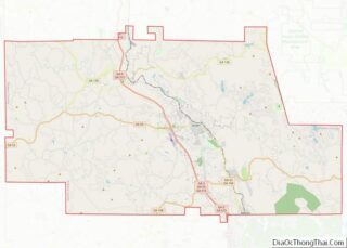
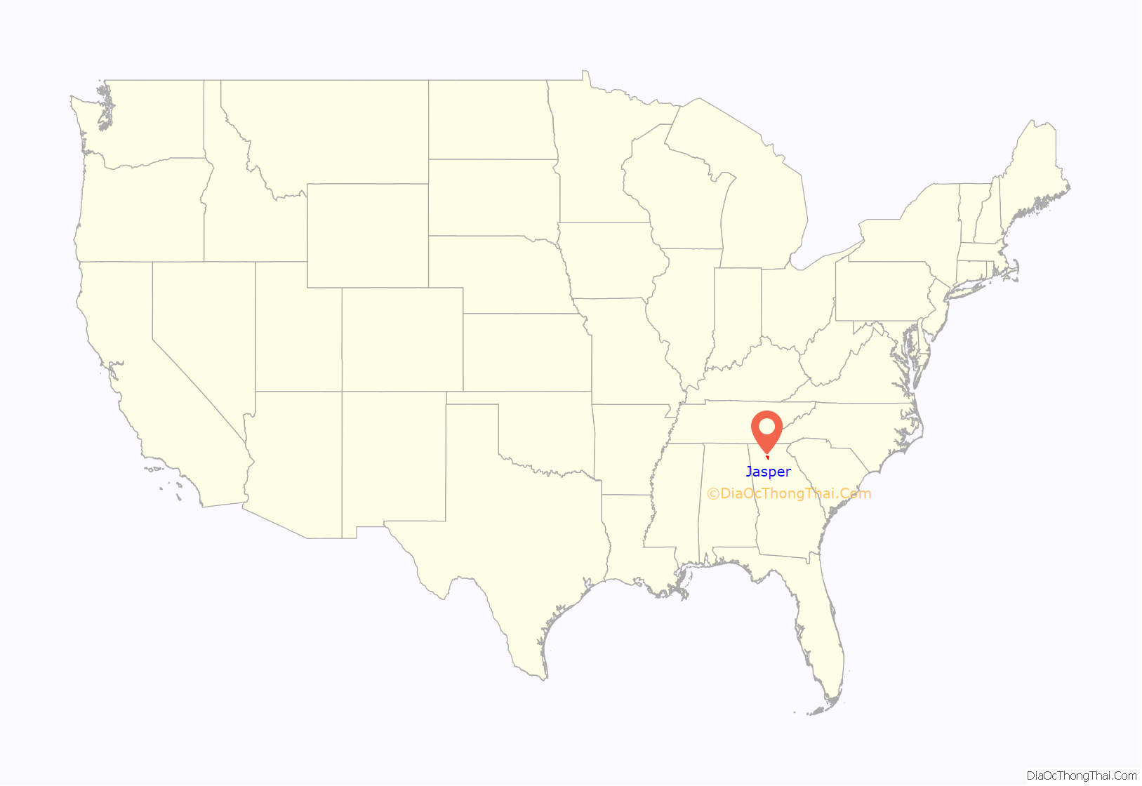
Jasper location map. Where is Jasper city?
History
Jasper was founded in 1853 as seat of the newly formed Pickens County. It was incorporated in 1857 as a town and in 1957 as a city. The community is named for William Jasper, a hero of the American Revolutionary War. Jasper is situated at an elevation of 1,463 feet (446 m).
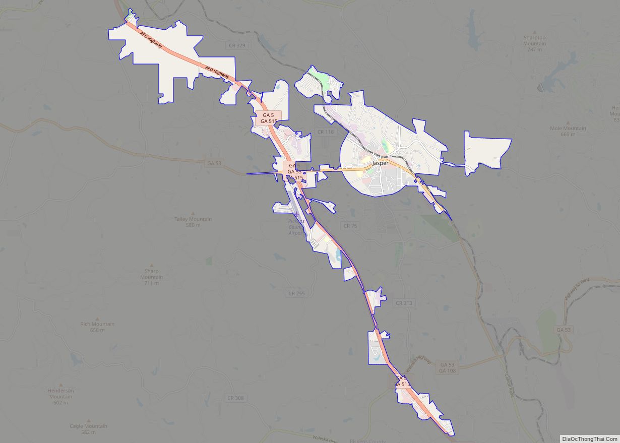
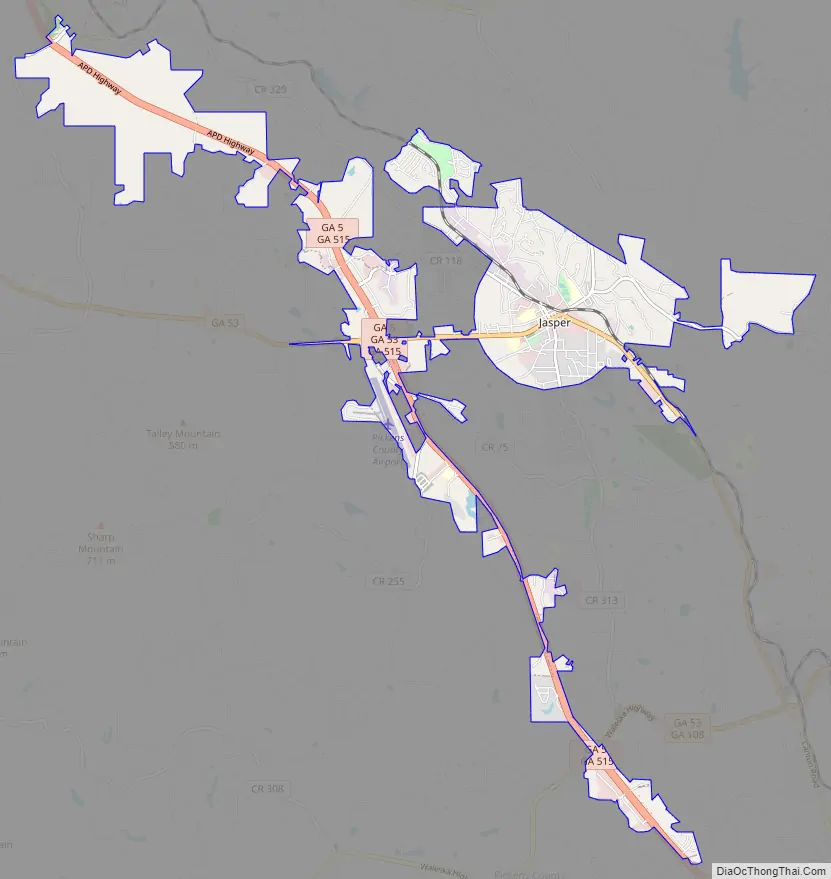
Jasper Road Map
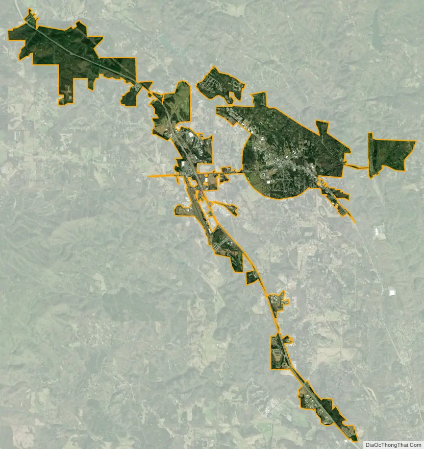
Jasper city Satellite Map
Geography
Jasper is located at 34°28′9″N 84°26′3″W / 34.46917°N 84.43417°W / 34.46917; -84.43417 (34.469127, -84.434039).
Georgia State Route 53 passes through the center of Jasper, while Georgia State Routes 5 and 515 bypass the city to its west. GA-5/515 lead north 21 mi (34 km) to Ellijay and south 60 mi (97 km) to Atlanta, via its connection with Interstate 575, which ends just south of the city. GA-53 runs through the downtown area as an east–west highway, leading east 24 mi (39 km) on a winding and mountainous route to Dawsonville, and west 36 mi (58 km) to Calhoun along Interstate 75.
According to the United States Census Bureau, the city has a total area of 3.3 square miles (8.5 km), all of it land.
See also
Map of Georgia State and its subdivision:- Appling
- Atkinson
- Bacon
- Baker
- Baldwin
- Banks
- Barrow
- Bartow
- Ben Hill
- Berrien
- Bibb
- Bleckley
- Brantley
- Brooks
- Bryan
- Bulloch
- Burke
- Butts
- Calhoun
- Camden
- Candler
- Carroll
- Catoosa
- Charlton
- Chatham
- Chattahoochee
- Chattooga
- Cherokee
- Clarke
- Clay
- Clayton
- Clinch
- Cobb
- Coffee
- Colquitt
- Columbia
- Cook
- Coweta
- Crawford
- Crisp
- Dade
- Dawson
- Decatur
- DeKalb
- Dodge
- Dooly
- Dougherty
- Douglas
- Early
- Echols
- Effingham
- Elbert
- Emanuel
- Evans
- Fannin
- Fayette
- Floyd
- Forsyth
- Franklin
- Fulton
- Gilmer
- Glascock
- Glynn
- Gordon
- Grady
- Greene
- Gwinnett
- Habersham
- Hall
- Hancock
- Haralson
- Harris
- Hart
- Heard
- Henry
- Houston
- Irwin
- Jackson
- Jasper
- Jeff Davis
- Jefferson
- Jenkins
- Johnson
- Jones
- Lamar
- Lanier
- Laurens
- Lee
- Liberty
- Lincoln
- Long
- Lowndes
- Lumpkin
- Macon
- Madison
- Marion
- McDuffie
- McIntosh
- Meriwether
- Miller
- Mitchell
- Monroe
- Montgomery
- Morgan
- Murray
- Muscogee
- Newton
- Oconee
- Oglethorpe
- Paulding
- Peach
- Pickens
- Pierce
- Pike
- Polk
- Pulaski
- Putnam
- Quitman
- Rabun
- Randolph
- Richmond
- Rockdale
- Schley
- Screven
- Seminole
- Spalding
- Stephens
- Stewart
- Sumter
- Talbot
- Taliaferro
- Tattnall
- Taylor
- Telfair
- Terrell
- Thomas
- Tift
- Toombs
- Towns
- Treutlen
- Troup
- Turner
- Twiggs
- Union
- Upson
- Walker
- Walton
- Ware
- Warren
- Washington
- Wayne
- Webster
- Wheeler
- White
- Whitfield
- Wilcox
- Wilkes
- Wilkinson
- Worth
- Alabama
- Alaska
- Arizona
- Arkansas
- California
- Colorado
- Connecticut
- Delaware
- District of Columbia
- Florida
- Georgia
- Hawaii
- Idaho
- Illinois
- Indiana
- Iowa
- Kansas
- Kentucky
- Louisiana
- Maine
- Maryland
- Massachusetts
- Michigan
- Minnesota
- Mississippi
- Missouri
- Montana
- Nebraska
- Nevada
- New Hampshire
- New Jersey
- New Mexico
- New York
- North Carolina
- North Dakota
- Ohio
- Oklahoma
- Oregon
- Pennsylvania
- Rhode Island
- South Carolina
- South Dakota
- Tennessee
- Texas
- Utah
- Vermont
- Virginia
- Washington
- West Virginia
- Wisconsin
- Wyoming