Dawsonville is a city in and the county seat of Dawson County, Georgia, United States. The population was 2,536 at the 2010 census, up from 619 in 2000.
Dawsonville is included in the Atlanta-Sandy Springs-Roswell, GA Metropolitan Statistical Area.
| Name: | Dawsonville city |
|---|---|
| LSAD Code: | 25 |
| LSAD Description: | city (suffix) |
| State: | Georgia |
| County: | Dawson County |
| Elevation: | 1,365 ft (416 m) |
| Total Area: | 8.61 sq mi (22.31 km²) |
| Land Area: | 8.59 sq mi (22.25 km²) |
| Water Area: | 0.02 sq mi (0.06 km²) |
| Total Population: | 3,720 |
| Population Density: | 433.01/sq mi (167.19/km²) |
| ZIP code: | 30534 |
| Area code: | 706 |
| FIPS code: | 1321940 |
| GNISfeature ID: | 0331529 |
| Website: | www.dawsonville-ga.gov |
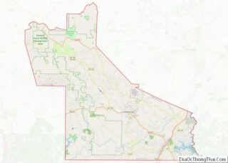
Online Interactive Map
Click on ![]() to view map in "full screen" mode.
to view map in "full screen" mode.
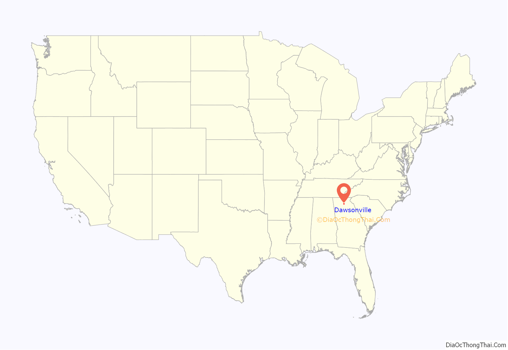
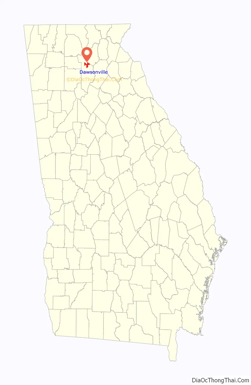
Dawsonville location map. Where is Dawsonville city?
History
Dawsonville was founded in 1857 as seat of the newly formed Dawson County. It was incorporated as a town in 1859 and as a city in 1952. The community and the county are named for state senator William Crosby Dawson.
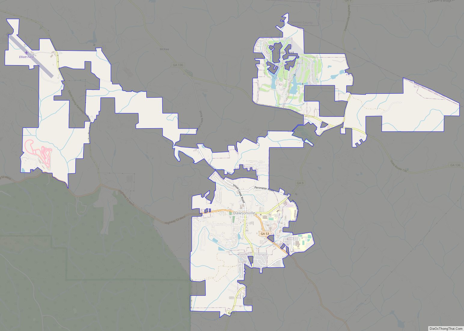
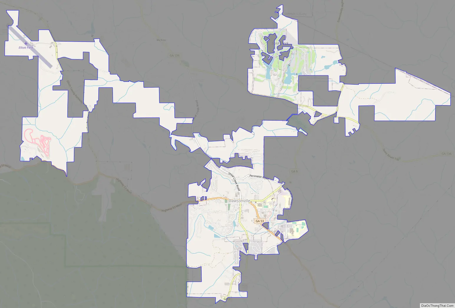
Dawsonville Road Map
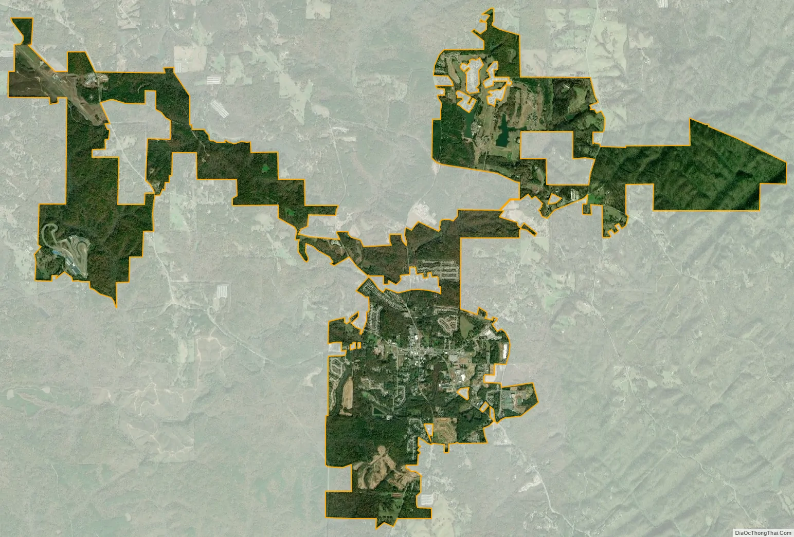
Dawsonville city Satellite Map
Geography
Dawsonville is located at 34°25′N 84°7′W.
According to the United States Census Bureau, the city has a total area of 8.2 square miles (21.3 km), of which 0.02 square miles (0.05 km), or 0.26%, is water.
The community is at the junction of State Routes 9, 53, and 136. SR 9 leads northeast 14 miles (23 km) to Dahlonega and south 17 miles (27 km) to Cumming, while SR 53 leads southeast 6 miles (10 km) to U.S. Route 19 and west 24 miles (39 km) to Jasper. SR 136 also leads to Jasper, on a 29-mile (47 km) route that runs further to the north through the southern end of the Blue Ridge Mountains.
Amicalola Falls, 15 miles (24 km) north of the center of Dawsonville, is one of the seven natural wonders of Georgia.
See also
Map of Georgia State and its subdivision:- Appling
- Atkinson
- Bacon
- Baker
- Baldwin
- Banks
- Barrow
- Bartow
- Ben Hill
- Berrien
- Bibb
- Bleckley
- Brantley
- Brooks
- Bryan
- Bulloch
- Burke
- Butts
- Calhoun
- Camden
- Candler
- Carroll
- Catoosa
- Charlton
- Chatham
- Chattahoochee
- Chattooga
- Cherokee
- Clarke
- Clay
- Clayton
- Clinch
- Cobb
- Coffee
- Colquitt
- Columbia
- Cook
- Coweta
- Crawford
- Crisp
- Dade
- Dawson
- Decatur
- DeKalb
- Dodge
- Dooly
- Dougherty
- Douglas
- Early
- Echols
- Effingham
- Elbert
- Emanuel
- Evans
- Fannin
- Fayette
- Floyd
- Forsyth
- Franklin
- Fulton
- Gilmer
- Glascock
- Glynn
- Gordon
- Grady
- Greene
- Gwinnett
- Habersham
- Hall
- Hancock
- Haralson
- Harris
- Hart
- Heard
- Henry
- Houston
- Irwin
- Jackson
- Jasper
- Jeff Davis
- Jefferson
- Jenkins
- Johnson
- Jones
- Lamar
- Lanier
- Laurens
- Lee
- Liberty
- Lincoln
- Long
- Lowndes
- Lumpkin
- Macon
- Madison
- Marion
- McDuffie
- McIntosh
- Meriwether
- Miller
- Mitchell
- Monroe
- Montgomery
- Morgan
- Murray
- Muscogee
- Newton
- Oconee
- Oglethorpe
- Paulding
- Peach
- Pickens
- Pierce
- Pike
- Polk
- Pulaski
- Putnam
- Quitman
- Rabun
- Randolph
- Richmond
- Rockdale
- Schley
- Screven
- Seminole
- Spalding
- Stephens
- Stewart
- Sumter
- Talbot
- Taliaferro
- Tattnall
- Taylor
- Telfair
- Terrell
- Thomas
- Tift
- Toombs
- Towns
- Treutlen
- Troup
- Turner
- Twiggs
- Union
- Upson
- Walker
- Walton
- Ware
- Warren
- Washington
- Wayne
- Webster
- Wheeler
- White
- Whitfield
- Wilcox
- Wilkes
- Wilkinson
- Worth
- Alabama
- Alaska
- Arizona
- Arkansas
- California
- Colorado
- Connecticut
- Delaware
- District of Columbia
- Florida
- Georgia
- Hawaii
- Idaho
- Illinois
- Indiana
- Iowa
- Kansas
- Kentucky
- Louisiana
- Maine
- Maryland
- Massachusetts
- Michigan
- Minnesota
- Mississippi
- Missouri
- Montana
- Nebraska
- Nevada
- New Hampshire
- New Jersey
- New Mexico
- New York
- North Carolina
- North Dakota
- Ohio
- Oklahoma
- Oregon
- Pennsylvania
- Rhode Island
- South Carolina
- South Dakota
- Tennessee
- Texas
- Utah
- Vermont
- Virginia
- Washington
- West Virginia
- Wisconsin
- Wyoming