Calhoun is a city in Gordon County, Georgia, United States. As of the 2020 census, the city had a population of 16,949. Calhoun is the county seat of Gordon County.
| Name: | Calhoun city |
|---|---|
| LSAD Code: | 25 |
| LSAD Description: | city (suffix) |
| State: | Georgia |
| County: | Gordon County |
| Elevation: | 659 ft (201 m) |
| Total Area: | 16.11 sq mi (41.72 km²) |
| Land Area: | 16.04 sq mi (41.53 km²) |
| Water Area: | 0.07 sq mi (0.19 km²) |
| Total Population: | 16,949 |
| Population Density: | 1,057.00/sq mi (408.11/km²) |
| ZIP code: | 30701, 30703 (PO Boxes) |
| Area code: | 706/762 |
| FIPS code: | 1312456 |
| GNISfeature ID: | 0354936 |
| Website: | www.cityofcalhoun-ga.com |
Online Interactive Map
Click on ![]() to view map in "full screen" mode.
to view map in "full screen" mode.
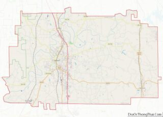
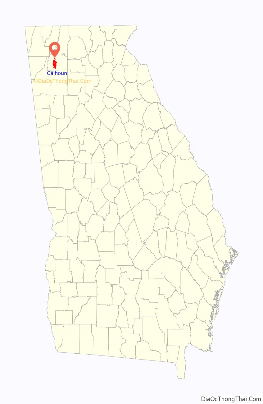
Calhoun location map. Where is Calhoun city?

History
In December 1827, Georgia had already claimed the Cherokee lands that became Gordon County and other counties. A small town called “Dawsonville” was created and founded in Gordon County, named for the owner of an early general store. Dawsonville was later renamed “Calhoun” to honor U.S. Senator John C. Calhoun, following his death in 1850.
Gordon County’s inferior court called an election for the selection of the county seat, offering voters a choice between a site on the Western & Atlantic Railroad (near Adairsville) or a site more centrally located within the county. Voters chose a site along the railroad, so the inferior court designated Calhoun as county seat in 1851. The legislature incorporated Calhoun in an act approved on January 12, 1852.
On January 5, 1861, Georgia seceded from the Union as a prelude to the American Civil War. Calhounians joined the Confederacy. Most warfare took place elsewhere, but on May 16, 1864, Calhoun was near where the Union General William Tecumseh Sherman and Confederate General Joseph E. Johnston postured before the Battle of Adairsville during Sherman’s Atlanta Campaign. Oakleigh, the home of Dr. Wall, was used by Sherman as his headquarters at that time.
A tornado on March 20, 1888, leveled much of Calhoun. A devastating fire on October 23 of that year destroyed most of what remained.
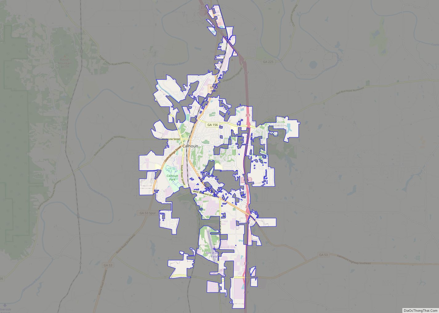
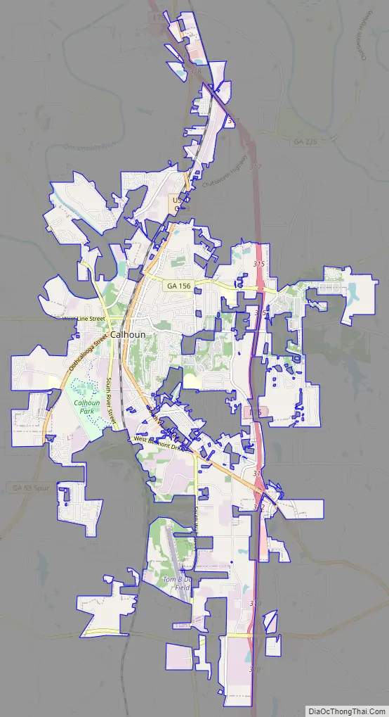
Calhoun Road Map
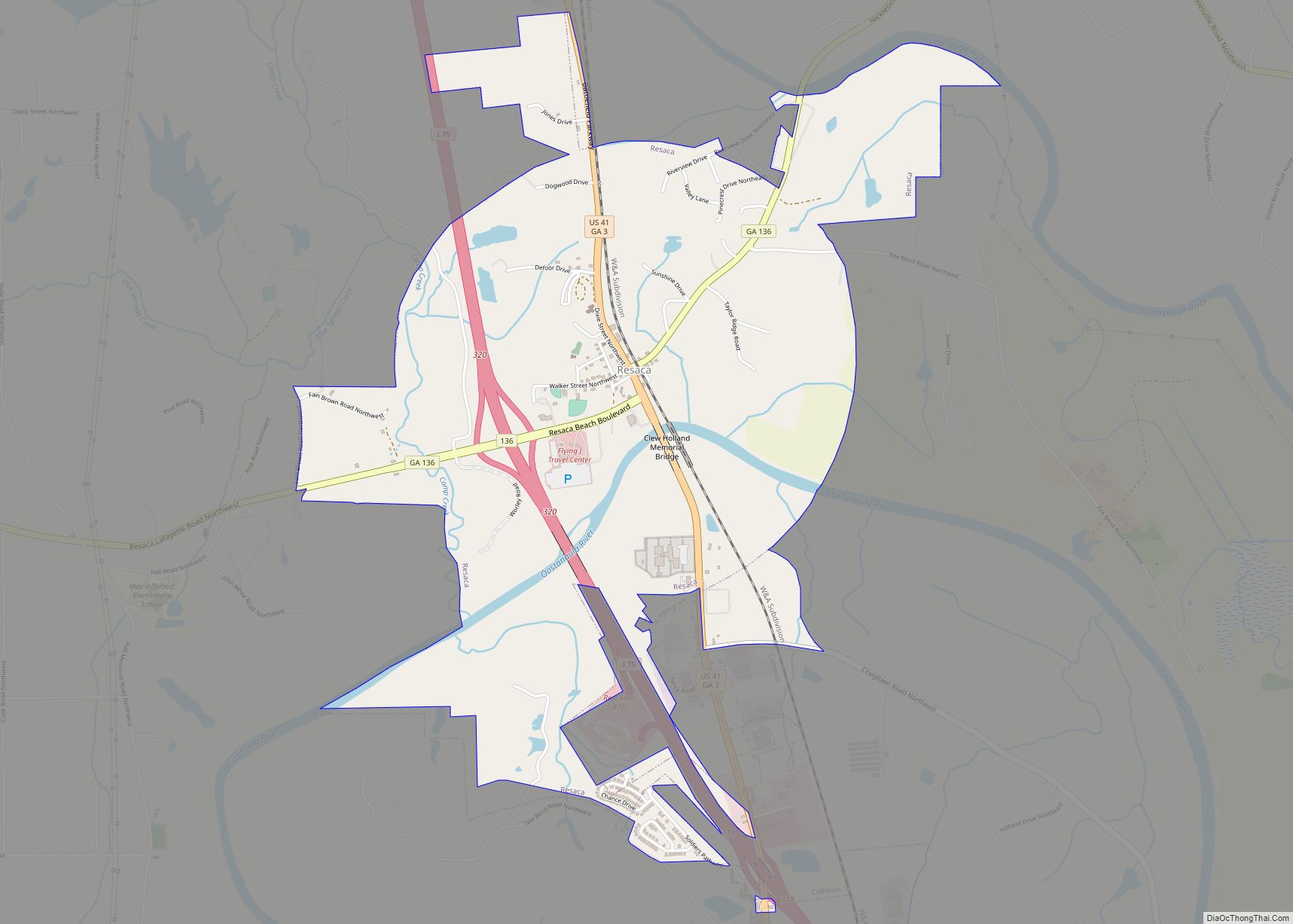
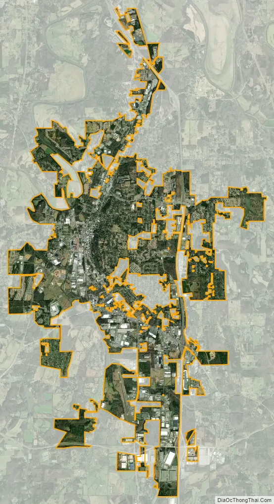
Calhoun city Satellite Map
Geography
Calhoun is located west of the center of Gordon County at 34°30′0″N 84°56′33″W / 34.50000°N 84.94250°W / 34.50000; -84.94250 (34.499898, -84.942584), along the Oostanaula River where it is joined by Oothkalooga Creek. It is part of the Coosa River/Alabama River watershed.
U.S. Route 41 passes through the center of town as Wall Street, and Interstate 75 runs along the eastern edge of the city, with access from Exits 310, 312, 315, 317, and 318. I-75 leads north 49 miles (79 km) to Chattanooga, Tennessee, and south 68 miles (109 km) to Atlanta. US-41, running parallel to I-75, leads north 5 miles (8.0 km) to Resaca and south 10 miles (16 km) to Adairsville. Georgia State Route 156 runs west out of town as West Line Street, leading 18 miles (29 km) to Armuchee, and heads east out of town as Red Bud Road, leading 8 miles (13 km) to Red Bud. Georgia State Route 373 (East Line Street and Dews Pond Road) leads east 8 miles (13 km) to Cash. Georgia State Route 136 (North River Street) leads northwest 30 miles (48 km) to LaFayette. Georgia State Route 53 passes through the southern part of Calhoun, leading east 15 miles (24 km) to Fairmount and southwest 22 miles (35 km) to Rome.
According to the United States Census Bureau, the city of Calhoun has a total area of 15.0 square miles (38.9 km), of which 14.9 square miles (38.7 km) is land and 0.1 square miles (0.2 km), or 0.64%, is water.
Climate
The climate in this area is characterized by relatively high temperatures and evenly distributed precipitation throughout the year. According to the Köppen Climate Classification system, Calhoun has a humid subtropical climate, abbreviated “Cfa” on climate maps.
See also
Map of Georgia State and its subdivision:- Appling
- Atkinson
- Bacon
- Baker
- Baldwin
- Banks
- Barrow
- Bartow
- Ben Hill
- Berrien
- Bibb
- Bleckley
- Brantley
- Brooks
- Bryan
- Bulloch
- Burke
- Butts
- Calhoun
- Camden
- Candler
- Carroll
- Catoosa
- Charlton
- Chatham
- Chattahoochee
- Chattooga
- Cherokee
- Clarke
- Clay
- Clayton
- Clinch
- Cobb
- Coffee
- Colquitt
- Columbia
- Cook
- Coweta
- Crawford
- Crisp
- Dade
- Dawson
- Decatur
- DeKalb
- Dodge
- Dooly
- Dougherty
- Douglas
- Early
- Echols
- Effingham
- Elbert
- Emanuel
- Evans
- Fannin
- Fayette
- Floyd
- Forsyth
- Franklin
- Fulton
- Gilmer
- Glascock
- Glynn
- Gordon
- Grady
- Greene
- Gwinnett
- Habersham
- Hall
- Hancock
- Haralson
- Harris
- Hart
- Heard
- Henry
- Houston
- Irwin
- Jackson
- Jasper
- Jeff Davis
- Jefferson
- Jenkins
- Johnson
- Jones
- Lamar
- Lanier
- Laurens
- Lee
- Liberty
- Lincoln
- Long
- Lowndes
- Lumpkin
- Macon
- Madison
- Marion
- McDuffie
- McIntosh
- Meriwether
- Miller
- Mitchell
- Monroe
- Montgomery
- Morgan
- Murray
- Muscogee
- Newton
- Oconee
- Oglethorpe
- Paulding
- Peach
- Pickens
- Pierce
- Pike
- Polk
- Pulaski
- Putnam
- Quitman
- Rabun
- Randolph
- Richmond
- Rockdale
- Schley
- Screven
- Seminole
- Spalding
- Stephens
- Stewart
- Sumter
- Talbot
- Taliaferro
- Tattnall
- Taylor
- Telfair
- Terrell
- Thomas
- Tift
- Toombs
- Towns
- Treutlen
- Troup
- Turner
- Twiggs
- Union
- Upson
- Walker
- Walton
- Ware
- Warren
- Washington
- Wayne
- Webster
- Wheeler
- White
- Whitfield
- Wilcox
- Wilkes
- Wilkinson
- Worth
- Alabama
- Alaska
- Arizona
- Arkansas
- California
- Colorado
- Connecticut
- Delaware
- District of Columbia
- Florida
- Georgia
- Hawaii
- Idaho
- Illinois
- Indiana
- Iowa
- Kansas
- Kentucky
- Louisiana
- Maine
- Maryland
- Massachusetts
- Michigan
- Minnesota
- Mississippi
- Missouri
- Montana
- Nebraska
- Nevada
- New Hampshire
- New Jersey
- New Mexico
- New York
- North Carolina
- North Dakota
- Ohio
- Oklahoma
- Oregon
- Pennsylvania
- Rhode Island
- South Carolina
- South Dakota
- Tennessee
- Texas
- Utah
- Vermont
- Virginia
- Washington
- West Virginia
- Wisconsin
- Wyoming