Kingsland is a city in Camden County, Georgia, United States. The population was 18,337 at the 2020 census.
The Kingsland Commercial Historic District was added to the National Register of Historic Places on March 17, 1994. It includes the area surrounding South Lee Street between King Street and William Street. It hosts an annual Catfish Festival on Labor Day weekend, and is the location where the fan series Star Trek Continues was filmed.
| Name: | Kingsland city |
|---|---|
| LSAD Code: | 25 |
| LSAD Description: | city (suffix) |
| State: | Georgia |
| County: | Camden County |
| Founded: | 1894 |
| Incorporated: | 1908 |
| Elevation: | 36 ft (11 m) |
| Total Area: | 44.95 sq mi (116.43 km²) |
| Land Area: | 44.74 sq mi (115.87 km²) |
| Water Area: | 0.22 sq mi (0.56 km²) |
| Total Population: | 18,337 |
| Population Density: | 409.88/sq mi (158.26/km²) |
| ZIP code: | 31548 |
| Area code: | 912 |
| FIPS code: | 1343640 |
| GNISfeature ID: | 0316462 |
| Website: | www.visitkingsland.com |
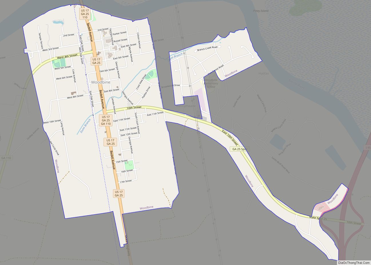
Online Interactive Map
Click on ![]() to view map in "full screen" mode.
to view map in "full screen" mode.
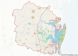
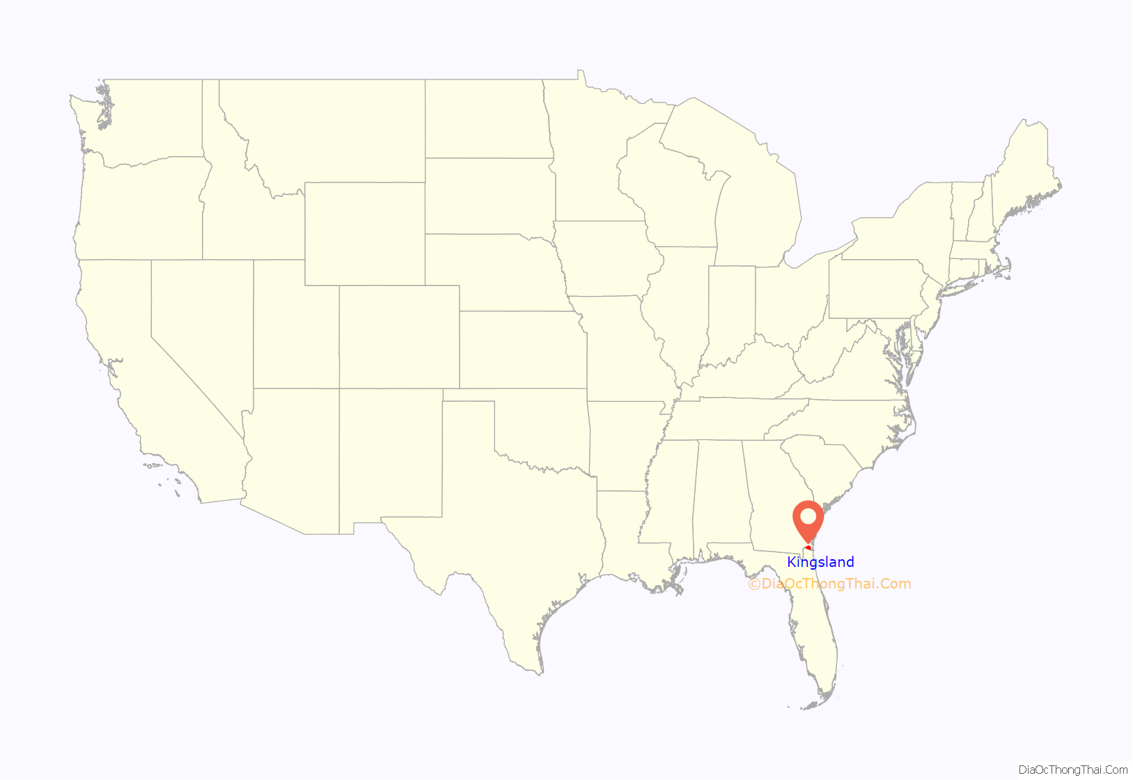
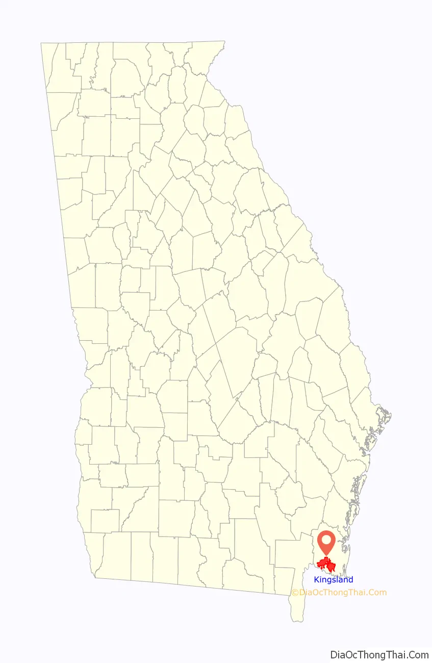
Kingsland location map. Where is Kingsland city?
History
Kingsland was platted in the 1894 when the railroad was extended to that point, and named after William Henry King, the original owner of the site.
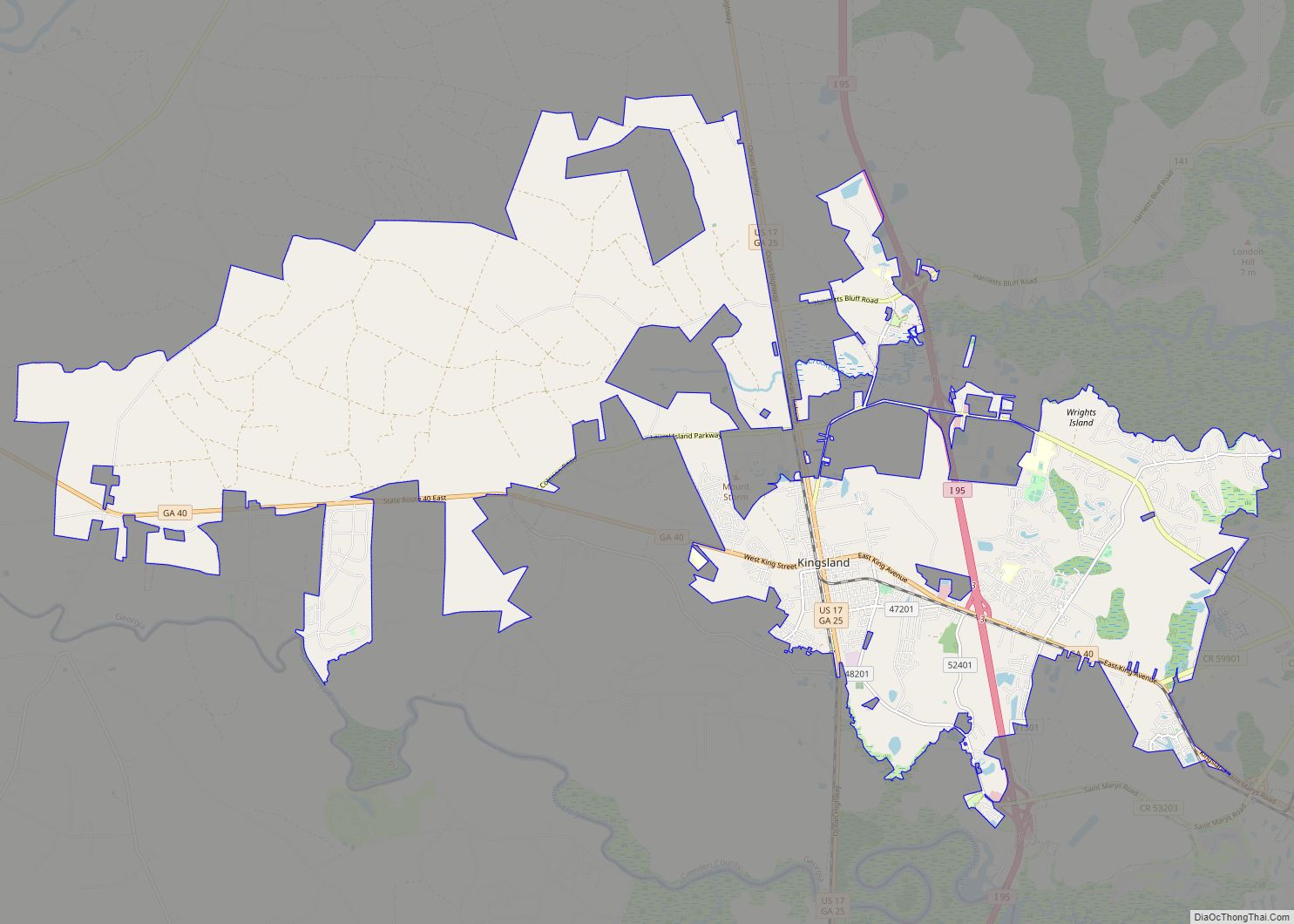
Kingsland Road Map
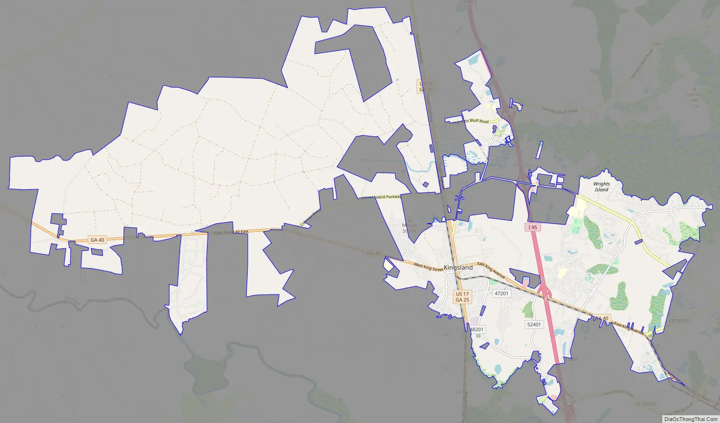
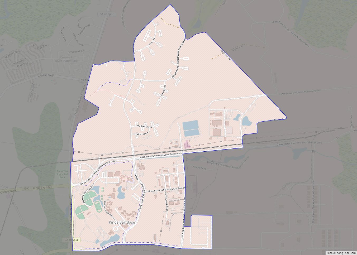
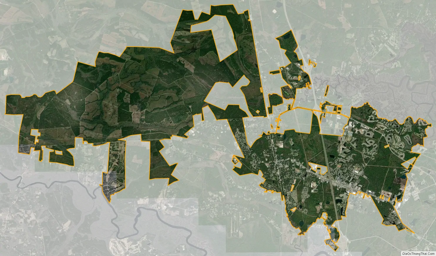
Kingsland city Satellite Map
Geography
Kingsland is in southwestern Camden County at 30°47′41″N 81°40′18″W / 30.79472°N 81.67167°W / 30.79472; -81.67167 (30.794612, -81.671720), just north of the Florida line. It is bordered by St. Marys to the east. Interstate 95 runs through the eastern part of the city, with access from three exits. U.S. Route 17, an older highway running parallel to I-95, passes through the center of Kingsland. Jacksonville, Florida, is 36 miles (58 km) to the south, and Brunswick is 34 miles (55 km) to the north.
According to the United States Census Bureau, recent annexations by the city of large tracts of land have resulted in a total area of 45.0 square miles (116.5 km), of which 42.7 square miles (110.7 km) is land and 2.2 square miles (5.8 km), or 4.99%, is water. This recent growth makes Kingsland Georgia’s 12th-largest city by land mass.
See also
Map of Georgia State and its subdivision:- Appling
- Atkinson
- Bacon
- Baker
- Baldwin
- Banks
- Barrow
- Bartow
- Ben Hill
- Berrien
- Bibb
- Bleckley
- Brantley
- Brooks
- Bryan
- Bulloch
- Burke
- Butts
- Calhoun
- Camden
- Candler
- Carroll
- Catoosa
- Charlton
- Chatham
- Chattahoochee
- Chattooga
- Cherokee
- Clarke
- Clay
- Clayton
- Clinch
- Cobb
- Coffee
- Colquitt
- Columbia
- Cook
- Coweta
- Crawford
- Crisp
- Dade
- Dawson
- Decatur
- DeKalb
- Dodge
- Dooly
- Dougherty
- Douglas
- Early
- Echols
- Effingham
- Elbert
- Emanuel
- Evans
- Fannin
- Fayette
- Floyd
- Forsyth
- Franklin
- Fulton
- Gilmer
- Glascock
- Glynn
- Gordon
- Grady
- Greene
- Gwinnett
- Habersham
- Hall
- Hancock
- Haralson
- Harris
- Hart
- Heard
- Henry
- Houston
- Irwin
- Jackson
- Jasper
- Jeff Davis
- Jefferson
- Jenkins
- Johnson
- Jones
- Lamar
- Lanier
- Laurens
- Lee
- Liberty
- Lincoln
- Long
- Lowndes
- Lumpkin
- Macon
- Madison
- Marion
- McDuffie
- McIntosh
- Meriwether
- Miller
- Mitchell
- Monroe
- Montgomery
- Morgan
- Murray
- Muscogee
- Newton
- Oconee
- Oglethorpe
- Paulding
- Peach
- Pickens
- Pierce
- Pike
- Polk
- Pulaski
- Putnam
- Quitman
- Rabun
- Randolph
- Richmond
- Rockdale
- Schley
- Screven
- Seminole
- Spalding
- Stephens
- Stewart
- Sumter
- Talbot
- Taliaferro
- Tattnall
- Taylor
- Telfair
- Terrell
- Thomas
- Tift
- Toombs
- Towns
- Treutlen
- Troup
- Turner
- Twiggs
- Union
- Upson
- Walker
- Walton
- Ware
- Warren
- Washington
- Wayne
- Webster
- Wheeler
- White
- Whitfield
- Wilcox
- Wilkes
- Wilkinson
- Worth
- Alabama
- Alaska
- Arizona
- Arkansas
- California
- Colorado
- Connecticut
- Delaware
- District of Columbia
- Florida
- Georgia
- Hawaii
- Idaho
- Illinois
- Indiana
- Iowa
- Kansas
- Kentucky
- Louisiana
- Maine
- Maryland
- Massachusetts
- Michigan
- Minnesota
- Mississippi
- Missouri
- Montana
- Nebraska
- Nevada
- New Hampshire
- New Jersey
- New Mexico
- New York
- North Carolina
- North Dakota
- Ohio
- Oklahoma
- Oregon
- Pennsylvania
- Rhode Island
- South Carolina
- South Dakota
- Tennessee
- Texas
- Utah
- Vermont
- Virginia
- Washington
- West Virginia
- Wisconsin
- Wyoming