Brunswick (/ˈbrʌnzwɪk/ BRUN-zwik) is a city in and the county seat of Glynn County in the U.S. state of Georgia. As the primary urban and economic center of the lower southeast portion of Georgia, it is the second-largest urban area on the Georgia coastline after Savannah and contains the Brunswick Old Town Historic District. At the 2020 U.S. census, the population of the city proper was 15,210; the Brunswick metropolitan area’s population as of 2020 was 113,495.
Established as “Brunswick” after the German Duchy of Brunswick–Lüneburg, the ancestral home of the House of Hanover, the municipal community was incorporated as a city in 1856. Throughout its history, Brunswick has served as an important port city; in World War II, for example, it served as a strategic military location with an operational base for escort blimps and a shipbuilding facility for the U.S. Maritime Commission. Since then, its port has served numerous economic purposes.
Brunswick supports a progressive economy largely based on tourism and logistics, with a metropolitan GDP of $3.9 billion as of 2013. The Port of Brunswick handles approximately 10 percent of all U.S. roll-on/roll-off trade—third in the U.S., behind the ports of Los Angeles and Newark. The headquarters of the Federal Law Enforcement Training Center is located 5 miles (8 km) north of the central business district of the city and is adjacent to Brunswick Golden Isles Airport, which provides commercial air service to the area.
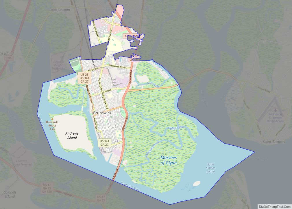
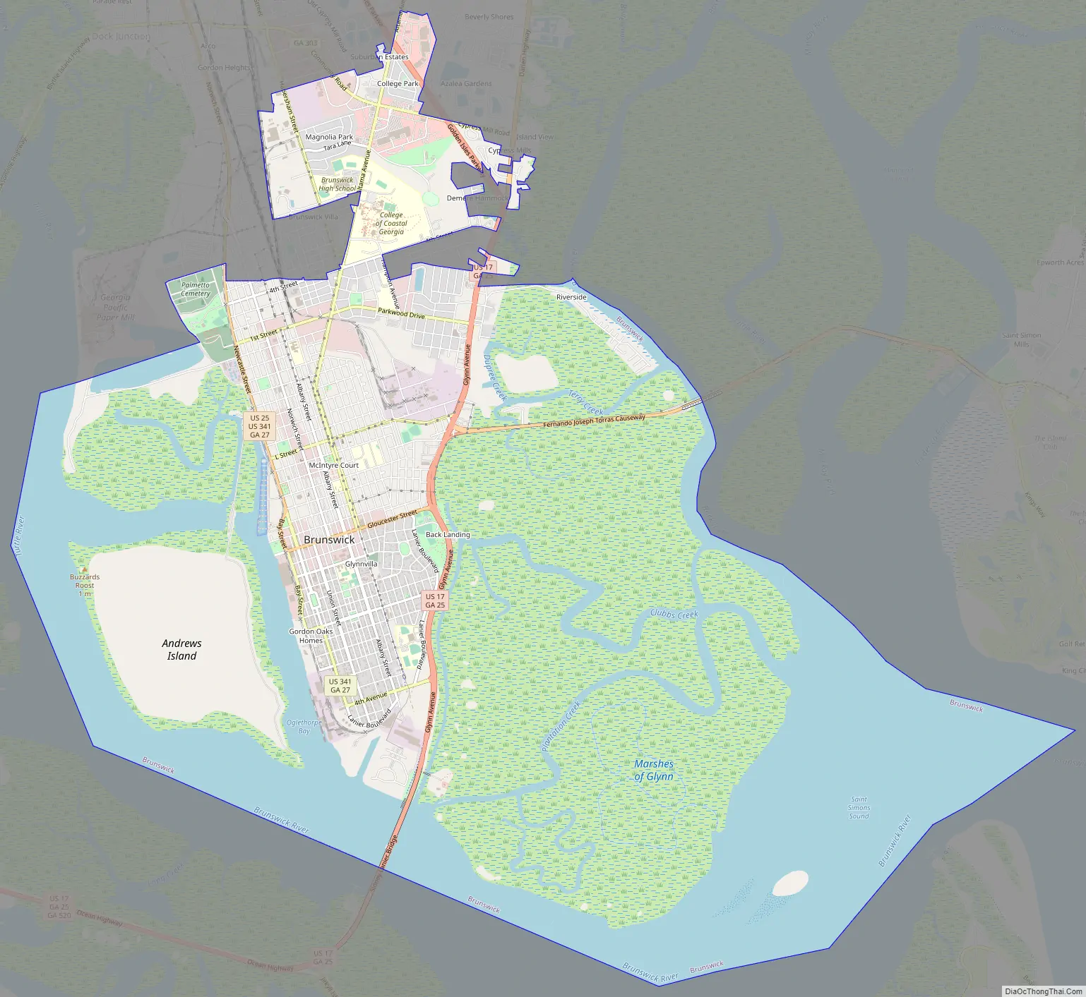
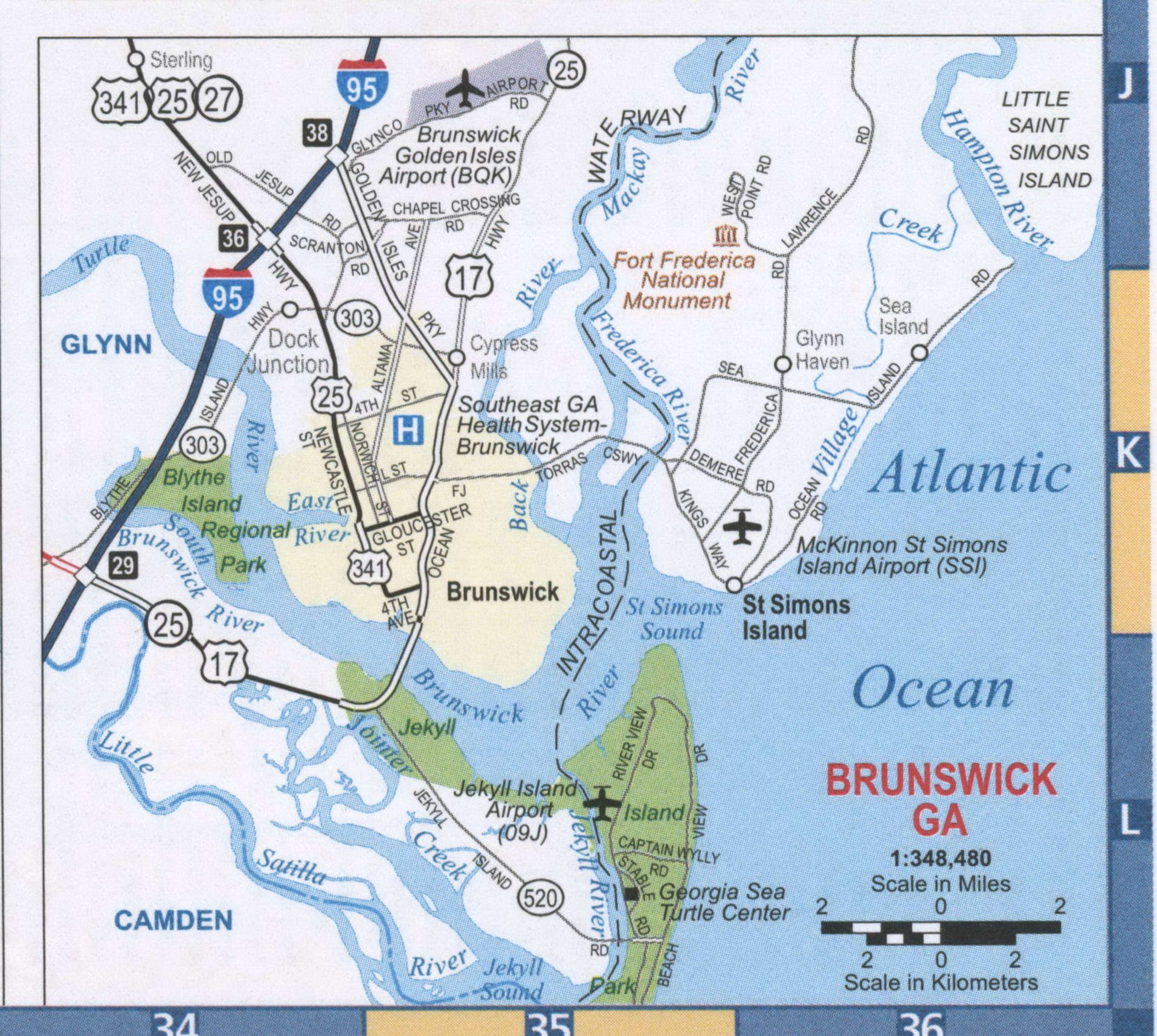
Brunswick is located on a harbor of the Atlantic Ocean, approximately 40 mi (60 km) north of Florida and 80 mi (130 km) south of South Carolina. Brunswick is bordered on the west by Oglethorpe Bay, the East River, and the Turtle River. It is bordered on the south by the Brunswick River and on the east by the Atlantic Intracoastal Waterway in the Mackay River, which separates it from the Golden Isles.
| Name: | Brunswick city |
|---|---|
| LSAD Code: | 25 |
| LSAD Description: | city (suffix) |
| State: | Georgia |
| County: | Glynn County |
| Founded: | 1771 |
| Incorporated: | 1856 |
| Elevation: | 14 ft (4 m) |
| Land Area: | 17.02 sq mi (44.08 km²) |
| Water Area: | 8.07 sq mi (20.91 km²) |
| Population Density: | 893.71/sq mi (345.06/km²) |
| ZIP code: | 31520-31525, 31527, 31561 |
| Area code: | 912 |
| FIPS code: | 1311560 |
| GNISfeature ID: | 0354878 |
| Website: | www.brunswickga.org |
Online Interactive Map
Click on ![]() to view map in "full screen" mode.
to view map in "full screen" mode.
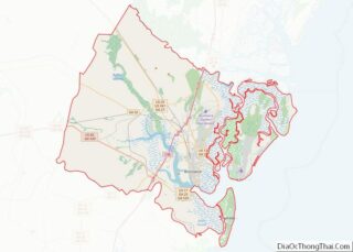
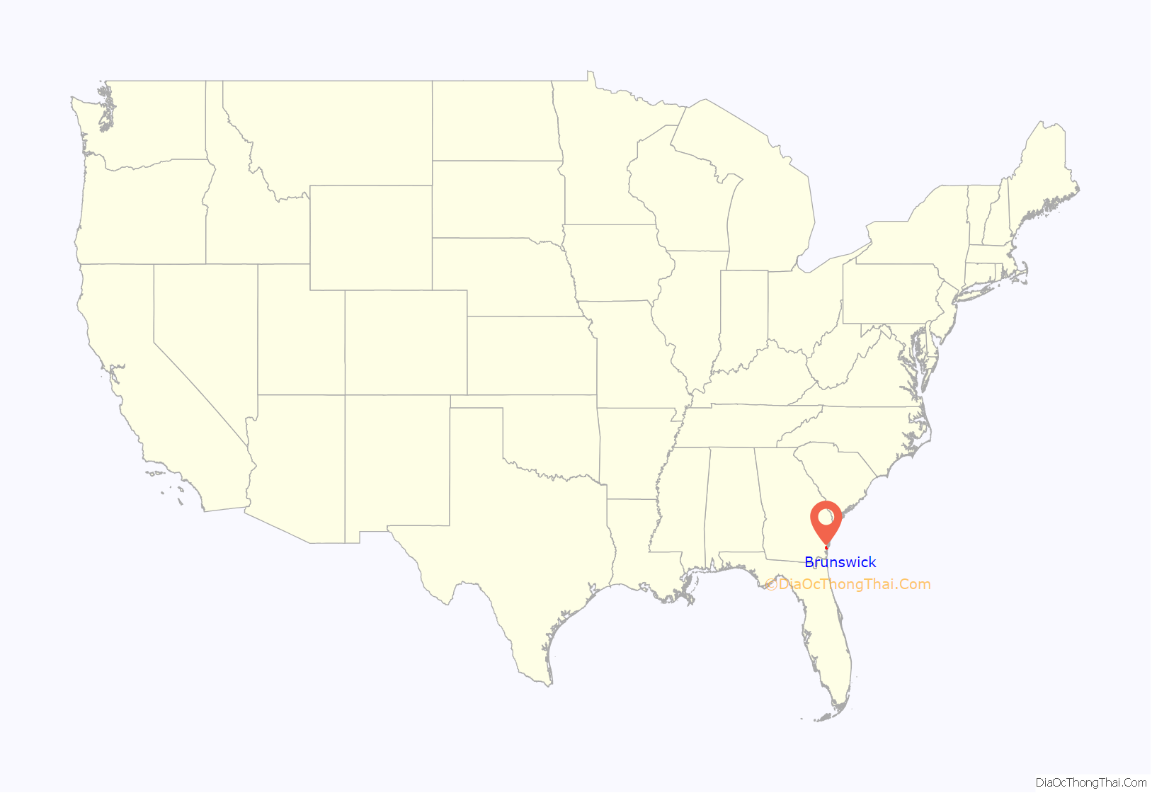
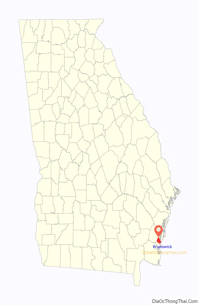
Brunswick location map. Where is Brunswick city?
History
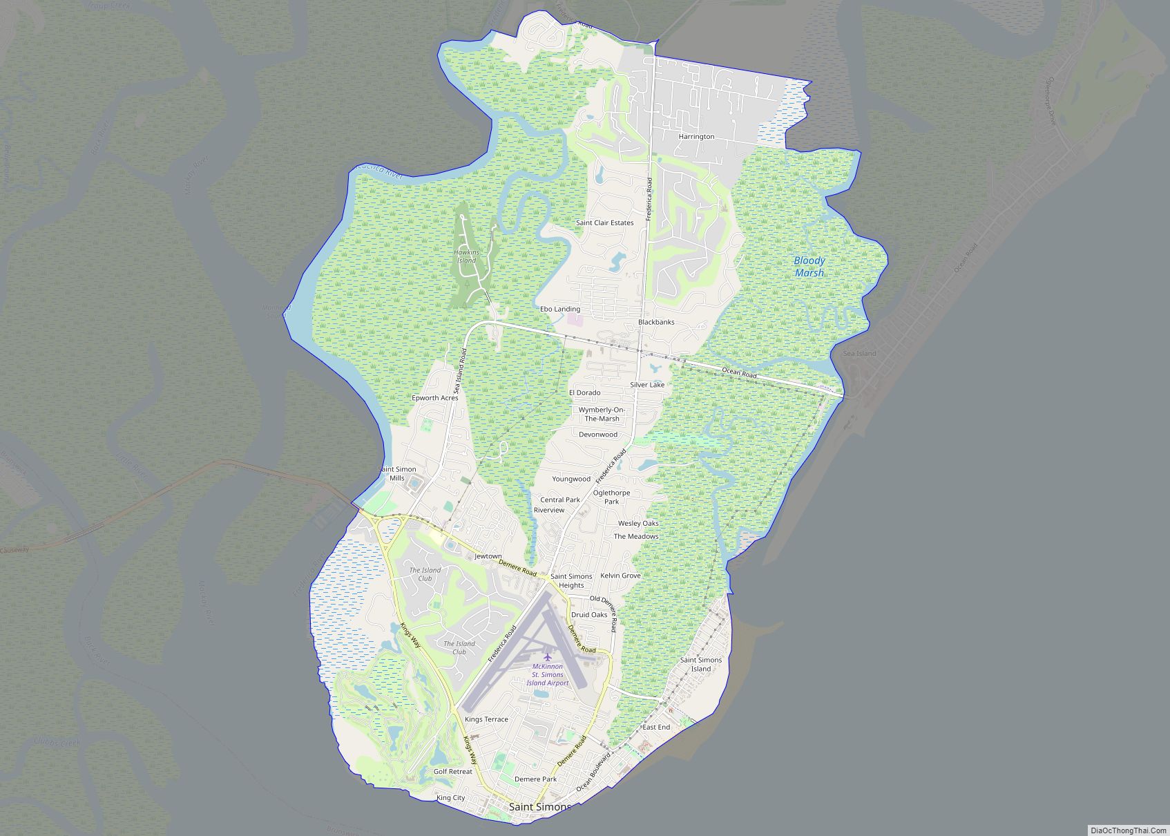
The Mocama, a Timucua-speaking people, lived in and cultivated the lands in what is now Brunswick. The Spanish established missions in Timucuan villages beginning in 1568. During this time, much of the Native American population was depleted through enslavement and disease. When the Province of Carolina was founded in 1663, the British claimed all lands south to the 31st parallel north, but little colonization occurred south of the Altamaha River as the Spanish also claimed this land. Three years after the Province of Georgia was founded in 1733, James Oglethorpe had the town of Frederica built on St. Simons Island, challenging Spaniards who laid claim to the island. The Spanish were driven out of the province after British victories in the battles of Bloody Marsh and Gully Hole Creek in 1742; it was not until the Treaty of Paris of 1763 that Spain’s threat to the province was formally ended, when all lands north of the St. Marys River and south of the Savannah River were designated as Georgia.
The area’s first European settler, Mark Carr, arrived in 1738. Carr, a Scotsman, was a captain in Oglethorpe’s Marine Boat Company. Upon landing, he established his 1,000-acre (400 ha) tobacco plantation, which he called “Plug Point”, along the East and Brunswick rivers. The Province of Georgia purchased Carr’s fields in 1771 and laid out the town of Brunswick in the grid plan akin to that of Savannah, with large, public squares at given intervals. The town was named for the duchy of Brunswick-Lüneburg in Germany, the ancestral home of George III and the House of Hanover. Brunswick was a rectangular tract of land consisting of 383.5 acres (155.2 ha). The first lot was granted on June 30, 1772; 179 lots were granted in the first three years. However, about this time Brunswick lost most of its citizens, many of whom were Loyalists, to East Florida, the Caribbean Basin, and the United Kingdom for protection during the American Revolutionary War. From 1783 to 1788 a number of these lots were regranted and there collected in Brunswick a few families who desired proper education for their children. By the act of the General Assembly on February 1, 1788, eight town commissioners were appointed and Glynn Academy was chartered, the funding of which was to come from the sales of town lots. Brunswick was recognized as an official port of entry in 1789 by an act of the United States Congress. In 1797 the General Assembly transferred the seat of Glynn County from Frederica to Brunswick.
At the end of the eighteenth century, a large tract of land surrounding Brunswick on three sides had been laid off and designated as Commons. Commissioners were named in 1796 to support these efforts. The General Assembly authorized them to sell 500 acres (200 ha) of Commons, one-half of the proceeds to go to the construction of the courthouse and jail and one-half to the support of the academy. In 1819 the commissioners erected a suitable building for school purposes on the southeastern corner of Reynolds and L streets. This was the first public building in Brunswick. It was abandoned four years later, but a new building was erected on Hillsborough Square in 1840 using Commons proceeds. A courthouse and jail were built around this time.
The town was officially incorporated as a city on February 22, 1856. It was at this time that state representative Jacob Moore in conjunction with others conspired to control the Commons, and any proceeds that might be had from sales. Moore managed to persuade the Georgia General Assembly to pass legislation giving him control over significant amounts of local real estate. This precipitated a period of strife, pitting the powerful interests, headed by Rep. Moore, against the common citizenry. It was into this turmoil that Carey Wentworth Styles appeared, in 1857, when he moved his family to Brunswick from Edgefield, South Carolina. Styles, an attorney, was attracted to the area by news of the civil strife. As one observer later wrote, the citizens of Brunswick were in “need of a defender”.
Styles quickly became embroiled in the dispute, siding with the citizenry. He announced his intention to run for mayor, and organized a mass protest rally for the evening of December 24. In spite of bad weather, a crowd gathered at the protest point, where Styles delivered an impassioned speech against the powerful interests, and the legislative act giving them the power to seize local property. Styles called the legislation “dishonorable”, at which point Moore (the bill’s sponsor and beneficiary) jumped to his feet and shouted at Styles, calling the accusation a “falsehood”. In the official testimony on file in the Glynn County courthouse, Styles is said to have yelled back at Moore, saying “You are a damned liar!”, to which Moore replied “You are a damneder liar!”. Gunfire ensued, resulting in the death of Moore. Witness accounts had Moore firing first, and though Styles was subsequently arrested for manslaughter, the charges were eventually dropped. On March 1, 1858, Styles was elected mayor of Brunswick. Some years later, Styles moved to Atlanta, where he founded The Atlanta Constitution. In November 1879, nineteen years after he left, Styles returned to Brunswick, where he established the local weekly Seaport Appeal. When that eventually failed, Styles moved to Texas, never to see Brunswick again.
By 1860 Brunswick had a population of 468, a bank, a weekly newspaper, and a sawmill which employed nine workers.
Brunswick was abandoned during the American Civil War when citizens were ordered to evacuate. The city, like many others in the South, suffered from post-war depression. After one of the nation’s largest lumber mills began operation on nearby St. Simons Island, economic prosperity returned. Rail lines were constructed from Brunswick to inland Georgia, which stimulated a sawmill boom, said to average one mill every two miles, along with the new industrial corridor. In his book The New South Comes to Wiregrass Georgia, 1860–1910 author Mark V. Wetherington states that from Eastman, former Quartermaster General Ira R. Foster “shipped lumber to Brunswick, where it was loaded onto timber schooners and transported to international markets like Liverpool, Rio de Janeiro, and Havana.” Unlike many other southern cities during the Reconstruction period, Brunswick experienced an economic boom.
In 1878, poet and native Georgian Sidney Lanier, who sought relief from tuberculosis in Brunswick’s climate, wrote “The Marshes of Glynn”, a poem based on the salt marshes that span Glynn County. The December 1888 issue of Harper’s Weekly predicted that “Brunswick by the Sea” was destined to become the “winter Newport of America.” Jekyll Island had become a resort destination for some of the era’s most influential families (most notably Rockefellers, Vanderbilts, Pulitzers, and Goodyears) who arrived by train or yacht.
A yellow fever epidemic began in 1893, which heralded a decade of hardships for the city; it was flooded in 1893 when a modern-day Category 3 hurricane (today known as the Sea Islands Hurricane) paralleled the coast of Georgia before hitting South Carolina. The storm left the city under 6 feet (1.8 m) of water. A Category 4 hurricane hit Cumberland Island just south of Brunswick in October 1898, which caused a 16-foot (4.9 m) storm surge in the city. As a result, 179 were killed.
Construction of an electric streetcar line began in 1909 and was completed in 1911. Tracks were located in the center of several city streets. In July 1924, the F.J. Torras Causeway, the roadway between Brunswick and St. Simons Island, was completed, and passenger boat service from Brunswick to St. Simons Island was terminated. By 1926, the electric streetcar line in Brunswick was discontinued; the decline of the streetcar systems coincided with the rise of the automobile.
In World War II, Brunswick served as a strategic military location. German U-boats threatened the coast of the southern United States, and blimps became a common sight as they patrolled the coastal areas. During the war, blimps from Brunswick’s Naval Air Station Glynco (at the time, the largest blimp base in the world) safely escorted almost 100,000 ships without a single vessel lost to enemy submarines.
In World War II, Brunswick boomed as over 16,000 workers of the J.A. Jones Construction Company produced ninety-nine Liberty ships and “Knot” ships (type C1-M ships which were designed for short coastal runs, and most often named for knots for the U.S. Maritime Commission to transport materiel to the European and Pacific theatres.
The first ship was the SS James M. Wayne (named after James Moore Wayne), whose keel was laid on July 6, 1942, and which was launched on March 13, 1943. The last ship was the SS Coastal Ranger, whose keel was laid on June 7, 1945, and which was launched on August 25, 1945. The first six ships took 305 to 331 days each to complete, but soon production ramped up and most of the remaining ships were built in about two months, bringing the average down to 89 days each. By November 1943, about four ships were launched per month. The SS William F. Jerman was completed in only 34 days in November and December 1944. Six ships could be under construction in slipways at one time.
Brunswick Road Map
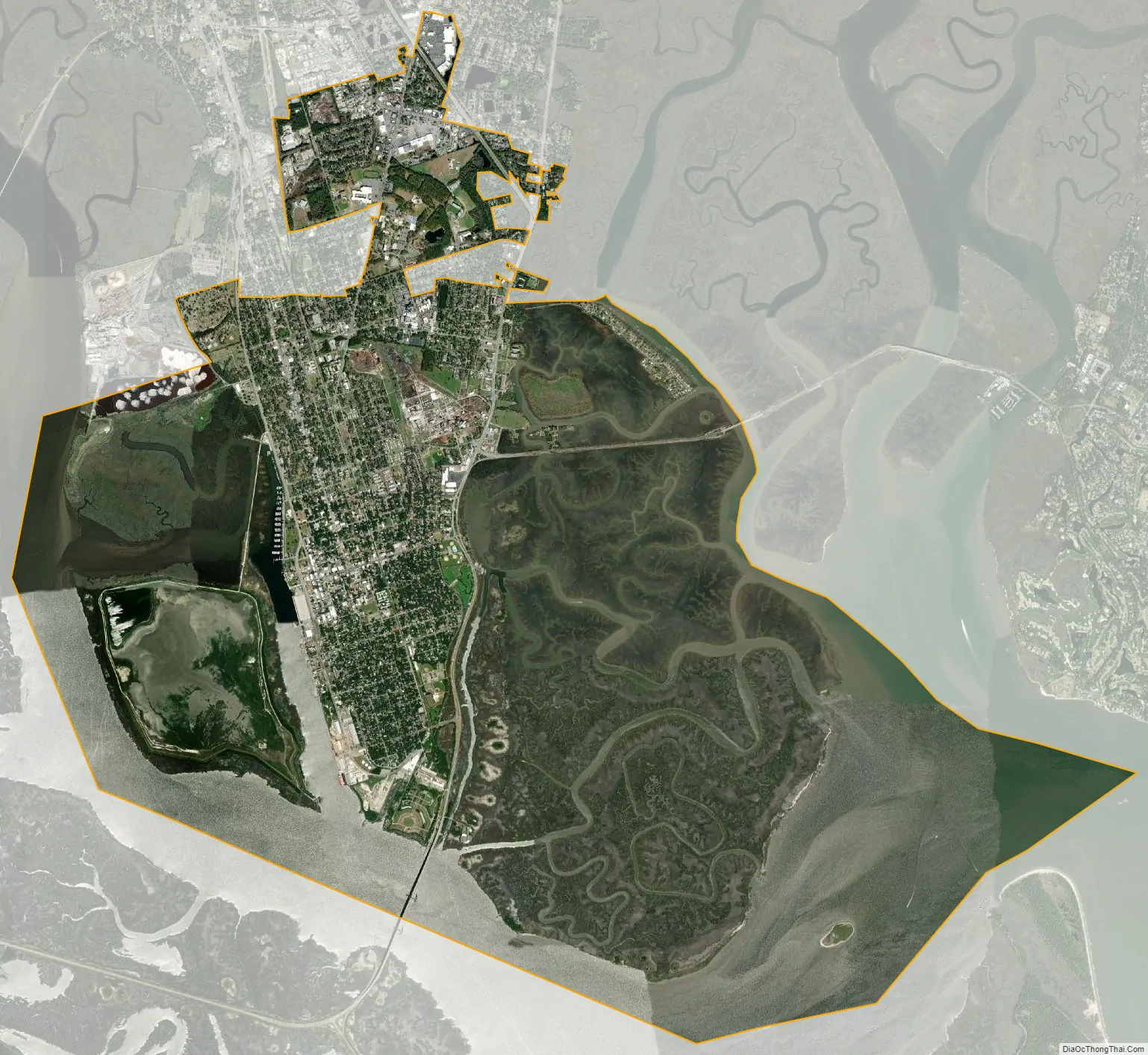
Brunswick city Satellite Map
Geography
The city of Brunswick is located in southeastern Georgia, approximately halfway between Jacksonville, Florida and Savannah. The city is located at the apex of the bight of the Georgia coast, the westernmost point on the Atlantic seaboard, and is naturally sheltered by two barrier islands, Jekyll and St. Simons. The city is situated on a peninsula with the East River and the Turtle River to the west, the Brunswick River to the south, and the Mackay River with the Intracoastal Waterway to the east. An abundance of salt marshes separates the city from the Intracoastal Waterway, which passes between Brunswick and the barrier islands. The East River separates Brunswick from Andrews Island, a dredge spoil site.
The city is the lowest in the U.S. state of Georgia, with an elevation of only 10 to 14 feet (3.0 to 4.3 m) above sea level. According to the U.S. Census Bureau, Brunswick’s land area is 32.4 square miles (83.8 km). Its total area is 42.4 square miles (109.8 km); 10.0 square miles (26.0 km) of this is water.
Climate
Brunswick’s climate is classified as humid subtropical (Cfa in the Köppen climate classification system). During the summer months, it is common for the temperature to reach over 90 °F (32 °C). However, the humidity results in a heat index higher than the actual temperature. Summer mornings average nearly 90 percent humidity and nearly 60 percent in the afternoon. Scattered afternoon thunderstorms are common in the summer. The hottest temperature ever recorded in Brunswick was 106 °F (41 °C) in 1986. Winters in Brunswick are fairly temperate. The average high in January, the coldest month, is 63 °F (17 °C), while the average low is 44 °F (7 °C). Snowfall is very rare. The last snow accumulation in Brunswick was on December 23, 1989. The coldest temperature ever recorded in Brunswick was 5 °F (−15 °C) on January 21, 1985, and January 30, 1966.
Brunswick receives a high amount of rainfall annually, averaging about 49.6 inches (1,260 mm). The wettest months are August and September, the peak of hurricane season. The city has suffered less damage from hurricanes than most other East Coast cities. A major hurricane has not made landfall on the Georgia coast since 1898, and the only hurricane that has hit the coast since then was Hurricane David in 1979. However, the city has experienced hurricane or near-hurricane conditions several times due to storms passing through Florida from the Gulf of Mexico and entering Georgia or passing to the north or south in the Atlantic and brushing the area.
Environment
The Brunswick area has four Superfund sites, formerly home to heavily contaminated toxic waste sites: the LCP Chemicals site, Brunswick Wood Preserving, the Hercules 009 Landfill, and the Terry Creek Dredge Spoil Areas/Hercules Outfall. Research published in 2011 revealed that bottlenose dolphins that fed in the estuaries near these Superfund sites had the highest concentration of PCBs of any mammal in the world.
See also
Map of Georgia State and its subdivision:- Appling
- Atkinson
- Bacon
- Baker
- Baldwin
- Banks
- Barrow
- Bartow
- Ben Hill
- Berrien
- Bibb
- Bleckley
- Brantley
- Brooks
- Bryan
- Bulloch
- Burke
- Butts
- Calhoun
- Camden
- Candler
- Carroll
- Catoosa
- Charlton
- Chatham
- Chattahoochee
- Chattooga
- Cherokee
- Clarke
- Clay
- Clayton
- Clinch
- Cobb
- Coffee
- Colquitt
- Columbia
- Cook
- Coweta
- Crawford
- Crisp
- Dade
- Dawson
- Decatur
- DeKalb
- Dodge
- Dooly
- Dougherty
- Douglas
- Early
- Echols
- Effingham
- Elbert
- Emanuel
- Evans
- Fannin
- Fayette
- Floyd
- Forsyth
- Franklin
- Fulton
- Gilmer
- Glascock
- Glynn
- Gordon
- Grady
- Greene
- Gwinnett
- Habersham
- Hall
- Hancock
- Haralson
- Harris
- Hart
- Heard
- Henry
- Houston
- Irwin
- Jackson
- Jasper
- Jeff Davis
- Jefferson
- Jenkins
- Johnson
- Jones
- Lamar
- Lanier
- Laurens
- Lee
- Liberty
- Lincoln
- Long
- Lowndes
- Lumpkin
- Macon
- Madison
- Marion
- McDuffie
- McIntosh
- Meriwether
- Miller
- Mitchell
- Monroe
- Montgomery
- Morgan
- Murray
- Muscogee
- Newton
- Oconee
- Oglethorpe
- Paulding
- Peach
- Pickens
- Pierce
- Pike
- Polk
- Pulaski
- Putnam
- Quitman
- Rabun
- Randolph
- Richmond
- Rockdale
- Schley
- Screven
- Seminole
- Spalding
- Stephens
- Stewart
- Sumter
- Talbot
- Taliaferro
- Tattnall
- Taylor
- Telfair
- Terrell
- Thomas
- Tift
- Toombs
- Towns
- Treutlen
- Troup
- Turner
- Twiggs
- Union
- Upson
- Walker
- Walton
- Ware
- Warren
- Washington
- Wayne
- Webster
- Wheeler
- White
- Whitfield
- Wilcox
- Wilkes
- Wilkinson
- Worth
- Alabama
- Alaska
- Arizona
- Arkansas
- California
- Colorado
- Connecticut
- Delaware
- District of Columbia
- Florida
- Georgia
- Hawaii
- Idaho
- Illinois
- Indiana
- Iowa
- Kansas
- Kentucky
- Louisiana
- Maine
- Maryland
- Massachusetts
- Michigan
- Minnesota
- Mississippi
- Missouri
- Montana
- Nebraska
- Nevada
- New Hampshire
- New Jersey
- New Mexico
- New York
- North Carolina
- North Dakota
- Ohio
- Oklahoma
- Oregon
- Pennsylvania
- Rhode Island
- South Carolina
- South Dakota
- Tennessee
- Texas
- Utah
- Vermont
- Virginia
- Washington
- West Virginia
- Wisconsin
- Wyoming