Claxton is a city in Evans County, Georgia, United States. The population was 2,746 at the 2010 census, up from 2,276 in 2000. It is the county seat of Evans County.
| Name: | Claxton city |
|---|---|
| LSAD Code: | 25 |
| LSAD Description: | city (suffix) |
| State: | Georgia |
| County: | Evans County |
| Founded: | May 1890 |
| Incorporated: | April 1894 |
| Elevation: | 184 ft (56 m) |
| Total Area: | 1.75 sq mi (4.54 km²) |
| Land Area: | 1.74 sq mi (4.50 km²) |
| Water Area: | 0.01 sq mi (0.04 km²) |
| Total Population: | 2,602 |
| Population Density: | 1,497.12/sq mi (577.90/km²) |
| ZIP code: | 30414, 30417 |
| Area code: | 912 |
| FIPS code: | 1316600 |
| GNISfeature ID: | 0312697 |
| Website: | cityofclaxton.net |
Online Interactive Map
Click on ![]() to view map in "full screen" mode.
to view map in "full screen" mode.
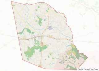
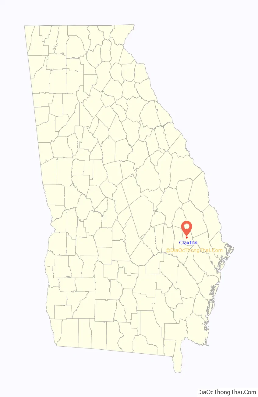
Claxton location map. Where is Claxton city?

History
The town had its visionary, W.R. Hendricks. In May 1890 there were only a couple of dwellings scattered around the area that is Claxton. Hendricks, son of Glenn and Nancy Hendricks, had been given a large tract of land by his parents. The Hendricks’s ambition was to secure a railroad station at the site, but they met considerable opposition from railroad company officials who maintained that existing stations in the area were sufficient to meet the needs. W.R. Hendricks made a proposition to railroad officials that a well be dug and pump installed free of charge so that trains could stop for water. The deal was made and actual construction began in the latter part of June 1890. The vision of building a town was fully supported by Hendricks’s mother, who offered to give a lot to anyone who would erect a building upon it. A number of people accepted her offer, so she revised the plan and proposed to sell one lot and give an adjoining parcel to ones who desired to build.
With the establishment of a town well underway, efforts were begun to establish a post office at the settlement already widely known as “Hendricks”. Postal officials in Washington, D.C., upon receiving an application from George E. Wood, declined to approve the name, because a post office in the state was already operating under that name in Upson County. Two other names were then submitted, “Jenny” and “Claxton”. Postal officials agreed to Claxton, and the post office opened in 1890.
There is some dispute about the origin of the name. Some local historians contend that the name of a popular actress, Kate Claxton, was the source, while others believe it was in honor of Philander Priestly Claxton, a noted educator of the time.
Shortly after the Claxton post office opened, D.C. Newton, one of the partners in a naval stores company, laid out on a sheet of brown wrapping paper what became the original map of Claxton. Newton drew in the streets, laid out lots and later added street names. The whereabouts of the original map is not known; however, it is believed that this first map remained in his possession until his death and was passed down to his son who died in the 1990s. Another map, believed to be similar to the original, was in the possession of R.R. “Bobby” Tippins, president of Tippins Bank and Trust Company and descendant of the family who founded the bank in Claxton; he died in the 2000s.
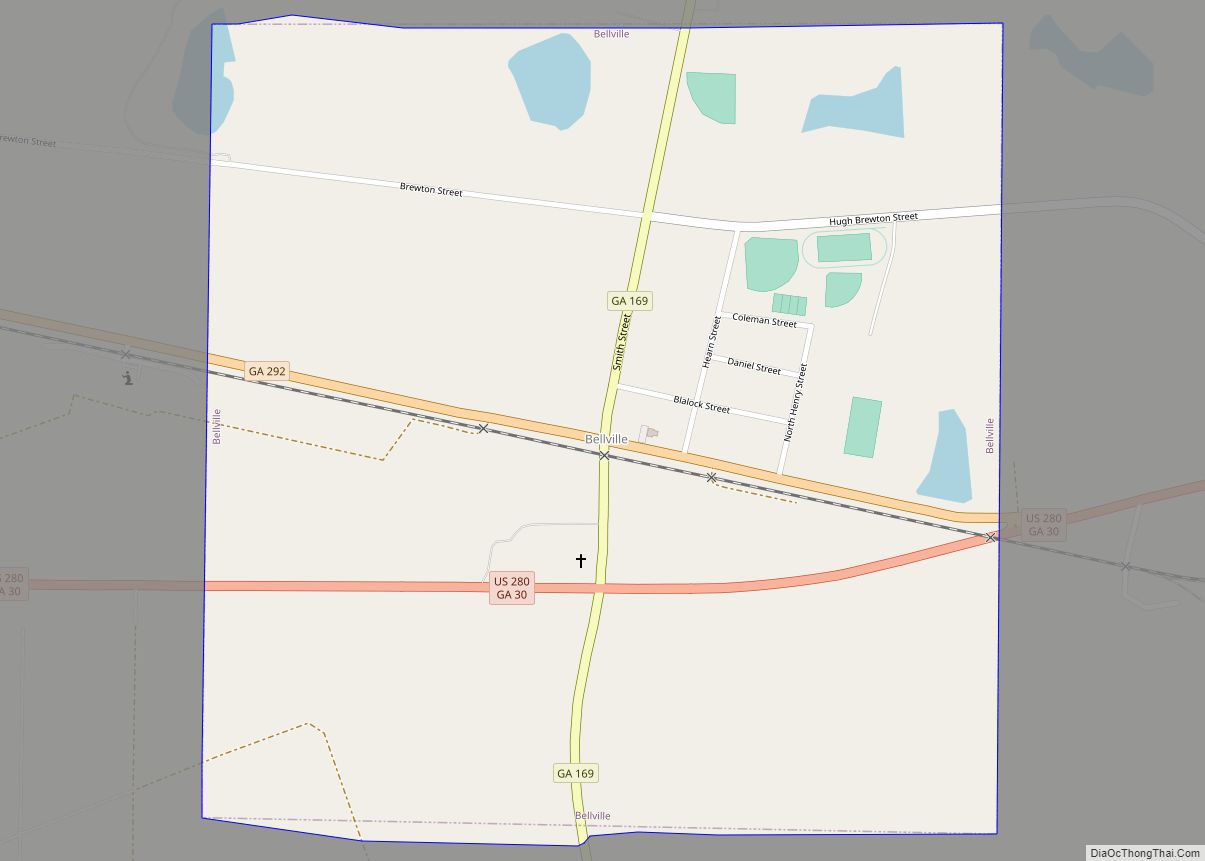
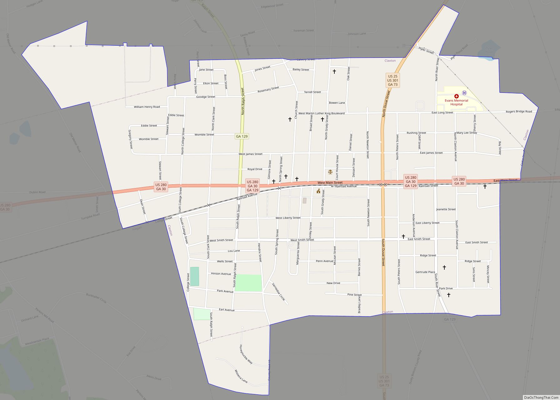
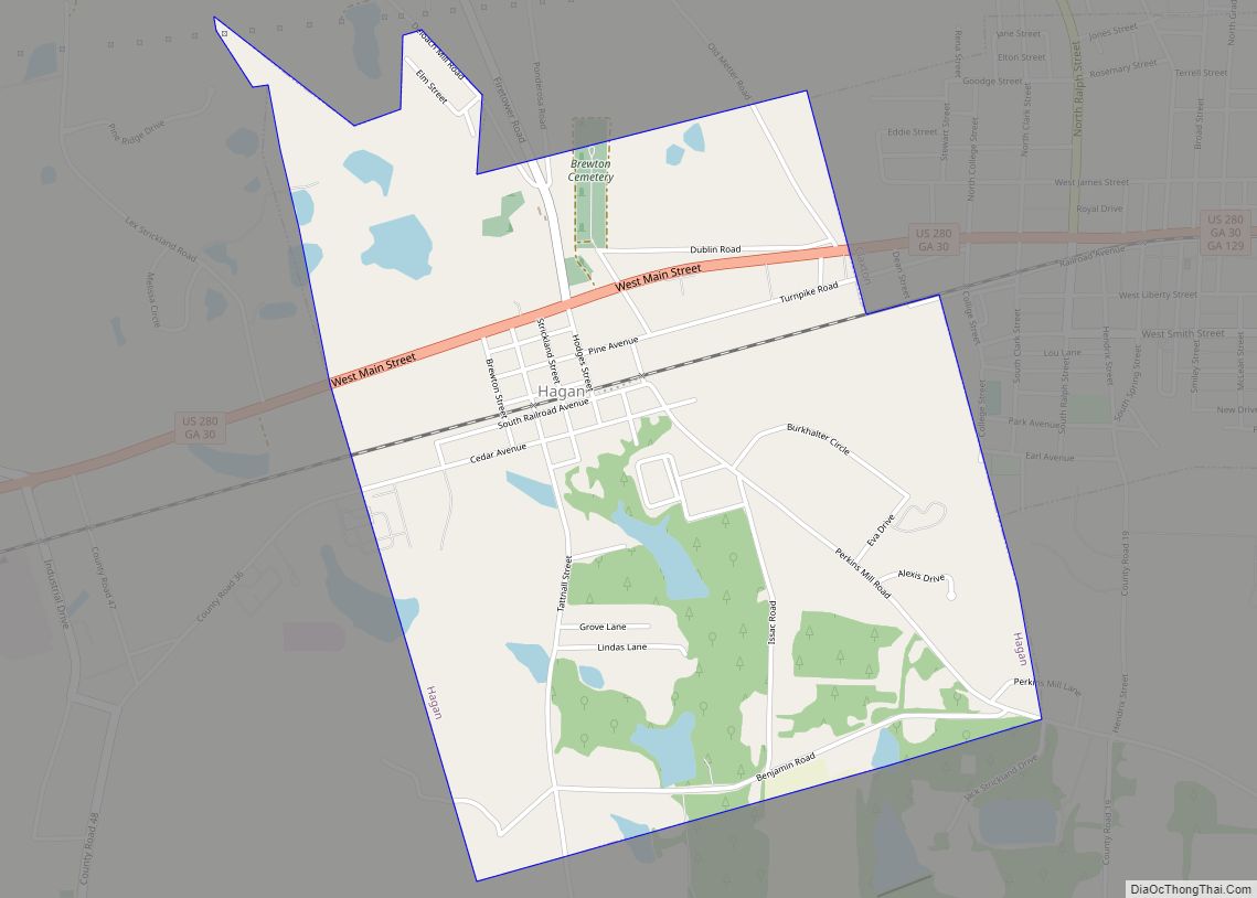
Claxton Road Map

Claxton city Satellite Map

Geography
Claxton is located at the center of Evans County at 32°9′39″N 81°54′31″W / 32.16083°N 81.90861°W / 32.16083; -81.90861 (32.160932, -81.908674). It is bordered to the west by the city of Hagan. U.S. Routes 280 and 301 intersect in the center of town; US 280 leads east 52 miles (84 km) to Savannah and west 36 miles (58 km) to Vidalia, while US 301 leads north 22 miles (35 km) to Statesboro and south 48 miles (77 km) to Jesup.
According to the United States Census Bureau, Claxton has a total area of 1.7 square miles (4.5 km), of which 0.02 square miles (0.04 km), or 0.84%, is water. The city is in the coastal plain region of Georgia. Several types of tree, including pine, oak, sycamore, chinaberry, live oak, sweetgum, and poplar are prevalent in the area.
Climate
Claxton has a humid subtropical climate according to the Köppen classification. It has hot and humid summers with average highs of 94 and lows of 70 in July. Winters are mild with average January highs of 61 and lows of 36. Winter storms are occasional.
See also
Map of Georgia State and its subdivision:- Appling
- Atkinson
- Bacon
- Baker
- Baldwin
- Banks
- Barrow
- Bartow
- Ben Hill
- Berrien
- Bibb
- Bleckley
- Brantley
- Brooks
- Bryan
- Bulloch
- Burke
- Butts
- Calhoun
- Camden
- Candler
- Carroll
- Catoosa
- Charlton
- Chatham
- Chattahoochee
- Chattooga
- Cherokee
- Clarke
- Clay
- Clayton
- Clinch
- Cobb
- Coffee
- Colquitt
- Columbia
- Cook
- Coweta
- Crawford
- Crisp
- Dade
- Dawson
- Decatur
- DeKalb
- Dodge
- Dooly
- Dougherty
- Douglas
- Early
- Echols
- Effingham
- Elbert
- Emanuel
- Evans
- Fannin
- Fayette
- Floyd
- Forsyth
- Franklin
- Fulton
- Gilmer
- Glascock
- Glynn
- Gordon
- Grady
- Greene
- Gwinnett
- Habersham
- Hall
- Hancock
- Haralson
- Harris
- Hart
- Heard
- Henry
- Houston
- Irwin
- Jackson
- Jasper
- Jeff Davis
- Jefferson
- Jenkins
- Johnson
- Jones
- Lamar
- Lanier
- Laurens
- Lee
- Liberty
- Lincoln
- Long
- Lowndes
- Lumpkin
- Macon
- Madison
- Marion
- McDuffie
- McIntosh
- Meriwether
- Miller
- Mitchell
- Monroe
- Montgomery
- Morgan
- Murray
- Muscogee
- Newton
- Oconee
- Oglethorpe
- Paulding
- Peach
- Pickens
- Pierce
- Pike
- Polk
- Pulaski
- Putnam
- Quitman
- Rabun
- Randolph
- Richmond
- Rockdale
- Schley
- Screven
- Seminole
- Spalding
- Stephens
- Stewart
- Sumter
- Talbot
- Taliaferro
- Tattnall
- Taylor
- Telfair
- Terrell
- Thomas
- Tift
- Toombs
- Towns
- Treutlen
- Troup
- Turner
- Twiggs
- Union
- Upson
- Walker
- Walton
- Ware
- Warren
- Washington
- Wayne
- Webster
- Wheeler
- White
- Whitfield
- Wilcox
- Wilkes
- Wilkinson
- Worth
- Alabama
- Alaska
- Arizona
- Arkansas
- California
- Colorado
- Connecticut
- Delaware
- District of Columbia
- Florida
- Georgia
- Hawaii
- Idaho
- Illinois
- Indiana
- Iowa
- Kansas
- Kentucky
- Louisiana
- Maine
- Maryland
- Massachusetts
- Michigan
- Minnesota
- Mississippi
- Missouri
- Montana
- Nebraska
- Nevada
- New Hampshire
- New Jersey
- New Mexico
- New York
- North Carolina
- North Dakota
- Ohio
- Oklahoma
- Oregon
- Pennsylvania
- Rhode Island
- South Carolina
- South Dakota
- Tennessee
- Texas
- Utah
- Vermont
- Virginia
- Washington
- West Virginia
- Wisconsin
- Wyoming