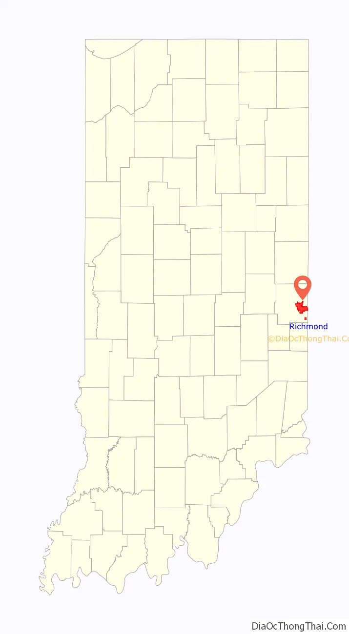
Richmond (/ˈrɪtʃmənd/) is a city in eastern Wayne County, Indiana, United States. Bordering the state of Ohio, it is the county seat of Wayne County. In the 2020 census, the city had a population of 35,720. It is the principal city of the Richmond micropolitan area. Situated largely within Wayne Township, its area includes a non-contiguous portion in nearby Boston Township, where Richmond Municipal Airport is located.
Richmond is sometimes called the “cradle of recorded jazz” because the earliest jazz recordings and records were made at the studio of Gennett Records, a division of the Starr Piano Company. Gennett Records was the first to record such artists as Louis Armstrong, Bix Beiderbecke, Jelly Roll Morton, Hoagy Carmichael, Lawrence Welk, and Gene Autry. The city has twice received the All-America City Award, most recently in 2009.
| Name: | Richmond city |
|---|---|
| LSAD Code: | 25 |
| LSAD Description: | city (suffix) |
| State: | Indiana |
| County: | Wayne County |
| Elevation: | 981 ft (299 m) |
| Total Area: | 24.16 sq mi (62.56 km²) |
| Land Area: | 24.00 sq mi (62.17 km²) |
| Water Area: | 0.15 sq mi (0.39 km²) |
| Total Population: | 35,720 |
| Population Density: | 1,488.02/sq mi (574.54/km²) |
| ZIP code: | 47374-47375 |
| Area code: | 765 |
| FIPS code: | 1864260 |
| GNISfeature ID: | 441976 |
| Website: | richmondindiana.gov |
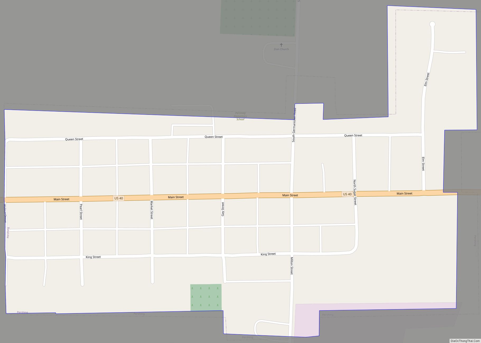
Online Interactive Map
Click on ![]() to view map in "full screen" mode.
to view map in "full screen" mode.
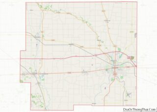
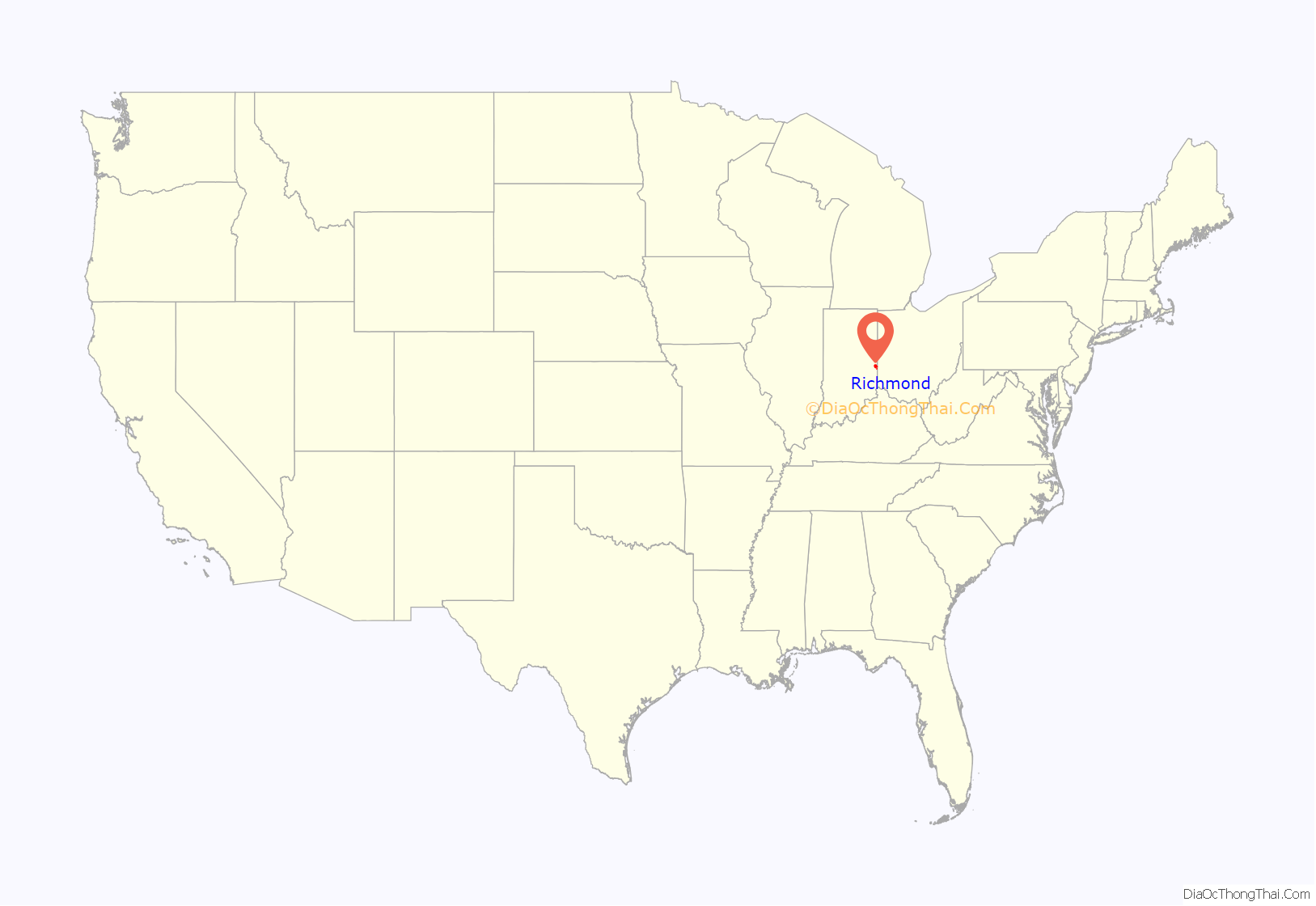
Richmond location map. Where is Richmond city?
History
In 1806 the first European Americans in the area, Quaker families from the state of North Carolina, settled along the East Fork of the Whitewater River. This was part of a general westward migration in the early decades after the American Revolution. John Smith was one of the earliest settlers. Richmond is still home to several Quaker institutions, including Friends United Meeting, Richmond Friends School, Earlham College and the Earlham School of Religion.
The first post office in Richmond was established in 1818 with Robert Morrison as the first postmaster. The town was officially incorporated in 1840, with John Sailor elected the first mayor.
Early cinema and television pioneer Charles Francis Jenkins grew up on a farm north of Richmond, where he began inventing useful gadgets. As the Richmond Telegram reported, on June 6, 1894, Jenkins gathered his family, friends and newsmen at his cousin’s jewelry store in downtown Richmond and projected a filmed motion picture for the first time in front of an audience. The motion picture was of a vaudeville entertainer performing a butterfly dance, which Jenkins had filmed himself. Jenkins filed for a patent for the Phantoscope projector in November 1894 and it was issued in March 1895. A modified version of the Phantoscope was later sold to Thomas Edison, who named it Edison’s Vitascope and began projecting motion pictures in New York City vaudeville theaters, raising the curtain on American cinema.
Joseph E. Maddy is credited with founding the country’s first complete high school orchestra at Richmond, and later founded the National High School Orchestra Camp, which became the Interlochen Center for the Arts in Michigan.
Hoagy Carmichael recorded “Stardust” for the first time in Richmond at the Gennett recording studio. Famed trumpeter and singer Louis Armstrong was first recorded at Gennett as a member of King Oliver and his Creole Jazz Band. Many other internationally famous musicians recorded at Gennett’s Richmond facility, including Jelly Roll Morton, Bix Beiderbecke, Duke Ellington, and Fats Waller. Gennett also recorded Klan musicians.
A group of artists in the area in the late 19th and early 20th centuries came to be known as the Richmond Group. They included John Elwood Bundy, Charles Conner, George Herbert Baker, Maude Kaufman Eggemeyer and John Albert Seaford. The Richmond Art Museum has a collection of regional and American art. Many consider the most significant painting in the collection to be a self-portrait of Indiana-born William Merritt Chase.
The city was connected to the National Road, the first road built by the federal government and a major route west for pioneers of the 19th century. It became part of the system of National Auto Trails. The highway is now known as U.S. Route 40. One of the extant Madonna of the Trail monuments was dedicated at Richmond on October 28, 1928. It sits in a corner of Glen Miller Park adjacent to US 40.
Richmond’s cultural resources include two of Indiana’s three Egyptian mummies. One is held by the Wayne County Historical Museum and the other by Earlham College’s Joseph Moore Museum, leading to the local nickname “Mummy capital of Indiana”.
The arts were supported by a strong economy increasingly based on manufacturing. Richmond was once known as “the lawnmower capital” because it was a center for manufacturing of lawnmowers from the late 19th century through the mid-20th century. Manufacturers included Davis, Motomower, Dille-McGuire and F&N. The farm machinery builder Gaar-Scott was based in Richmond. The Davis Aircraft Co., builder of a light parasol wing monoplane, operated in Richmond beginning in 1929.
After starting out in nearby Union City, Wayne Agricultural Works moved to Richmond. Wayne manufactured horse-drawn vehicles, including the “kid hack”, a precursor of the motorized school bus. From the early 1930s through the 1940s, Richmond had several automobile designers and manufacturers. Among the automobiles locally manufactured were the Richmond, built by the Wayne Works; the “Rodefeld”; the Davis; the Pilot; the Westcott; and the Crosley. In the 1950s Wayne Works changed its name to Wayne Corporation, by then a well-known bus and school-bus manufacturer. In 1967 it relocated to a site adjacent to Interstate 70. The company was a leader in school-bus safety innovations, but closed in 1992 during a period of school-bus manufacturing industry consolidations.
Richmond was known as the “Rose City” because of the many varieties once grown there by Hill’s Roses. The company had several sprawling complexes of greenhouses, with a total of about 34 acres (14 ha) under glass. The annual Richmond Rose Festival honored the rose industry and was a popular summer attraction.
Downtown explosion
On April 6, 1968, an explosion triggered by a natural gas leak destroyed or damaged several downtown blocks and killed 41 people; more than 150 were injured. The event is documented in the book Death in a Sunny Street.
Richmond Road Map
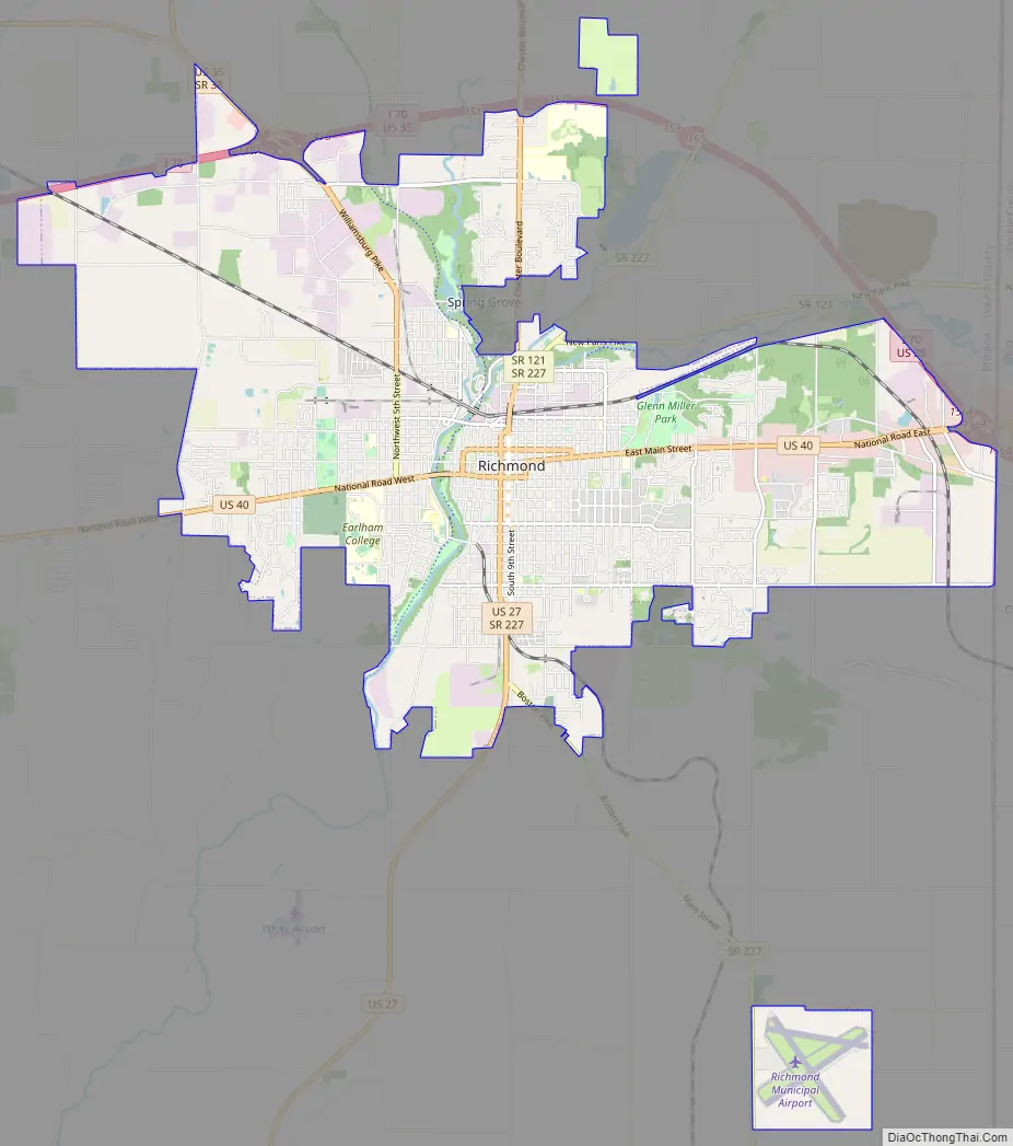
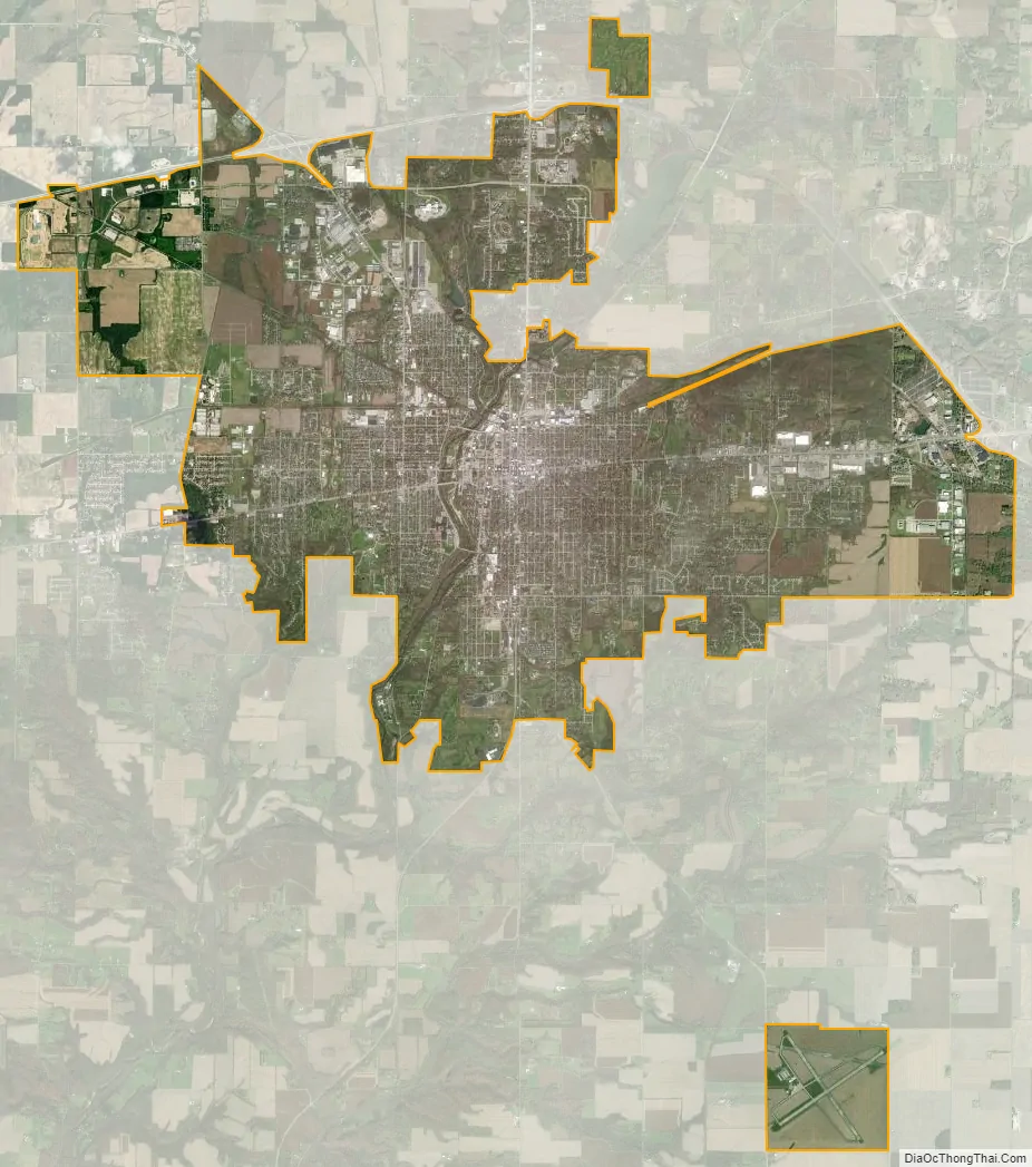
Richmond city Satellite Map
Geography
Richmond is located at 39°49′49″N 84°53′26″W / 39.830189°N 84.890668°W / 39.830189; -84.890668.
According to the 2010 census, Richmond has a total area of 24.067 square miles (62.33 km), of which 23.91 square miles (61.93 km) (or 99.35%) is land and 0.157 square miles (0.41 km) (or 0.65%) is water.
Richmond is located about 12 miles S of Hoosier Hill, the highest point in Indiana.
Cityscape
Richmond is noted for its rich stock of historic architecture. In 2003, a book entitled Richmond Indiana: Its Physical Development and Aesthetic Heritage to 1920 by Cornell University architectural historians, Michael and Mary Raddant Tomlan, was published by the Indiana Historical Society. Particularly notable buildings are the 1902 Pennsylvania Railroad Station designed by Daniel H. Burnham of Chicago and the 1893 Wayne County Court House designed by James W. McLaughlin of Cincinnati. Local architects of note include John A. Hasecoster, William S. Kaufman and Stephen O. Yates.
The significance of the architecture has been recognized. Five large districts, such as the Depot District, and several individual buildings are listed in the National Register of Historic Places, the Historic American Buildings Survey and the Historic American Engineering Record.
See also
Map of Indiana State and its subdivision:- Adams
- Allen
- Bartholomew
- Benton
- Blackford
- Boone
- Brown
- Carroll
- Cass
- Clark
- Clay
- Clinton
- Crawford
- Daviess
- De Kalb
- Dearborn
- Decatur
- Delaware
- Dubois
- Elkhart
- Fayette
- Floyd
- Fountain
- Franklin
- Fulton
- Gibson
- Grant
- Greene
- Hamilton
- Hancock
- Harrison
- Hendricks
- Henry
- Howard
- Huntington
- Jackson
- Jasper
- Jay
- Jefferson
- Jennings
- Johnson
- Knox
- Kosciusko
- LaGrange
- Lake
- Lake Michigan
- LaPorte
- Lawrence
- Madison
- Marion
- Marshall
- Martin
- Miami
- Monroe
- Montgomery
- Morgan
- Newton
- Noble
- Ohio
- Orange
- Owen
- Parke
- Perry
- Pike
- Porter
- Posey
- Pulaski
- Putnam
- Randolph
- Ripley
- Rush
- Saint Joseph
- Scott
- Shelby
- Spencer
- Starke
- Steuben
- Sullivan
- Switzerland
- Tippecanoe
- Tipton
- Union
- Vanderburgh
- Vermillion
- Vigo
- Wabash
- Warren
- Warrick
- Washington
- Wayne
- Wells
- White
- Whitley
- Alabama
- Alaska
- Arizona
- Arkansas
- California
- Colorado
- Connecticut
- Delaware
- District of Columbia
- Florida
- Georgia
- Hawaii
- Idaho
- Illinois
- Indiana
- Iowa
- Kansas
- Kentucky
- Louisiana
- Maine
- Maryland
- Massachusetts
- Michigan
- Minnesota
- Mississippi
- Missouri
- Montana
- Nebraska
- Nevada
- New Hampshire
- New Jersey
- New Mexico
- New York
- North Carolina
- North Dakota
- Ohio
- Oklahoma
- Oregon
- Pennsylvania
- Rhode Island
- South Carolina
- South Dakota
- Tennessee
- Texas
- Utah
- Vermont
- Virginia
- Washington
- West Virginia
- Wisconsin
- Wyoming