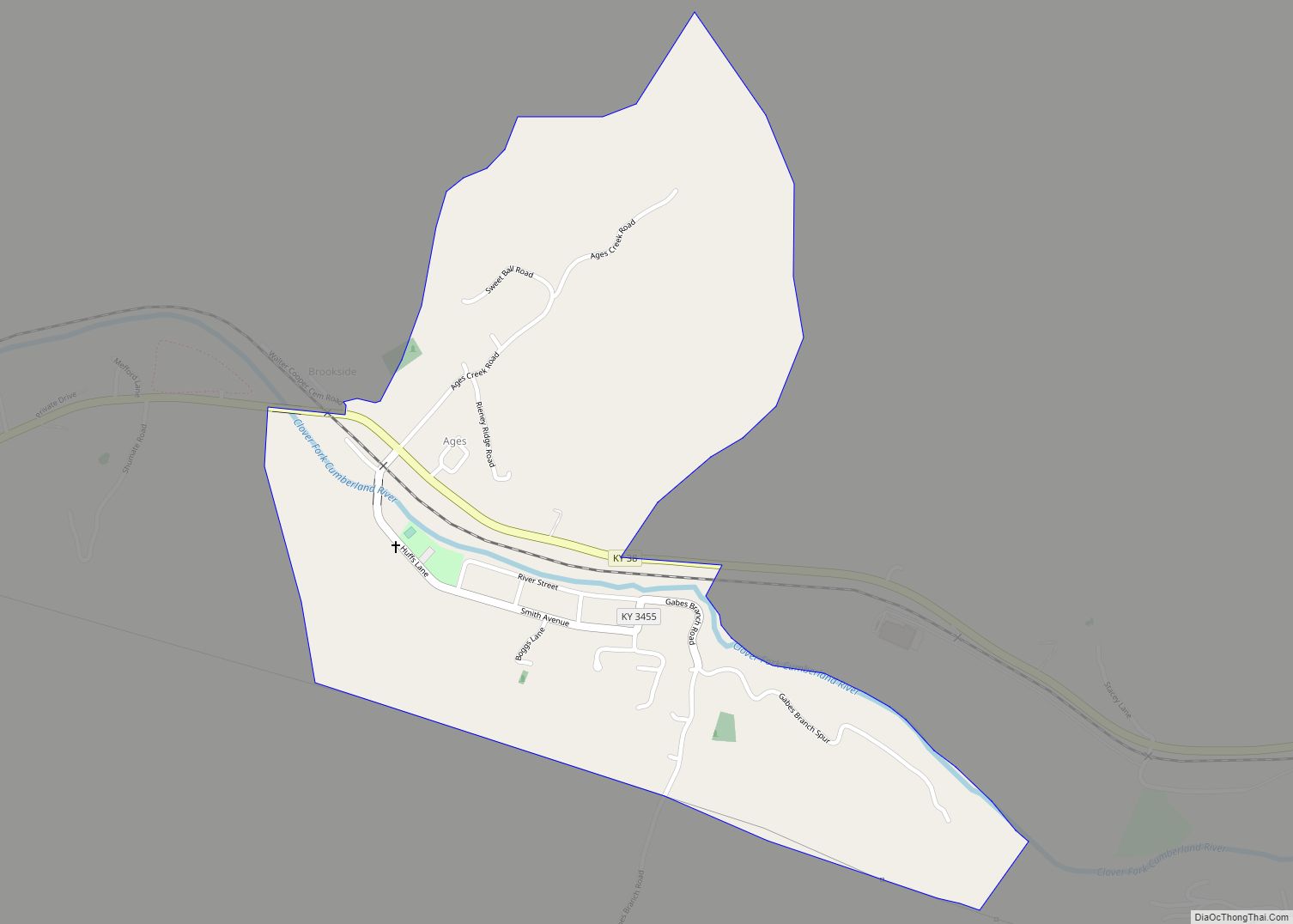
Ages is an unincorporated coal town and census-designated place (CDP) in Harlan County, Kentucky, United States.
| Name: | Ages CDP |
|---|---|
| LSAD Code: | 57 |
| LSAD Description: | CDP (suffix) |
| State: | Kentucky |
| County: | Harlan County |
| Elevation: | 1,325 ft (404 m) |
| Total Area: | 0.57 sq mi (1.47 km²) |
| Land Area: | 0.56 sq mi (1.44 km²) |
| Water Area: | 0.01 sq mi (0.03 km²) |
| Total Population: | 345 |
| Population Density: | 619.39/sq mi (239.24/km²) |
| ZIP code: | 40801 |
| FIPS code: | 2100514 |
| GNISfeature ID: | 485792 |
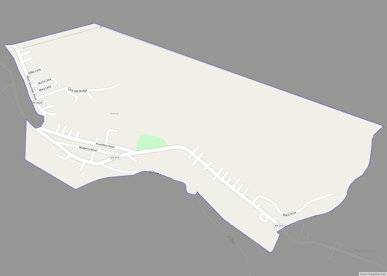
Online Interactive Map
Click on ![]() to view map in "full screen" mode.
to view map in "full screen" mode.
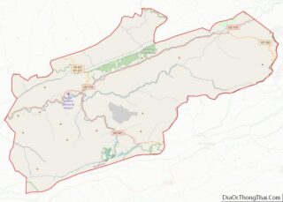
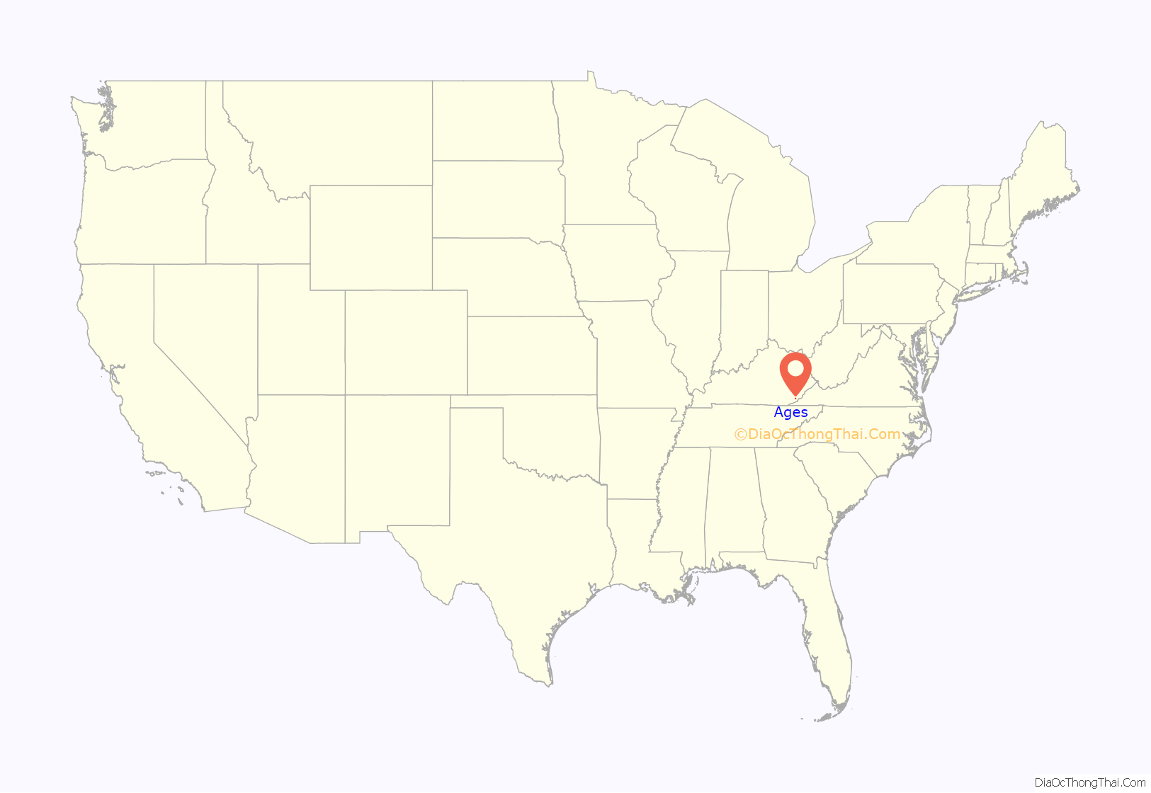
Ages location map. Where is Ages CDP?

History
A post office called “Ages” was established in 1892, and the post office removed to Brookside, Kentucky and its name changed to “Ages-Brookside” in 1975. The community takes its name from nearby Ages Creek.
The community was listed by the U.S. Census Bureau as a census-designated place in 2014. Population estimated at 439 in the 2017 US Census American Community Survey.
Ages Road Map

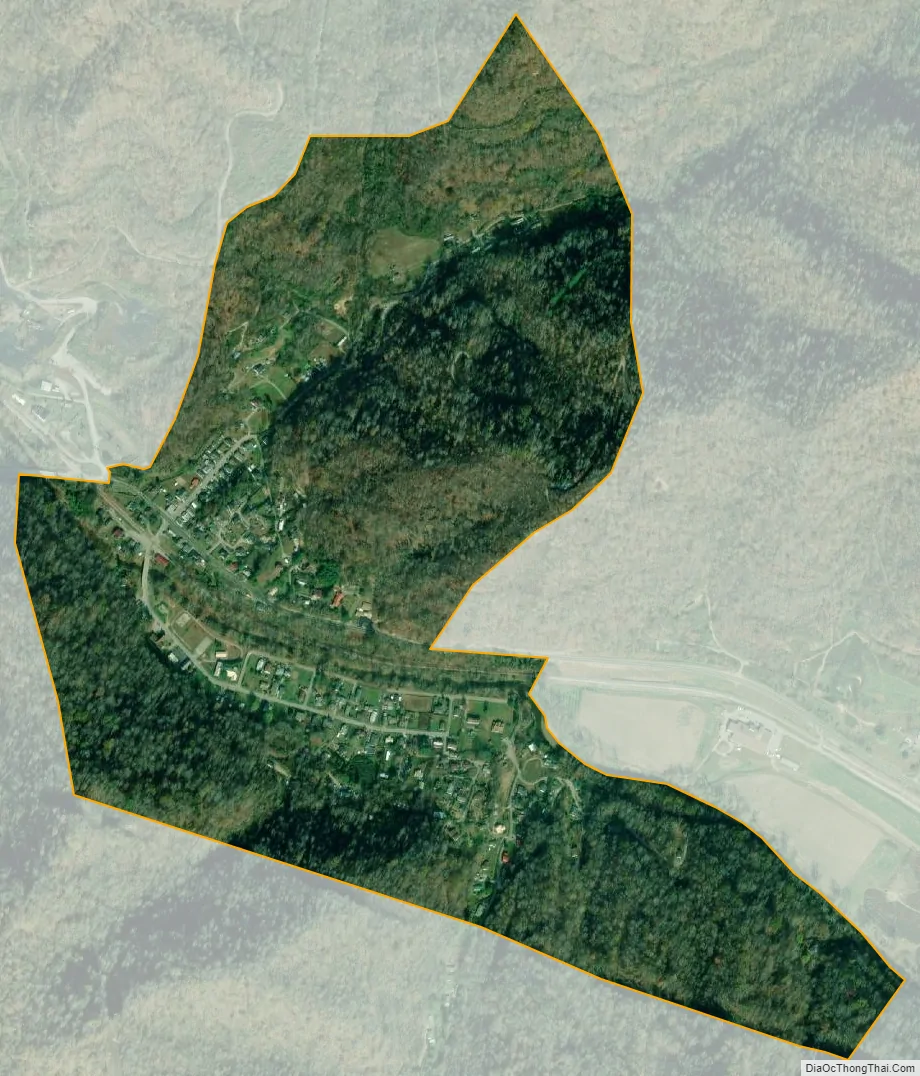
Ages city Satellite Map
Geography
Ages is located in central Harlan County in the valley of the Clover Fork of the Cumberland River. It is bordered to the west by Brookside and to the east by Verda, both unincorporated. The Clover Fork valley lies between Black Mountain to the north and Little Black Mountain to the south. Elevations in the area range from 1,245 feet (379 m) in the center of Ages, to 3,355 feet (1,023 m) on the closest summit of Black Mountain, to 3,380 feet (1,030 m) on the closest summit of Little Black Mountain. (Black Mountain continues east 20 miles (32 km) to its true summit, the highest point in Kentucky at 4,145 feet [1,263 m].)
Kentucky Route 38 is the main road through Ages, leading west down the Clover Fork valley 5 miles (8 km) to Harlan, the county seat, and east 3 miles (5 km) to Evarts.
See also
Map of Kentucky State and its subdivision:- Adair
- Allen
- Anderson
- Ballard
- Barren
- Bath
- Bell
- Boone
- Bourbon
- Boyd
- Boyle
- Bracken
- Breathitt
- Breckinridge
- Bullitt
- Butler
- Caldwell
- Calloway
- Campbell
- Carlisle
- Carroll
- Carter
- Casey
- Christian
- Clark
- Clay
- Clinton
- Crittenden
- Cumberland
- Daviess
- Edmonson
- Elliott
- Estill
- Fayette
- Fleming
- Floyd
- Franklin
- Fulton
- Gallatin
- Garrard
- Grant
- Graves
- Grayson
- Green
- Greenup
- Hancock
- Hardin
- Harlan
- Harrison
- Hart
- Henderson
- Henry
- Hickman
- Hopkins
- Jackson
- Jefferson
- Jessamine
- Johnson
- Kenton
- Knott
- Knox
- Larue
- Laurel
- Lawrence
- Lee
- Leslie
- Letcher
- Lewis
- Lincoln
- Livingston
- Logan
- Lyon
- Madison
- Magoffin
- Marion
- Marshall
- Martin
- Mason
- McCracken
- McCreary
- McLean
- Meade
- Menifee
- Mercer
- Metcalfe
- Monroe
- Montgomery
- Morgan
- Muhlenberg
- Nelson
- Nicholas
- Ohio
- Oldham
- Owen
- Owsley
- Pendleton
- Perry
- Pike
- Powell
- Pulaski
- Robertson
- Rockcastle
- Rowan
- Russell
- Scott
- Shelby
- Simpson
- Spencer
- Taylor
- Todd
- Trigg
- Trimble
- Union
- Warren
- Washington
- Wayne
- Webster
- Whitley
- Wolfe
- Woodford
- Alabama
- Alaska
- Arizona
- Arkansas
- California
- Colorado
- Connecticut
- Delaware
- District of Columbia
- Florida
- Georgia
- Hawaii
- Idaho
- Illinois
- Indiana
- Iowa
- Kansas
- Kentucky
- Louisiana
- Maine
- Maryland
- Massachusetts
- Michigan
- Minnesota
- Mississippi
- Missouri
- Montana
- Nebraska
- Nevada
- New Hampshire
- New Jersey
- New Mexico
- New York
- North Carolina
- North Dakota
- Ohio
- Oklahoma
- Oregon
- Pennsylvania
- Rhode Island
- South Carolina
- South Dakota
- Tennessee
- Texas
- Utah
- Vermont
- Virginia
- Washington
- West Virginia
- Wisconsin
- Wyoming