Cumberland is a home rule-class city in Harlan County, Kentucky, in the United States. The population according to the 2010 Census was 2,237, down from 2,611 at the 2000 census.
| Name: | Cumberland city |
|---|---|
| LSAD Code: | 25 |
| LSAD Description: | city (suffix) |
| State: | Kentucky |
| County: | Harlan County |
| Elevation: | 1,444 ft (440 m) |
| Total Area: | 3.15 sq mi (8.15 km²) |
| Land Area: | 3.12 sq mi (8.07 km²) |
| Water Area: | 0.03 sq mi (0.08 km²) |
| Total Population: | 1,947 |
| Population Density: | 625.04/sq mi (241.34/km²) |
| ZIP code: | 40823 |
| Area code: | 606 |
| FIPS code: | 2119108 |
| GNISfeature ID: | 0511673 |
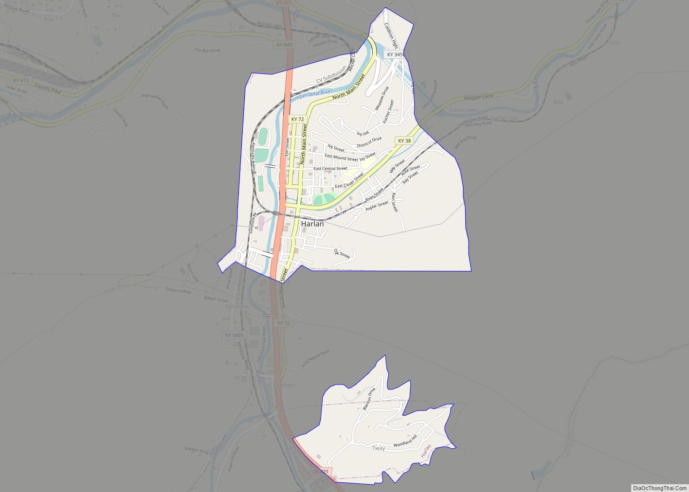
Online Interactive Map
Click on ![]() to view map in "full screen" mode.
to view map in "full screen" mode.
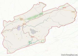
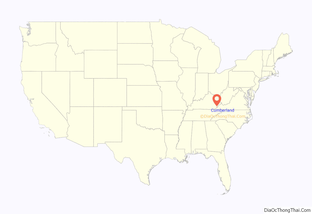
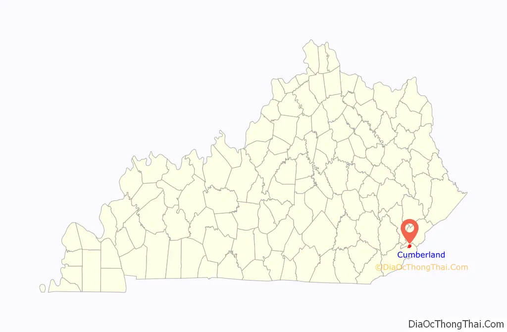
Cumberland location map. Where is Cumberland city?
History
Cumberland was settled in 1837 and named “Poor Fork”, for its location on a fork of the Cumberland River with relatively poor soil. It remained isolated until the coal mining boom of the 1900s when railroads connected it with surrounding towns. It was renamed “Cumberland” in 1926.
On July 29, 2019, a group of coal miners blocked a coal train on a track in protest when the company they worked for, Blackjewel LLC, refused to pay them after declaring bankruptcy. Blackjewel was founded in 2017, and it was one of the largest coal mining companies in the country. Its bankruptcy filing also affected employees in Virginia and Wyoming; in total about 1700 miners have been affected. The miners called off the protest in late September 2019, mostly because they have found other jobs. They intend to continue their fight in court.
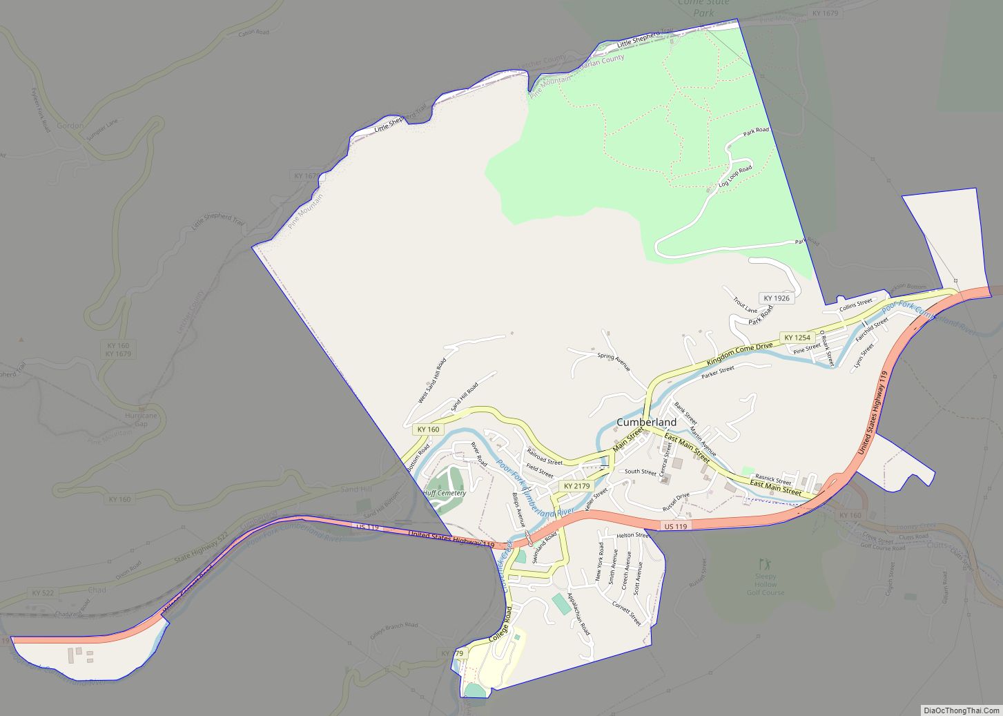
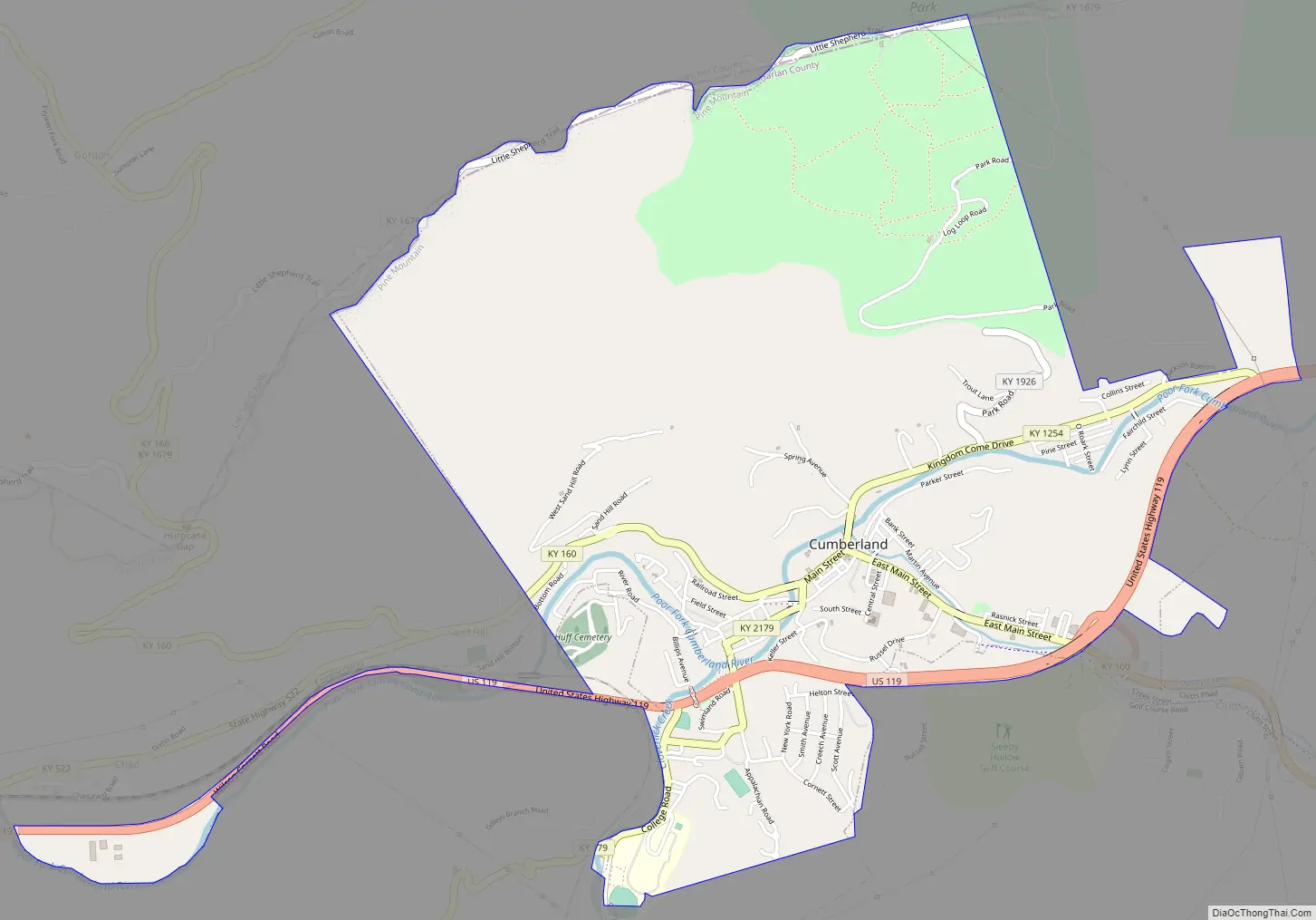
Cumberland Road Map
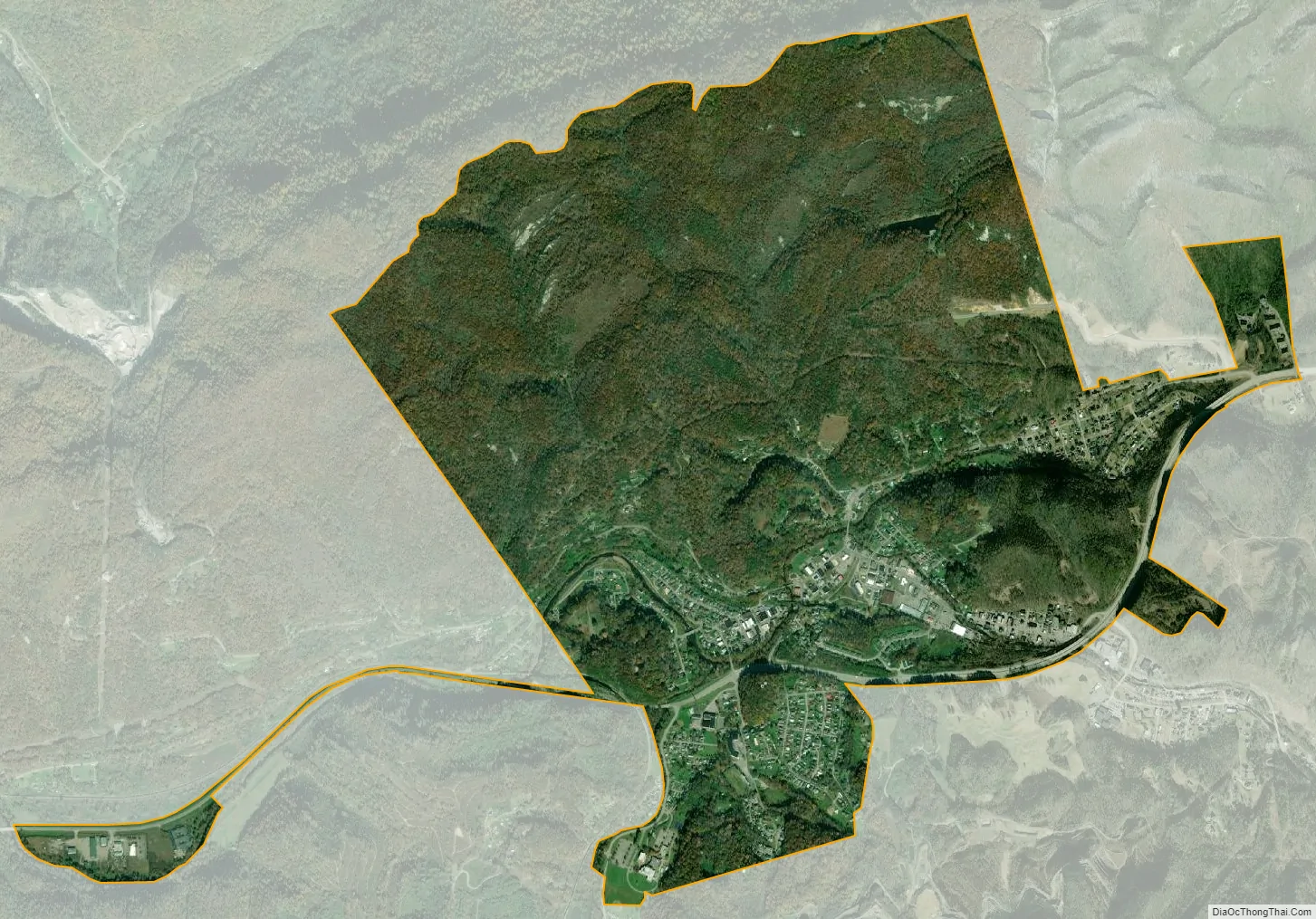
Cumberland city Satellite Map
Geography
Cumberland is located in northeastern Harlan County at 36°58′37″N 82°59′15″W / 36.97694°N 82.98750°W / 36.97694; -82.98750 (36.977016, -82.987434) in the valley of the Poor Fork of the Cumberland River, where it is joined by Looney Creek from the southeast and Cloverlick Creek from the south. The city limits extend to the north up to the crest of Pine Mountain, which forms the Letcher County line. Elevations within the city range from 1,400 feet (430 m) above sea level along the Poor Fork on the west side of town to 2,700 feet (820 m) atop Pine Mountain.
U.S. Route 119 passes through Cumberland, passing south of the city center. US 119 leads northeast 34 miles (55 km) to Jenkins and southwest 22 miles (35 km) to Harlan, the Harlan County seat. Kentucky Route 160 passes through the center of Cumberland, leading southeast 2.5 miles (4.0 km) to Benham and 12 miles (19 km) to the Virginia border, and north over Pine Mountain 5 miles (8 km) to Gordon.
According to the United States Census Bureau, the city of Cumberland has a total area of 3.1 square miles (8.1 km), of which 0.03 square miles (0.08 km), or 0.95%, are water.
Climate
The climate in this area is characterized by hot, humid summers and generally mild to cool winters. According to the Köppen Climate Classification system, Cumberland has a humid subtropical climate, abbreviated “Cfa” on climate maps.
See also
Map of Kentucky State and its subdivision:- Adair
- Allen
- Anderson
- Ballard
- Barren
- Bath
- Bell
- Boone
- Bourbon
- Boyd
- Boyle
- Bracken
- Breathitt
- Breckinridge
- Bullitt
- Butler
- Caldwell
- Calloway
- Campbell
- Carlisle
- Carroll
- Carter
- Casey
- Christian
- Clark
- Clay
- Clinton
- Crittenden
- Cumberland
- Daviess
- Edmonson
- Elliott
- Estill
- Fayette
- Fleming
- Floyd
- Franklin
- Fulton
- Gallatin
- Garrard
- Grant
- Graves
- Grayson
- Green
- Greenup
- Hancock
- Hardin
- Harlan
- Harrison
- Hart
- Henderson
- Henry
- Hickman
- Hopkins
- Jackson
- Jefferson
- Jessamine
- Johnson
- Kenton
- Knott
- Knox
- Larue
- Laurel
- Lawrence
- Lee
- Leslie
- Letcher
- Lewis
- Lincoln
- Livingston
- Logan
- Lyon
- Madison
- Magoffin
- Marion
- Marshall
- Martin
- Mason
- McCracken
- McCreary
- McLean
- Meade
- Menifee
- Mercer
- Metcalfe
- Monroe
- Montgomery
- Morgan
- Muhlenberg
- Nelson
- Nicholas
- Ohio
- Oldham
- Owen
- Owsley
- Pendleton
- Perry
- Pike
- Powell
- Pulaski
- Robertson
- Rockcastle
- Rowan
- Russell
- Scott
- Shelby
- Simpson
- Spencer
- Taylor
- Todd
- Trigg
- Trimble
- Union
- Warren
- Washington
- Wayne
- Webster
- Whitley
- Wolfe
- Woodford
- Alabama
- Alaska
- Arizona
- Arkansas
- California
- Colorado
- Connecticut
- Delaware
- District of Columbia
- Florida
- Georgia
- Hawaii
- Idaho
- Illinois
- Indiana
- Iowa
- Kansas
- Kentucky
- Louisiana
- Maine
- Maryland
- Massachusetts
- Michigan
- Minnesota
- Mississippi
- Missouri
- Montana
- Nebraska
- Nevada
- New Hampshire
- New Jersey
- New Mexico
- New York
- North Carolina
- North Dakota
- Ohio
- Oklahoma
- Oregon
- Pennsylvania
- Rhode Island
- South Carolina
- South Dakota
- Tennessee
- Texas
- Utah
- Vermont
- Virginia
- Washington
- West Virginia
- Wisconsin
- Wyoming