Harlan is a home rule-class city in and the county seat of Harlan County, Kentucky, United States. The population was 1,745 at the 2010 census, down from 2,081 at the 2000 census.
Harlan is one of three Kentucky county seats to share its name with its county, the others being Greenup and Henderson.
| Name: | Harlan city |
|---|---|
| LSAD Code: | 25 |
| LSAD Description: | city (suffix) |
| State: | Kentucky |
| County: | Harlan County |
| Elevation: | 1,191 ft (363 m) |
| Total Area: | 1.33 sq mi (3.46 km²) |
| Land Area: | 1.30 sq mi (3.37 km²) |
| Water Area: | 0.03 sq mi (0.08 km²) |
| Total Population: | 1,776 |
| Population Density: | 1,364.06/sq mi (526.68/km²) |
| ZIP code: | 40831 |
| Area code: | 606 |
| FIPS code: | 2134732 |
| GNISfeature ID: | 0493746 |
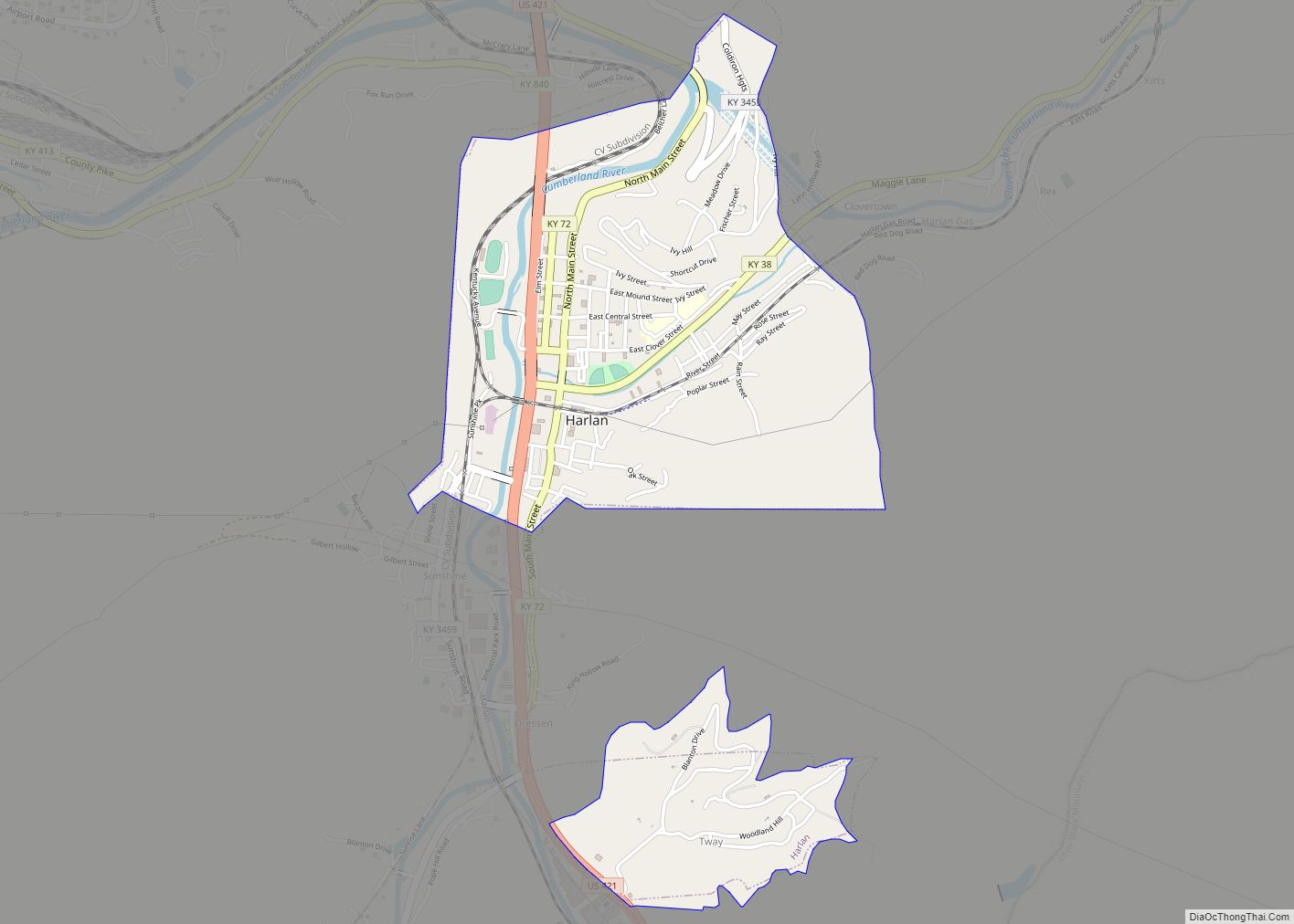
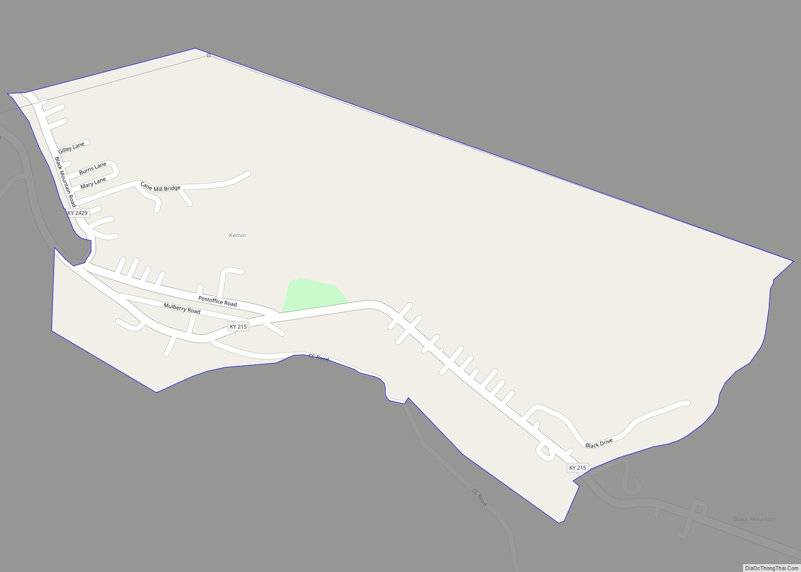
Online Interactive Map
Click on ![]() to view map in "full screen" mode.
to view map in "full screen" mode.
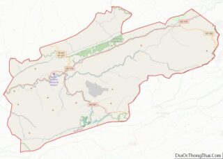
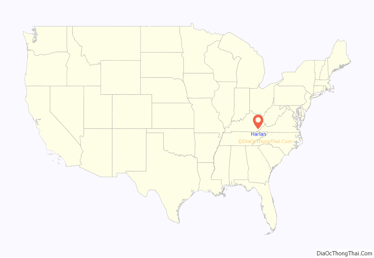
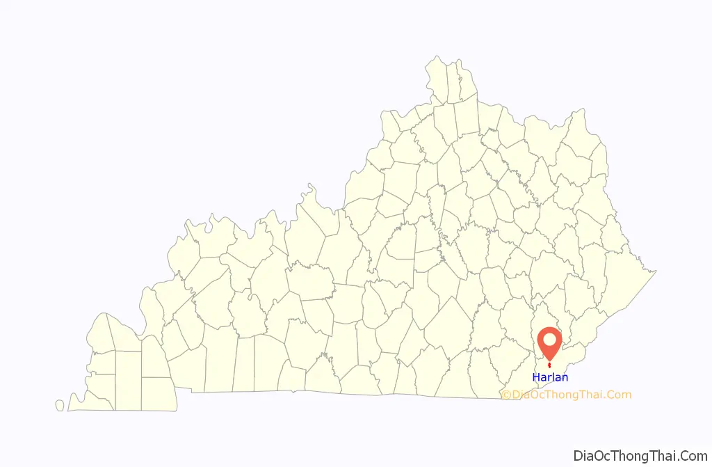
Harlan location map. Where is Harlan city?
History
Harlan was first settled by Samuel and Chloe Howard in 1796. Upon the founding of Harlan County (named for Kentucky pioneer Silas Harlan) in 1819, the Howards donated 12 acres (49,000 m) of land to serve as the county seat. The community there was already known as “Mount Pleasant”, apparently owing to a nearby Indian mound. A post office was established on September 19, 1828, but called “Harlan Court House” due to another Mt. Pleasant preempting that name. During the Civil War, Confederate raiders under Gen. Humphrey Marshall occupied the town; the local postmaster renamed the community “Spurlock” after himself; and, in October 1863, the courthouse was burnt down in reprisal for the Union destruction of the courthouse in Lee County, Virginia. In 1865, the post office was renamed “Harlan” and, although the community was formally incorporated by the state assembly as “Mount Pleasant” on April 15, 1884, the town was already usually called “Harlan Court House” or “Harlan Town” by its inhabitants. The city’s terms of incorporation were amended to change the name to “Harlan” on March 13, 1912. One year before, the Louisville and Nashville Railroad had arrived in Harlan and prompted massive growth. The city had initially expanded east along the Clover Fork; after World War II, it also expanded south along Martin’s Fork.
Harlan is the site of a criminal case in which a man, Condy Dabney, was convicted in 1924 of murdering a person who was later found alive.
A flood in 1977 prompted federal aid that diverted the Clover Fork into man-made tunnels under Ivy Hill in 1989. In the 1990s, a flood wall was completed on the city’s west side along the four-lane bypass U.S. Route 421.
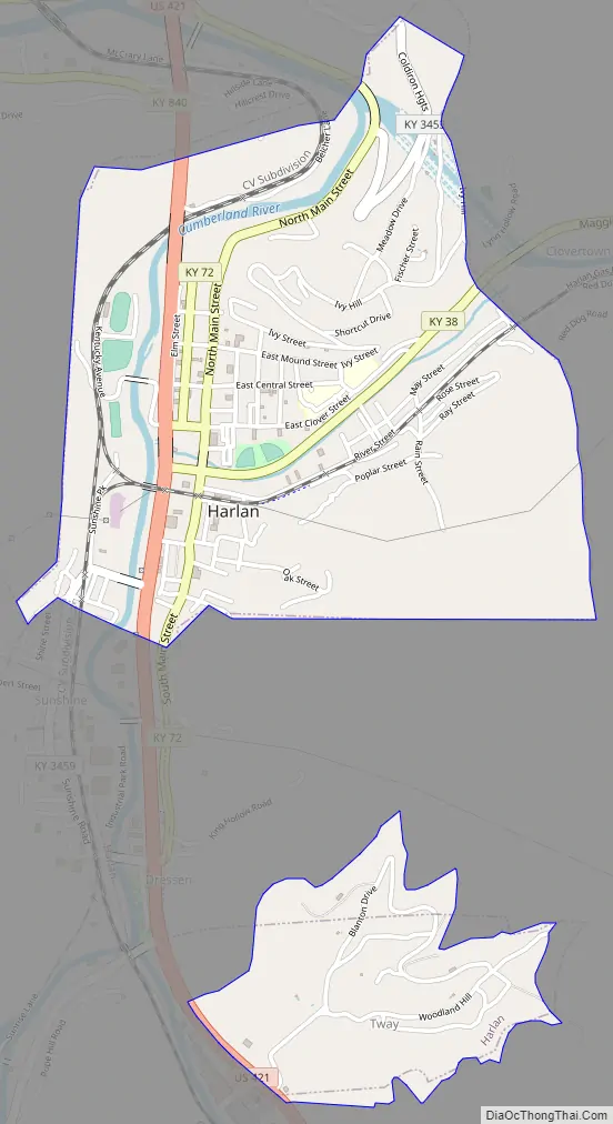
Harlan Road Map
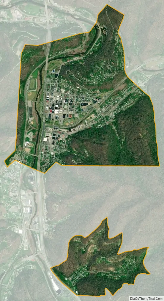
Harlan city Satellite Map
Geography
Harlan is located in west-central Harlan County at 36°50′29″N 83°19′12″W / 36.84139°N 83.32000°W / 36.84139; -83.32000 (36.841487, -83.320066), at the junction of the Clover Fork and Martin’s Fork rivers. The Clover Fork continues north 1.5 miles (2.4 km) to join the Poor Fork, forming the Cumberland River, a major tributary of the Ohio River. Harlan is in a narrow mountain valley, constrained to the north by the western end of Black Mountain, to the south by Little Black Mountain, and to the west by Ewing Spur. The elevation at the Harlan Courthouse is 1,197 feet (365 m) above sea level, while the surrounding ridges rise outside the city limits to 2,100 feet (640 m) (Black Mountain), 3,000 feet (910 m) (Little Black Mountain), and 2,300 feet (700 m) (Ewing Spur).
U.S. Route 421 passes through the city as four-lane highway; it leads north 34 miles (55 km) to Hyden and southeast 23 miles (37 km) to Pennington Gap, Virginia. The closest city with a population greater than 10,000 is Middlesboro, Kentucky, 42 miles (68 km) to the southeast via U.S. Routes 119 and 25E.
According to the United States Census Bureau, the city of Harlan has a total area of 1.4 square miles (3.5 km), of which 0.03 square miles (0.08 km), or 2.45%, are water.
Climate
The climate in this area is characterized by hot, humid summers and generally mild to cool winters. According to the Köppen Climate Classification system, Harlan has a humid subtropical climate, abbreviated “Cfa” on climate maps.
See also
Map of Kentucky State and its subdivision:- Adair
- Allen
- Anderson
- Ballard
- Barren
- Bath
- Bell
- Boone
- Bourbon
- Boyd
- Boyle
- Bracken
- Breathitt
- Breckinridge
- Bullitt
- Butler
- Caldwell
- Calloway
- Campbell
- Carlisle
- Carroll
- Carter
- Casey
- Christian
- Clark
- Clay
- Clinton
- Crittenden
- Cumberland
- Daviess
- Edmonson
- Elliott
- Estill
- Fayette
- Fleming
- Floyd
- Franklin
- Fulton
- Gallatin
- Garrard
- Grant
- Graves
- Grayson
- Green
- Greenup
- Hancock
- Hardin
- Harlan
- Harrison
- Hart
- Henderson
- Henry
- Hickman
- Hopkins
- Jackson
- Jefferson
- Jessamine
- Johnson
- Kenton
- Knott
- Knox
- Larue
- Laurel
- Lawrence
- Lee
- Leslie
- Letcher
- Lewis
- Lincoln
- Livingston
- Logan
- Lyon
- Madison
- Magoffin
- Marion
- Marshall
- Martin
- Mason
- McCracken
- McCreary
- McLean
- Meade
- Menifee
- Mercer
- Metcalfe
- Monroe
- Montgomery
- Morgan
- Muhlenberg
- Nelson
- Nicholas
- Ohio
- Oldham
- Owen
- Owsley
- Pendleton
- Perry
- Pike
- Powell
- Pulaski
- Robertson
- Rockcastle
- Rowan
- Russell
- Scott
- Shelby
- Simpson
- Spencer
- Taylor
- Todd
- Trigg
- Trimble
- Union
- Warren
- Washington
- Wayne
- Webster
- Whitley
- Wolfe
- Woodford
- Alabama
- Alaska
- Arizona
- Arkansas
- California
- Colorado
- Connecticut
- Delaware
- District of Columbia
- Florida
- Georgia
- Hawaii
- Idaho
- Illinois
- Indiana
- Iowa
- Kansas
- Kentucky
- Louisiana
- Maine
- Maryland
- Massachusetts
- Michigan
- Minnesota
- Mississippi
- Missouri
- Montana
- Nebraska
- Nevada
- New Hampshire
- New Jersey
- New Mexico
- New York
- North Carolina
- North Dakota
- Ohio
- Oklahoma
- Oregon
- Pennsylvania
- Rhode Island
- South Carolina
- South Dakota
- Tennessee
- Texas
- Utah
- Vermont
- Virginia
- Washington
- West Virginia
- Wisconsin
- Wyoming