Blackey is an unincorporated community in Letcher County, Kentucky, in the United States. As of the 2010 census, the population was 120. It is located near the early settlement of Indian Bottom. Blackey is thought to have been named after Blackey Brown, one of its citizens.
| Name: | Blackey city |
|---|---|
| LSAD Code: | 25 |
| LSAD Description: | city (suffix) |
| State: | Kentucky |
| County: | Letcher County |
| Incorporated: | January 27, 1915 |
| Elevation: | 1,007 ft (307 m) |
| Total Area: | 0.45 sq mi (1.16 km²) |
| Land Area: | 0.44 sq mi (1.13 km²) |
| Water Area: | 0.01 sq mi (0.03 km²) |
| Total Population: | 109 |
| Population Density: | 249.43/sq mi (96.27/km²) |
| ZIP code: | 41804 |
| Area code: | 606 |
| FIPS code: | 2107012 |
| GNISfeature ID: | 0507346 |
Online Interactive Map
Click on ![]() to view map in "full screen" mode.
to view map in "full screen" mode.
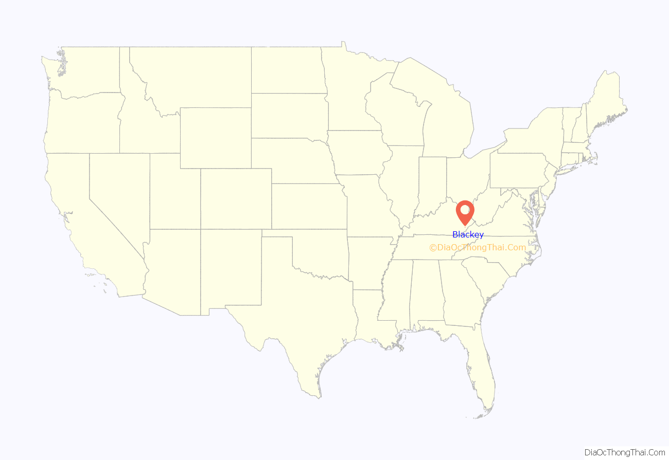
Blackey location map. Where is Blackey city?
History
The history of Blackey began in 1908, after local resident Jim Brown was given permission to establish a post office on Elk Creek. He decided to name the post office “Blackey”, after his brother Joseph “Blackey” Brown. Due to the area’s massive coal deposits, the Lexington and Eastern Railroad ran a line through Blackey in November 1912. Over the next fifteen years, Blackey was transformed from a sleepy mountain town to a bustling modern city. It was chartered in November 1912 and incorporated on January 27, 1915. In 1913, the community became the home of the Stuart Robinson School, a Presbyterian settlement school that was to operate there until 1957. In 1917, the Blackey Coal Company was established as the first coal company in the community. The company constructed thirty houses and employed eighty miners.
In May 1927, a flash flood devastated the city. In one hour, the North Fork of the Kentucky River rose 18 feet (5.5 m), killing 26 people in Letcher County alone. Later in December a fire broke out, destroying most of the city’s business district. Then in February 1928, another fire broke out and destroyed the rest of the town. Shortly afterwards, Blackey State Bank failed and the Great Depression ended the prosperity of the boom town.
Today, Blackey is home to just over 150 people, with only a few abandoned buildings and a few occupied homes on Main Street. Within the last few years, the city has seen some revitalization consisting of a Head Start, a new city water system, and a public library.
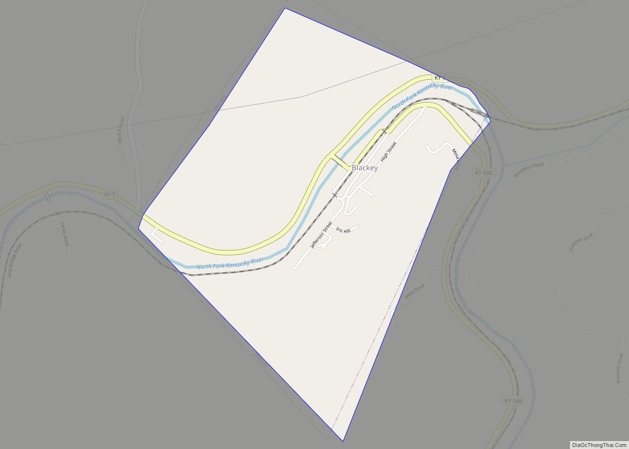
Blackey Road Map
Blackey city Satellite Map
Geography
Blackey is located in western Letcher County at 37°8′25″N 82°58′46″W / 37.14028°N 82.97944°W / 37.14028; -82.97944 (37.140413, -82.979368), in the valley of the North Fork of the Kentucky River. Kentucky Route 7 passes through the town, leading west and northwest down the North Fork valley 19 miles (31 km) to Jeff, and northeast up the valley of Rockhouse Creek then north down the valley of the Right Fork of Beaver Creek 40 miles (64 km) to Wayland. Kentucky Route 588 leads south and east up the North Fork of the Kentucky 15 miles (24 km) to Whitesburg, the Letcher county seat.
According to the United States Census Bureau, the city of Blackey has a total area of 0.46 square miles (1.2 km), of which 0.01 square miles (0.03 km), or 2.72%, are water.
See also
Map of Kentucky State and its subdivision:- Adair
- Allen
- Anderson
- Ballard
- Barren
- Bath
- Bell
- Boone
- Bourbon
- Boyd
- Boyle
- Bracken
- Breathitt
- Breckinridge
- Bullitt
- Butler
- Caldwell
- Calloway
- Campbell
- Carlisle
- Carroll
- Carter
- Casey
- Christian
- Clark
- Clay
- Clinton
- Crittenden
- Cumberland
- Daviess
- Edmonson
- Elliott
- Estill
- Fayette
- Fleming
- Floyd
- Franklin
- Fulton
- Gallatin
- Garrard
- Grant
- Graves
- Grayson
- Green
- Greenup
- Hancock
- Hardin
- Harlan
- Harrison
- Hart
- Henderson
- Henry
- Hickman
- Hopkins
- Jackson
- Jefferson
- Jessamine
- Johnson
- Kenton
- Knott
- Knox
- Larue
- Laurel
- Lawrence
- Lee
- Leslie
- Letcher
- Lewis
- Lincoln
- Livingston
- Logan
- Lyon
- Madison
- Magoffin
- Marion
- Marshall
- Martin
- Mason
- McCracken
- McCreary
- McLean
- Meade
- Menifee
- Mercer
- Metcalfe
- Monroe
- Montgomery
- Morgan
- Muhlenberg
- Nelson
- Nicholas
- Ohio
- Oldham
- Owen
- Owsley
- Pendleton
- Perry
- Pike
- Powell
- Pulaski
- Robertson
- Rockcastle
- Rowan
- Russell
- Scott
- Shelby
- Simpson
- Spencer
- Taylor
- Todd
- Trigg
- Trimble
- Union
- Warren
- Washington
- Wayne
- Webster
- Whitley
- Wolfe
- Woodford
- Alabama
- Alaska
- Arizona
- Arkansas
- California
- Colorado
- Connecticut
- Delaware
- District of Columbia
- Florida
- Georgia
- Hawaii
- Idaho
- Illinois
- Indiana
- Iowa
- Kansas
- Kentucky
- Louisiana
- Maine
- Maryland
- Massachusetts
- Michigan
- Minnesota
- Mississippi
- Missouri
- Montana
- Nebraska
- Nevada
- New Hampshire
- New Jersey
- New Mexico
- New York
- North Carolina
- North Dakota
- Ohio
- Oklahoma
- Oregon
- Pennsylvania
- Rhode Island
- South Carolina
- South Dakota
- Tennessee
- Texas
- Utah
- Vermont
- Virginia
- Washington
- West Virginia
- Wisconsin
- Wyoming
