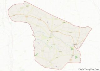
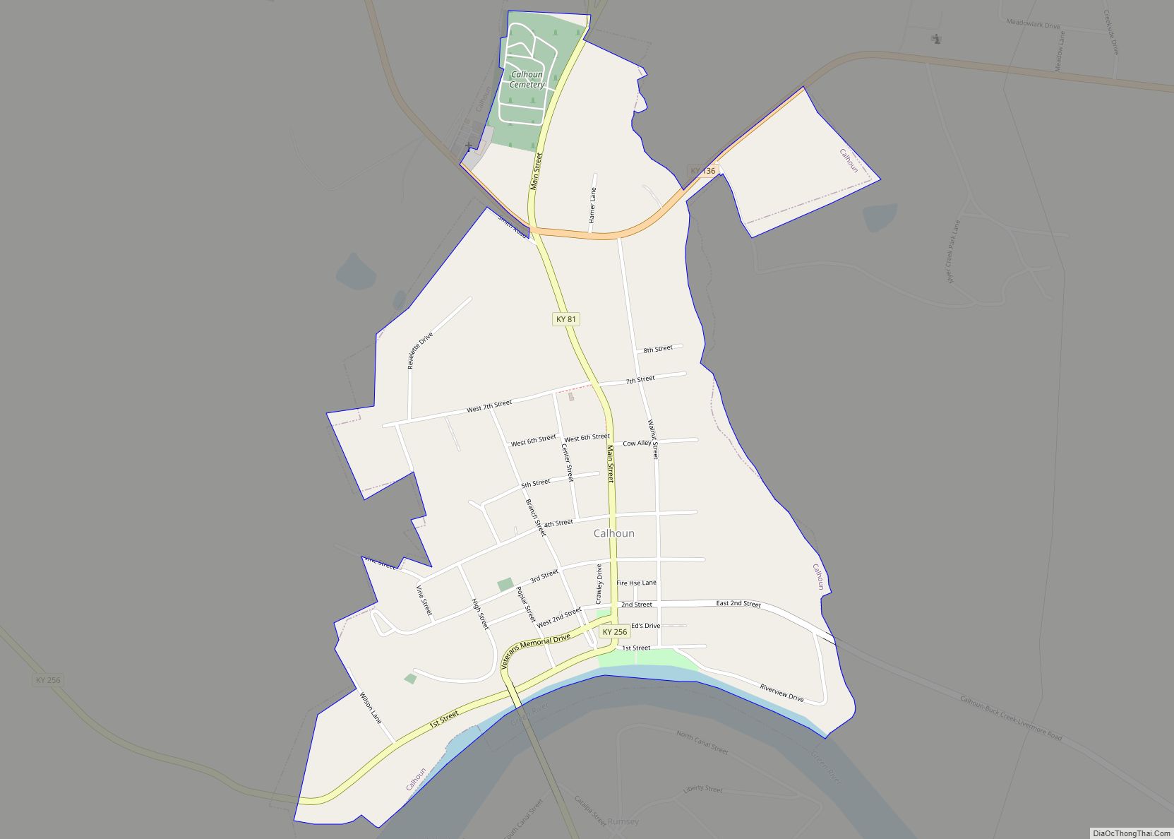
Calhoun is a home rule-class city in McLean County, Kentucky, United States. The population was 725 at the 2020 census. It is the county seat of McLean County. It is included in the Owensboro, Kentucky Metropolitan Statistical Area.
| Name: | Calhoun city |
|---|---|
| LSAD Code: | 25 |
| LSAD Description: | city (suffix) |
| State: | Kentucky |
| County: | McLean County |
| Elevation: | 394 ft (120 m) |
| Total Area: | 0.67 sq mi (1.73 km²) |
| Land Area: | 0.65 sq mi (1.69 km²) |
| Water Area: | 0.02 sq mi (0.04 km²) |
| Total Population: | 725 |
| Population Density: | 1,108.56/sq mi (427.99/km²) |
| ZIP code: | 42327 |
| Area code: | 270 & 364 |
| FIPS code: | 2111854 |
| GNISfeature ID: | 0488604 |
Online Interactive Map
Click on ![]() to view map in "full screen" mode.
to view map in "full screen" mode.
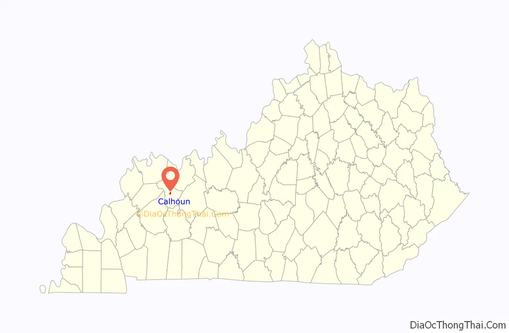
Calhoun location map. Where is Calhoun city?

History
Present-day Calhoun was first known as “Rhoadsville” after the German-born Pennsylvanian Captain Henry Rhoads (1739–1809), who laid out the town from 1784 to 1785 near the Long Falls of the Green River. His brother Solomon then erected a fort to protect the settlers and the transit around the falls.
Around the time John Hanley acquired Rhoads’ lands in a 1787 lawsuit, the site was renamed and was alternately known as “Fort Vienna” and “Vienna Station”. The post office established in 1849, however, was called “Calhoon” after Rep. John Calhoon of Kentucky, and the town was chartered by the state assembly in 1852 under this new name. At some later point, presumably out of confusion with the more famous Senator and Vice President John Calhoun of South Carolina, the spelling of the town was changed.
In 1854, it beat out the settlement of Rumsey on the other side of the river to become the seat of the newly formed McLean County.
Calhoun Road Map
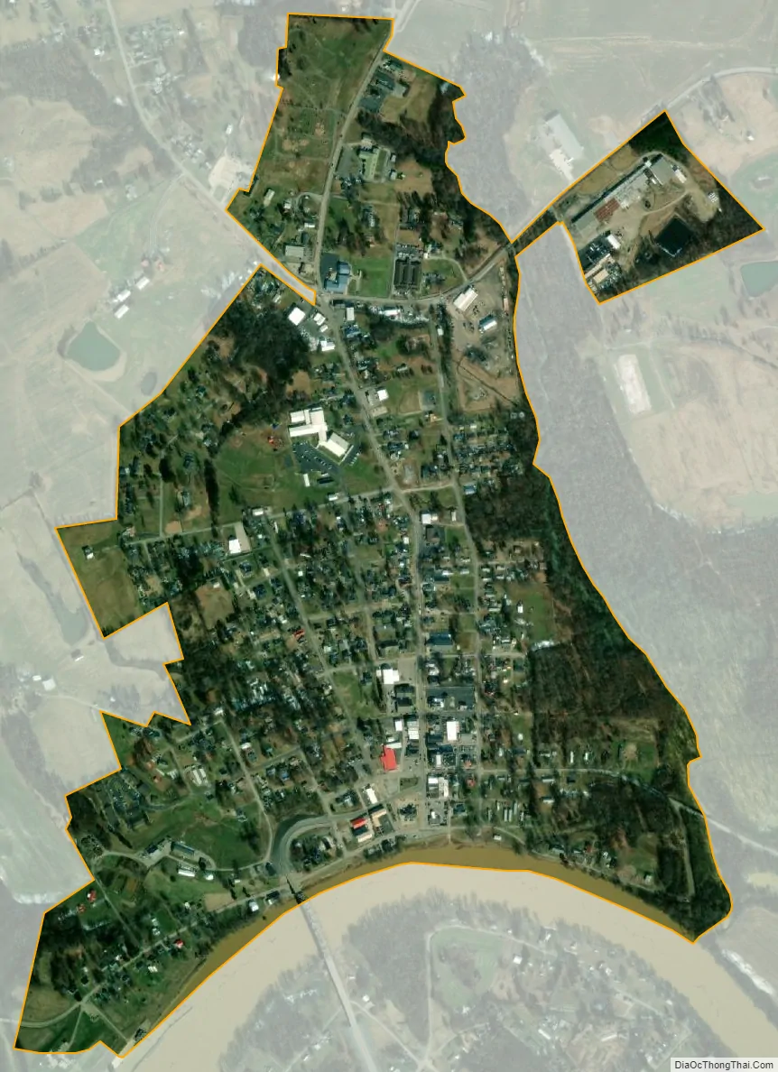
Calhoun city Satellite Map
Geography
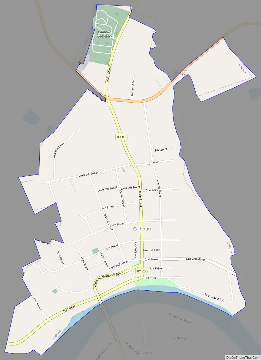
Calhoun is located in central McLean County at 37°32′19″N 87°15′34″W / 37.53861°N 87.25944°W / 37.53861; -87.25944 (37.538633, -87.259414), on the north bank of the Green River, the longest river entirely in the state. The Army Corps of Engineers’ Lock and Dam #2 on the river is at Calhoun. Calhoun is bordered to the south, across the river, by the community of Rumsey.
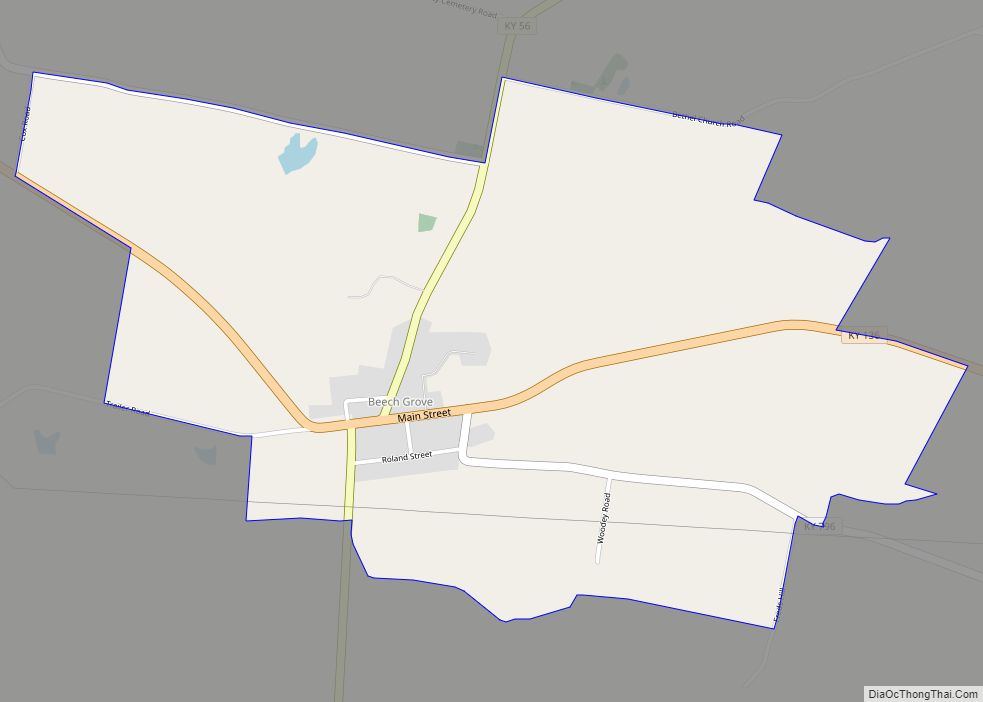
Kentucky Route 81 passes through Calhoun as its Main Street, leading north 21 miles (34 km) to Owensboro and south 23 miles (37 km) to Central City. Kentucky Route 256 leaves the center of Calhoun as 1st Street and leads northwest 10 miles (16 km) to Beech Grove. Kentucky Route 136 crosses the northern end of Calhoun, leading northwest to Beech Grove as well and southeast 10 miles (16 km) to Livermore.
According to the United States Census Bureau, Calhoun has a total area of 0.67 square miles (1.7 km), of which 0.02 square miles (0.05 km) , or 2.39%, are water.
See also
Map of Kentucky State and its subdivision:- Adair
- Allen
- Anderson
- Ballard
- Barren
- Bath
- Bell
- Boone
- Bourbon
- Boyd
- Boyle
- Bracken
- Breathitt
- Breckinridge
- Bullitt
- Butler
- Caldwell
- Calloway
- Campbell
- Carlisle
- Carroll
- Carter
- Casey
- Christian
- Clark
- Clay
- Clinton
- Crittenden
- Cumberland
- Daviess
- Edmonson
- Elliott
- Estill
- Fayette
- Fleming
- Floyd
- Franklin
- Fulton
- Gallatin
- Garrard
- Grant
- Graves
- Grayson
- Green
- Greenup
- Hancock
- Hardin
- Harlan
- Harrison
- Hart
- Henderson
- Henry
- Hickman
- Hopkins
- Jackson
- Jefferson
- Jessamine
- Johnson
- Kenton
- Knott
- Knox
- Larue
- Laurel
- Lawrence
- Lee
- Leslie
- Letcher
- Lewis
- Lincoln
- Livingston
- Logan
- Lyon
- Madison
- Magoffin
- Marion
- Marshall
- Martin
- Mason
- McCracken
- McCreary
- McLean
- Meade
- Menifee
- Mercer
- Metcalfe
- Monroe
- Montgomery
- Morgan
- Muhlenberg
- Nelson
- Nicholas
- Ohio
- Oldham
- Owen
- Owsley
- Pendleton
- Perry
- Pike
- Powell
- Pulaski
- Robertson
- Rockcastle
- Rowan
- Russell
- Scott
- Shelby
- Simpson
- Spencer
- Taylor
- Todd
- Trigg
- Trimble
- Union
- Warren
- Washington
- Wayne
- Webster
- Whitley
- Wolfe
- Woodford
- Alabama
- Alaska
- Arizona
- Arkansas
- California
- Colorado
- Connecticut
- Delaware
- District of Columbia
- Florida
- Georgia
- Hawaii
- Idaho
- Illinois
- Indiana
- Iowa
- Kansas
- Kentucky
- Louisiana
- Maine
- Maryland
- Massachusetts
- Michigan
- Minnesota
- Mississippi
- Missouri
- Montana
- Nebraska
- Nevada
- New Hampshire
- New Jersey
- New Mexico
- New York
- North Carolina
- North Dakota
- Ohio
- Oklahoma
- Oregon
- Pennsylvania
- Rhode Island
- South Carolina
- South Dakota
- Tennessee
- Texas
- Utah
- Vermont
- Virginia
- Washington
- West Virginia
- Wisconsin
- Wyoming