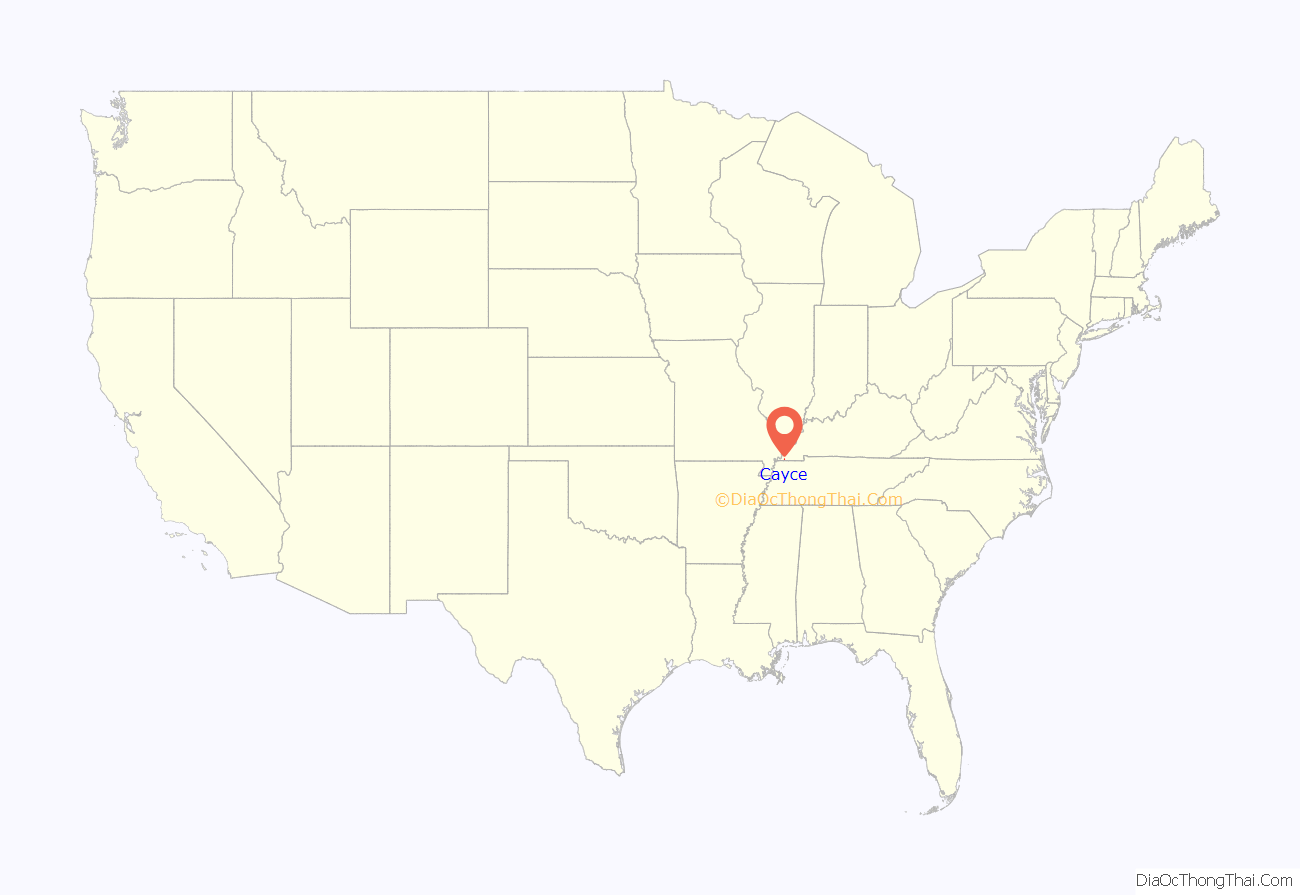
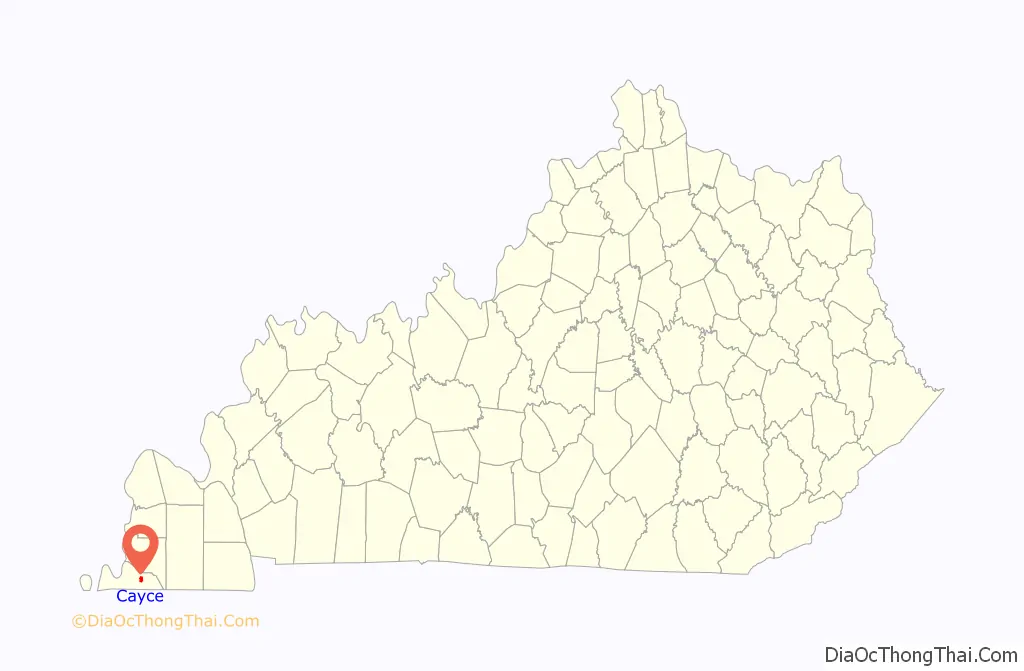
Cayce /ˈkeɪsiː/ is an unincorporated community and census-designated place (CDP) in Fulton County, Kentucky, United States, in the state’s southwestern corner. As of the 2020 census it had a population of 119.
The community was named for James Hardie Cayce, who established stores in Moscow, Clinton, and Cayce. Cayce is centrally located in Kentucky’s westernmost county, Fulton. The name is a homophone of “Casey”.
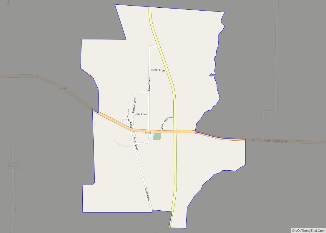
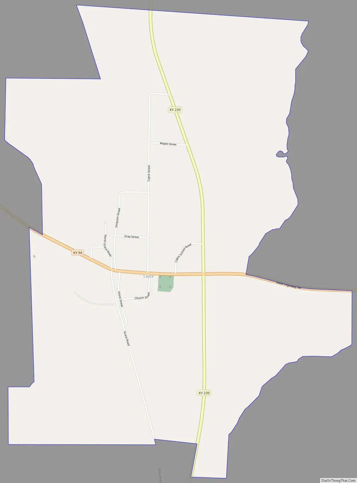
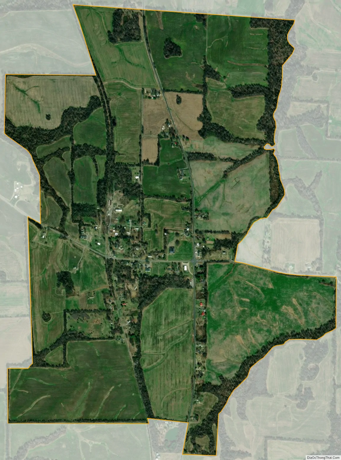
Cayce includes the area east and west from Willingham Bottom and Bayou de Chien Creek to Mud Creek and north and south from Moscow to the Middle Road (Kentucky Route 166). Part of the town, known as the “junction”, is at the junction of Kentucky Routes 94 and 239. This is the location of the service stations and cafe. Also at that junction (on the northwest corner) is an old elementary school (now closed), with a monument out front identifying Cayce as the hometown of American cultural icon, railroad engineer Casey Jones (1864–1900), who grew up in the area.
| Name: | Cayce CDP |
|---|---|
| LSAD Code: | 57 |
| LSAD Description: | CDP (suffix) |
| State: | Kentucky |
| County: | Fulton County |
| Elevation: | 400 ft (100 m) |
| Total Area: | 1.64 sq mi (4.24 km²) |
| Land Area: | 1.63 sq mi (4.22 km²) |
| Water Area: | 0.01 sq mi (0.01 km²) |
| Total Population: | 119 |
| Population Density: | 72.96/sq mi (28.18/km²) |
| ZIP code: | 42041 |
| Area code: | 270 & 364 |
| FIPS code: | 2113600 |
| GNISfeature ID: | 0489154 |
Online Interactive Map
Click on ![]() to view map in "full screen" mode.
to view map in "full screen" mode.
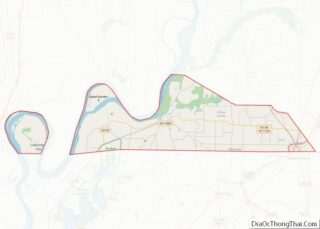
Cayce location map. Where is Cayce CDP?
History
Jones began work in 1878 for the north-south Mobile and Ohio Railroad (later the Gulf, Mobile and Ohio, and since the early 1970s a part of the Illinois Central Gulf Railroad); by 1890 he had worked his way up to engineer on the Illinois Central Railroad. John Luther “Casey” Jones earned his place in American folklore and legend for remaining at the throttle in the 1900 crash in which he lost his life.
In that era, railroaders with common surnames were often referred to by their hometown. John Luther Jones’s nickname thus became “Cayce” Jones (“Casey” would later become the accepted spelling).
In the late 19th century and early 20th century Cayce was a thriving southern business town. Today, however it is a residential small town.
December 2021 tornado
In December 2021, during a major tornado outbreak, Cayce was hit by the Western Kentucky tornado. Dozens of structures—including approximately 2/3 of all homes in the town—sustained major damage, and several were completely destroyed by winds rated up to EF4. These included the town’s fire department and the former Cayce High School. After killing 1 person in Cayce, the tornado continued traveling east through multiple counties and cities in Western Kentucky, causing widespread devastation and killing 58 people.
In the months following the storm, residents struggled with trauma from the outbreak and the slow rebuilding process, with many continuing to live in trailers or converted containers.
Cayce Road Map
Cayce city Satellite Map
See also
Map of Kentucky State and its subdivision:- Adair
- Allen
- Anderson
- Ballard
- Barren
- Bath
- Bell
- Boone
- Bourbon
- Boyd
- Boyle
- Bracken
- Breathitt
- Breckinridge
- Bullitt
- Butler
- Caldwell
- Calloway
- Campbell
- Carlisle
- Carroll
- Carter
- Casey
- Christian
- Clark
- Clay
- Clinton
- Crittenden
- Cumberland
- Daviess
- Edmonson
- Elliott
- Estill
- Fayette
- Fleming
- Floyd
- Franklin
- Fulton
- Gallatin
- Garrard
- Grant
- Graves
- Grayson
- Green
- Greenup
- Hancock
- Hardin
- Harlan
- Harrison
- Hart
- Henderson
- Henry
- Hickman
- Hopkins
- Jackson
- Jefferson
- Jessamine
- Johnson
- Kenton
- Knott
- Knox
- Larue
- Laurel
- Lawrence
- Lee
- Leslie
- Letcher
- Lewis
- Lincoln
- Livingston
- Logan
- Lyon
- Madison
- Magoffin
- Marion
- Marshall
- Martin
- Mason
- McCracken
- McCreary
- McLean
- Meade
- Menifee
- Mercer
- Metcalfe
- Monroe
- Montgomery
- Morgan
- Muhlenberg
- Nelson
- Nicholas
- Ohio
- Oldham
- Owen
- Owsley
- Pendleton
- Perry
- Pike
- Powell
- Pulaski
- Robertson
- Rockcastle
- Rowan
- Russell
- Scott
- Shelby
- Simpson
- Spencer
- Taylor
- Todd
- Trigg
- Trimble
- Union
- Warren
- Washington
- Wayne
- Webster
- Whitley
- Wolfe
- Woodford
- Alabama
- Alaska
- Arizona
- Arkansas
- California
- Colorado
- Connecticut
- Delaware
- District of Columbia
- Florida
- Georgia
- Hawaii
- Idaho
- Illinois
- Indiana
- Iowa
- Kansas
- Kentucky
- Louisiana
- Maine
- Maryland
- Massachusetts
- Michigan
- Minnesota
- Mississippi
- Missouri
- Montana
- Nebraska
- Nevada
- New Hampshire
- New Jersey
- New Mexico
- New York
- North Carolina
- North Dakota
- Ohio
- Oklahoma
- Oregon
- Pennsylvania
- Rhode Island
- South Carolina
- South Dakota
- Tennessee
- Texas
- Utah
- Vermont
- Virginia
- Washington
- West Virginia
- Wisconsin
- Wyoming