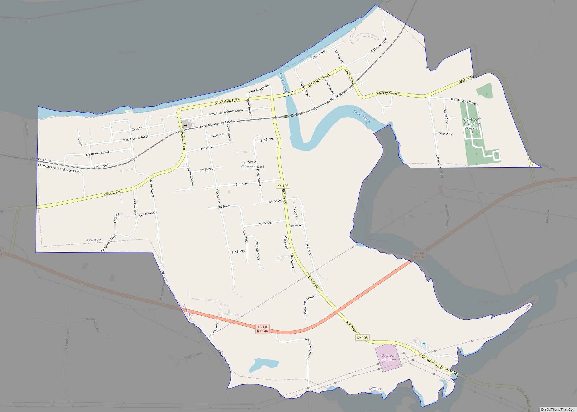
Cloverport is a home rule-class city in Breckinridge County, Kentucky, United States, on the banks of the Ohio River. The population was 1,152 at the 2010 census.
| Name: | Cloverport city |
|---|---|
| LSAD Code: | 25 |
| LSAD Description: | city (suffix) |
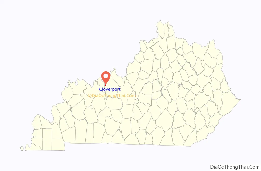
| State: | Kentucky |
| County: | Breckinridge County |
| Elevation: | 489 ft (149 m) |
| Total Area: | 1.52 sq mi (3.94 km²) |
| Land Area: | 1.46 sq mi (3.78 km²) |
| Water Area: | 0.06 sq mi (0.16 km²) |
| Total Population: | 1,119 |
| Population Density: | 765.91/sq mi (295.73/km²) |
| ZIP code: | 40111 |
| Area code: | 270 & 364 |
| FIPS code: | 2115904 |
| GNISfeature ID: | 0489709 |
| Website: | www.cloverport.com |
Online Interactive Map
Click on ![]() to view map in "full screen" mode.
to view map in "full screen" mode.
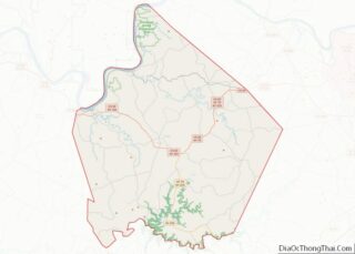
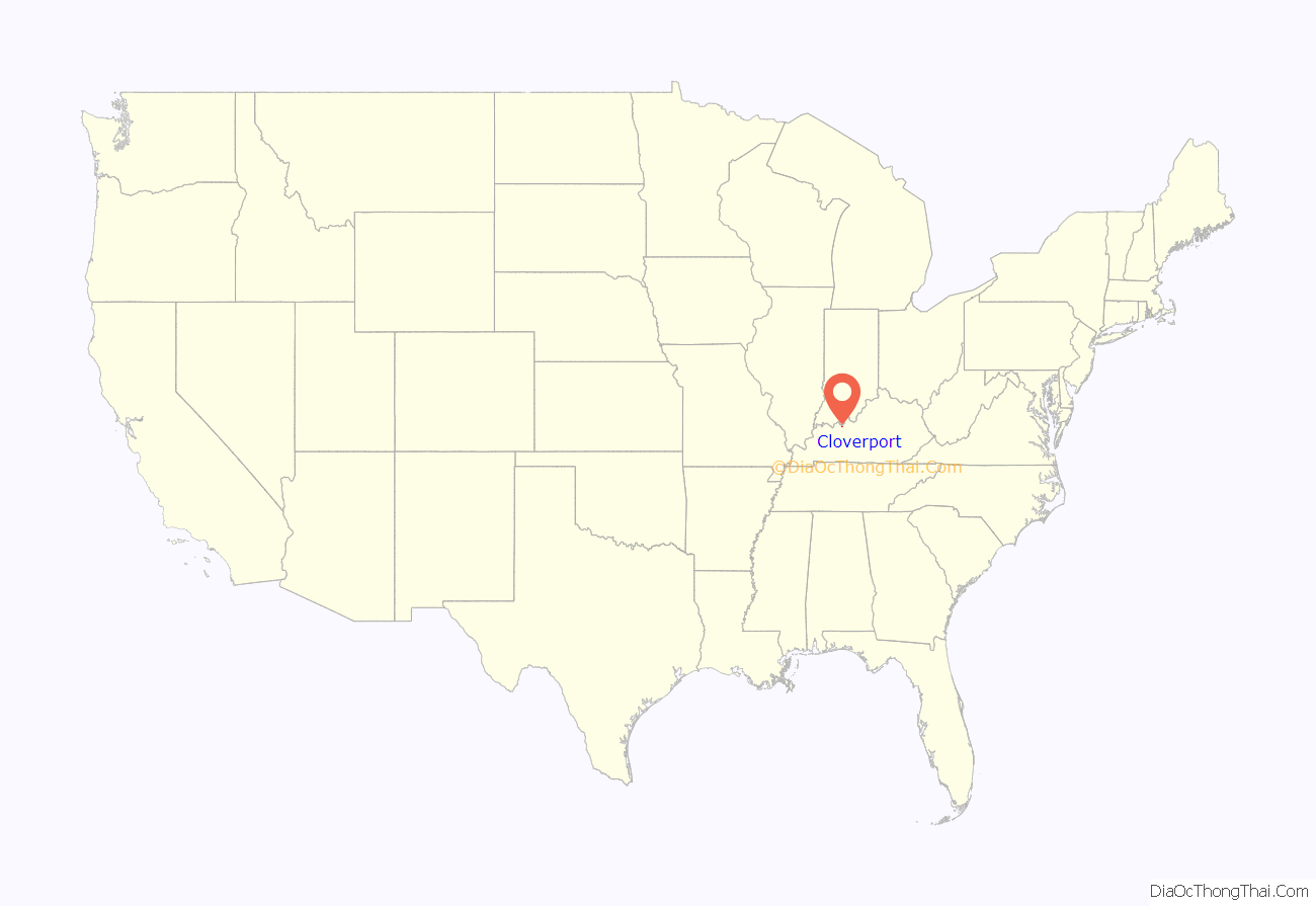
Cloverport location map. Where is Cloverport city?
History
The town was once known as Joesville after its founder, Joe Huston. Established around 1798 (or possibly 1808) on the east side of where Clover Creek meets the Ohio River. The town was the site of the ferry where, in 1816, Jacob Weatherholt piloted the family of Abraham Lincoln, then seven, across the Ohio River on its way to a newly acquired farm in Spencer County, Indiana.
Around 1820 a building was constructed that became the town’s first school and was shared by the Baptist and Methodist congregations as a church on Sundays. The town’s first graveyard, known as the Scott Cemetery, was beside this building which was located south of present Murray Avenue and east of Cherry Street.
The town was renamed Cloverport in 1828 after nearby Clover Creek. Seven years before, in 1821, the Kentucky Legislature had built a toll road between the town and Bowling Green. 1828 also saw the town open a post office with George LaHeist as post master.
In 1829, the Baptist congregation built their own church. In 1831, a new graveyard, known as the Murray Graveyard, was established on the north side of Main Street near the Cherry Street intersection. The Methodist congregation built their own church in 1840 on east Huston Street. The old building then became a church for the town’s black residents. The Methodist moved again in 1871 to a site on Elm Street.
The town was the site of a button factory, which made use of mussel shells from the Ohio. In the nineteenth century, the Victoria Coal Mines (named in honor of the British queen) produced coal oil from cannel coal that was used to light Buckingham Palace.
In 1857, the first Roman Catholic church, St. Malachi, was built on Chestnut Street south of Huston Street. In 1887, a new church was built and named St. Rose of Lima across the railroad tracks from the old St. Malachi church. The church and rectory were both burned in 1894 and rebuilt at their present locations.
The town was formally incorporated by an act of the state assembly in 1860 and expanded to take in the growing number of homes on the west side of Clover Creek. Land was also donated that year for a Presbyterian church at the corner of Main Street and Lynn Street. A church was never built there but in 1889 the property was exchanged for land on east Main Street where a church was built.
The town had its own newspaper beginning on July 17, 1878. The Breckenridge News was started by John D. Babbage and run by his family until 1950 when it was sold to George and Edith Wilson. The Wilsons merged the paper with their other newspaper, the Irvington Herald, and formed the Breckinridge County Herald-News in 1956.
In 1892 Cloverport became the home of the maintenance shops for the Louisville, Henderson, and St. Louis Railroad. The town raised $20,000 to bring the shops and donated ten acres for the location. The shops employed two hundred men at one time. The shop burned down on March 13, 1916 but was rebuilt. The shops stayed open until 1929 when the Louisville, Henderson and St. Louis was bought out by the Louisville and Nashville Railroad. The city and railroad company went to federal court in Louisville with the city trying to force the shops to stay open or for the railroad to pay the city back the original $20,000 that was raised for the shops plus $30,000 in interest. The dispute was settled out of court with the railroad paying back the original $20,000 plus returning the ten acres of land to the city. The city turned the land into an athletic park and a waste treatment facility.
Former United States Supreme Court Justice Wiley Blount Rutledge was born at nearby Tar Springs on July 20, 1894. Rutledge was the son of the pastor of Cloverport’s Baptist church.
On March 13, 1901 a fire swept through the city leaving about half of the residents homeless and destroying almost all of the business buildings, including two full American Tobacco Company warehouses. The Lucille Memorial Presbyterian Church, whose congregation had just paid off the mortgage, was burned down as was the Methodist church. Damage was estimated to be over $500,000 in the city.
In 1903, The Murray Roofing Tile Company started a tile plant in the city. In 1959 the company merged with other companies to form the Ceramic Tile Division of National Gypsum. This division then became known as American Olean Tile Company.
Another fire struck Cloverport on March 14, 1910 and destroyed many homes on the east side of town. At the time, the closest fire truck was in Owensboro and men from the Louisville, Henderson, and St. Louis Railroad repair yard were credited with saving many homes.
The Methodist church on Elm Street burned down in 1943. Two years later the congregation moved into a renovated building at the intersection of Main Street and Elm Street and was named Grant Memorial Church for their minister, Rev. W. A. Grant. In 1971, Grant Memorial’s congregation merged with Lucille Memorial Presbyterian church and the Evangelical United Brethren Church to form Cloverport United Methodist Church. This combined congregation purchased land for their new building in 1972 at their current site on south Elm Street.
In 2003, the National Park Service transferred the Cloverport Access Site to the city so that a community riverfront park could be developed. The property included the boat ramp on Clover Creek and 15.7 acres of property.
Flooding
Being a river town, Cloverport has been subjected to several floods since its founding. The Ohio River Flood of 1884 had been what all other floods which have struck the city were compared to until 1937. A flood in January 1907 crested at two feet below the 1884 high water mark. The city was also struck by the Great Flood of 1913. The Phelps’ Button factory flooded leaving many out of work and many other families were forced to leave their homes. It was reported that the flood waters were seven feet over the Tar Fork bridge and neck deep on a horse at Hites Run. All of the homes across the river in Tobinsport, Indiana were under water. The Ohio River flood of 1937 saw seventy percent of the town’s residents hit by the flood waters. The crest of the flood at the downstream Cannelton Locks and Dam was measured at 60.8 feet. This is over six feet higher than the next highest flood, which was the 1945 flood that crested at 54.4 feet. Cloverport was also hit by large floods in 1997, 2011, and 2018.
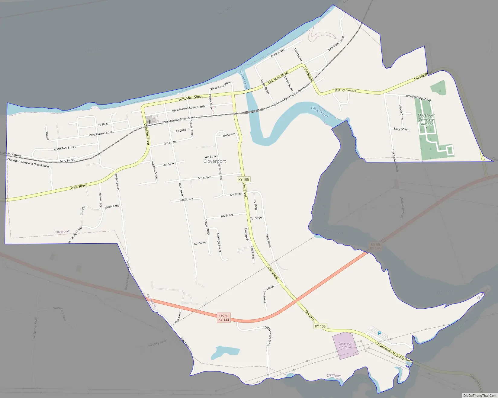
Cloverport Road Map
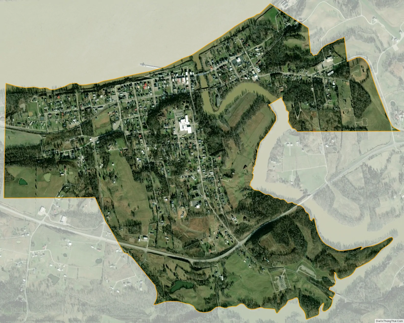
Cloverport city Satellite Map
Geography
According to the U.S. Census Bureau, the city has a total area of 1.5 square miles (4.0 km), of which 1.5 square miles (3.8 km) is land and 0.04 square miles (0.1 km), or 3.74%, is water.
See also
Map of Kentucky State and its subdivision:- Adair
- Allen
- Anderson
- Ballard
- Barren
- Bath
- Bell
- Boone
- Bourbon
- Boyd
- Boyle
- Bracken
- Breathitt
- Breckinridge
- Bullitt
- Butler
- Caldwell
- Calloway
- Campbell
- Carlisle
- Carroll
- Carter
- Casey
- Christian
- Clark
- Clay
- Clinton
- Crittenden
- Cumberland
- Daviess
- Edmonson
- Elliott
- Estill
- Fayette
- Fleming
- Floyd
- Franklin
- Fulton
- Gallatin
- Garrard
- Grant
- Graves
- Grayson
- Green
- Greenup
- Hancock
- Hardin
- Harlan
- Harrison
- Hart
- Henderson
- Henry
- Hickman
- Hopkins
- Jackson
- Jefferson
- Jessamine
- Johnson
- Kenton
- Knott
- Knox
- Larue
- Laurel
- Lawrence
- Lee
- Leslie
- Letcher
- Lewis
- Lincoln
- Livingston
- Logan
- Lyon
- Madison
- Magoffin
- Marion
- Marshall
- Martin
- Mason
- McCracken
- McCreary
- McLean
- Meade
- Menifee
- Mercer
- Metcalfe
- Monroe
- Montgomery
- Morgan
- Muhlenberg
- Nelson
- Nicholas
- Ohio
- Oldham
- Owen
- Owsley
- Pendleton
- Perry
- Pike
- Powell
- Pulaski
- Robertson
- Rockcastle
- Rowan
- Russell
- Scott
- Shelby
- Simpson
- Spencer
- Taylor
- Todd
- Trigg
- Trimble
- Union
- Warren
- Washington
- Wayne
- Webster
- Whitley
- Wolfe
- Woodford
- Alabama
- Alaska
- Arizona
- Arkansas
- California
- Colorado
- Connecticut
- Delaware
- District of Columbia
- Florida
- Georgia
- Hawaii
- Idaho
- Illinois
- Indiana
- Iowa
- Kansas
- Kentucky
- Louisiana
- Maine
- Maryland
- Massachusetts
- Michigan
- Minnesota
- Mississippi
- Missouri
- Montana
- Nebraska
- Nevada
- New Hampshire
- New Jersey
- New Mexico
- New York
- North Carolina
- North Dakota
- Ohio
- Oklahoma
- Oregon
- Pennsylvania
- Rhode Island
- South Carolina
- South Dakota
- Tennessee
- Texas
- Utah
- Vermont
- Virginia
- Washington
- West Virginia
- Wisconsin
- Wyoming