Hawesville is a home rule-class city on the south bank of the Ohio River in Hancock County, Kentucky, in the United States. It is the seat of its county. The population was 945 at the 2010 census. It is included in the Owensboro metropolitan area.
| Name: | Hawesville city |
|---|---|
| LSAD Code: | 25 |
| LSAD Description: | city (suffix) |
| State: | Kentucky |
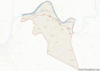
| County: | Hancock County |
| Incorporated: | 1847 |
| Elevation: | 410 ft (158 m) |
| Total Area: | 1.63 sq mi (4.22 km²) |
| Land Area: | 1.62 sq mi (4.20 km²) |
| Water Area: | 0.01 sq mi (0.01 km²) |
| Total Population: | 1,023 |
| Population Density: | 630.31/sq mi (243.30/km²) |
| ZIP code: | 42348 |
| Area code: | 270 & 364 |
| FIPS code: | 2135200 |
| GNISfeature ID: | 0493884 |
| Website: | www.hawesville.us |
Online Interactive Map
Click on ![]() to view map in "full screen" mode.
to view map in "full screen" mode.
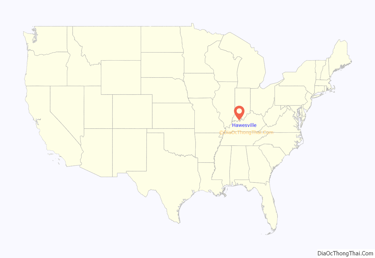
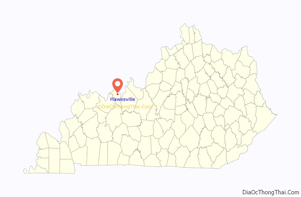
Hawesville location map. Where is Hawesville city?
History
Upon the establishment of Hancock County in 1829, local landowner Richard Hawes Sr. (father of Rep. Richard Hawes Jr.) donated land for a county seat, free to any homesteaders who settled there. The Hawesville post office was established later that year. The city was formally established in 1836 and incorporated by the state assembly in 1847.
Despite the Immaculate Conception Church’s listing on the National Register of Historic Places, it was demolished and replaced with a modern structure.
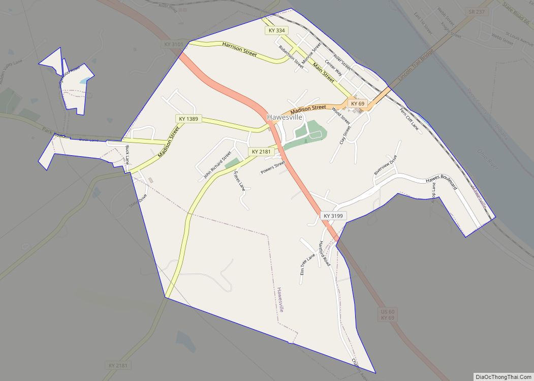
Hawesville Road Map

Hawesville city Satellite Map

Geography
Hawesville is located in northern Hancock County at 37°53′56″N 86°45′20″W / 37.89889°N 86.75556°W / 37.89889; -86.75556 (37.898865, -86.755570), on the south bank of the Ohio River and on the hills that rise south of the river. The Lincoln Trail Bridge carries Kentucky Route 69 across the Ohio at Hawesville, connecting the city with Cannelton, Indiana. U.S. Route 60 passes through the southwest part of Hawesville, leading southeast 10 miles (16 km) to Cloverport and southwest 25 miles (40 km) to Owensboro.
According to the United States Census Bureau, Hawesville has a total area of 1.2 square miles (3.2 km), all land.
See also
Map of Kentucky State and its subdivision:- Adair
- Allen
- Anderson
- Ballard
- Barren
- Bath
- Bell
- Boone
- Bourbon
- Boyd
- Boyle
- Bracken
- Breathitt
- Breckinridge
- Bullitt
- Butler
- Caldwell
- Calloway
- Campbell
- Carlisle
- Carroll
- Carter
- Casey
- Christian
- Clark
- Clay
- Clinton
- Crittenden
- Cumberland
- Daviess
- Edmonson
- Elliott
- Estill
- Fayette
- Fleming
- Floyd
- Franklin
- Fulton
- Gallatin
- Garrard
- Grant
- Graves
- Grayson
- Green
- Greenup
- Hancock
- Hardin
- Harlan
- Harrison
- Hart
- Henderson
- Henry
- Hickman
- Hopkins
- Jackson
- Jefferson
- Jessamine
- Johnson
- Kenton
- Knott
- Knox
- Larue
- Laurel
- Lawrence
- Lee
- Leslie
- Letcher
- Lewis
- Lincoln
- Livingston
- Logan
- Lyon
- Madison
- Magoffin
- Marion
- Marshall
- Martin
- Mason
- McCracken
- McCreary
- McLean
- Meade
- Menifee
- Mercer
- Metcalfe
- Monroe
- Montgomery
- Morgan
- Muhlenberg
- Nelson
- Nicholas
- Ohio
- Oldham
- Owen
- Owsley
- Pendleton
- Perry
- Pike
- Powell
- Pulaski
- Robertson
- Rockcastle
- Rowan
- Russell
- Scott
- Shelby
- Simpson
- Spencer
- Taylor
- Todd
- Trigg
- Trimble
- Union
- Warren
- Washington
- Wayne
- Webster
- Whitley
- Wolfe
- Woodford
- Alabama
- Alaska
- Arizona
- Arkansas
- California
- Colorado
- Connecticut
- Delaware
- District of Columbia
- Florida
- Georgia
- Hawaii
- Idaho
- Illinois
- Indiana
- Iowa
- Kansas
- Kentucky
- Louisiana
- Maine
- Maryland
- Massachusetts
- Michigan
- Minnesota
- Mississippi
- Missouri
- Montana
- Nebraska
- Nevada
- New Hampshire
- New Jersey
- New Mexico
- New York
- North Carolina
- North Dakota
- Ohio
- Oklahoma
- Oregon
- Pennsylvania
- Rhode Island
- South Carolina
- South Dakota
- Tennessee
- Texas
- Utah
- Vermont
- Virginia
- Washington
- West Virginia
- Wisconsin
- Wyoming