Lewisport is a home rule-class city in the floodplain of the Ohio River in Hancock County, Kentucky, in the United States. The population was 1,670 at the 2010 census, and is also the most populous community in the county. It is included in the Owensboro metropolitan area.
| Name: | Lewisport city |
|---|---|
| LSAD Code: | 25 |
| LSAD Description: | city (suffix) |
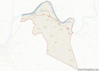
| State: | Kentucky |
| County: | Hancock County |
| Incorporated: | 1844 |
| Elevation: | 397 ft (121 m) |
| Total Area: | 0.97 sq mi (2.51 km²) |
| Land Area: | 0.95 sq mi (2.47 km²) |
| Water Area: | 0.01 sq mi (0.04 km²) |
| Total Population: | 1,767 |
| Population Density: | 1,854.14/sq mi (716.19/km²) |
| ZIP code: | 42351 |
| Area code: | 270 & 364 |
| FIPS code: | 2145136 |
| GNISfeature ID: | 0496341 |
| Website: | www.lewisport.cityof.org |
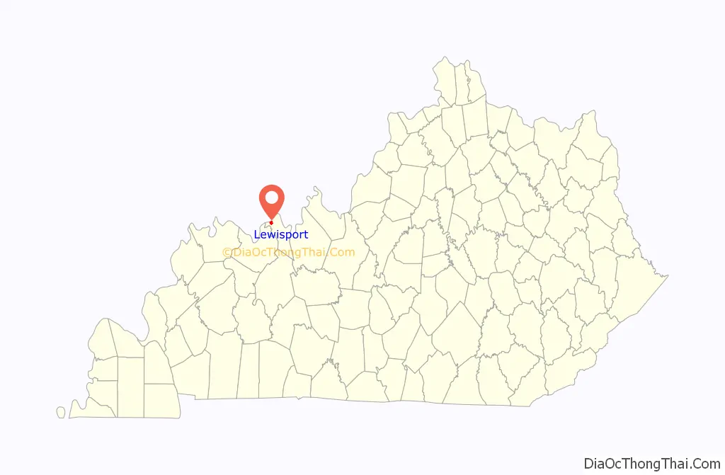
Online Interactive Map
Click on ![]() to view map in "full screen" mode.
to view map in "full screen" mode.
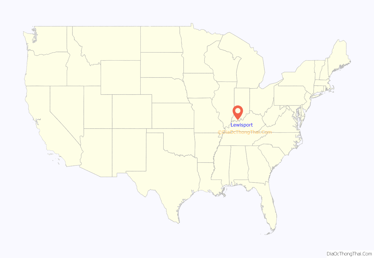
Lewisport location map. Where is Lewisport city?
History
Lewisport was originally a ferry landing site known as “Little Yellow Banks”, in allusion to Owensboro’s original name of “Yellow Banks”. The first settler was James Prentis, who platted the current town in 1837 with his brother John. An attempt to rename the city “Prentisport” failed, though, when James insisted the town be named after his friend Dr. John Lewis instead. The town was chartered as “Lewisport” in 1839, and the post office was established under that name in 1844. The city was formally incorporated by the state assembly the same year, but needed to be reincorporated in 1882.
Logging and flatboat construction were the initial chief industries. The river has flooded the city repeatedly, and the importance of lumber construction and industry has sparked several major fires.
Abraham Lincoln won his first case – Commonwealth of Kentucky v. Abraham Lincoln – in Lewisport’s Pate House, at the time the site of the local circuit court. He was tried in the east room of the log house before Squire Pate for operating a ferry across the Ohio River without a license, but the justice of the peace dismissed the case against him. The house is now a county landmark and is open for tours throughout the year.
During the Civil War, Bill Davison and Isaac Coulter captured and robbed the steamship Morning Star here on December 23, 1864, killing three Union soldiers. The town’s only bank was shuttered during the Great Depression. Upon its founding in 1938, the Lewisport School System comprised eight local one-room schools; today it is part of the Hancock County Consolidated School System.
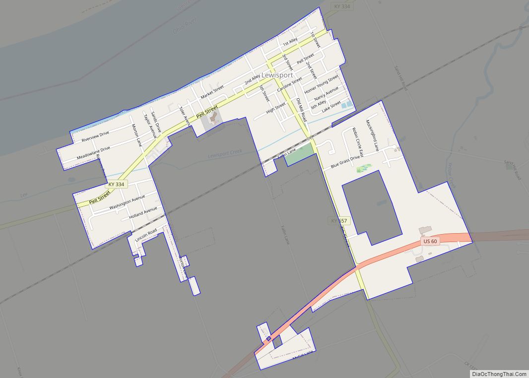
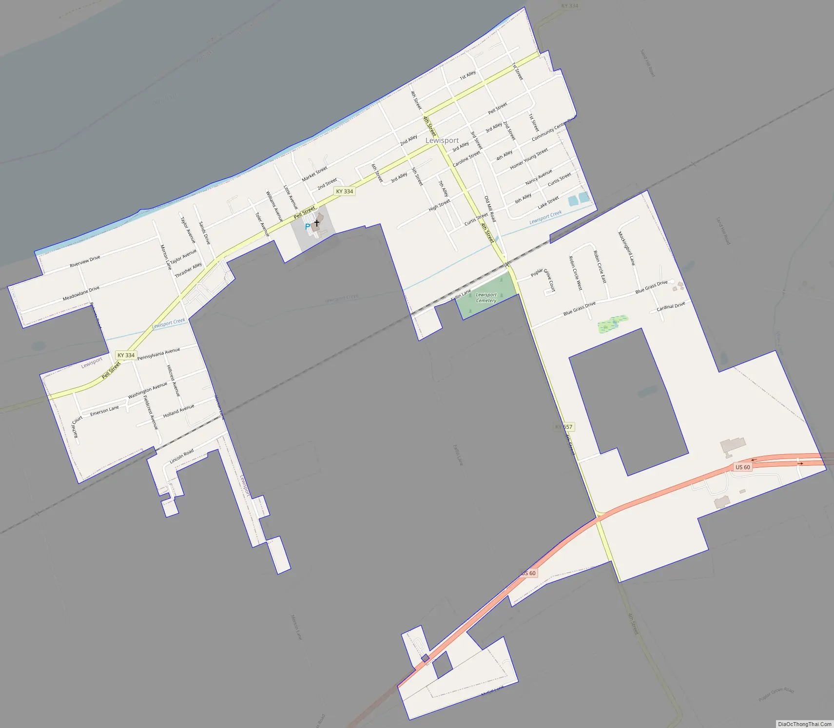
Lewisport Road Map
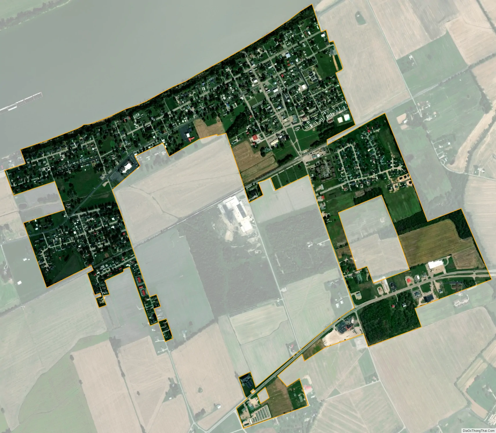
Lewisport city Satellite Map
Geography
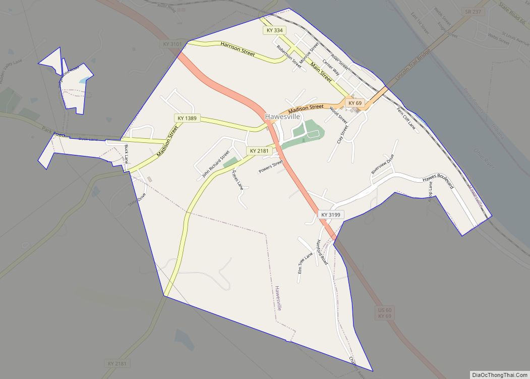
Lewisport is located in northwestern Hancock County at 37°56′6″N 86°54′19″W / 37.93500°N 86.90528°W / 37.93500; -86.90528 (37.935023, -86.905270), on the south bank of the Ohio River. The closest river crossings are 10 miles (16 km) by road to the east, at Hawesville, and the same distance to the west, at U.S. Route 231 near Rockport, Indiana. U.S. Route 60 passes east-west through the southern end of Lewisport. According to the United States Census Bureau, the city has a total area of 1.0 square mile (2.5 km), all land.
See also
Map of Kentucky State and its subdivision:- Adair
- Allen
- Anderson
- Ballard
- Barren
- Bath
- Bell
- Boone
- Bourbon
- Boyd
- Boyle
- Bracken
- Breathitt
- Breckinridge
- Bullitt
- Butler
- Caldwell
- Calloway
- Campbell
- Carlisle
- Carroll
- Carter
- Casey
- Christian
- Clark
- Clay
- Clinton
- Crittenden
- Cumberland
- Daviess
- Edmonson
- Elliott
- Estill
- Fayette
- Fleming
- Floyd
- Franklin
- Fulton
- Gallatin
- Garrard
- Grant
- Graves
- Grayson
- Green
- Greenup
- Hancock
- Hardin
- Harlan
- Harrison
- Hart
- Henderson
- Henry
- Hickman
- Hopkins
- Jackson
- Jefferson
- Jessamine
- Johnson
- Kenton
- Knott
- Knox
- Larue
- Laurel
- Lawrence
- Lee
- Leslie
- Letcher
- Lewis
- Lincoln
- Livingston
- Logan
- Lyon
- Madison
- Magoffin
- Marion
- Marshall
- Martin
- Mason
- McCracken
- McCreary
- McLean
- Meade
- Menifee
- Mercer
- Metcalfe
- Monroe
- Montgomery
- Morgan
- Muhlenberg
- Nelson
- Nicholas
- Ohio
- Oldham
- Owen
- Owsley
- Pendleton
- Perry
- Pike
- Powell
- Pulaski
- Robertson
- Rockcastle
- Rowan
- Russell
- Scott
- Shelby
- Simpson
- Spencer
- Taylor
- Todd
- Trigg
- Trimble
- Union
- Warren
- Washington
- Wayne
- Webster
- Whitley
- Wolfe
- Woodford
- Alabama
- Alaska
- Arizona
- Arkansas
- California
- Colorado
- Connecticut
- Delaware
- District of Columbia
- Florida
- Georgia
- Hawaii
- Idaho
- Illinois
- Indiana
- Iowa
- Kansas
- Kentucky
- Louisiana
- Maine
- Maryland
- Massachusetts
- Michigan
- Minnesota
- Mississippi
- Missouri
- Montana
- Nebraska
- Nevada
- New Hampshire
- New Jersey
- New Mexico
- New York
- North Carolina
- North Dakota
- Ohio
- Oklahoma
- Oregon
- Pennsylvania
- Rhode Island
- South Carolina
- South Dakota
- Tennessee
- Texas
- Utah
- Vermont
- Virginia
- Washington
- West Virginia
- Wisconsin
- Wyoming