Lewisburg (/ˈluːɪsbɜːrɡ/) is a home rule-class city in Logan County, Kentucky, in the United States. The population was 810 at the 2010 census, down from 903 at the 2000 census.
| Name: | Lewisburg city |
|---|---|
| LSAD Code: | 25 |
| LSAD Description: | city (suffix) |
| State: | Kentucky |
| County: | Logan County |
| Incorporated: | 1878 |
| Elevation: | 479 ft (146 m) |
| Total Area: | 1.18 sq mi (3.05 km²) |
| Land Area: | 1.16 sq mi (3.01 km²) |
| Water Area: | 0.02 sq mi (0.04 km²) |
| Total Population: | 748 |
| Population Density: | 643.72/sq mi (248.55/km²) |
| ZIP code: | 42256 |
| Area code: | 270 |
| FIPS code: | 2145064 |
| GNISfeature ID: | 0496337 |
| Website: | cityoflewisburgky.com |
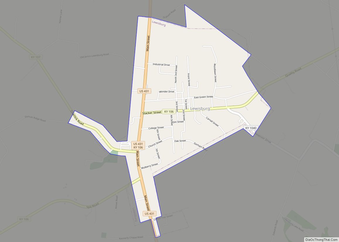
Online Interactive Map
Click on ![]() to view map in "full screen" mode.
to view map in "full screen" mode.
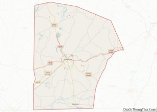
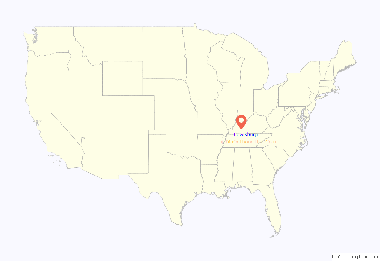
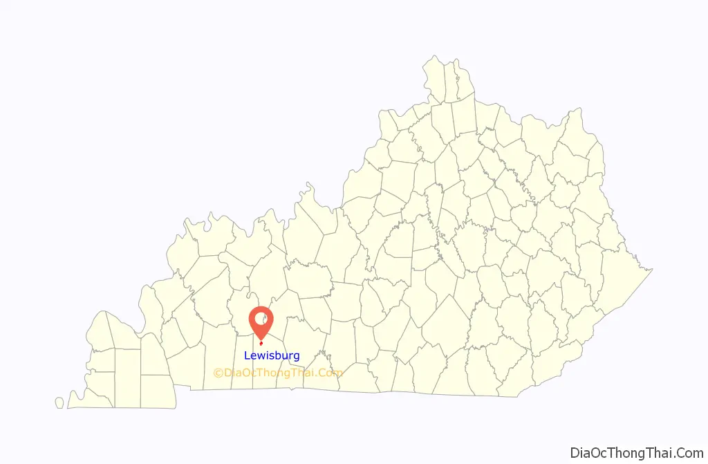
Lewisburg location map. Where is Lewisburg city?
History
The local post office was established at a nearby stage coach stop in 1852 under the name “Henrysville” in honor of the local postmaster’s family name.
In 1872, Lewisburg was surveyed, platted, and founded by the Owensboro and Nashville Railroad to serve as a depot on its line. It was named for Eugene C. Lewis, the line’s chief engineer. In 1877, the post office moved to the new community and changed its name. The city was formally incorporated by the state assembly the next year.
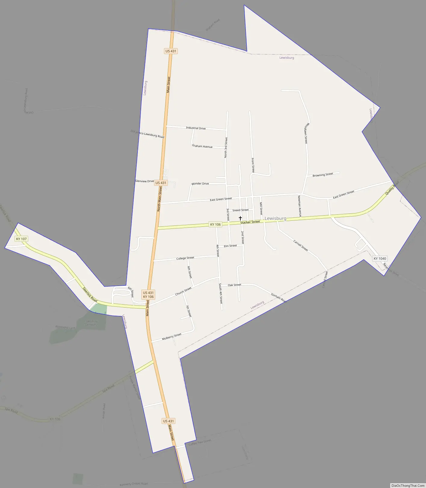
Lewisburg Road Map
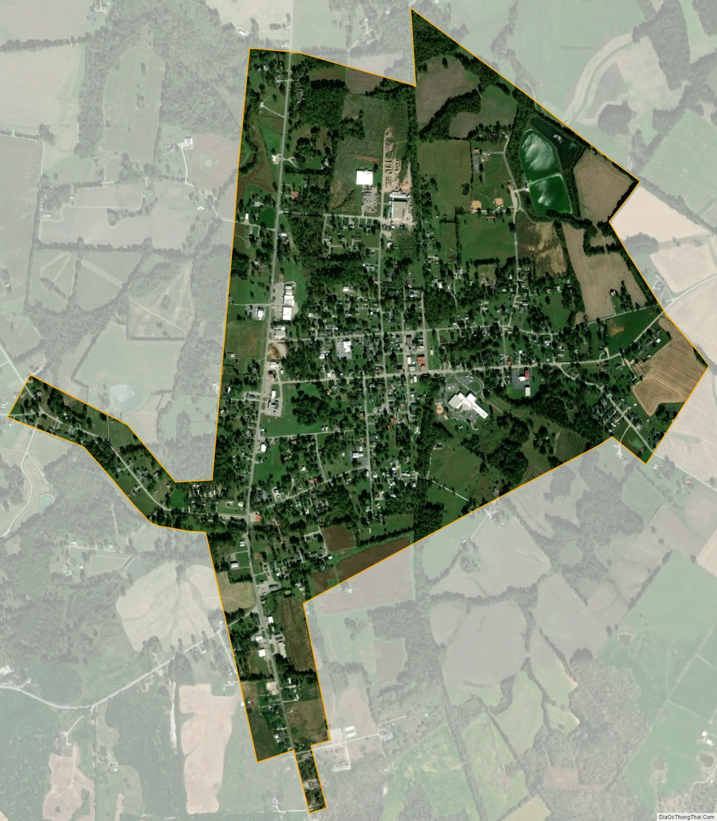
Lewisburg city Satellite Map
Geography
Lewisburg is located in northern Logan County at 36°59′8″N 86°57′4″W / 36.98556°N 86.95111°W / 36.98556; -86.95111 (36.985622, -86.951059). U.S. Route 431 passes through the west side of the city as Main Street, leading south 11 miles (18 km) to Russellville, the county seat, and north 26 miles (42 km) to Central City. Kentucky Route 106 runs through the center of Lewisburg as Stacker Street, leading northeast 20 miles (32 km) to Rochester and southwest 18 miles (29 km) to Elkton.
According to the United States Census Bureau, Lewisburg has a total area of 1.2 square miles (3.1 km), of which 0.02 square miles (0.04 km), or 1.39%, are water.
See also
Map of Kentucky State and its subdivision:- Adair
- Allen
- Anderson
- Ballard
- Barren
- Bath
- Bell
- Boone
- Bourbon
- Boyd
- Boyle
- Bracken
- Breathitt
- Breckinridge
- Bullitt
- Butler
- Caldwell
- Calloway
- Campbell
- Carlisle
- Carroll
- Carter
- Casey
- Christian
- Clark
- Clay
- Clinton
- Crittenden
- Cumberland
- Daviess
- Edmonson
- Elliott
- Estill
- Fayette
- Fleming
- Floyd
- Franklin
- Fulton
- Gallatin
- Garrard
- Grant
- Graves
- Grayson
- Green
- Greenup
- Hancock
- Hardin
- Harlan
- Harrison
- Hart
- Henderson
- Henry
- Hickman
- Hopkins
- Jackson
- Jefferson
- Jessamine
- Johnson
- Kenton
- Knott
- Knox
- Larue
- Laurel
- Lawrence
- Lee
- Leslie
- Letcher
- Lewis
- Lincoln
- Livingston
- Logan
- Lyon
- Madison
- Magoffin
- Marion
- Marshall
- Martin
- Mason
- McCracken
- McCreary
- McLean
- Meade
- Menifee
- Mercer
- Metcalfe
- Monroe
- Montgomery
- Morgan
- Muhlenberg
- Nelson
- Nicholas
- Ohio
- Oldham
- Owen
- Owsley
- Pendleton
- Perry
- Pike
- Powell
- Pulaski
- Robertson
- Rockcastle
- Rowan
- Russell
- Scott
- Shelby
- Simpson
- Spencer
- Taylor
- Todd
- Trigg
- Trimble
- Union
- Warren
- Washington
- Wayne
- Webster
- Whitley
- Wolfe
- Woodford
- Alabama
- Alaska
- Arizona
- Arkansas
- California
- Colorado
- Connecticut
- Delaware
- District of Columbia
- Florida
- Georgia
- Hawaii
- Idaho
- Illinois
- Indiana
- Iowa
- Kansas
- Kentucky
- Louisiana
- Maine
- Maryland
- Massachusetts
- Michigan
- Minnesota
- Mississippi
- Missouri
- Montana
- Nebraska
- Nevada
- New Hampshire
- New Jersey
- New Mexico
- New York
- North Carolina
- North Dakota
- Ohio
- Oklahoma
- Oregon
- Pennsylvania
- Rhode Island
- South Carolina
- South Dakota
- Tennessee
- Texas
- Utah
- Vermont
- Virginia
- Washington
- West Virginia
- Wisconsin
- Wyoming