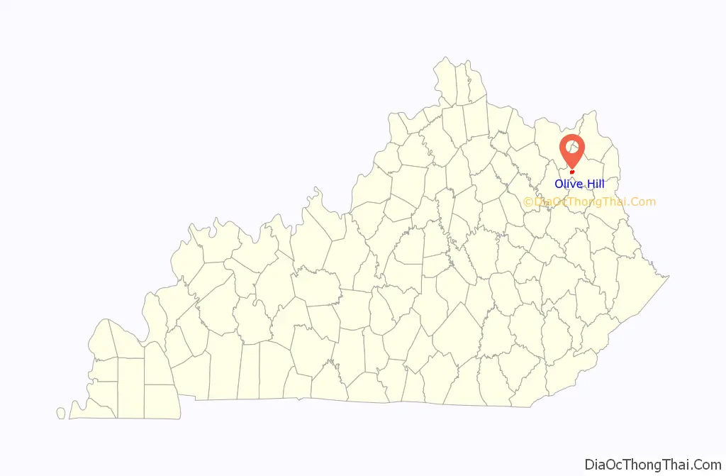
Olive Hill is a home rule-class city along Tygarts Creek in Carter County, Kentucky, in the United States. The population was 1,599 during the year 2010 U.S. Census.
| Name: | Olive Hill city |
|---|---|
| LSAD Code: | 25 |
| LSAD Description: | city (suffix) |
| State: | Kentucky |
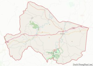
| County: | Carter County |
| Incorporated: | March 24, 1884 |
| Elevation: | 748 ft (228 m) |
| Total Area: | 2.02 sq mi (5.24 km²) |
| Land Area: | 1.99 sq mi (5.15 km²) |
| Water Area: | 0.03 sq mi (0.08 km²) |
| Total Population: | 1,580 |
| Population Density: | 793.97/sq mi (306.55/km²) |
| ZIP code: | 41164 |
| Area code: | 606 |
| FIPS code: | 2157918 |
| GNISfeature ID: | 0499923 |
| Website: | olivehill.ky.gov |
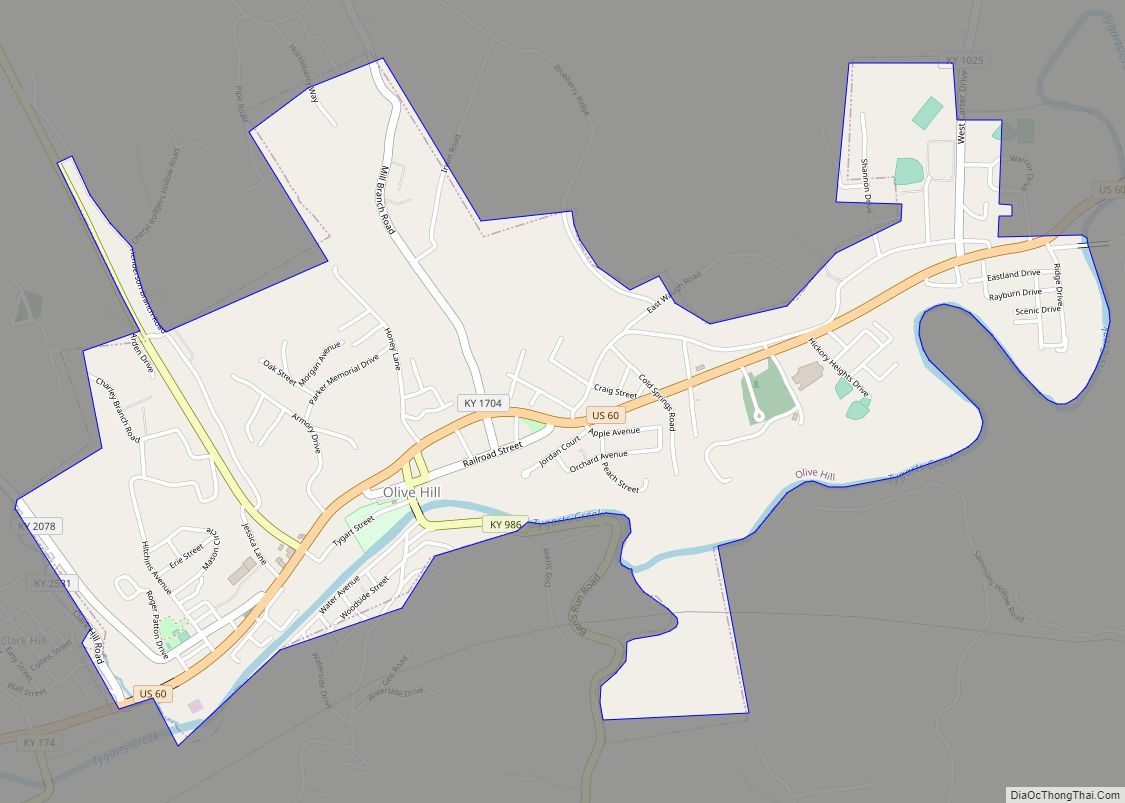
Online Interactive Map
Click on ![]() to view map in "full screen" mode.
to view map in "full screen" mode.
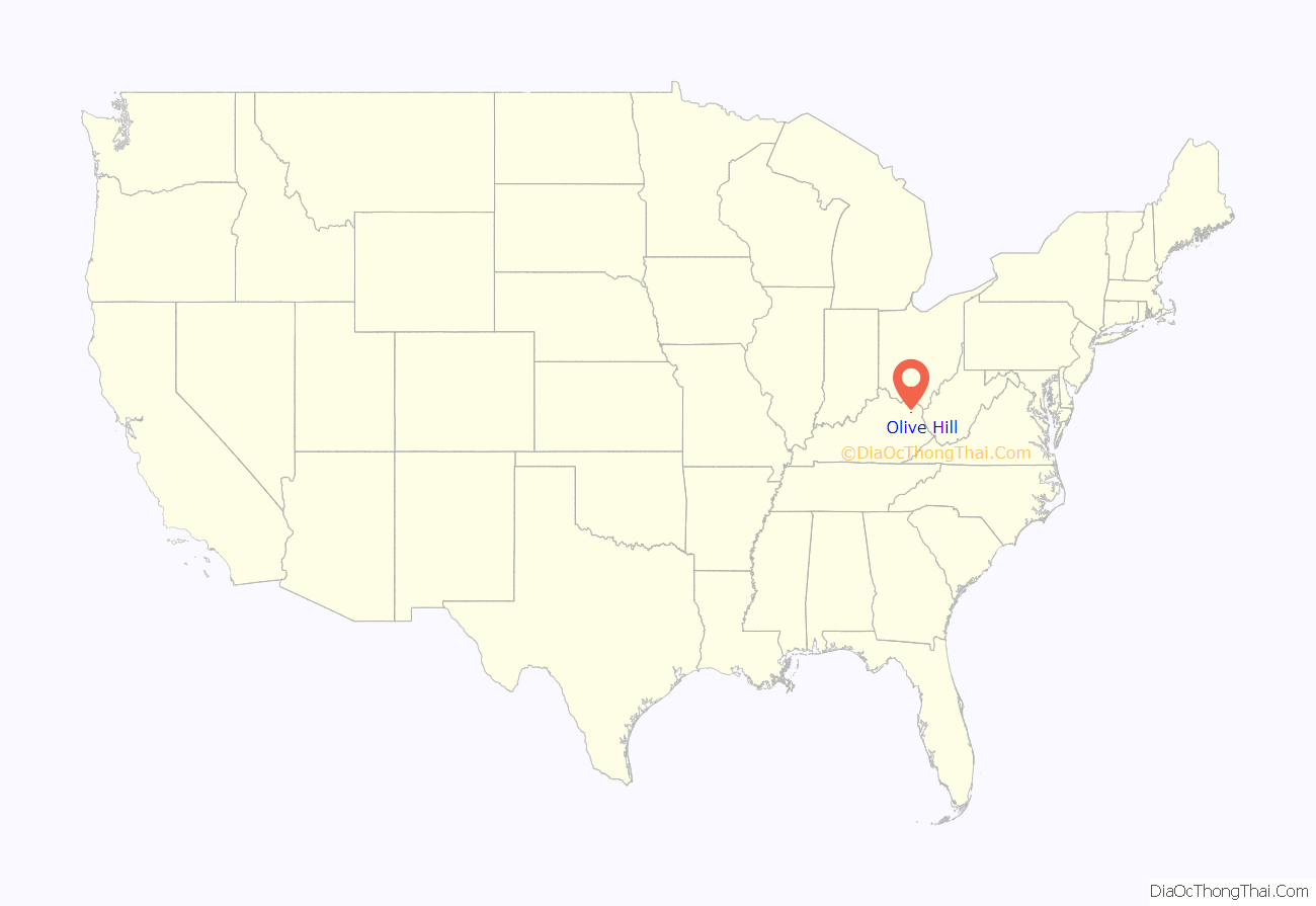
Olive Hill location map. Where is Olive Hill city?
History
Olive Hill began as a rural trading post established by the Henderson brothers in the first part of the 19th century. Although Olive Hill was allegedly named by Elias P. Davis for his friend Thomas Oliver, there is no evidence to support this popular contention. In 1881, the town was moved from a hillside location to the current location in the Tygarts Creek valley, where the Elizabethtown, Lexington, and Big Sandy Railroad had laid tracks. The hillside location become known as Old Olive Hill and now serves as the city’s residential area. On March 24, 1884, Olive Hill incorporated as a city and served as the county seat of the short-lived Beckham County from February 9 to April 29, 1904.
The Chesapeake and Ohio Railway served Olive Hill and many other places on the railroad’s Lexington Subdivision (running from Ashland to Lexington). The C&O merged into the Chessie System, which CSX Transportation later bought out, and after that CSX pulled up the railroad in the mid-1980s. Olive Hill retained and restored a passenger depot as well as a caboose (“John Hop Brown” Memorial Park).
According to George C. Wright in his A History of Blacks in Kentucky, volume 2, “In the small community of Olive Hill in 1917, several hundred white laborers at the brick-making General Refractories Company threatened to strike unless recently employed blacks were dismissed. After first refusing to meet with the leaders of the disgruntled workers, the company managers acceded to their demand and fired all the black workers,”(p. 14).
John “Hop” Brown Memorial park
Preserved Passenger Depot
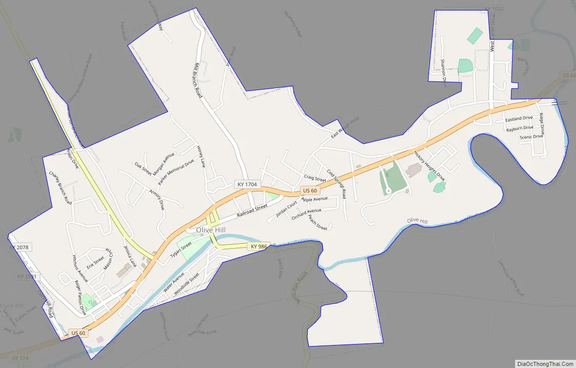
Olive Hill Road Map
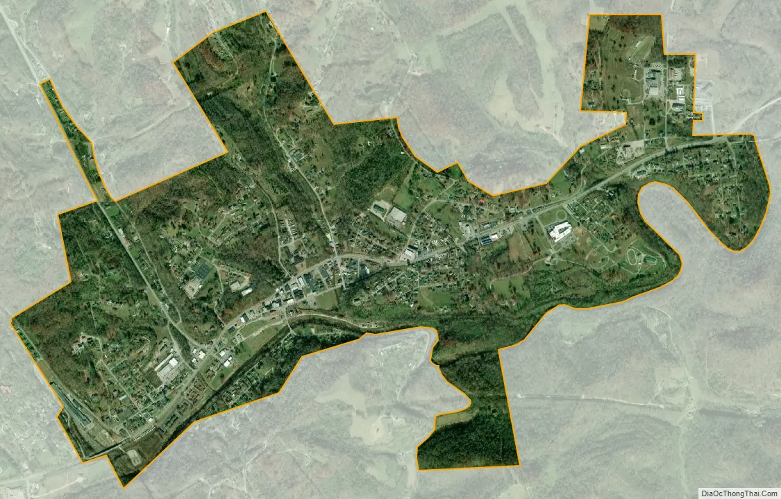
Olive Hill city Satellite Map
Geography
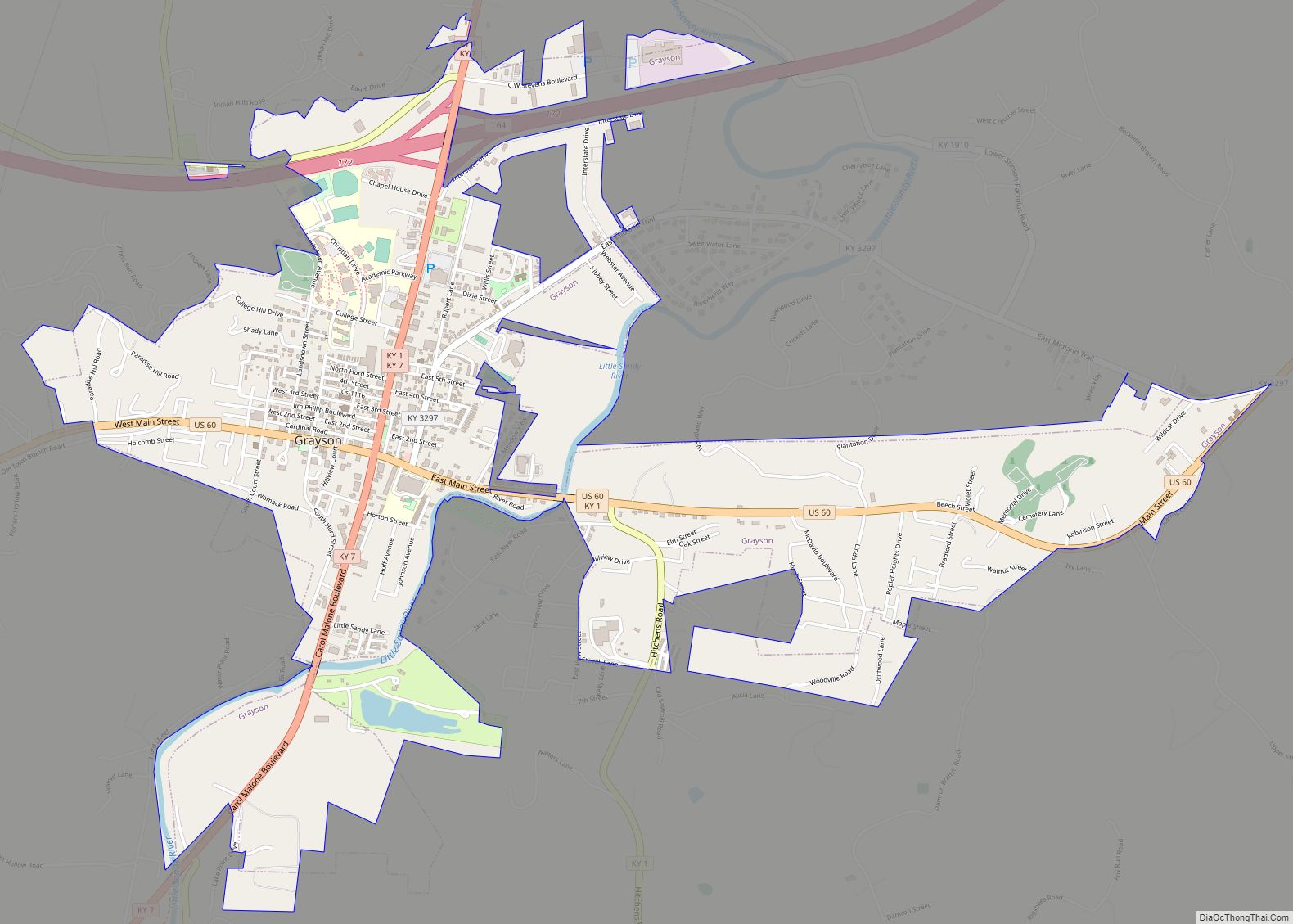
Olive Hill is located in western Carter County at 38°18′4″N 83°10′27″W / 38.30111°N 83.17417°W / 38.30111; -83.17417 (38.301007, -83.174091), primarily on the north side of Tygarts Creek, a tributary of the Ohio River. U.S. Route 60 passes through the city, leading east 14 miles (23 km) to Grayson, the Carter County seat, and west 18 miles (29 km) to Morehead. Interstate 64 passes 3 miles (5 km) north of Olive Hill, leading east 44 miles (71 km) to Huntington, West Virginia, and west 84 miles (135 km) to Lexington.
According to the United States Census Bureau, Olive Hill has a total area of 1.8 square miles (4.7 km), of which 0.027 square miles (0.07 km), or 1.51%, is water.
See also
Map of Kentucky State and its subdivision:- Adair
- Allen
- Anderson
- Ballard
- Barren
- Bath
- Bell
- Boone
- Bourbon
- Boyd
- Boyle
- Bracken
- Breathitt
- Breckinridge
- Bullitt
- Butler
- Caldwell
- Calloway
- Campbell
- Carlisle
- Carroll
- Carter
- Casey
- Christian
- Clark
- Clay
- Clinton
- Crittenden
- Cumberland
- Daviess
- Edmonson
- Elliott
- Estill
- Fayette
- Fleming
- Floyd
- Franklin
- Fulton
- Gallatin
- Garrard
- Grant
- Graves
- Grayson
- Green
- Greenup
- Hancock
- Hardin
- Harlan
- Harrison
- Hart
- Henderson
- Henry
- Hickman
- Hopkins
- Jackson
- Jefferson
- Jessamine
- Johnson
- Kenton
- Knott
- Knox
- Larue
- Laurel
- Lawrence
- Lee
- Leslie
- Letcher
- Lewis
- Lincoln
- Livingston
- Logan
- Lyon
- Madison
- Magoffin
- Marion
- Marshall
- Martin
- Mason
- McCracken
- McCreary
- McLean
- Meade
- Menifee
- Mercer
- Metcalfe
- Monroe
- Montgomery
- Morgan
- Muhlenberg
- Nelson
- Nicholas
- Ohio
- Oldham
- Owen
- Owsley
- Pendleton
- Perry
- Pike
- Powell
- Pulaski
- Robertson
- Rockcastle
- Rowan
- Russell
- Scott
- Shelby
- Simpson
- Spencer
- Taylor
- Todd
- Trigg
- Trimble
- Union
- Warren
- Washington
- Wayne
- Webster
- Whitley
- Wolfe
- Woodford
- Alabama
- Alaska
- Arizona
- Arkansas
- California
- Colorado
- Connecticut
- Delaware
- District of Columbia
- Florida
- Georgia
- Hawaii
- Idaho
- Illinois
- Indiana
- Iowa
- Kansas
- Kentucky
- Louisiana
- Maine
- Maryland
- Massachusetts
- Michigan
- Minnesota
- Mississippi
- Missouri
- Montana
- Nebraska
- Nevada
- New Hampshire
- New Jersey
- New Mexico
- New York
- North Carolina
- North Dakota
- Ohio
- Oklahoma
- Oregon
- Pennsylvania
- Rhode Island
- South Carolina
- South Dakota
- Tennessee
- Texas
- Utah
- Vermont
- Virginia
- Washington
- West Virginia
- Wisconsin
- Wyoming