Owensboro is a home rule-class city in and the county seat of Daviess County, Kentucky, United States. It is the fourth-largest city in the state by population. Owensboro is located on U.S. Route 60 and Interstate 165 about 107 miles (172 km) southwest of Louisville, and is the principal city of the Owensboro metropolitan area. The 2020 census had its population at 60,183. The metropolitan population was estimated at 116,506. The metropolitan area is the sixth largest in the state as of 2018, and the seventh largest population center in the state when including micropolitan areas.
| Name: | Owensboro city |
|---|---|
| LSAD Code: | 25 |
| LSAD Description: | city (suffix) |
| State: | Kentucky |
| County: | Daviess County |
| Incorporated: | 1850 |
| Elevation: | 394 ft (120 m) |
| Land Area: | 20.65 sq mi (53.49 km²) |
| Water Area: | 1.45 sq mi (3.76 km²) 6.47% |
| Population Density: | 2,914.15/sq mi (1,125.16/km²) |
| ZIP code: | 42301-42304 |
| Area code: | 270 & 364 |
| FIPS code: | 2158620 |
| GNISfeature ID: | 0500082 |
| Website: | www.owensboro.org |
Online Interactive Map
Click on ![]() to view map in "full screen" mode.
to view map in "full screen" mode.
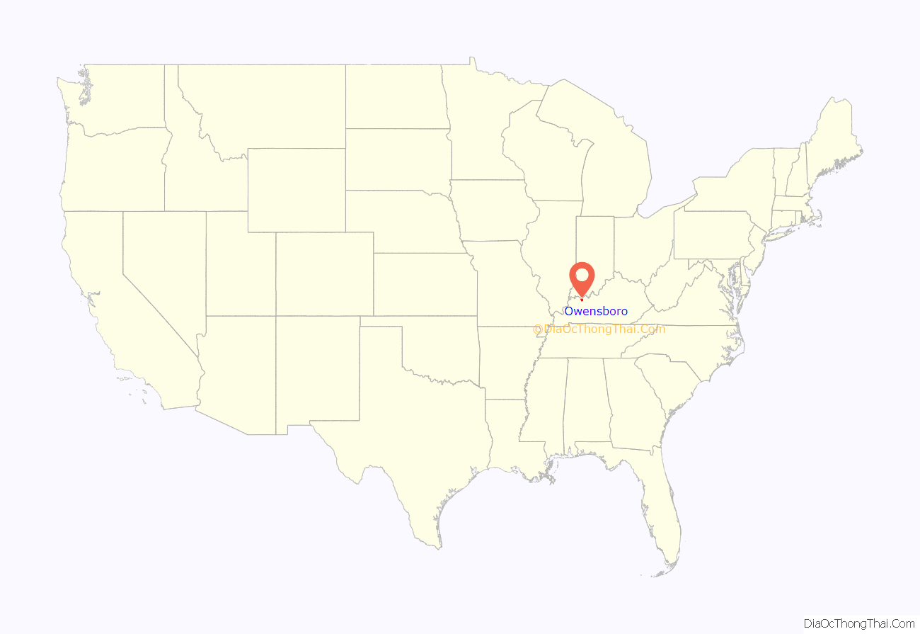
Owensboro location map. Where is Owensboro city?
History
Evidence of Native American settlement in the area dates back 12,000 years. Following a series of failed uprisings with British support, however, the last Shawnee were forced to vacate the area before the end of the 18th century.
The first European descendant to settle in Owensboro was frontiersman William Smeathers or Smothers in 1797, for whom the riverfront park is named. The settlement was originally known as “Yellow Banks” from the color of the land beside the Ohio River. In 1817, Yellow Banks was formally established under the name Owensborough, named after Col. Abraham Owen. In 1893, the spelling of the name was shortened to its current Owensboro.
Several distillers, mainly of bourbon whiskey, have been in and around the city of Owensboro. The major distillery still in operation is the Glenmore Distillery Company, now owned by the Sazerac Company.
On August 14, 1936, downtown Owensboro was the site of the last public hanging in the United States. A 26 year old African American man, Rainey Bethea, was convicted and sentenced for the rape and murder of 70-year-old Lischa Edwards in a very short time (only 37 days lapsed between the crime and the execution). A carnival atmosphere was in place with vendors selling hotdogs, attended by a large crowd including children and many reporters. The execution was presided over by a female sheriff, Florence Shoemaker Thompson, who gained national media attention for her role in the process, although she declined to spring the trap. Before Bethea was dead, the crowd had already begun to tear at his clothes and even his body for souvenirs. The Kentucky General Assembly quickly abolished public executions after the embarrassment this caused.
The end of the Second World War brought civil engineering projects which helped turn Owensboro from a sleepy industrial town into a modern, expanding community by the turn of the 1960s. Many of the projects were set in motion by Johnson, Depp & Quisenberry, a firm of consulting engineers then engaged in a runway redesign at the County Airport; the “Depp” in question was a member of an old and prominent Kentucky family which includes the town’s most famous son, actor Johnny Depp.
Manufacturing
As of 1903, Owensboro was home to several stemmeries. Pinkerton Tobacco produced Red Man chewing tobacco in Owensboro. Swedish Match continues to make Red Man in a plant outside city limits.
The Owensboro Wagon Company, established in 1884, was one of the largest and most influential wagon companies in the nation. With eight styles or sizes of wagons, the company set the standard of quality at the turn of the 20th century.
Frederick A. Ames came to Owensboro from Washington, Pennsylvania, in 1887. He started the Carriage Woodstock Company to repair horse-drawn carriages. In 1910, he began to manufacture a line of automobiles under the Ames brand name. Ames hired industrialist Vincent Bendix in 1912, and the company became the Ames Motor Car Company. Despite its product being called the “best $1500” car by a Texas car dealer, the company ceased production of its own model in 1915. The company then began manufacturing replacement bodies for the more widely sold Ford Model T. In 1922, the company remade itself and started to manufacture furniture under the name Ames Corporation. The company finally sold out to Whitehall Furniture in 1970.
The start of the Kentucky Electrical Lamp Company, a light bulb manufacturing company was in 1899; it eventually was acquired by Kentucky Radio Company (Ken-Rad) in 1918 and later acquired by General Electric in 1945 and in 1987 acquired by MPD, Inc., created the light bulbs that illuminated the first night game in the history of Major League Baseball on May 24, 1935, between the Reds and Phillies at Cincinnati’s Crosley Field. The Owensboro plant was a major part of General Electric’s vacuum tube manufacturing operations, producing both receiving types and military/industrial ceramic types. In 1961, engineers at the General Electric plant in Owensboro introduced a family of vacuum tubes called the Compactron.
In June 1932, John G. Barnard founded the Modern Welding Company in a small building located near the Ohio River at First and Frederica Streets where the Bluegrass Music Hall of Fame and Museum sits today. Today, Modern Welding Company has nine steel tank and vessel fabrication subsidiaries located throughout the United States, and five welding supply stores located in Kentucky and Indiana. The company is the country’s largest supplier of underground and above ground steel storage tanks for flammable and combustible liquids. The company celebrated its 75th anniversary in 2007.
Texas Gas Transmission Corporation was created in 1948 with the merger of Memphis Natural Gas Company and Kentucky Natural Gas Corporation and made its headquarters in Owensboro. Since that time, Texas Gas changed ownership four times. The company was bought by CSX Corp. in 1983, by Transco Energy Corp. in 1989, by Williams in 1995, and by Loews Corporation in 2003.
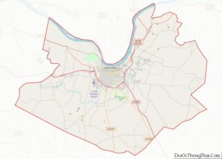
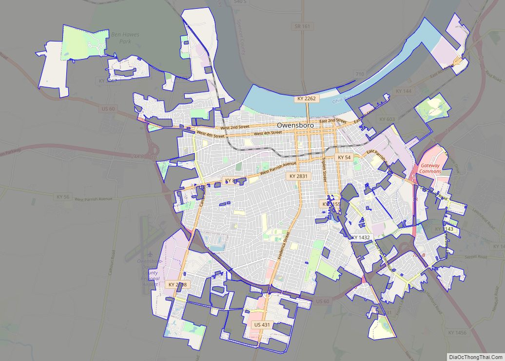
Owensboro Road Map
Owensboro city Satellite Map
Geography
Owensboro is located at the crook of a bend in the Ohio River, 37 miles (60 km) southeast of Evansville, Indiana.
According to the United States Census Bureau, Owensboro has a total area of 20.4 square miles (52.9 km), of which 19.1 square miles (49.5 km) is land and 1.3 square miles (3.4 km), or 6.47%, is water.
Climate
Owensboro has a humid subtropical climate which is characterized by hot, humid summers and moderately cold winters. Day-to-day temperature differences can be high during the winter. Summers, in comparison, are much more stable. Severe weather, including the threat of tornadoes, is not uncommon throughout much of the year, with several notable events occurring throughout the city’s history. One such event occurred on December 9, 1952, when F3 tornado tore directly through the city, injuring three people.
See also
Map of Kentucky State and its subdivision:- Adair
- Allen
- Anderson
- Ballard
- Barren
- Bath
- Bell
- Boone
- Bourbon
- Boyd
- Boyle
- Bracken
- Breathitt
- Breckinridge
- Bullitt
- Butler
- Caldwell
- Calloway
- Campbell
- Carlisle
- Carroll
- Carter
- Casey
- Christian
- Clark
- Clay
- Clinton
- Crittenden
- Cumberland
- Daviess
- Edmonson
- Elliott
- Estill
- Fayette
- Fleming
- Floyd
- Franklin
- Fulton
- Gallatin
- Garrard
- Grant
- Graves
- Grayson
- Green
- Greenup
- Hancock
- Hardin
- Harlan
- Harrison
- Hart
- Henderson
- Henry
- Hickman
- Hopkins
- Jackson
- Jefferson
- Jessamine
- Johnson
- Kenton
- Knott
- Knox
- Larue
- Laurel
- Lawrence
- Lee
- Leslie
- Letcher
- Lewis
- Lincoln
- Livingston
- Logan
- Lyon
- Madison
- Magoffin
- Marion
- Marshall
- Martin
- Mason
- McCracken
- McCreary
- McLean
- Meade
- Menifee
- Mercer
- Metcalfe
- Monroe
- Montgomery
- Morgan
- Muhlenberg
- Nelson
- Nicholas
- Ohio
- Oldham
- Owen
- Owsley
- Pendleton
- Perry
- Pike
- Powell
- Pulaski
- Robertson
- Rockcastle
- Rowan
- Russell
- Scott
- Shelby
- Simpson
- Spencer
- Taylor
- Todd
- Trigg
- Trimble
- Union
- Warren
- Washington
- Wayne
- Webster
- Whitley
- Wolfe
- Woodford
- Alabama
- Alaska
- Arizona
- Arkansas
- California
- Colorado
- Connecticut
- Delaware
- District of Columbia
- Florida
- Georgia
- Hawaii
- Idaho
- Illinois
- Indiana
- Iowa
- Kansas
- Kentucky
- Louisiana
- Maine
- Maryland
- Massachusetts
- Michigan
- Minnesota
- Mississippi
- Missouri
- Montana
- Nebraska
- Nevada
- New Hampshire
- New Jersey
- New Mexico
- New York
- North Carolina
- North Dakota
- Ohio
- Oklahoma
- Oregon
- Pennsylvania
- Rhode Island
- South Carolina
- South Dakota
- Tennessee
- Texas
- Utah
- Vermont
- Virginia
- Washington
- West Virginia
- Wisconsin
- Wyoming
