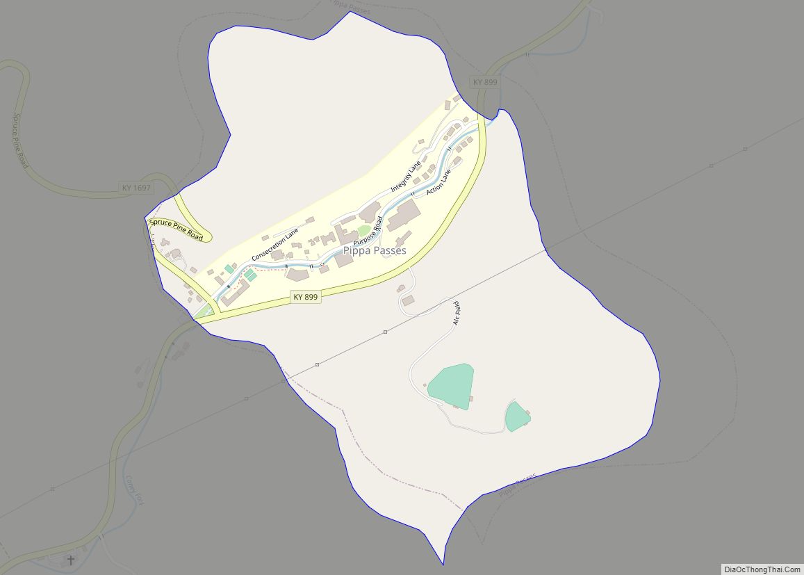
Pippa Passes is a home rule-class city located along Caney Fork in Knott County, eastern Kentucky, United States. Its formal name was chosen to honor benefactors of Alice Lloyd College. Residents commonly call the community “Caney” or “Caney Creek”. The population was 533 at the 2010 census, up from 297 at the 2000 census. The small city is located in the mountainous Appalachia region, an area of coal mining.
| Name: | Pippa Passes city |
|---|---|
| LSAD Code: | 25 |
| LSAD Description: | city (suffix) |
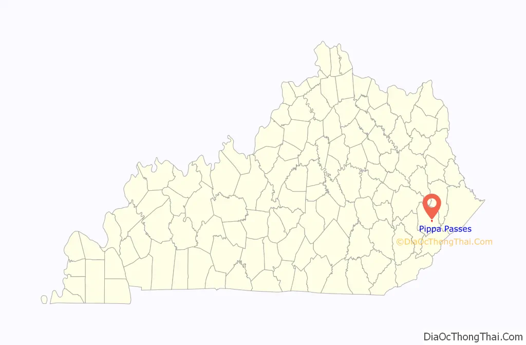
| State: | Kentucky |
| County: | Knott County |
| Incorporated: | 1983 |
| Elevation: | 991 ft (302 m) |
| Total Area: | 0.45 sq mi (1.15 km²) |
| Land Area: | 0.45 sq mi (1.15 km²) |
| Water Area: | 0.00 sq mi (0.00 km²) |
| Total Population: | 468 |
| Population Density: | 1,049.33/sq mi (405.36/km²) |
| ZIP code: | 41844 |
| Area code: | 606 |
| FIPS code: | 2161374 |
| GNISfeature ID: | 0500757 |
Online Interactive Map
Click on ![]() to view map in "full screen" mode.
to view map in "full screen" mode.
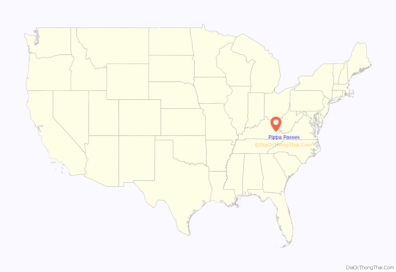
Pippa Passes location map. Where is Pippa Passes city?
History
This settlement was known as “Caney” or “Caney Creek” before 1916, when Alice Lloyd arrived from Boston, Massachusetts. She solicited funds for the construction of a local post office and the founding of Caney Creek Junior College, which were opened in 1917 and 1923, respectively. A donation from the Browning Society led to the post office’s being named after Robert Browning’s Pippa Passes. In this verse drama, he coined the phrase “God’s in His heaven, all’s right with the world.” (Given the U.S. Postal Service’s preference for monogrammatic names, this location was known as “Pippapass” until 1955.)
The city of Pippa Passes was incorporated by the state assembly on July 1, 1983.
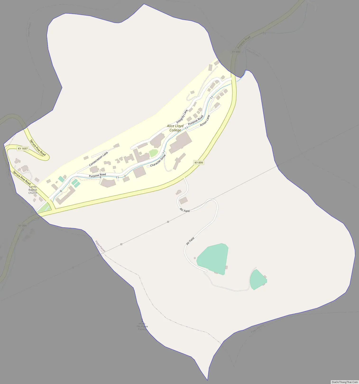
Pippa Passes Road Map
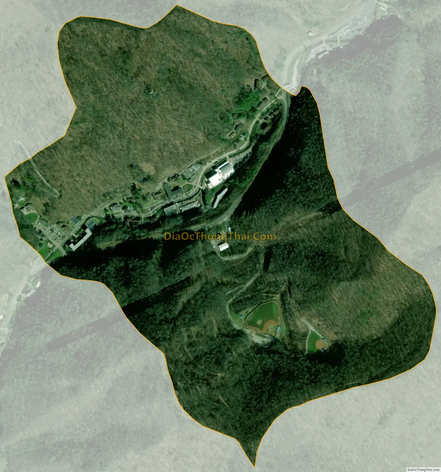
Pippa Passes city Satellite Map
Geography
Pippa Passes is in eastern Knott County at 37°20′5″N 82°52′32″W / 37.33472°N 82.87556°W / 37.33472; -82.87556 (37.334629, -82.875490), in the valley of the Caney Fork. Kentucky Route 899 passes through the community, leading northeast down the valley of the Caney Fork 11 miles (18 km) to Wayland and southwest then northwest 8 miles (13 km) to Hindman, the Knott county seat.
According to the United States Census Bureau, the city of Pippa Passes has a total area of 0.44 square miles (1.15 km), all of it recorded as land. The Caney Fork flows northeast to the Right Fork of Beaver Creek near Wayland and is part of the Levisa Fork watershed.
See also
Map of Kentucky State and its subdivision:- Adair
- Allen
- Anderson
- Ballard
- Barren
- Bath
- Bell
- Boone
- Bourbon
- Boyd
- Boyle
- Bracken
- Breathitt
- Breckinridge
- Bullitt
- Butler
- Caldwell
- Calloway
- Campbell
- Carlisle
- Carroll
- Carter
- Casey
- Christian
- Clark
- Clay
- Clinton
- Crittenden
- Cumberland
- Daviess
- Edmonson
- Elliott
- Estill
- Fayette
- Fleming
- Floyd
- Franklin
- Fulton
- Gallatin
- Garrard
- Grant
- Graves
- Grayson
- Green
- Greenup
- Hancock
- Hardin
- Harlan
- Harrison
- Hart
- Henderson
- Henry
- Hickman
- Hopkins
- Jackson
- Jefferson
- Jessamine
- Johnson
- Kenton
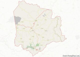
- Knott
- Knox
- Larue
- Laurel
- Lawrence
- Lee
- Leslie
- Letcher
- Lewis
- Lincoln
- Livingston
- Logan
- Lyon
- Madison
- Magoffin
- Marion
- Marshall
- Martin
- Mason
- McCracken
- McCreary
- McLean
- Meade
- Menifee
- Mercer
- Metcalfe
- Monroe
- Montgomery
- Morgan
- Muhlenberg
- Nelson
- Nicholas
- Ohio
- Oldham
- Owen
- Owsley
- Pendleton
- Perry
- Pike
- Powell
- Pulaski
- Robertson
- Rockcastle
- Rowan
- Russell
- Scott
- Shelby
- Simpson
- Spencer
- Taylor
- Todd
- Trigg
- Trimble
- Union
- Warren
- Washington
- Wayne
- Webster
- Whitley
- Wolfe
- Woodford
- Alabama
- Alaska
- Arizona
- Arkansas
- California
- Colorado
- Connecticut
- Delaware
- District of Columbia
- Florida
- Georgia
- Hawaii
- Idaho
- Illinois
- Indiana
- Iowa
- Kansas
- Kentucky
- Louisiana
- Maine
- Maryland
- Massachusetts
- Michigan
- Minnesota
- Mississippi
- Missouri
- Montana
- Nebraska
- Nevada
- New Hampshire
- New Jersey
- New Mexico
- New York
- North Carolina
- North Dakota
- Ohio
- Oklahoma
- Oregon
- Pennsylvania
- Rhode Island
- South Carolina
- South Dakota
- Tennessee
- Texas
- Utah
- Vermont
- Virginia
- Washington
- West Virginia
- Wisconsin
- Wyoming