Sacramento is a home rule-class city in McLean County, Kentucky, in the United States. The population was 429 as of the 2020 census. It is included in the Owensboro metropolitan area.
| Name: | Sacramento city |
|---|---|
| LSAD Code: | 25 |
| LSAD Description: | city (suffix) |
| State: | Kentucky |
| County: | McLean County |
| Incorporated: | 1860 |
| Elevation: | 492 ft (150 m) |
| Total Area: | 0.43 sq mi (1.12 km²) |
| Land Area: | 0.43 sq mi (1.11 km²) |
| Water Area: | 0.00 sq mi (0.00 km²) |
| Total Population: | 429 |
| Population Density: | 997.67/sq mi (384.99/km²) |
| ZIP code: | 42372 |
| Area code: | 270 |
| FIPS code: | 2167638 |
| GNISfeature ID: | 0502550 |
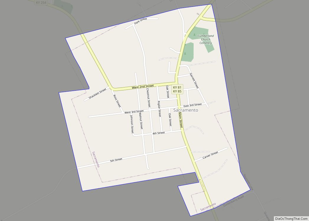
Online Interactive Map
Click on ![]() to view map in "full screen" mode.
to view map in "full screen" mode.
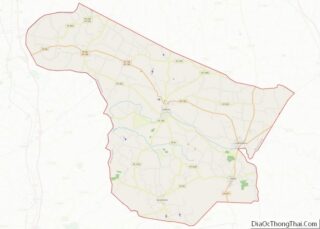
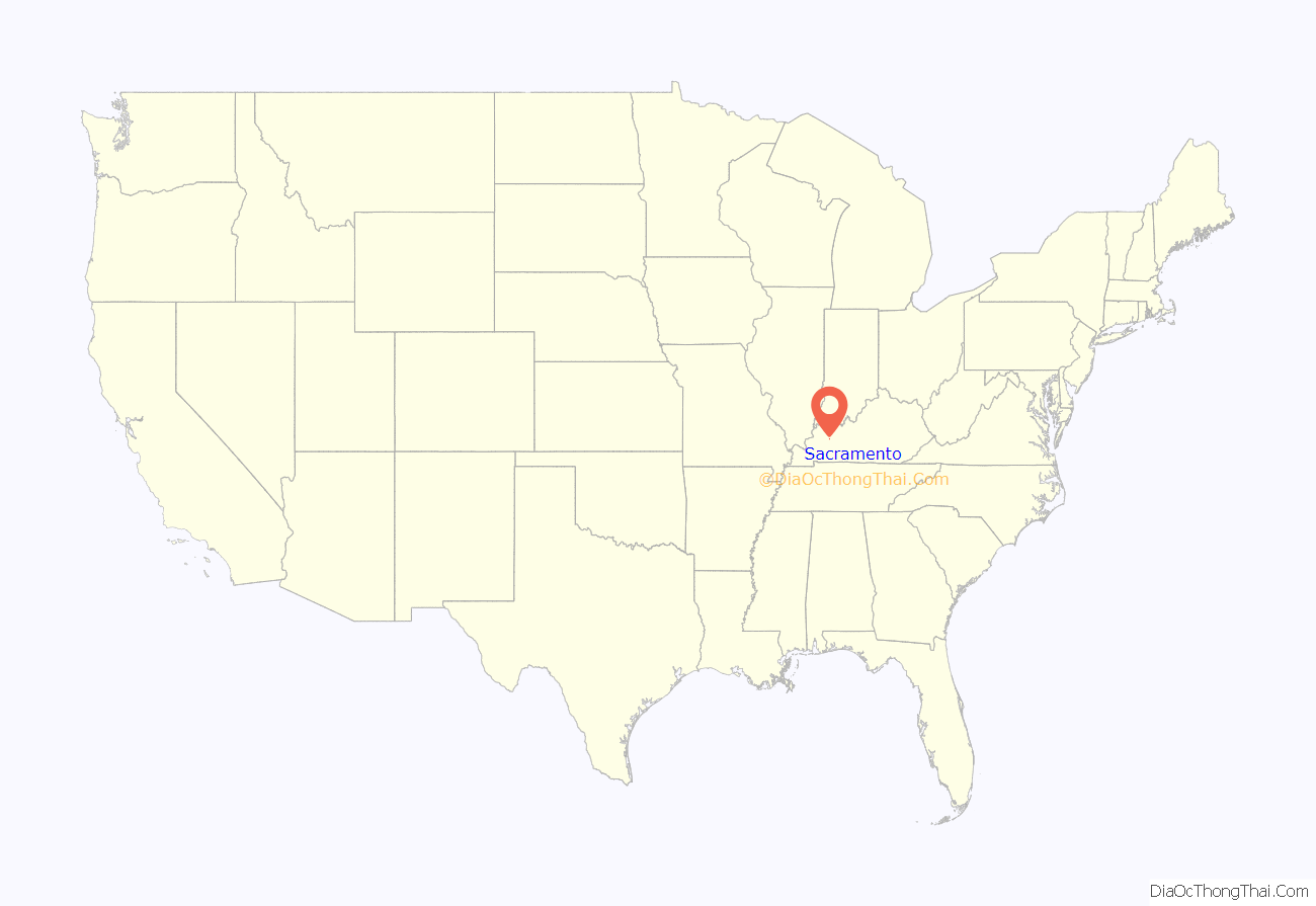
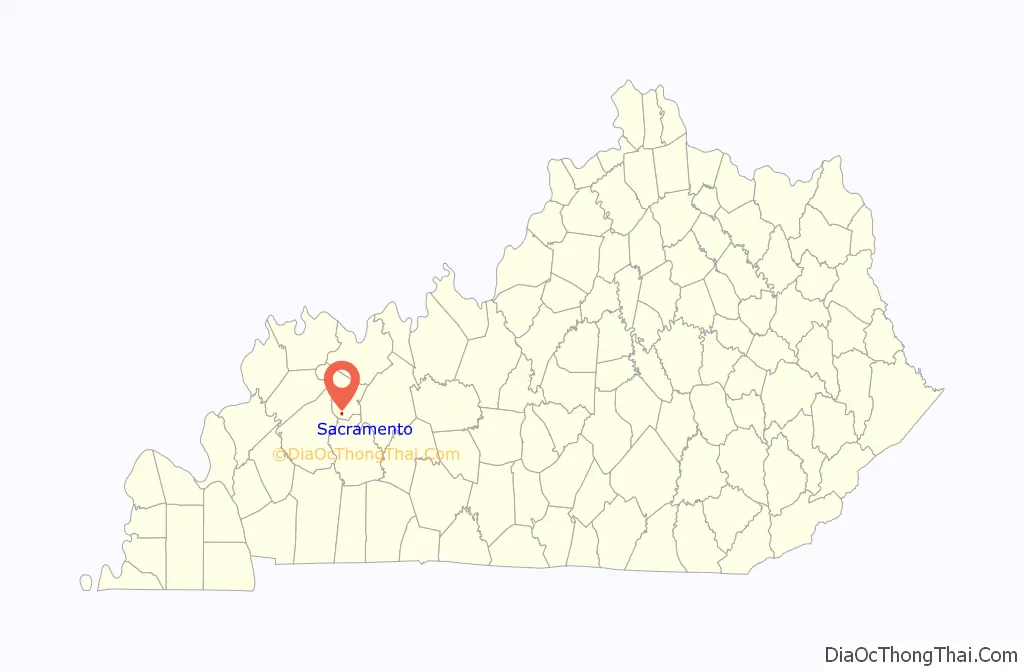
Sacramento location map. Where is Sacramento city?
History
Early history
The first community at the site was known as “Crossroads”, but the post office established in 1852 was named “Social Hill”. In 1854, George L. Helm platted the town and renamed it Sacramento. Local tradition holds the name was suggested by John Vickers, recently returned from the California Gold Rush. The city was incorporated on October 8, 1860, and the post office followed suit the next year.
The Battle of Sacramento
Sacramento was the site of a Civil War battle between Union forces under Maj. Eli H. Murray and Confederate forces under Colonel Nathan Bedford Forrest. Nicknamed “Forrest’s First Fight”, the Battle of Sacramento took place on December 28, 1861. The battle began when a Confederate sympathizer named Mollie Morehead informed Forrest that a Union force was watering their horses nearby. Forrest used the element of surprise to rout the Union troops. The city holds an annual reënactment of the battle in which local residents participate, along with professional and amateur reënactors.
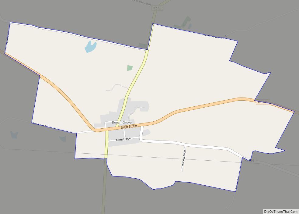
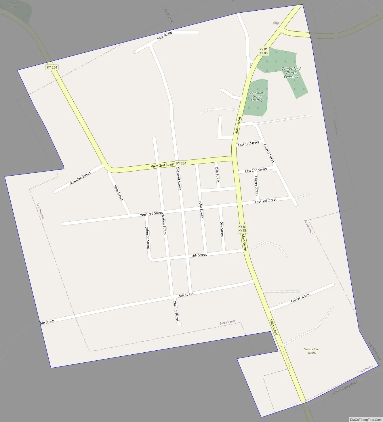
Sacramento Road Map
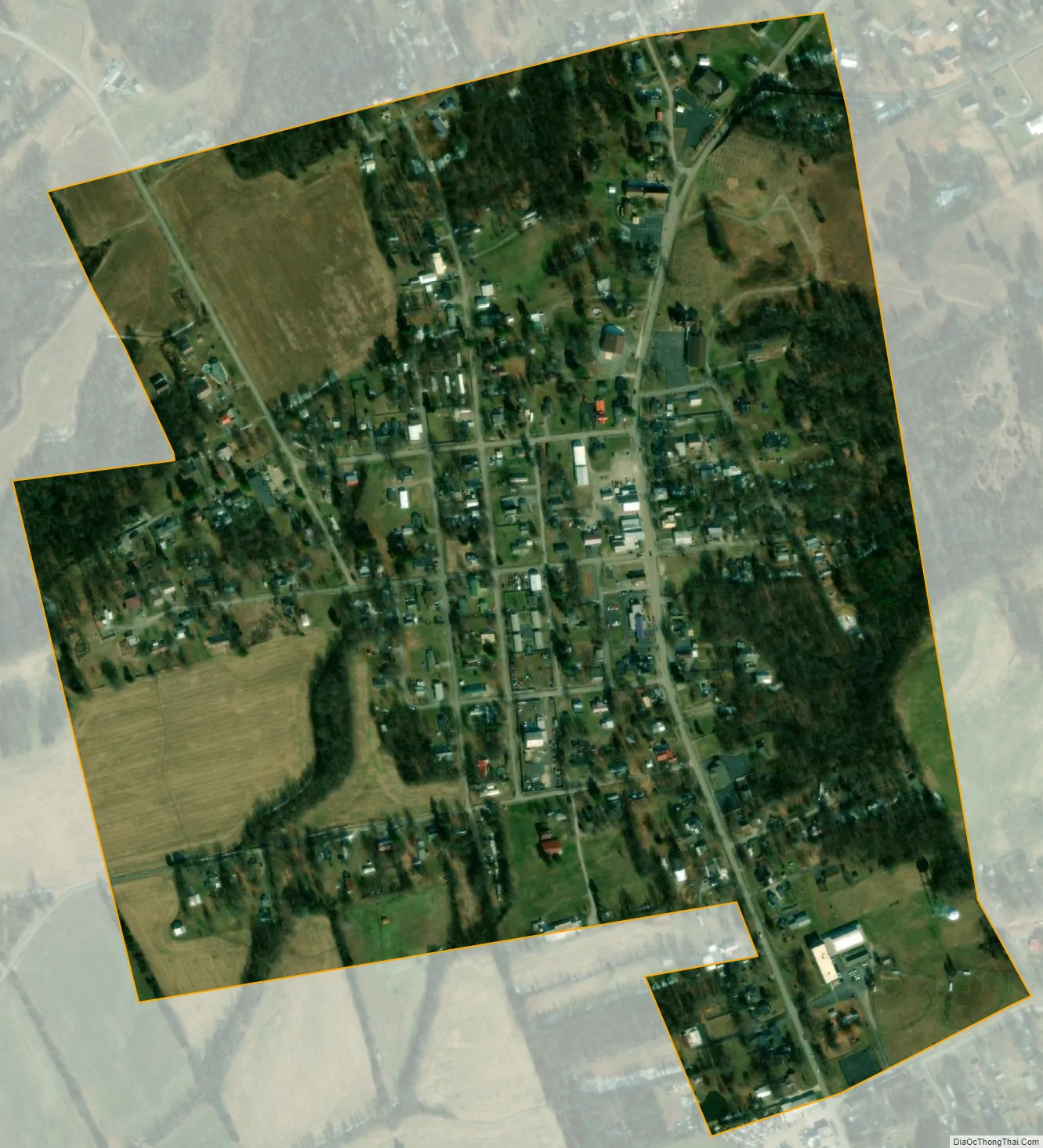
Sacramento city Satellite Map
Geography
Sacramento is located in southern McLean County at 37°24′59″N 87°16′4″W / 37.41639°N 87.26778°W / 37.41639; -87.26778 (37.416489, -87.267839). The city is concentrated around the intersection of Kentucky Route 81/Kentucky Route 85 (Main Street) and Kentucky Route 254 (2nd Street), northeast of Madisonville. KY 81 and KY 85 converge in the northeastern part of town, and diverge just south of the city. KY 81 leads north 10 miles (16 km) to Calhoun, the county seat, and southeast the same distance to South Carrollton, while KY 85 leads east 8 miles (13 km) to Island and west 15 miles (24 km) to Madisonville. KY 254 also leads to Madisonville, by a more northerly route of 18 miles (29 km).
According to the United States Census Bureau, Sacramento has a total area of 0.43 square miles (1.1 km), all land.
See also
Map of Kentucky State and its subdivision:- Adair
- Allen
- Anderson
- Ballard
- Barren
- Bath
- Bell
- Boone
- Bourbon
- Boyd
- Boyle
- Bracken
- Breathitt
- Breckinridge
- Bullitt
- Butler
- Caldwell
- Calloway
- Campbell
- Carlisle
- Carroll
- Carter
- Casey
- Christian
- Clark
- Clay
- Clinton
- Crittenden
- Cumberland
- Daviess
- Edmonson
- Elliott
- Estill
- Fayette
- Fleming
- Floyd
- Franklin
- Fulton
- Gallatin
- Garrard
- Grant
- Graves
- Grayson
- Green
- Greenup
- Hancock
- Hardin
- Harlan
- Harrison
- Hart
- Henderson
- Henry
- Hickman
- Hopkins
- Jackson
- Jefferson
- Jessamine
- Johnson
- Kenton
- Knott
- Knox
- Larue
- Laurel
- Lawrence
- Lee
- Leslie
- Letcher
- Lewis
- Lincoln
- Livingston
- Logan
- Lyon
- Madison
- Magoffin
- Marion
- Marshall
- Martin
- Mason
- McCracken
- McCreary
- McLean
- Meade
- Menifee
- Mercer
- Metcalfe
- Monroe
- Montgomery
- Morgan
- Muhlenberg
- Nelson
- Nicholas
- Ohio
- Oldham
- Owen
- Owsley
- Pendleton
- Perry
- Pike
- Powell
- Pulaski
- Robertson
- Rockcastle
- Rowan
- Russell
- Scott
- Shelby
- Simpson
- Spencer
- Taylor
- Todd
- Trigg
- Trimble
- Union
- Warren
- Washington
- Wayne
- Webster
- Whitley
- Wolfe
- Woodford
- Alabama
- Alaska
- Arizona
- Arkansas
- California
- Colorado
- Connecticut
- Delaware
- District of Columbia
- Florida
- Georgia
- Hawaii
- Idaho
- Illinois
- Indiana
- Iowa
- Kansas
- Kentucky
- Louisiana
- Maine
- Maryland
- Massachusetts
- Michigan
- Minnesota
- Mississippi
- Missouri
- Montana
- Nebraska
- Nevada
- New Hampshire
- New Jersey
- New Mexico
- New York
- North Carolina
- North Dakota
- Ohio
- Oklahoma
- Oregon
- Pennsylvania
- Rhode Island
- South Carolina
- South Dakota
- Tennessee
- Texas
- Utah
- Vermont
- Virginia
- Washington
- West Virginia
- Wisconsin
- Wyoming