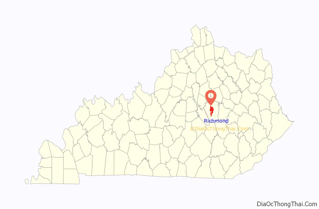
Richmond is a home rule-class city in and the county seat of Madison County, Kentucky, United States. It is named after Richmond, Virginia, and is home to Eastern Kentucky University. The population was 34,585 at the 2020 census. Richmond is the fourth-largest city in the Bluegrass region (after Louisville, Lexington and Georgetown) and the state’s seventh-largest city. It is the ninth largest population center in the state with a Micropolitan population of 106,864. The city serves as the center for work and shopping for south-central Kentucky. In addition, Richmond is the principal city of the Richmond-Berea, Kentucky Micropolitan Area, which includes all of Madison and Rockcastle counties.
| Name: | Richmond city |
|---|---|
| LSAD Code: | 25 |
| LSAD Description: | city (suffix) |
| State: | Kentucky |
| County: | Madison County |
| Elevation: | 1,001 ft (305 m) |
| Total Area: | 20.57 sq mi (53.28 km²) |
| Land Area: | 20.32 sq mi (52.63 km²) |
| Water Area: | 0.25 sq mi (0.65 km²) |
| Total Population: | 34,585 |
| Population Density: | 1,701.93/sq mi (657.12/km²) |
| ZIP code: | 40475-40476 |
| Area code: | 859 |
| FIPS code: | 2165226 |
| GNISfeature ID: | 2404614 |
| Website: | richmond.ky.us |
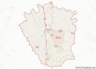
Online Interactive Map
Click on ![]() to view map in "full screen" mode.
to view map in "full screen" mode.
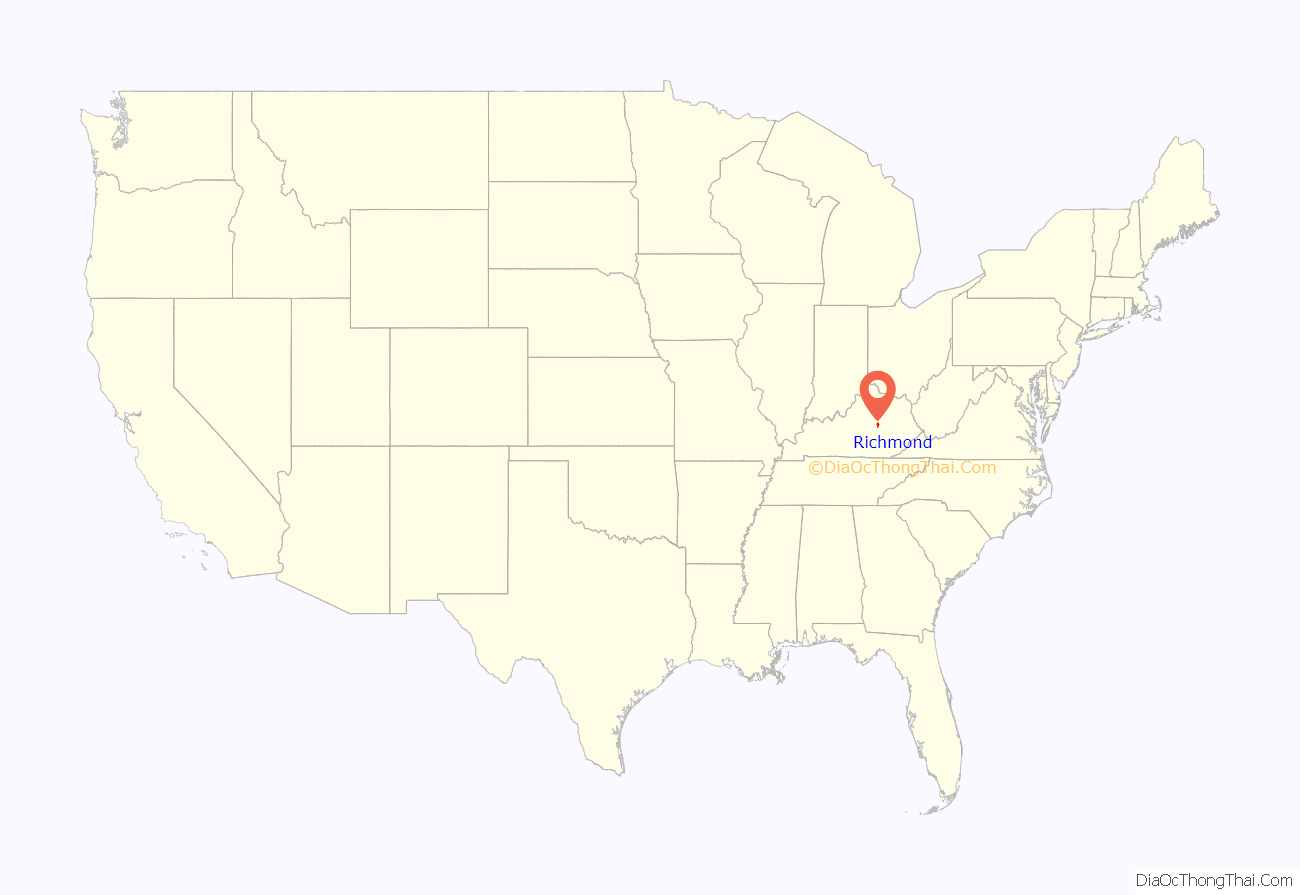
Richmond location map. Where is Richmond city?
History
Richmond was founded in 1798 by Colonel John Miller from Richmond, Virginia. A British American, Miller served with the rebels in the Revolutionary War. According to lore, he was attracted to the area by its good spring water and friendly Native Americans.
With the original county seat of Madison County being Milford, Kentucky, Miller successfully lobbied the Kentucky legislature to move it from Milford to present-day Richmond. Although the residents of Milford strongly opposed the move, the county approved the transfer in March 1798. On July 4, 1798, the new town was named Richmond in honor of Miller’s Virginia birthplace. Richmond was incorporated in 1809.
Kentucky was a border state during the Civil War and remained in the Union. On August 30, 1862, during the Civil War, the Battle of Richmond took place. Confederate General Edmund Kirby Smith routed the Union General William Nelson, capturing or killing 5,300 of his 6,500 men. One historian called this battle “the nearest thing to a Cannae ever scored by any general, North or South, in the course of the whole war.”
In 1906, Eastern Kentucky State Normal School was founded in Richmond to train teachers. The school graduated its first class of 11 teachers in 1909. In 1922, it was established as a four-year college and in 1935 added a graduate degree program. In 1965, the institution was renamed Eastern Kentucky University.
In the late 1990s and early 2000s, Richmond saw significant growth, becoming the state’s seventh-largest city in 2009.
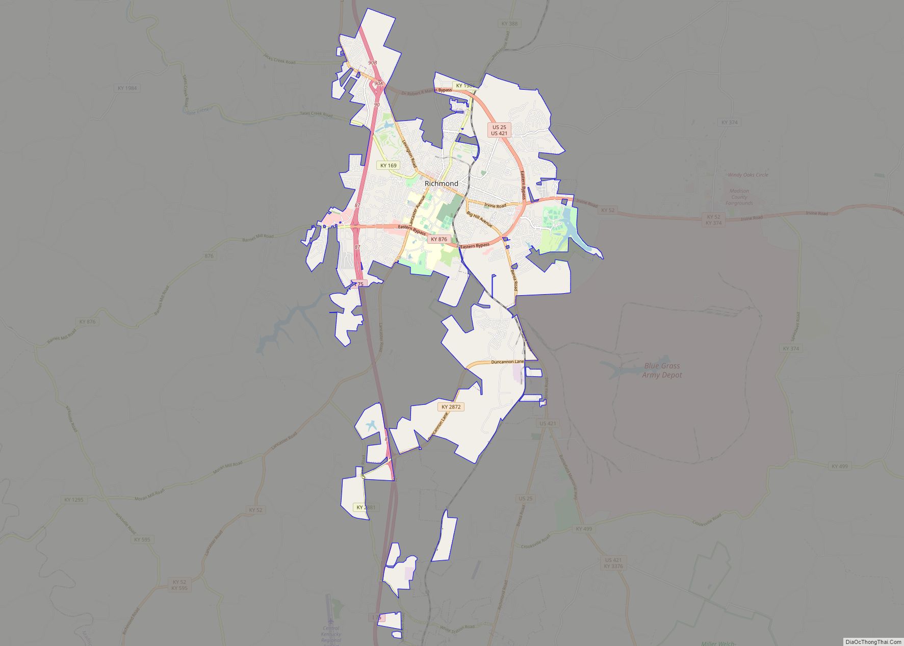
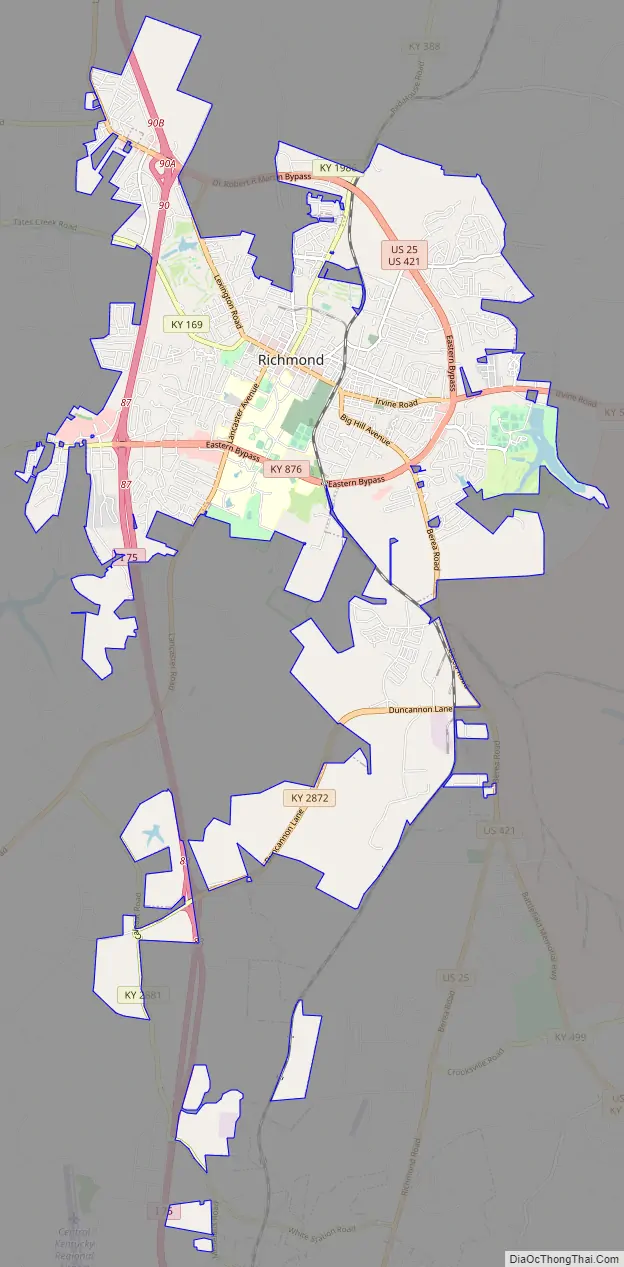
Richmond Road Map
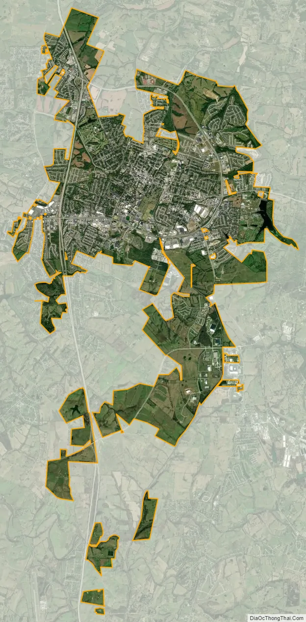
Richmond city Satellite Map
Geography
Richmond is located in Madison County in the Bluegrass region of the state. The Blue Grass Army Depot lies to the southeast of the city. The city is served by Interstate 75, U. S. Routes 25 and 421, and Kentucky Routes 52, 169 and 388. I-75 runs to the west of downtown, with access from exits 83, 87, and 90. Via I-75, downtown Lexington, Kentucky is 25 mi (40 km) northwest, and Knoxville, Tennessee is 147 mi (237 km) south. U.S. Route 25 forms the eastern bypass around the city, leading northwest to Lexington and south 14 mi (23 km) to Berea. U.S. Route 421 parallels U.S. 25 on the eastern bypass of the city, leading northwest to Lexington (with U.S. 25 and I-75) and southeast 34 mi (55 km) to McKee.
According to the United States Census Bureau, the city has a total area of 19.2 square miles (50 km), of which 19.1 square miles (49 km) is land and 0.1 square miles (0.26 km)(0.73%) is water.
Climate
The climate in this area is characterized by hot, humid summers and generally mild to cool winters. According to the Köppen Climate Classification system, Richmond has a humid subtropical climate, abbreviated “Cfa” on climate maps.
See also
Map of Kentucky State and its subdivision:- Adair
- Allen
- Anderson
- Ballard
- Barren
- Bath
- Bell
- Boone
- Bourbon
- Boyd
- Boyle
- Bracken
- Breathitt
- Breckinridge
- Bullitt
- Butler
- Caldwell
- Calloway
- Campbell
- Carlisle
- Carroll
- Carter
- Casey
- Christian
- Clark
- Clay
- Clinton
- Crittenden
- Cumberland
- Daviess
- Edmonson
- Elliott
- Estill
- Fayette
- Fleming
- Floyd
- Franklin
- Fulton
- Gallatin
- Garrard
- Grant
- Graves
- Grayson
- Green
- Greenup
- Hancock
- Hardin
- Harlan
- Harrison
- Hart
- Henderson
- Henry
- Hickman
- Hopkins
- Jackson
- Jefferson
- Jessamine
- Johnson
- Kenton
- Knott
- Knox
- Larue
- Laurel
- Lawrence
- Lee
- Leslie
- Letcher
- Lewis
- Lincoln
- Livingston
- Logan
- Lyon
- Madison
- Magoffin
- Marion
- Marshall
- Martin
- Mason
- McCracken
- McCreary
- McLean
- Meade
- Menifee
- Mercer
- Metcalfe
- Monroe
- Montgomery
- Morgan
- Muhlenberg
- Nelson
- Nicholas
- Ohio
- Oldham
- Owen
- Owsley
- Pendleton
- Perry
- Pike
- Powell
- Pulaski
- Robertson
- Rockcastle
- Rowan
- Russell
- Scott
- Shelby
- Simpson
- Spencer
- Taylor
- Todd
- Trigg
- Trimble
- Union
- Warren
- Washington
- Wayne
- Webster
- Whitley
- Wolfe
- Woodford
- Alabama
- Alaska
- Arizona
- Arkansas
- California
- Colorado
- Connecticut
- Delaware
- District of Columbia
- Florida
- Georgia
- Hawaii
- Idaho
- Illinois
- Indiana
- Iowa
- Kansas
- Kentucky
- Louisiana
- Maine
- Maryland
- Massachusetts
- Michigan
- Minnesota
- Mississippi
- Missouri
- Montana
- Nebraska
- Nevada
- New Hampshire
- New Jersey
- New Mexico
- New York
- North Carolina
- North Dakota
- Ohio
- Oklahoma
- Oregon
- Pennsylvania
- Rhode Island
- South Carolina
- South Dakota
- Tennessee
- Texas
- Utah
- Vermont
- Virginia
- Washington
- West Virginia
- Wisconsin
- Wyoming