The city of Gainesville is the seat of government of Hall County, Georgia, United States. As of the 2020 census, the city had a population of 42,296. Because of its large number of poultry processing plants, it has been called the “Poultry Capital of the World.” Gainesville is the principal city of the Gainesville, Georgia Metropolitan Statistical Area, which is included in the Atlanta–Sandy Springs–Gainesville, Georgia Combined Statistical Area.
| Name: | Gainesville city |
|---|---|
| LSAD Code: | 25 |
| LSAD Description: | city (suffix) |
| State: | Georgia |
| County: | Hall County |
| Elevation: | 1,214 ft (370 m) |
| Land Area: | 33.42 sq mi (86.57 km²) |
| Water Area: | 1.95 sq mi (5.04 km²) |
| Population Density: | 1,265.40/sq mi (488.57/km²) |
| ZIP code: | 30501, 30503-30504, 30506-30507 |
| Area code: | 770 |
| FIPS code: | 1331908 |
| GNISfeature ID: | 2403675 |
| Website: | www.gainesville.org |
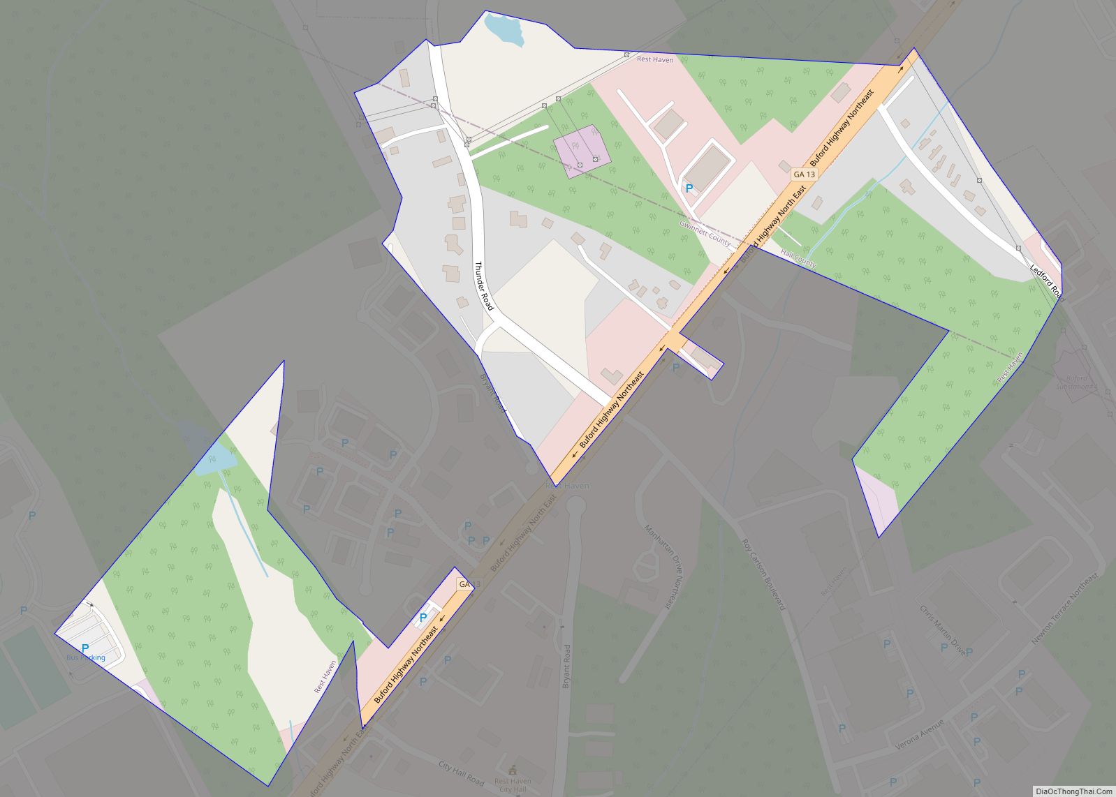
Online Interactive Map
Click on ![]() to view map in "full screen" mode.
to view map in "full screen" mode.
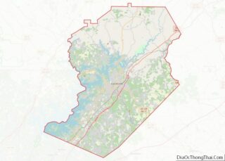
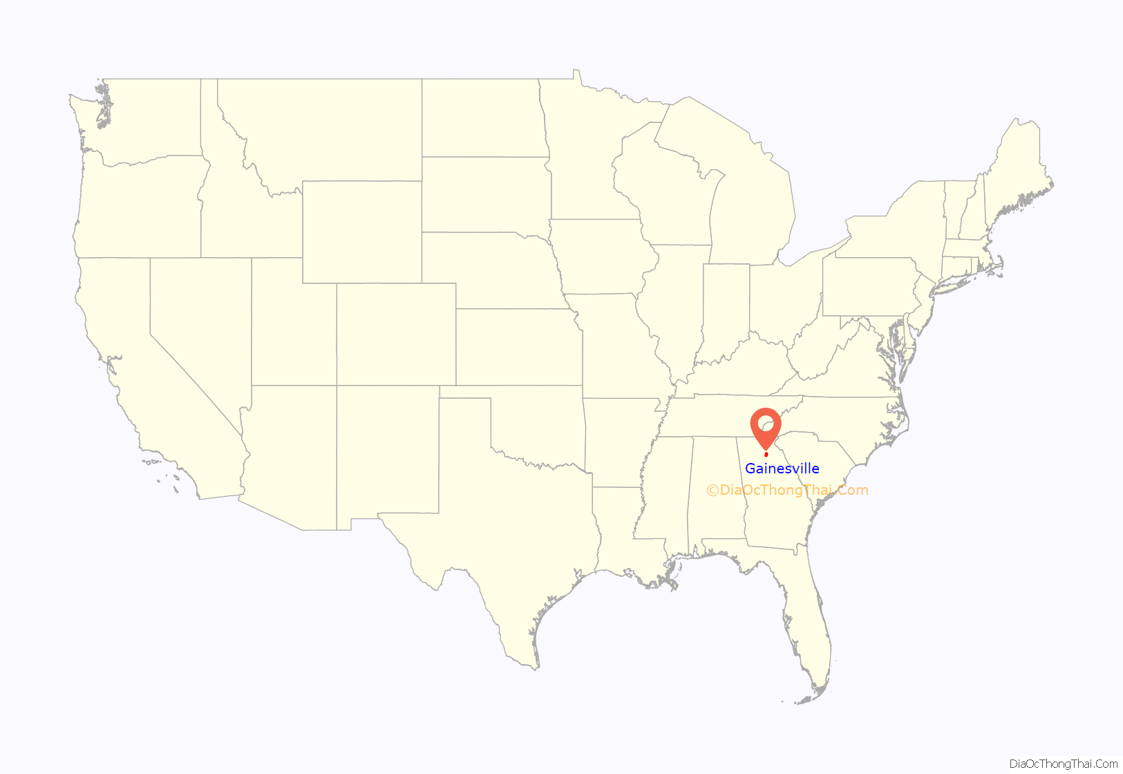
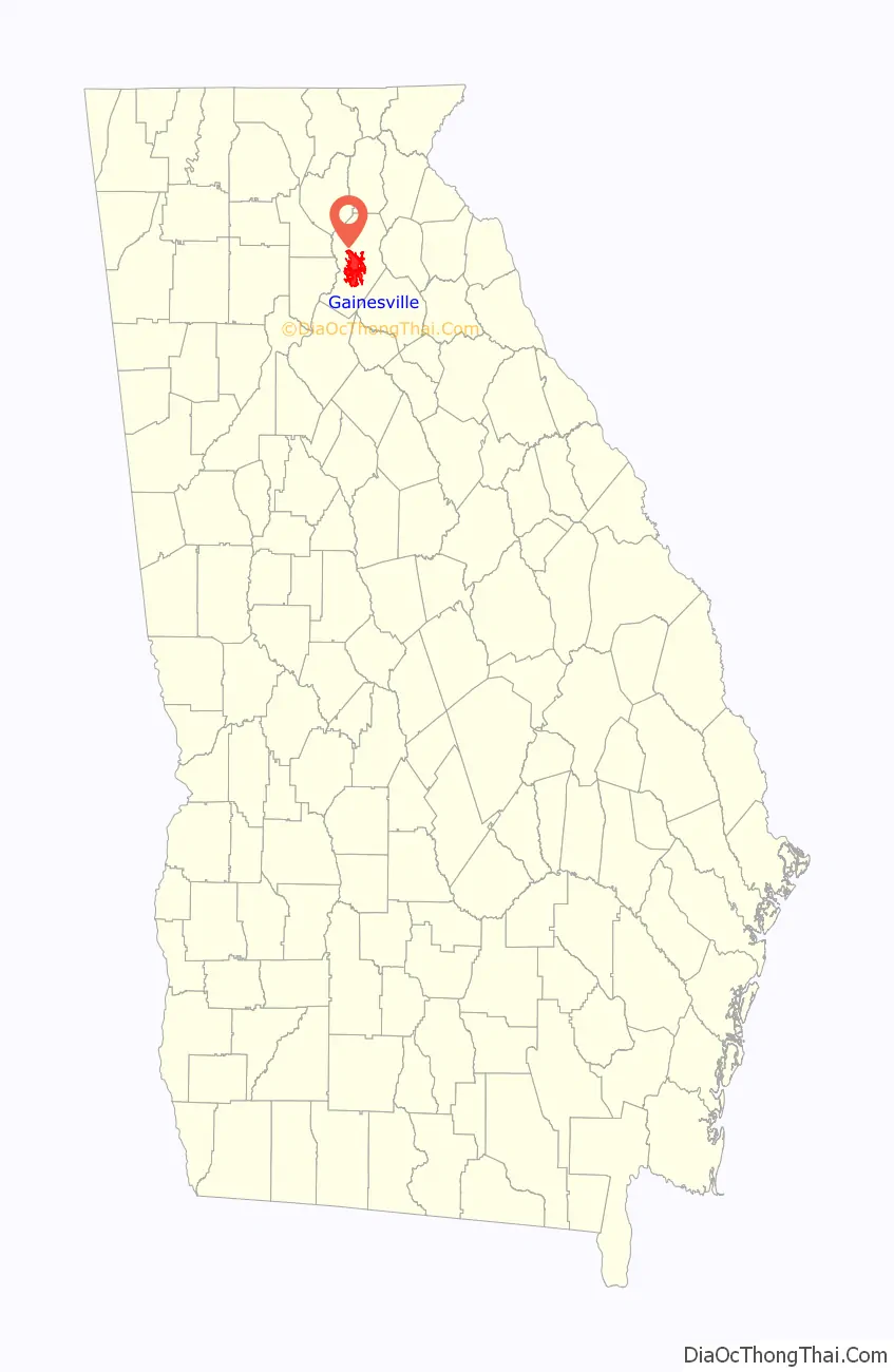
Gainesville location map. Where is Gainesville city?
History
Gainesville was established as “Mule Camp Springs” by European-American settlers in the early 1800s. Less than three years after the organization of Hall County on December 15, 1818, Mule Camp Springs was renamed “Gainesville” on April 21, 1821. It was named in honor of General Edmund P. Gaines, a hero of the War of 1812 and a noted military surveyor and road-builder. Gainesville was selected to be the county seat and chartered by the Georgia General Assembly on November 30, 1821.
A gold rush that began in nearby Lumpkin County in the 1830s resulted in an increase in the number of settlers and the beginning of a business community. In the middle of the 19th century, Gainesville had two important events. In 1849, it became established as a resort center, with people attracted to the springs. In 1851, much of the small city was destroyed by fire.
After the Civil War, Gainesville began to grow from 1870. In 1871 The Atlanta and Richmond Air-Line Railway, later re-organized into The Atlanta and Charlotte Air Line Railroad, began to stop in Gainesville, increasing its ties to other markets and stimulating business and population. It grew from 1,000 in 1870, to over 5,000 by 1900.
By 1898, textile mills had become the primary driver of the economy, with the railroad integral to delivering raw cotton and carrying away the mills’ products. With the revenues generated by the mills, in 1902, Gainesville became the first city south of Baltimore to install street lamps. On March 1, 1905, free mail delivery began in Gainesville, and on August 10, 1910, the Gainesville post office was opened. On December 22, 1915, the city’s first high-rise, the Jackson Building, had its formal opening. In 1919 Southern Bell made improvements to the phone system.
City services began in Gainesville on February 22, 1873, with the election of a City Marshal, followed by solid waste collection in 1874. In 1890, a bond issue to fund the waterworks was passed, and the original water distribution system was developed.
In 1943, at the height of World War II, Gainesville contributed to the war effort by leasing the airport to the US government for $1.00. The military used it as a naval air station for training purposes. In 1947, the airport was returned to the city of Gainesville, improved by the addition of two 4,000-foot (1,200 m) landing strips (one of which was later lengthened to 5,500 feet (1,700 m)).
After World War II, a businessman named Jesse Jewell started the poultry industry in north Georgia. Chickens have since become the state’s largest agricultural crop. This $1 billion a year industry has given Gainesville the title “Poultry Capital of the World”.
In 1956, the U.S. Army Corps of Engineers constructed Lake Sidney Lanier, by building Buford Dam on the Chattahoochee River. During the 1996 Summer Olympics, Gainesville served as the venue for the rowing and kayaking medal competitions, which were staged on Lake Lanier.
Gainesville gained accreditation of its Parks and Recreation Department in 2001. This was the third department in the state to be accredited. The Lakeside water treatment plant opened in 2002. The city has sponsored new social activities, including the Spring Chicken Festival in 2003, the Art in the Square gathering in 2004, and “Dredgefest” in 2008.
2008 saw the reopening of the Fair Street Neighborhood Center, the reopening of the Linwood Water Reclamation Facility Grand, and the completion of the Longwood Park Fishing Pier.
On January 28, 2021, a poultry plant in Gainesville leaked liquid nitrogen killing 6 and hospitalizing 12.
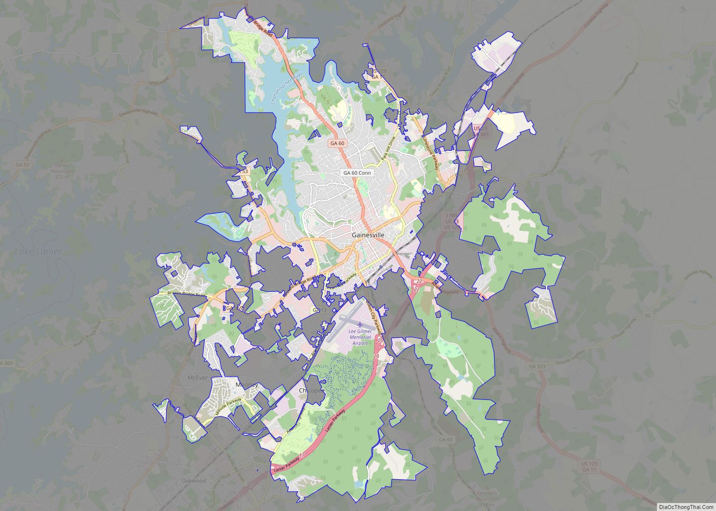
Gainesville Road Map
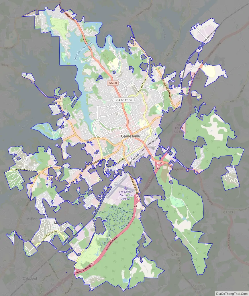
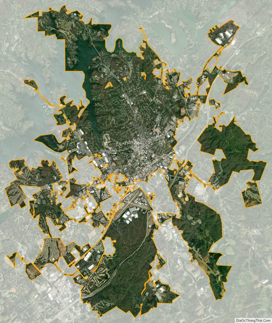
Gainesville city Satellite Map
Geography
Gainesville is located in central Hall County at 34°18′16″N 83°50′2″W / 34.30444°N 83.83389°W / 34.30444; -83.83389 (34.304490, -83.833897). It is bordered to the southwest by the city of Oakwood. Interstate 985/U.S. Route 23 passes through the southern part of the city, leading southwest 54 miles (87 km) to Atlanta and northeast 23 miles (37 km) to Baldwin and Cornelia. U.S. Route 129 runs through the east side of the city, leading north 24 miles (39 km) to Cleveland and southeast 21 miles (34 km) to Jefferson.
According to the United States Census Bureau, the city has a total area of 33.9 square miles (87.7 km), of which 31.9 square miles (82.7 km) are land and 1.9 square miles (5.0 km), or 5.75%, are water.
Nestled in the foothills of the Blue Ridge Mountains, parts of Gainesville lie along the shore of one of the nation’s most popular inland water destinations, Lake Lanier. Named after Confederate veteran, Georgia author and musician Sidney Lanier, the lake was created in 1956 when the U.S. Army Corps of Engineers dammed the Chattahoochee River near Buford and flooded the river’s valley. Although created primarily for hydroelectricity and flood control, it also serves as a reservoir providing water to the city of Atlanta and is a very popular recreational attraction for all of north Georgia.
Much of Gainesville is heavily wooded, with both deciduous and coniferous trees.
Climate
Much like the rest of northern Georgia, Gainesville has a humid subtropical climate (Köppen climate classification Cfa), with cool to mild winters and hot, humid summers.
While Gainesville does not sit in Tornado Alley, a region of the United States where severe weather is common, Supercell thunderstorms can sweep through any time between March and November, being primarily concentrated in the spring. Tornado watches are frequent in the spring and summer, with a warning appearing at least biannually, occasionally with more than one per year.
Tornado activity in the Gainesville area is above Georgia state average and is 108% greater than the overall U.S. average. Gainesville was the site of a deadly F4 on June 1, 1903, which killed 98 people. Gainesville was the site of the fifth deadliest tornado in U.S. history in 1936, in which Gainesville was devastated and 203 people were killed. In April 1974, an F4 tornado 22.6 miles away from the Gainesville city center killed six people and injured thirty. In December 1973, an F3 tornado 2.1 miles away from the city center injured twenty-one people. Both storms caused between $500,000 and $5,000,000 in property damages.
See also
Map of Georgia State and its subdivision:- Appling
- Atkinson
- Bacon
- Baker
- Baldwin
- Banks
- Barrow
- Bartow
- Ben Hill
- Berrien
- Bibb
- Bleckley
- Brantley
- Brooks
- Bryan
- Bulloch
- Burke
- Butts
- Calhoun
- Camden
- Candler
- Carroll
- Catoosa
- Charlton
- Chatham
- Chattahoochee
- Chattooga
- Cherokee
- Clarke
- Clay
- Clayton
- Clinch
- Cobb
- Coffee
- Colquitt
- Columbia
- Cook
- Coweta
- Crawford
- Crisp
- Dade
- Dawson
- Decatur
- DeKalb
- Dodge
- Dooly
- Dougherty
- Douglas
- Early
- Echols
- Effingham
- Elbert
- Emanuel
- Evans
- Fannin
- Fayette
- Floyd
- Forsyth
- Franklin
- Fulton
- Gilmer
- Glascock
- Glynn
- Gordon
- Grady
- Greene
- Gwinnett
- Habersham
- Hall
- Hancock
- Haralson
- Harris
- Hart
- Heard
- Henry
- Houston
- Irwin
- Jackson
- Jasper
- Jeff Davis
- Jefferson
- Jenkins
- Johnson
- Jones
- Lamar
- Lanier
- Laurens
- Lee
- Liberty
- Lincoln
- Long
- Lowndes
- Lumpkin
- Macon
- Madison
- Marion
- McDuffie
- McIntosh
- Meriwether
- Miller
- Mitchell
- Monroe
- Montgomery
- Morgan
- Murray
- Muscogee
- Newton
- Oconee
- Oglethorpe
- Paulding
- Peach
- Pickens
- Pierce
- Pike
- Polk
- Pulaski
- Putnam
- Quitman
- Rabun
- Randolph
- Richmond
- Rockdale
- Schley
- Screven
- Seminole
- Spalding
- Stephens
- Stewart
- Sumter
- Talbot
- Taliaferro
- Tattnall
- Taylor
- Telfair
- Terrell
- Thomas
- Tift
- Toombs
- Towns
- Treutlen
- Troup
- Turner
- Twiggs
- Union
- Upson
- Walker
- Walton
- Ware
- Warren
- Washington
- Wayne
- Webster
- Wheeler
- White
- Whitfield
- Wilcox
- Wilkes
- Wilkinson
- Worth
- Alabama
- Alaska
- Arizona
- Arkansas
- California
- Colorado
- Connecticut
- Delaware
- District of Columbia
- Florida
- Georgia
- Hawaii
- Idaho
- Illinois
- Indiana
- Iowa
- Kansas
- Kentucky
- Louisiana
- Maine
- Maryland
- Massachusetts
- Michigan
- Minnesota
- Mississippi
- Missouri
- Montana
- Nebraska
- Nevada
- New Hampshire
- New Jersey
- New Mexico
- New York
- North Carolina
- North Dakota
- Ohio
- Oklahoma
- Oregon
- Pennsylvania
- Rhode Island
- South Carolina
- South Dakota
- Tennessee
- Texas
- Utah
- Vermont
- Virginia
- Washington
- West Virginia
- Wisconsin
- Wyoming