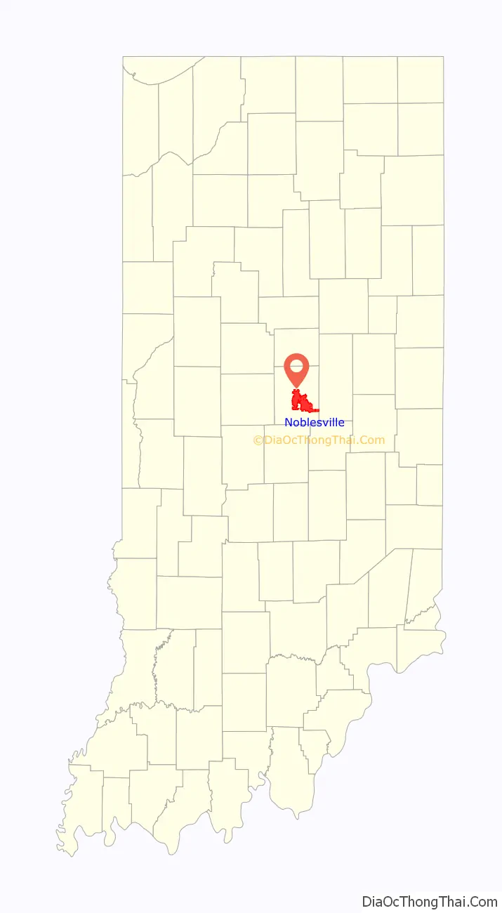
Noblesville is a city in and the county seat of Hamilton County, Indiana, United States, a part of the north Indianapolis suburbs along the White River. The population was 51,969 at the 2010 census making it the state’s 14th largest city/town, up from 19th in 2007. As of 2019 the estimated population was 64,668. The city is part of Delaware, Fall Creek, Noblesville, and Wayne townships.
Noblesville is home to the Ruoff Music Center, an outdoor music venue.
| Name: | Noblesville city |
|---|---|
| LSAD Code: | 25 |
| LSAD Description: | city (suffix) |
| State: | Indiana |
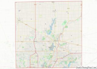
| County: | Hamilton County |
| Founded: | 1823 |
| Elevation: | 772 ft (235 m) |
| Total Area: | 35.82 sq mi (92.77 km²) |
| Land Area: | 34.40 sq mi (89.08 km²) |
| Water Area: | 1.42 sq mi (3.69 km²) |
| Total Population: | 69,604 |
| Population Density: | 2,023.67/sq mi (781.34/km²) |
| ZIP code: | 46060, 46061, 46062 |
| Area code: | 317 |
| FIPS code: | 1854180 |
| GNISfeature ID: | 0440192 |
| Website: | www.cityofnoblesville.org |
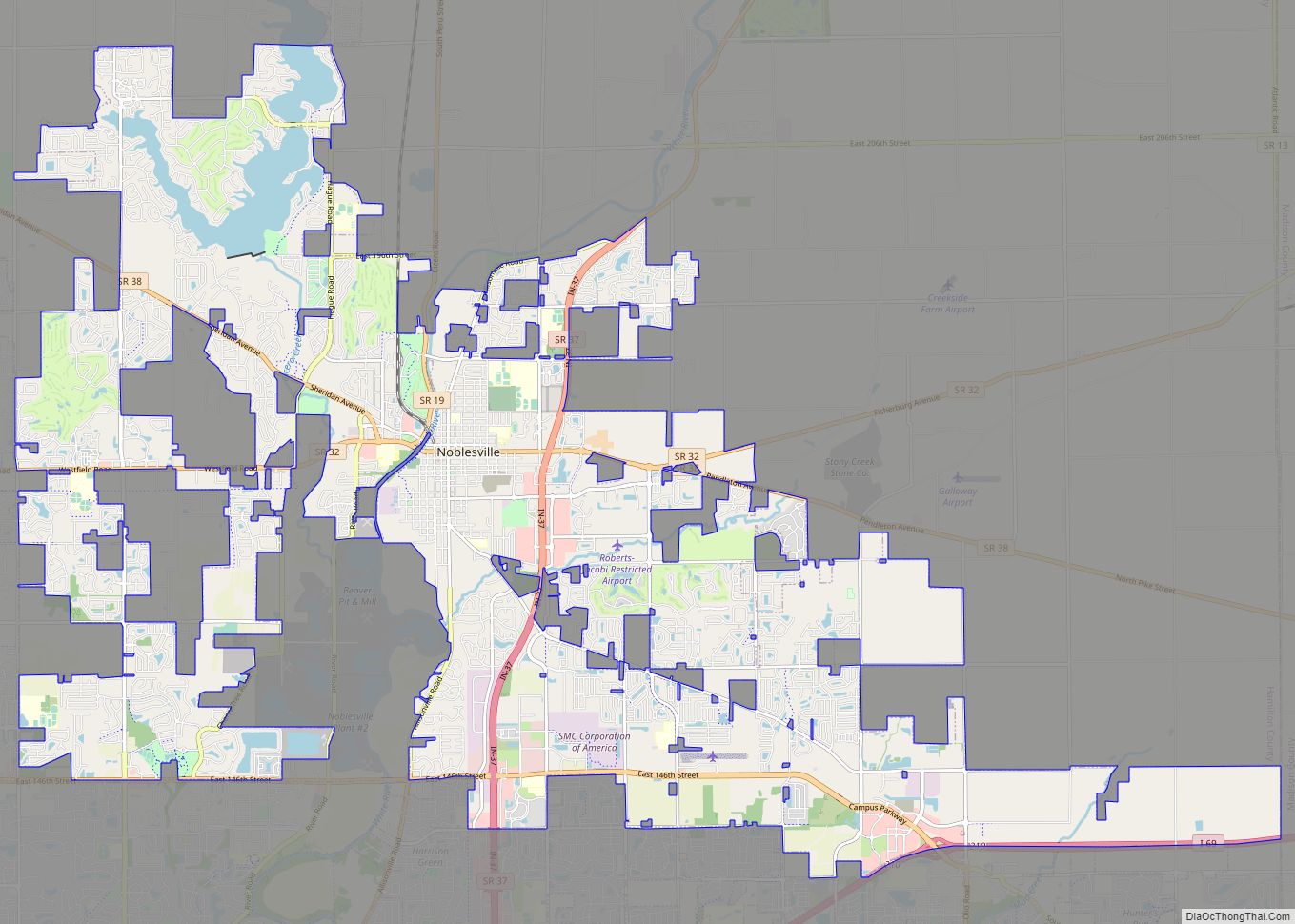
Online Interactive Map
Click on ![]() to view map in "full screen" mode.
to view map in "full screen" mode.
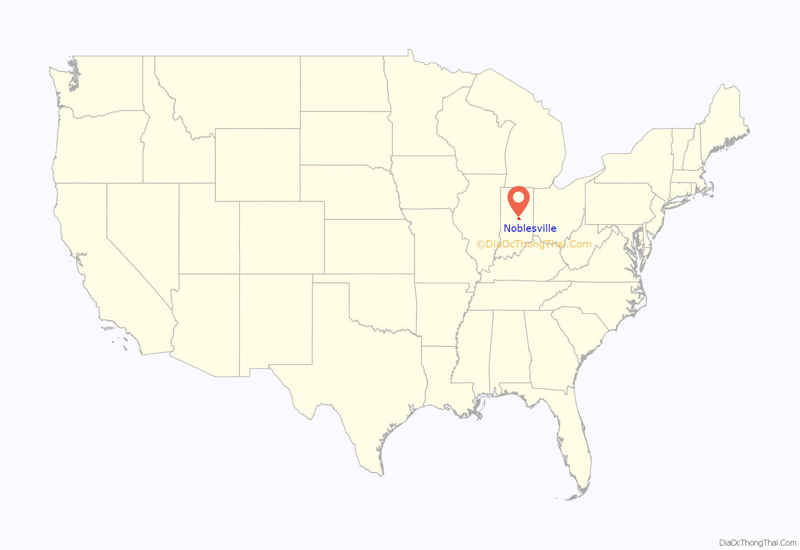
Noblesville location map. Where is Noblesville city?
History
Noblesville’s history dates to 1818 when the government purchased the land which is now Hamilton County from the Native Americans in this area. William Conner, the only settler living in the area at the time, and his wife Mekinges Conner, a Lenape woman, established the first trading post in central Indiana in 1802 and lived in the area’s first log cabin. William Conner and Josiah Polk laid out what is now downtown Noblesville in 1823, which was designated as the Hamilton County seat in 1824 and incorporated in 1851. Conner’s 1823 home is now one of a village of historic buildings that make up Conner Prairie Pioneer Settlement, a living history museum south of Noblesville in Fishers.
Noblesville was named either for James Noble, one of the first two U.S. senators from Indiana, or, according to legend, for Lavina Noble of Indianapolis, to whom Josiah Polk was engaged.
The Peru and Indianapolis Railroad was completed through town in 1851, strengthening the town economically and causing the population to increase. In 1875 work began on the town’s second railroad, the Anderson, Lebanon and St. Louis, later known as the Midland.
The city’s first large growth period occurred during the Indiana gas boom, with the discovery in 1888 of Noblesville’s first natural gas well near 11th and Pleasant streets. Many Victorian homes, as well as most of the downtown commercial district, were built during this time of prosperity. The city has undergone another increase recently as its population grew from 28,590 in 2000 to 51,969 in 2010. This growth echoes the increase in population of much of southern Hamilton County due to its proximity to Indianapolis.
Noblesville was once noted for its flour mills, the mostly widely known of which was the Noblesville Milling Company, producer of Diadem and Kismet flours. In 1925, the manager of the company offered to buy uniforms for the local high school athletic team in exchange for the school adopting the nickname “Millers”. The nickname persists to this day.
Other prominent businesses included the Union Sanitary Manufacturing Company, the American Strawboard Company and Firestone Industrial Products.
Among the notable disasters that have struck the town are the Great Flood of 1913, an interurban wreck on the courthouse square in 1919, and the Goeke fire of 1967. The fire, which began at the Paul Goeke auto dealership just off the square, destroyed two buildings and killed a firefighter’.
The old Hamilton County Sheriff’s Residence and Jail on the southwest corner of the courthouse square in downtown Noblesville is now the home of the Hamilton County Museum of History. As a working jail, it once housed Charles Manson as a teenager and D. C. Stephenson, former Grand Dragon of the Indiana Ku Klux Klan. The Stephenson trial, which took place in the adjoining Hamilton County courthouse in 1925, broke the power of the Klan in Indiana and drew national attention to Noblesville. Stephenson was convicted of second-degree murder in the death of Madge Oberholtzer.
During the early 1920s, Noblesville was one of several Indiana towns where the Ku Klux Klan was active, but the Klan’s influence quickly faded after Stephenson’s conviction. In 1973 Klansmen staging a march in Noblesville were met by counter-demonstrators carrying anti-Klan placards.
In 1995, a local contractor stumbled across a trunk containing Klan paraphernalia and membership records from the 1920s. The debate over how to handle the sensitive issue again put Noblesville in the national spotlight. The Hamilton County Historical Society, which received donated materials, opted to keep the public from seeing the former members’ names.
Noblesville also attracted national media attention in 1965 when Noblesville Daily Ledger editor James T. Neal was charged with contempt by Hamilton County Circuit Court judge Ed New. Neal’s fight for the First Amendment went before the Indiana Supreme Court. In May 2018, it drew national attention again as the Noblesville West Middle School was the site of a school shooting with a teacher and student injured.
List of mayors
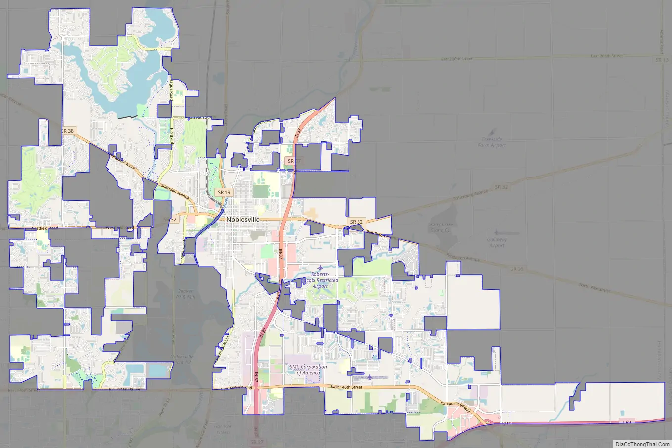
Noblesville Road Map
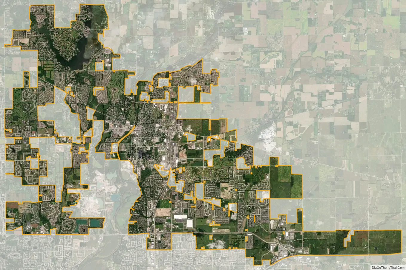
Noblesville city Satellite Map
Geography
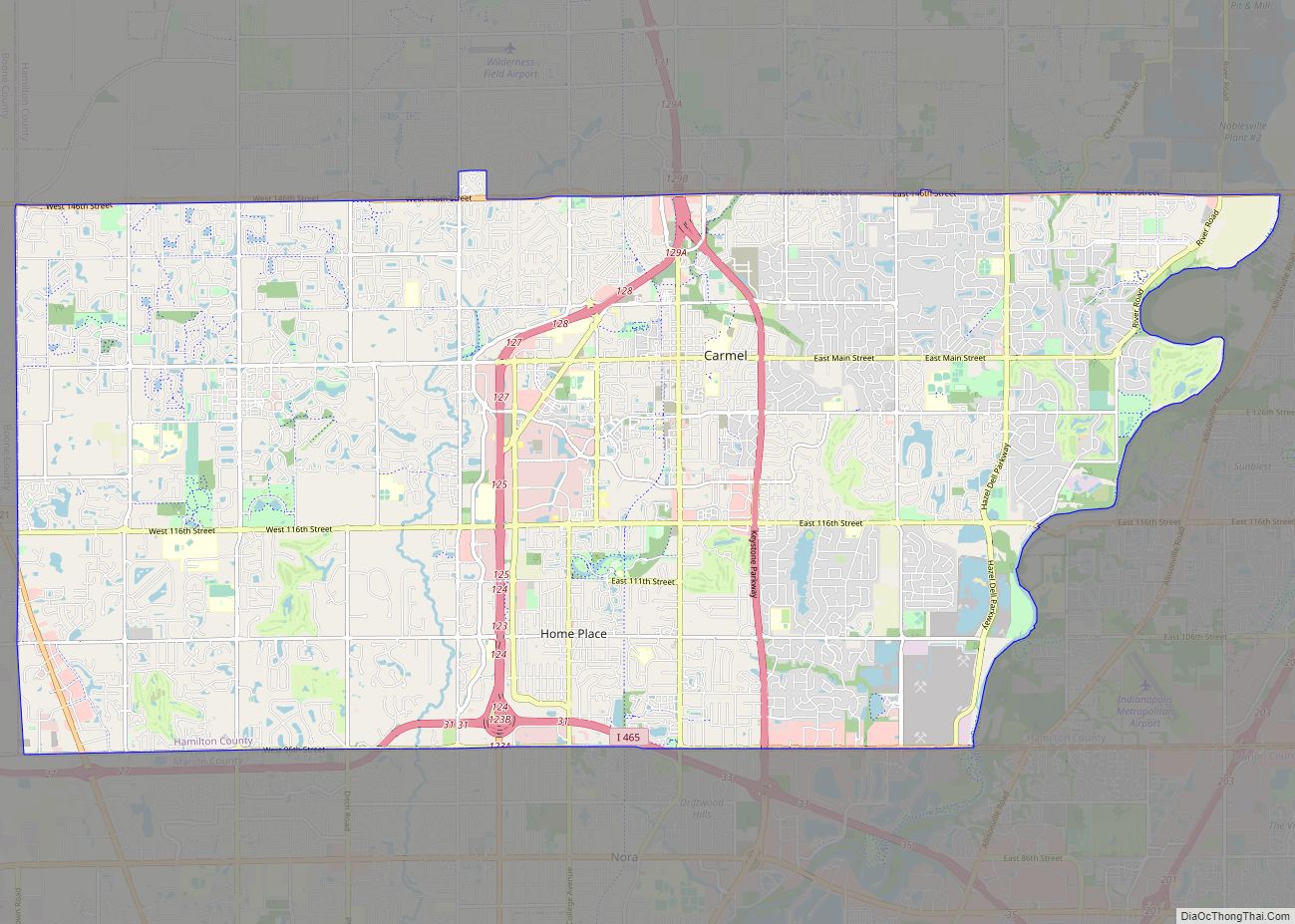
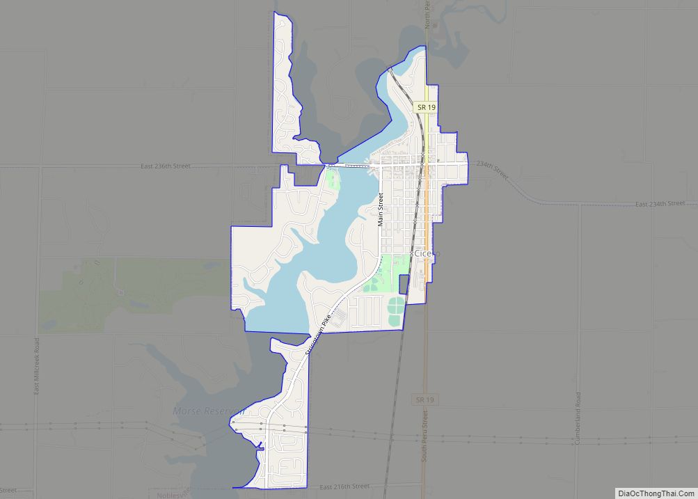
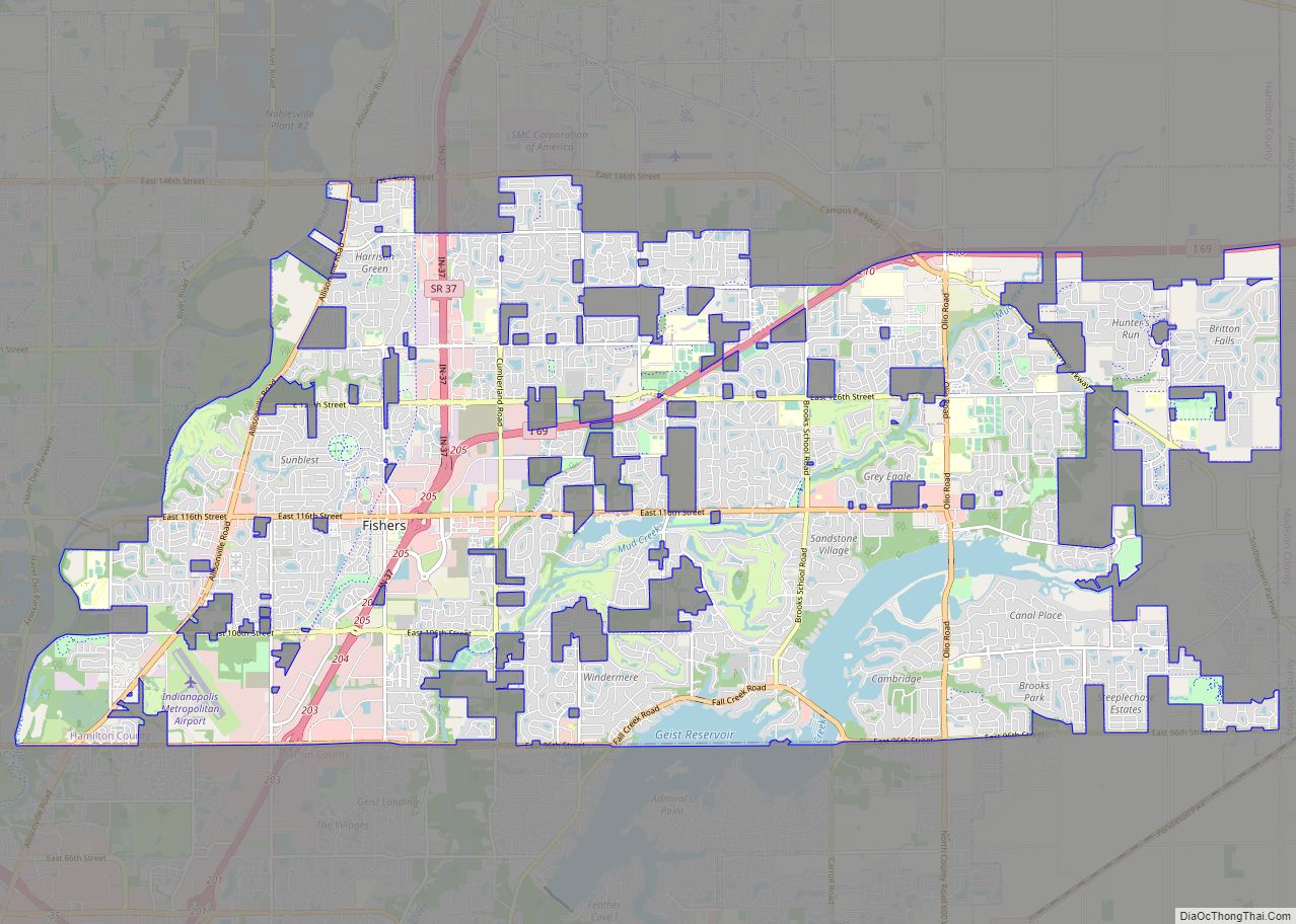
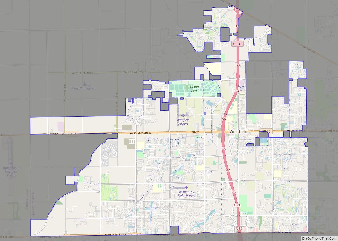
Noblesville is located in central Hamilton County at 40°3′0″N 86°1′17″W / 40.05000°N 86.02139°W / 40.05000; -86.02139 (40.049935, −86.021462). It is bordered to the north by Cicero, to the south by Fishers and Carmel, and to the west by Westfield. A narrow portion of Noblesville extends east to the Madison County line, where it is bordered by the town of Ingalls.
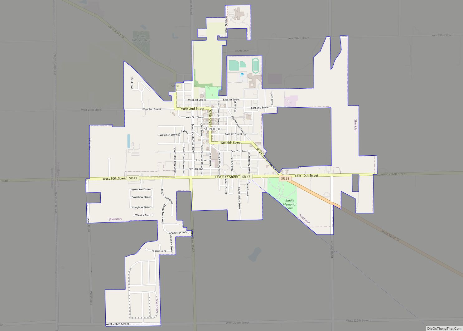
Noblesville is 23 miles (37 km) north-northeast of downtown Indianapolis. Indiana State Road 37 is the main highway through the city, running east of downtown. It leads south to Interstate 69 in Fishers and thence to Indianapolis, and northeast 43 miles (69 km) to Marion. Conner Street, carrying state routes 32 and 38, is the main east–west road through the center of Noblesville. SR 32 leads east-northeast 18 miles (29 km) to Anderson and west 6 miles (10 km) to Westfield, while SR 38 leads east-southeast 14 miles (23 km) to Pendleton and northwest 13 miles (21 km) to Sheridan. Indiana State Road 19 runs north from Noblesville, leading 17 miles (27 km) to Tipton.
According to the 2010 census, Noblesville has a total area of 32.785 square miles (84.91 km), of which 31.37 square miles (81.25 km) (or 95.68%) is land and 1.415 square miles (3.66 km) (or 4.32%) is water.
See also
Map of Indiana State and its subdivision:- Adams
- Allen
- Bartholomew
- Benton
- Blackford
- Boone
- Brown
- Carroll
- Cass
- Clark
- Clay
- Clinton
- Crawford
- Daviess
- De Kalb
- Dearborn
- Decatur
- Delaware
- Dubois
- Elkhart
- Fayette
- Floyd
- Fountain
- Franklin
- Fulton
- Gibson
- Grant
- Greene
- Hamilton
- Hancock
- Harrison
- Hendricks
- Henry
- Howard
- Huntington
- Jackson
- Jasper
- Jay
- Jefferson
- Jennings
- Johnson
- Knox
- Kosciusko
- LaGrange
- Lake
- Lake Michigan
- LaPorte
- Lawrence
- Madison
- Marion
- Marshall
- Martin
- Miami
- Monroe
- Montgomery
- Morgan
- Newton
- Noble
- Ohio
- Orange
- Owen
- Parke
- Perry
- Pike
- Porter
- Posey
- Pulaski
- Putnam
- Randolph
- Ripley
- Rush
- Saint Joseph
- Scott
- Shelby
- Spencer
- Starke
- Steuben
- Sullivan
- Switzerland
- Tippecanoe
- Tipton
- Union
- Vanderburgh
- Vermillion
- Vigo
- Wabash
- Warren
- Warrick
- Washington
- Wayne
- Wells
- White
- Whitley
- Alabama
- Alaska
- Arizona
- Arkansas
- California
- Colorado
- Connecticut
- Delaware
- District of Columbia
- Florida
- Georgia
- Hawaii
- Idaho
- Illinois
- Indiana
- Iowa
- Kansas
- Kentucky
- Louisiana
- Maine
- Maryland
- Massachusetts
- Michigan
- Minnesota
- Mississippi
- Missouri
- Montana
- Nebraska
- Nevada
- New Hampshire
- New Jersey
- New Mexico
- New York
- North Carolina
- North Dakota
- Ohio
- Oklahoma
- Oregon
- Pennsylvania
- Rhode Island
- South Carolina
- South Dakota
- Tennessee
- Texas
- Utah
- Vermont
- Virginia
- Washington
- West Virginia
- Wisconsin
- Wyoming