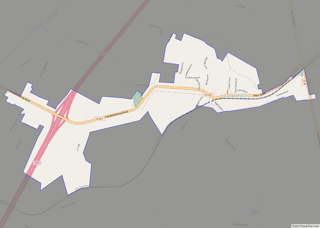
Campbellsburg is a home rule-class city in Henry County, Kentucky, in the United States. The population was 813 at the 2010 census, up from 705 at the 2000 census. It is home to Post 5 of the Kentucky State Police.
The city was incorporated by the state legislature in 1840 as “Chiltonsville”, in honor of its trustee Charles J. Chilton, but the name was changed within three weeks to “Campbellsburg” for another local family. Later the same year, the local post office at Benevola was renamed “Campbellsburg” as well. The arrival of the Louisville, Cincinnati and Lexington Railroad in 1869 led to a division of the town into “Old” and “New Campbellsburg”. The later was separately incorporated in 1876 but eventually expanded until the two polities merged into the present town.
Campbellsburg’s central business district was rebuilt after much of it was destroyed by a tornado on April 1, 1974.
| Name: | Campbellsburg city |
|---|---|
| LSAD Code: | 25 |
| LSAD Description: | city (suffix) |
| State: | Kentucky |
| County: | Henry County |
| Elevation: | 906 ft (276 m) |
| Total Area: | 1.35 sq mi (3.49 km²) |
| Land Area: | 1.32 sq mi (3.43 km²) |
| Water Area: | 0.03 sq mi (0.06 km²) |
| Total Population: | 836 |
| Population Density: | 631.90/sq mi (243.96/km²) |
| ZIP code: | 40011 |
| Area code: | 502 |
| FIPS code: | 2112142 |
| GNISfeature ID: | 0488741 |
| Website: | www.cityofcampbellsburg.org |
Online Interactive Map
Click on ![]() to view map in "full screen" mode.
to view map in "full screen" mode.
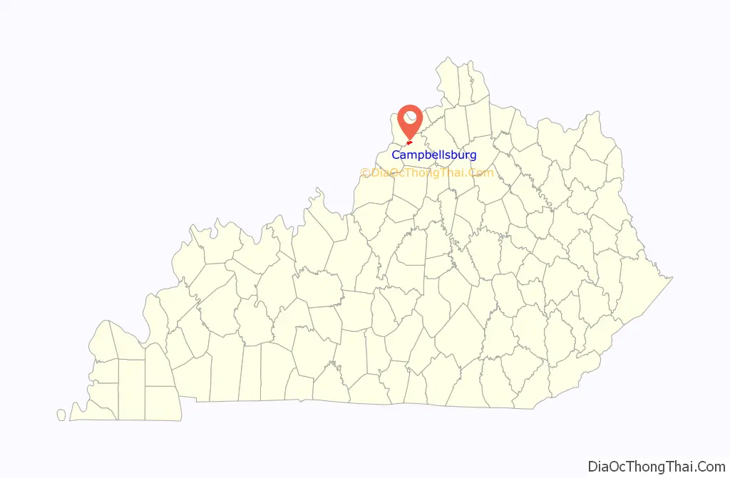
Campbellsburg location map. Where is Campbellsburg city?

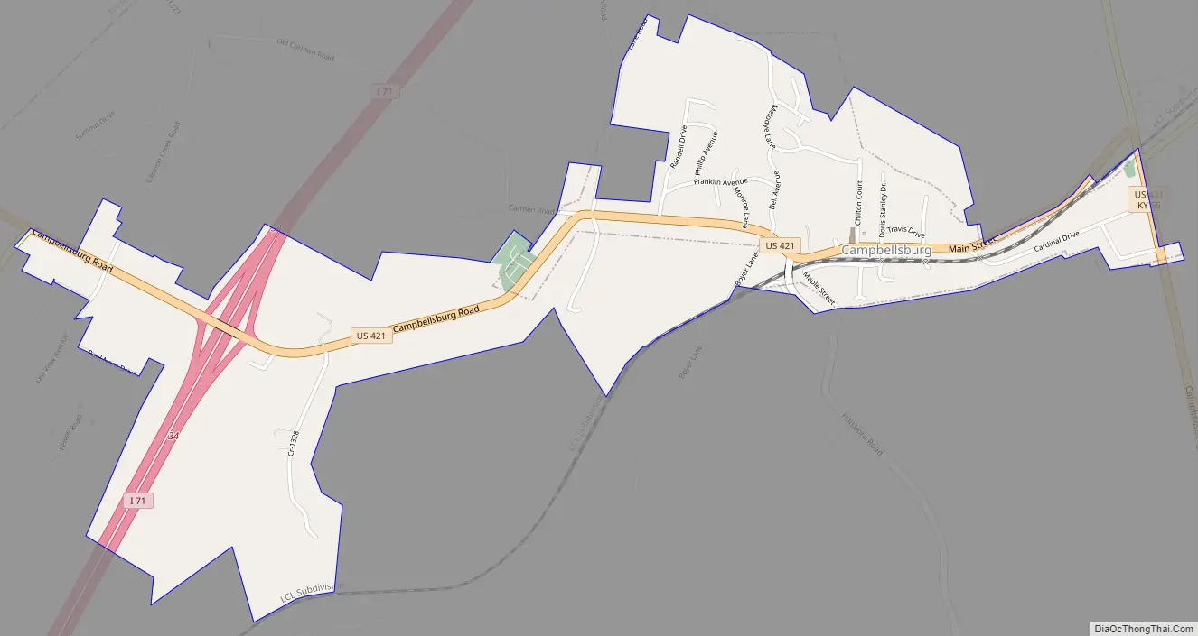
Campbellsburg Road Map
Campbellsburg city Satellite Map

Geography
Campbellsburg is located in northwestern Henry County at 38°31′23″N 85°12′16″W / 38.52306°N 85.20444°W / 38.52306; -85.20444 (38.523111, -85.204391). U.S. Route 421 is the city’s Main Street; it leads west 1.8 miles (2.9 km) to Interstate 71 at Exit 34 and northwest 9 miles (14 km) to Bedford, while to the southeast US-421 leads 37 miles (60 km) to Frankfort, the state capital. I-71 leads northeast 63 miles (101 km) to Cincinnati and southwest 35 miles (56 km) to Louisville.
According to the United States Census Bureau, Campbellsburg has a total area of 1.6 square miles (4.1 km), of which 0.04 square miles (0.1 km), or 2.45%, is water.
See also
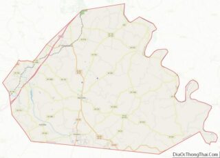
Map of Kentucky State and its subdivision:- Adair
- Allen
- Anderson
- Ballard
- Barren
- Bath
- Bell
- Boone
- Bourbon
- Boyd
- Boyle
- Bracken
- Breathitt
- Breckinridge
- Bullitt
- Butler
- Caldwell
- Calloway
- Campbell
- Carlisle
- Carroll
- Carter
- Casey
- Christian
- Clark
- Clay
- Clinton
- Crittenden
- Cumberland
- Daviess
- Edmonson
- Elliott
- Estill
- Fayette
- Fleming
- Floyd
- Franklin
- Fulton
- Gallatin
- Garrard
- Grant
- Graves
- Grayson
- Green
- Greenup
- Hancock
- Hardin
- Harlan
- Harrison
- Hart
- Henderson
- Henry
- Hickman
- Hopkins
- Jackson
- Jefferson
- Jessamine
- Johnson
- Kenton
- Knott
- Knox
- Larue
- Laurel
- Lawrence
- Lee
- Leslie
- Letcher
- Lewis
- Lincoln
- Livingston
- Logan
- Lyon
- Madison
- Magoffin
- Marion
- Marshall
- Martin
- Mason
- McCracken
- McCreary
- McLean
- Meade
- Menifee
- Mercer
- Metcalfe
- Monroe
- Montgomery
- Morgan
- Muhlenberg
- Nelson
- Nicholas
- Ohio
- Oldham
- Owen
- Owsley
- Pendleton
- Perry
- Pike
- Powell
- Pulaski
- Robertson
- Rockcastle
- Rowan
- Russell
- Scott
- Shelby
- Simpson
- Spencer
- Taylor
- Todd
- Trigg
- Trimble
- Union
- Warren
- Washington
- Wayne
- Webster
- Whitley
- Wolfe
- Woodford
- Alabama
- Alaska
- Arizona
- Arkansas
- California
- Colorado
- Connecticut
- Delaware
- District of Columbia
- Florida
- Georgia
- Hawaii
- Idaho
- Illinois
- Indiana
- Iowa
- Kansas
- Kentucky
- Louisiana
- Maine
- Maryland
- Massachusetts
- Michigan
- Minnesota
- Mississippi
- Missouri
- Montana
- Nebraska
- Nevada
- New Hampshire
- New Jersey
- New Mexico
- New York
- North Carolina
- North Dakota
- Ohio
- Oklahoma
- Oregon
- Pennsylvania
- Rhode Island
- South Carolina
- South Dakota
- Tennessee
- Texas
- Utah
- Vermont
- Virginia
- Washington
- West Virginia
- Wisconsin
- Wyoming