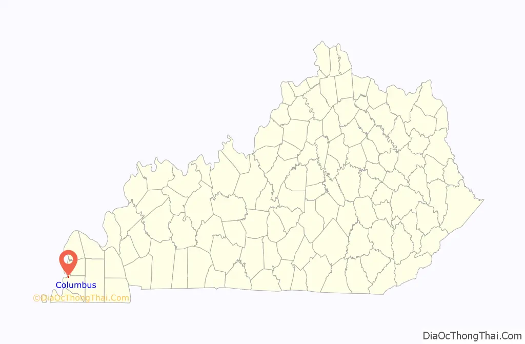
Columbus is a home rule-class city in Hickman County, Kentucky, in the United States. The population was 170 at the 2010 census, a decline from 229 in 2000. The city lies at the western end of the state, less than a mile from the Mississippi River.
Columbus-Belmont State Park borders the city to the west.
| Name: | Columbus city |
|---|---|
| LSAD Code: | 25 |
| LSAD Description: | city (suffix) |
| State: | Kentucky |
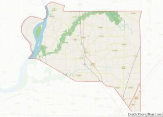
| County: | Hickman County |
| Elevation: | 459 ft (140 m) |
| Total Area: | 0.32 sq mi (0.83 km²) |
| Land Area: | 0.32 sq mi (0.82 km²) |
| Water Area: | 0.00 sq mi (0.00 km²) |
| Total Population: | 140 |
| Population Density: | 440.25/sq mi (169.85/km²) |
| ZIP code: | 42032 |
| Area code: | 270 & 364 |
| FIPS code: | 2116768 |
| GNISfeature ID: | 0489887 |
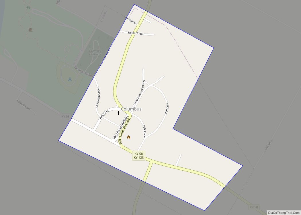
Online Interactive Map
Click on ![]() to view map in "full screen" mode.
to view map in "full screen" mode.
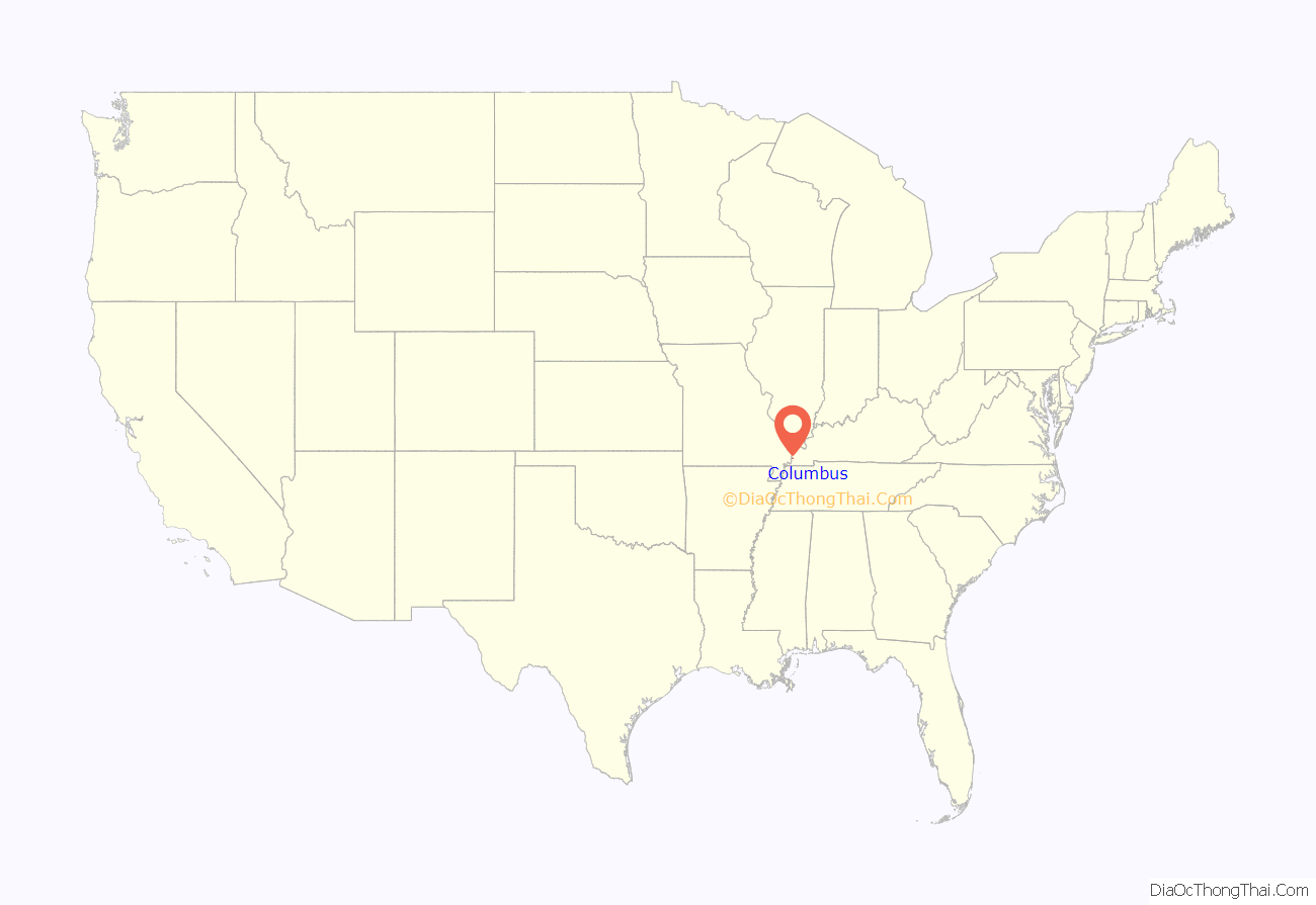
Columbus location map. Where is Columbus city?
History
Columbus is the oldest town in Kentucky’s Jackson Purchase. It was first settled on the Mississippi floodplain in 1804 and known as “Iron Banks” after the site’s French name les rivages de fer. The long-held local rumor that President Thomas Jefferson planned to remove the American capital to the site has absolutely no basis in fact.
The name of the town was changed to Columbus in 1820 (in honor of the Italian explorer), the year the town received its first post office and was formally established by the state assembly. It was the original Hickman County seat before the transfer of the court to the more central location of Clinton. It was formally incorporated in 1860.
In 1861, after the American Civil War broke out, the town was seized by Confederate forces (including the Louisiana “Shreveport Rebels”. They fortified the site overlooking the Mississippi River, building Fort de Russey.) Confederate general Leonidas Polk tried to run and maintain a large anchor chain across the entire Mississippi at Columbus in order to block Union traffic downriver. Columbus was also the northernmost spur on the Mobile and Ohio Railroad. The Union responded by General Ulysses S. Grant’s engaging the Confederates at Belmont on the Missouri shore. This was Grant’s first direct combat during the war. These actions are today commemorated at the Columbus-Belmont State Park on the bluff near Columbus.
In 1878, the American railroad legend Casey Jones got his first railroad job here, working as a telegrapher for the Mobile and Ohio at the age of 15.
The Great Mississippi Flood of 1927 deluged the town, as well as many areas downriver in the Mississippi Delta, where hundreds of thousands of acres were flooded. Survivors moved the town of Columbus, rebuilding it upon higher ground above the flood plain. Some of the original houses were saved and moved inland.
Given its isolated location in a rural area and the decline in river traffic, the town has lost population for years.
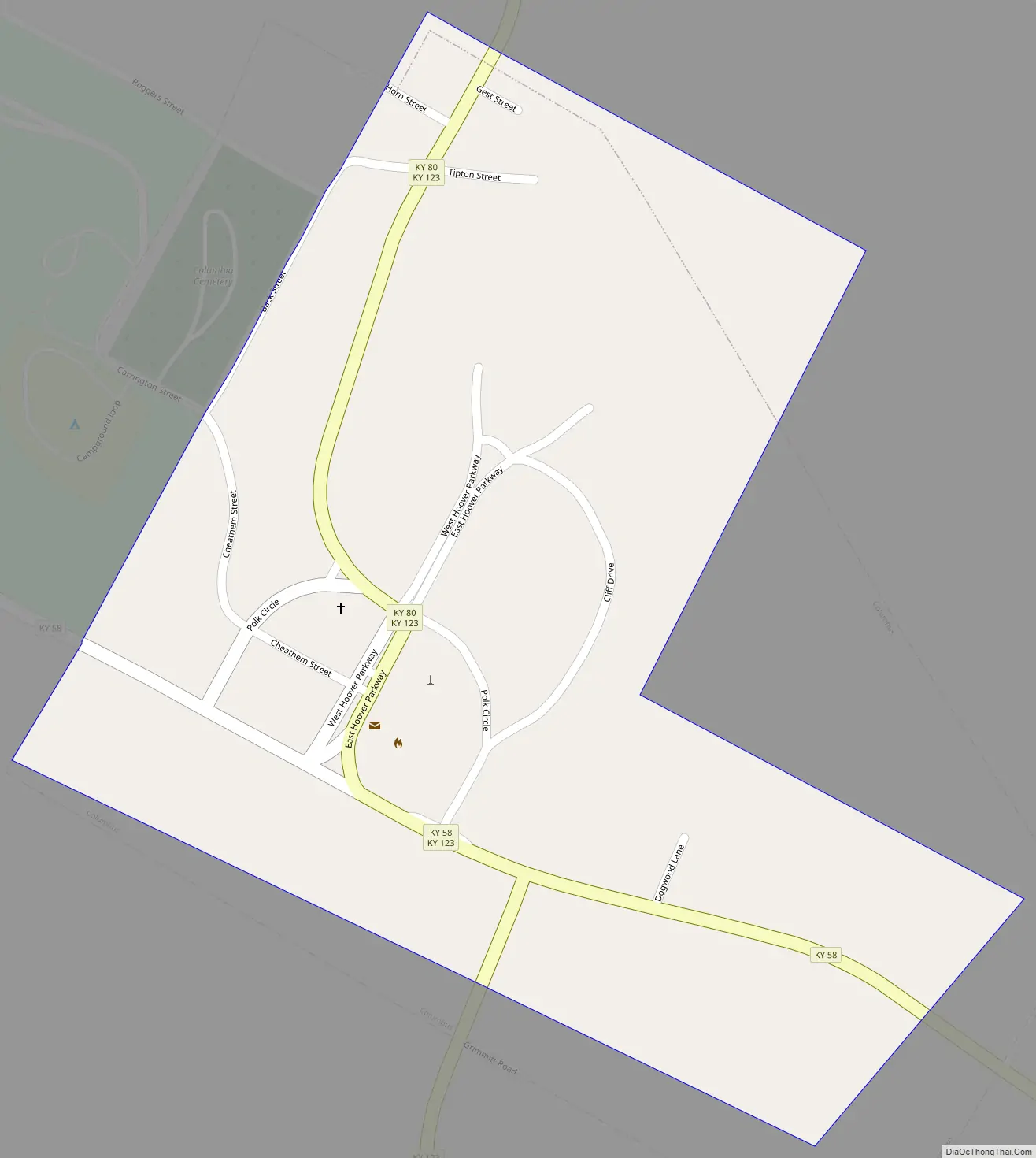
Columbus Road Map
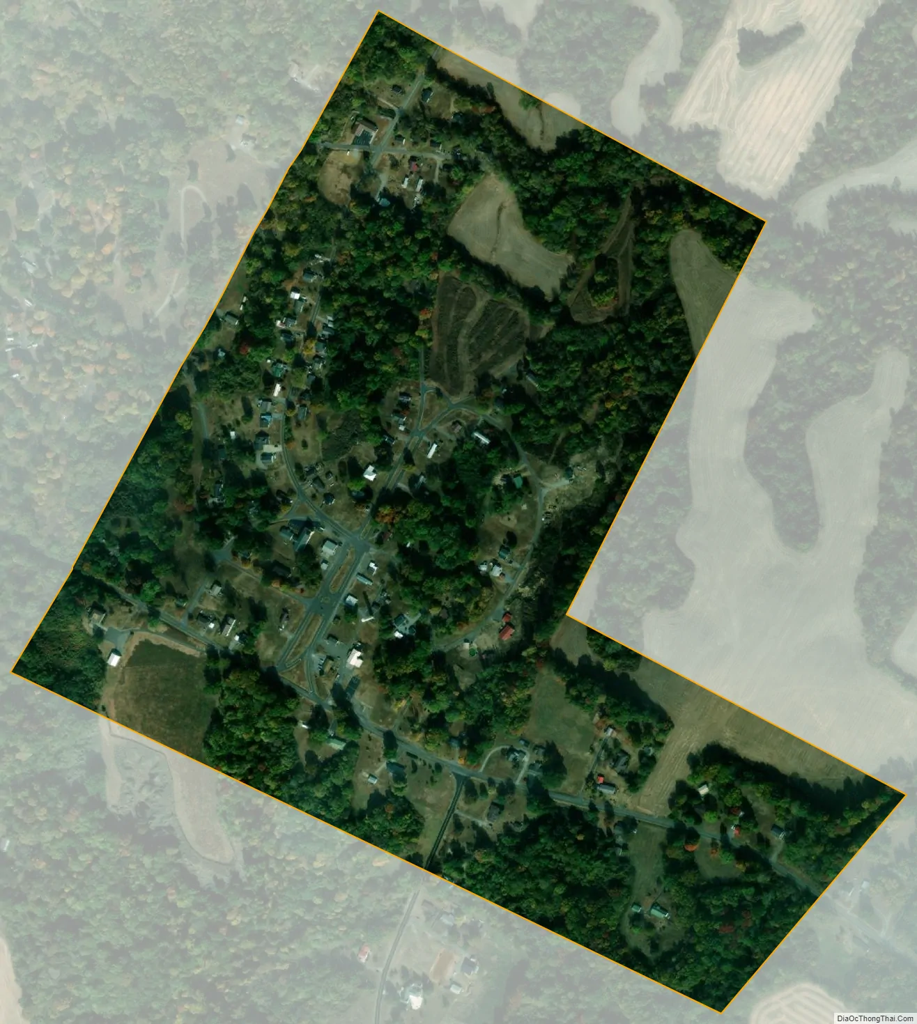
Columbus city Satellite Map
Geography
Columbus is located in northwestern Hickman County at 36°45′37″N 89°6′10″W / 36.76028°N 89.10278°W / 36.76028; -89.10278 (36.760176, -89.102840), on high ground 0.6 miles (0.97 km) east of the Mississippi River. It is bordered to the west by Columbus-Belmont State Park, which occupies a bluff rising nearly 200 feet (61 m) above the river.
Kentucky Route 58 leads southeast from Columbus 9 miles (14 km) to Clinton, the county seat. Kentucky Route 123 passes through the center of town, leading south then east 15 miles (24 km) to Clinton and north-northeast 10 miles (16 km) to Bardwell. Via Kentucky Route 80 it is 6 miles (10 km) east-northeast to Arlington.
According to the United States Census Bureau, the city has a total area of 0.3 square miles (0.8 km), all land.
See also
Map of Kentucky State and its subdivision:- Adair
- Allen
- Anderson
- Ballard
- Barren
- Bath
- Bell
- Boone
- Bourbon
- Boyd
- Boyle
- Bracken
- Breathitt
- Breckinridge
- Bullitt
- Butler
- Caldwell
- Calloway
- Campbell
- Carlisle
- Carroll
- Carter
- Casey
- Christian
- Clark
- Clay
- Clinton
- Crittenden
- Cumberland
- Daviess
- Edmonson
- Elliott
- Estill
- Fayette
- Fleming
- Floyd
- Franklin
- Fulton
- Gallatin
- Garrard
- Grant
- Graves
- Grayson
- Green
- Greenup
- Hancock
- Hardin
- Harlan
- Harrison
- Hart
- Henderson
- Henry
- Hickman
- Hopkins
- Jackson
- Jefferson
- Jessamine
- Johnson
- Kenton
- Knott
- Knox
- Larue
- Laurel
- Lawrence
- Lee
- Leslie
- Letcher
- Lewis
- Lincoln
- Livingston
- Logan
- Lyon
- Madison
- Magoffin
- Marion
- Marshall
- Martin
- Mason
- McCracken
- McCreary
- McLean
- Meade
- Menifee
- Mercer
- Metcalfe
- Monroe
- Montgomery
- Morgan
- Muhlenberg
- Nelson
- Nicholas
- Ohio
- Oldham
- Owen
- Owsley
- Pendleton
- Perry
- Pike
- Powell
- Pulaski
- Robertson
- Rockcastle
- Rowan
- Russell
- Scott
- Shelby
- Simpson
- Spencer
- Taylor
- Todd
- Trigg
- Trimble
- Union
- Warren
- Washington
- Wayne
- Webster
- Whitley
- Wolfe
- Woodford
- Alabama
- Alaska
- Arizona
- Arkansas
- California
- Colorado
- Connecticut
- Delaware
- District of Columbia
- Florida
- Georgia
- Hawaii
- Idaho
- Illinois
- Indiana
- Iowa
- Kansas
- Kentucky
- Louisiana
- Maine
- Maryland
- Massachusetts
- Michigan
- Minnesota
- Mississippi
- Missouri
- Montana
- Nebraska
- Nevada
- New Hampshire
- New Jersey
- New Mexico
- New York
- North Carolina
- North Dakota
- Ohio
- Oklahoma
- Oregon
- Pennsylvania
- Rhode Island
- South Carolina
- South Dakota
- Tennessee
- Texas
- Utah
- Vermont
- Virginia
- Washington
- West Virginia
- Wisconsin
- Wyoming