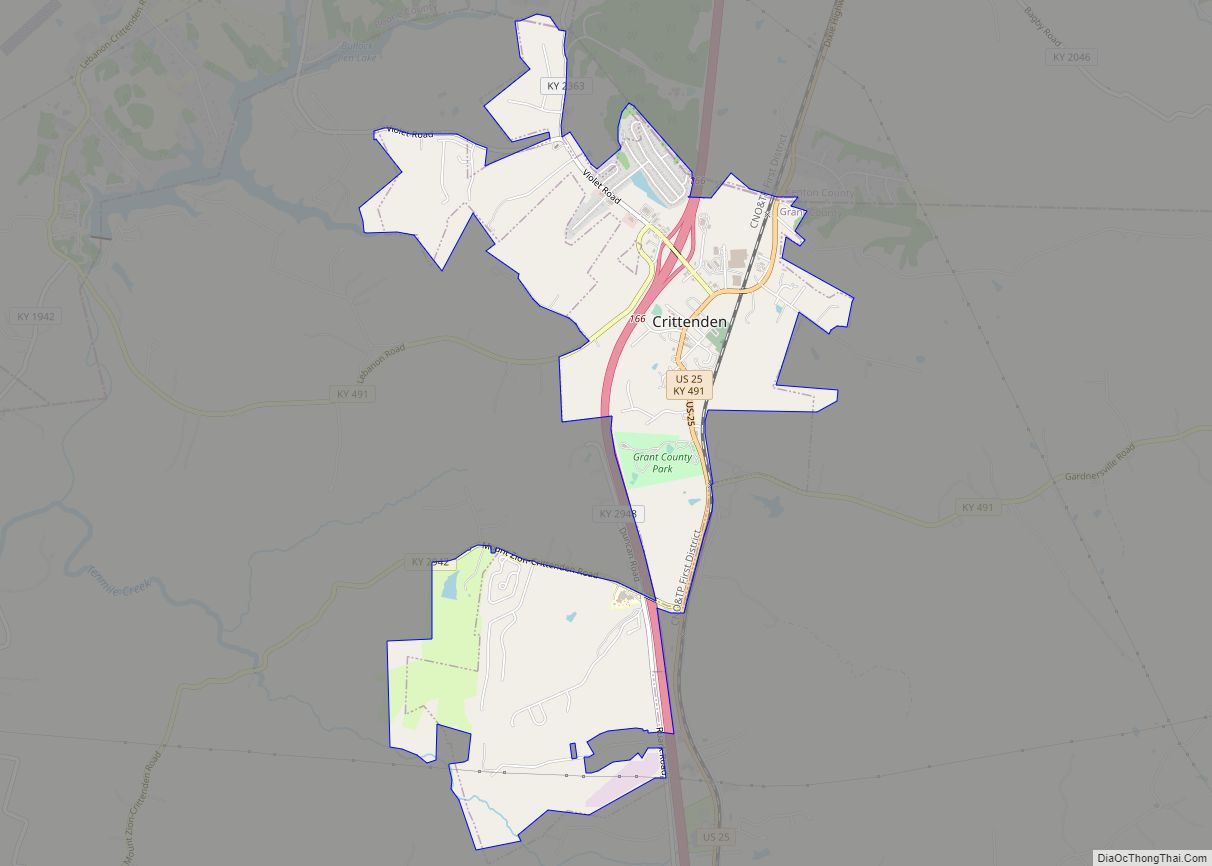
Crittenden is a home rule-class city in Grant and Kenton counties, Kentucky, in the United States. The population was 3,815 as of the 2010 census, up from 2,401 at the 2000 census.
| Name: | Crittenden city |
|---|---|
| LSAD Code: | 25 |
| LSAD Description: | city (suffix) |
| State: | Kentucky |
| County: | Grant County |
| Elevation: | 932 ft (284 m) |
| Total Area: | 3.43 sq mi (8.89 km²) |
| Land Area: | 3.40 sq mi (8.82 km²) |
| Water Area: | 0.03 sq mi (0.07 km²) |
| Total Population: | 4,023 |
| Population Density: | 1,181.50/sq mi (456.18/km²) |
| ZIP code: | 41030 |
| Area code: | 859 |
| FIPS code: | 2118568 |
| GNISfeature ID: | 0490355 |
| Website: | crittenden.ky.gov |
Online Interactive Map
Click on ![]() to view map in "full screen" mode.
to view map in "full screen" mode.
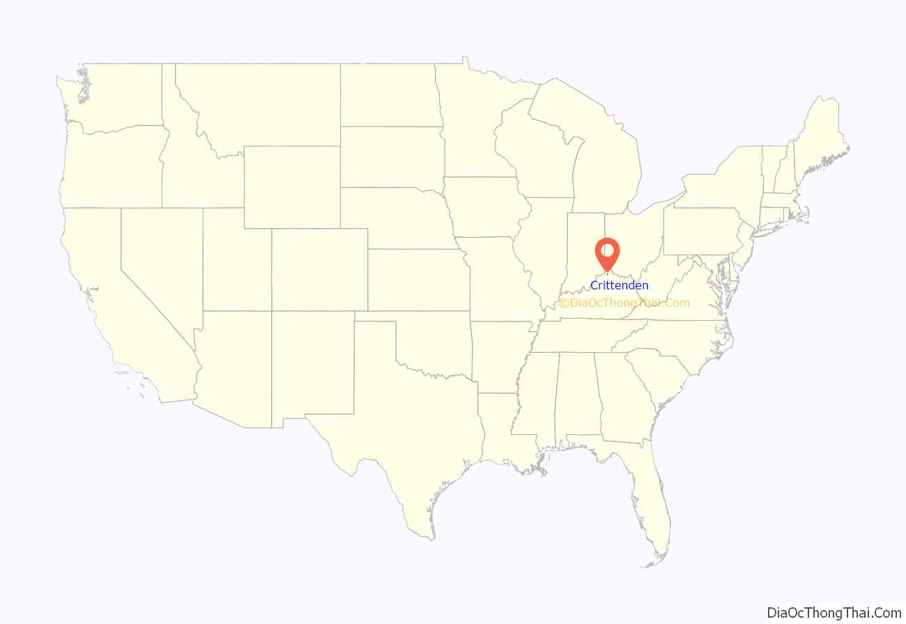
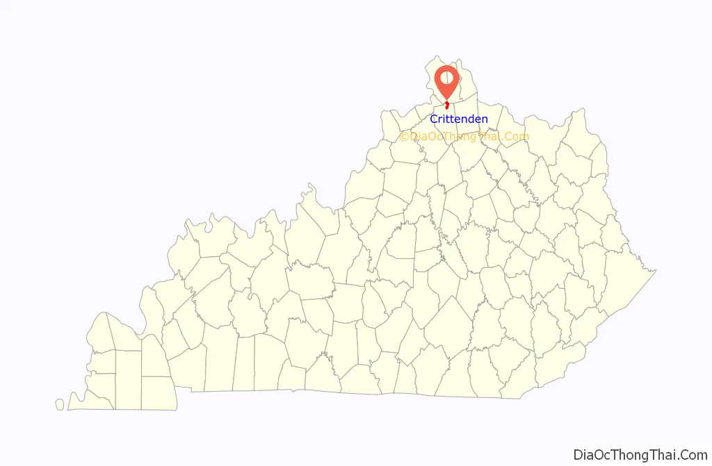
Crittenden location map. Where is Crittenden city?
History
The area of what is now Crittenden may have been settled as early as 1812. The community was called “Pin Hook” until 1834, when it was renamed for Kentucky statesman and later governor John J. Crittenden.
Crittenden Road Map
Crittenden city Satellite Map

Geography
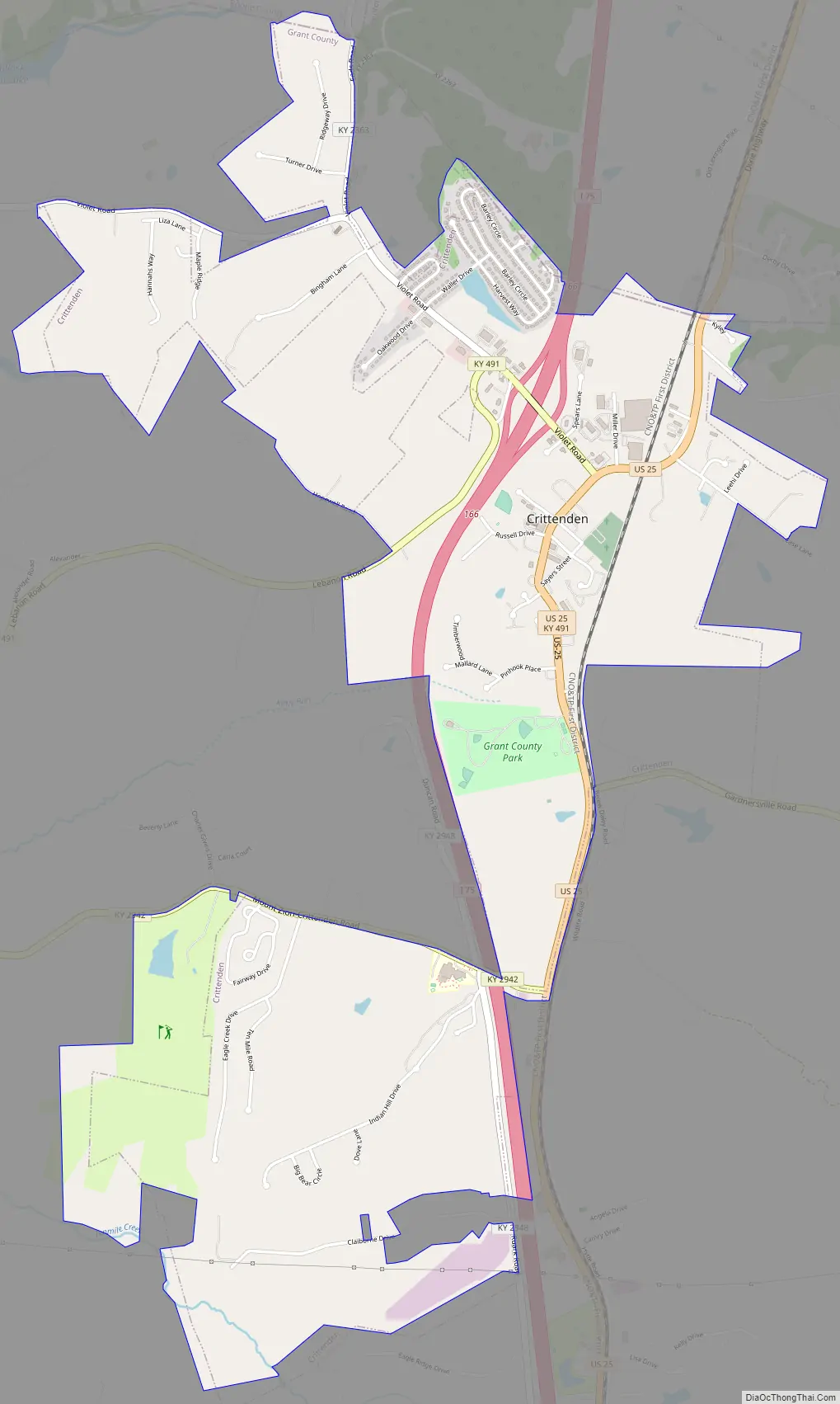
Crittenden is located in northern Grant County at 38°46′56″N 84°36′21″W / 38.78222°N 84.60583°W / 38.78222; -84.60583 (38.782248, -84.605794). A small portion of the northern border of the city touches the Boone County line, and another part of the city extends north into Kenton County.
Interstate 75 passes through Crittenden, with access from Exit 166; I-75 leads north 27 miles (43 km) to Cincinnati and south 56 miles (90 km) to Lexington. U.S. Route 25 (Dixie Highway) is a local road running parallel to I-75 that passes through the center of Crittenden; US 25 leads north 7 miles (11 km) to Walton and south 11 miles (18 km) to Williamstown, the Grant County seat.
According to the United States Census Bureau, Crittenden has a total area of 3.4 square miles (8.9 km), of which 0.03 square miles (0.07 km), or 0.80%, is water.
See also
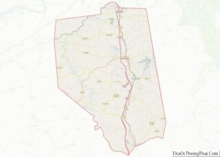
Map of Kentucky State and its subdivision:- Adair
- Allen
- Anderson
- Ballard
- Barren
- Bath
- Bell
- Boone
- Bourbon
- Boyd
- Boyle
- Bracken
- Breathitt
- Breckinridge
- Bullitt
- Butler
- Caldwell
- Calloway
- Campbell
- Carlisle
- Carroll
- Carter
- Casey
- Christian
- Clark
- Clay
- Clinton
- Crittenden
- Cumberland
- Daviess
- Edmonson
- Elliott
- Estill
- Fayette
- Fleming
- Floyd
- Franklin
- Fulton
- Gallatin
- Garrard
- Grant
- Graves
- Grayson
- Green
- Greenup
- Hancock
- Hardin
- Harlan
- Harrison
- Hart
- Henderson
- Henry
- Hickman
- Hopkins
- Jackson
- Jefferson
- Jessamine
- Johnson
- Kenton
- Knott
- Knox
- Larue
- Laurel
- Lawrence
- Lee
- Leslie
- Letcher
- Lewis
- Lincoln
- Livingston
- Logan
- Lyon
- Madison
- Magoffin
- Marion
- Marshall
- Martin
- Mason
- McCracken
- McCreary
- McLean
- Meade
- Menifee
- Mercer
- Metcalfe
- Monroe
- Montgomery
- Morgan
- Muhlenberg
- Nelson
- Nicholas
- Ohio
- Oldham
- Owen
- Owsley
- Pendleton
- Perry
- Pike
- Powell
- Pulaski
- Robertson
- Rockcastle
- Rowan
- Russell
- Scott
- Shelby
- Simpson
- Spencer
- Taylor
- Todd
- Trigg
- Trimble
- Union
- Warren
- Washington
- Wayne
- Webster
- Whitley
- Wolfe
- Woodford
- Alabama
- Alaska
- Arizona
- Arkansas
- California
- Colorado
- Connecticut
- Delaware
- District of Columbia
- Florida
- Georgia
- Hawaii
- Idaho
- Illinois
- Indiana
- Iowa
- Kansas
- Kentucky
- Louisiana
- Maine
- Maryland
- Massachusetts
- Michigan
- Minnesota
- Mississippi
- Missouri
- Montana
- Nebraska
- Nevada
- New Hampshire
- New Jersey
- New Mexico
- New York
- North Carolina
- North Dakota
- Ohio
- Oklahoma
- Oregon
- Pennsylvania
- Rhode Island
- South Carolina
- South Dakota
- Tennessee
- Texas
- Utah
- Vermont
- Virginia
- Washington
- West Virginia
- Wisconsin
- Wyoming