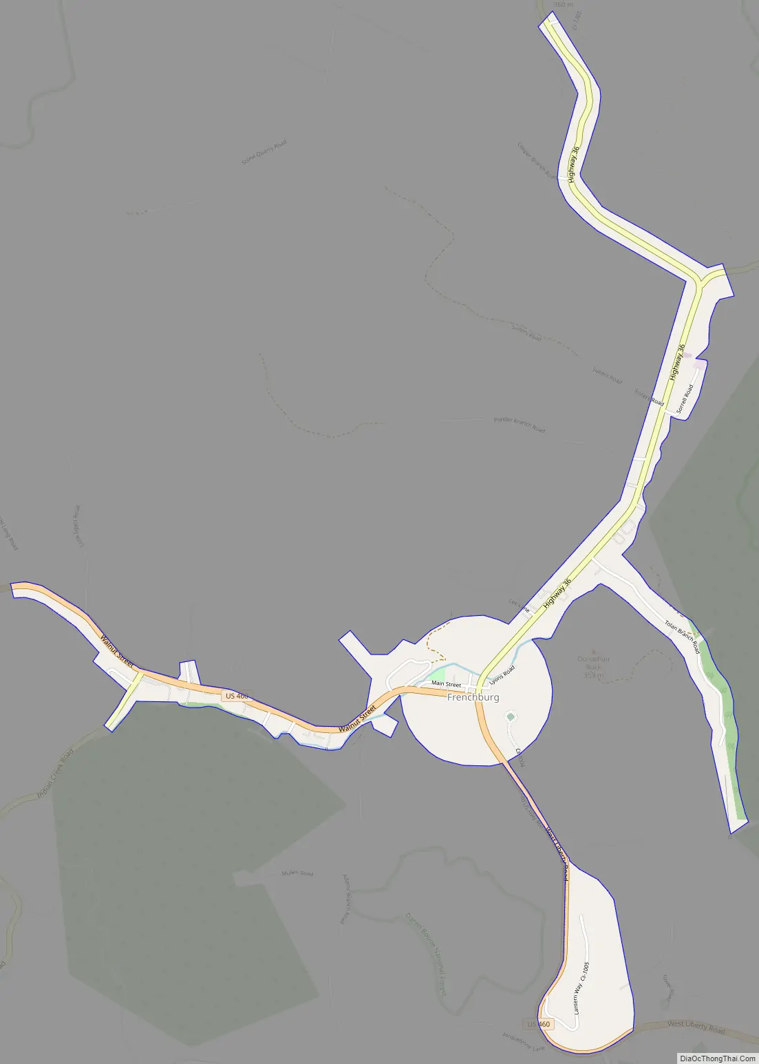
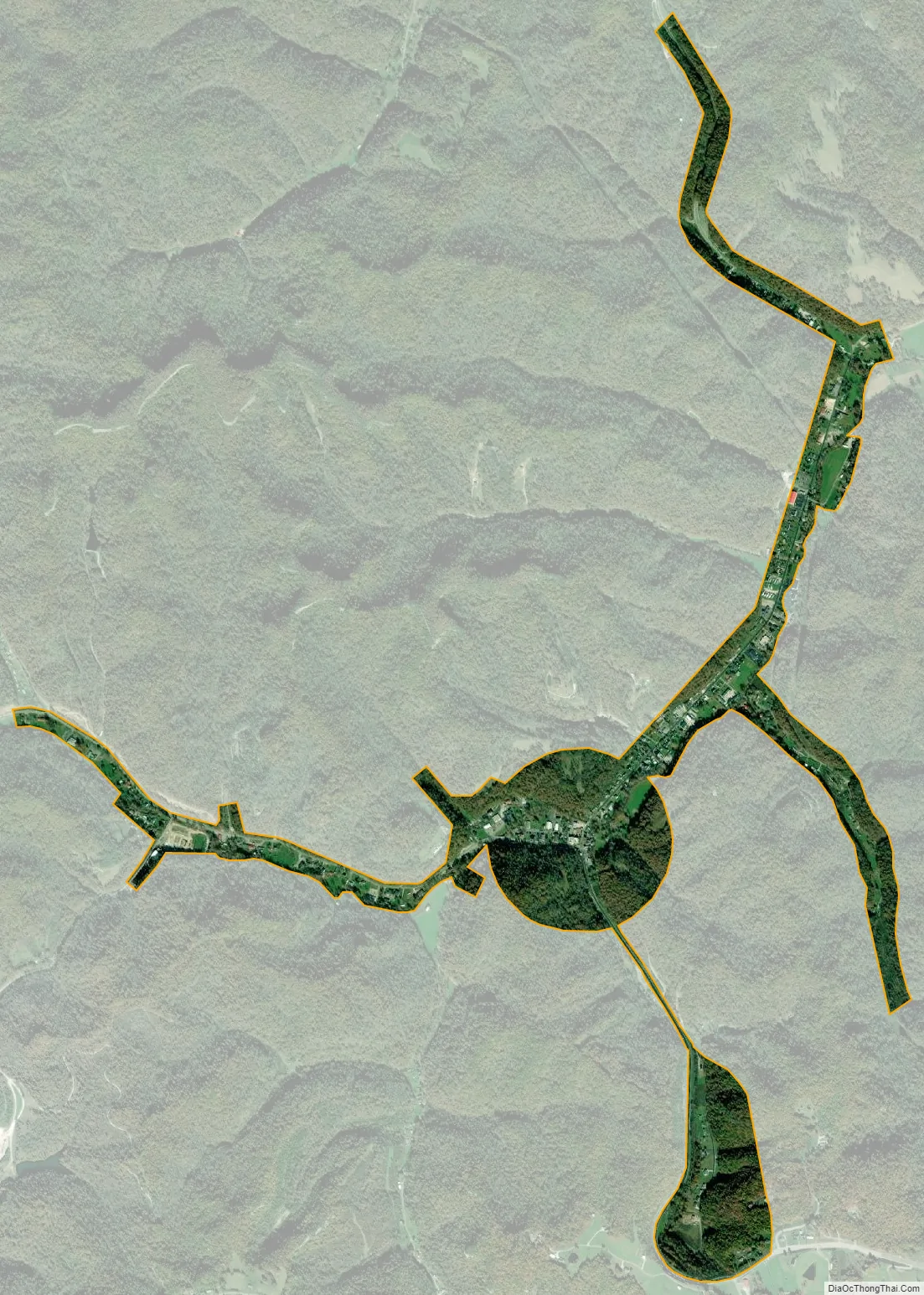
Frenchburg is a home rule-class city in Menifee County, Kentucky, in the United States. The population was 601 at the 2020 census, up from 486 in 2010. It is the seat and only incorporated city in its rural county. It is located at the junction of U.S. Route 460 and Kentucky Route 36. Logging is the primary industry.
Frenchburg is part of the Mount Sterling Micropolitan Statistical Area.
| Name: | Frenchburg city |
|---|---|
| LSAD Code: | 25 |
| LSAD Description: | city (suffix) |
| State: | Kentucky |
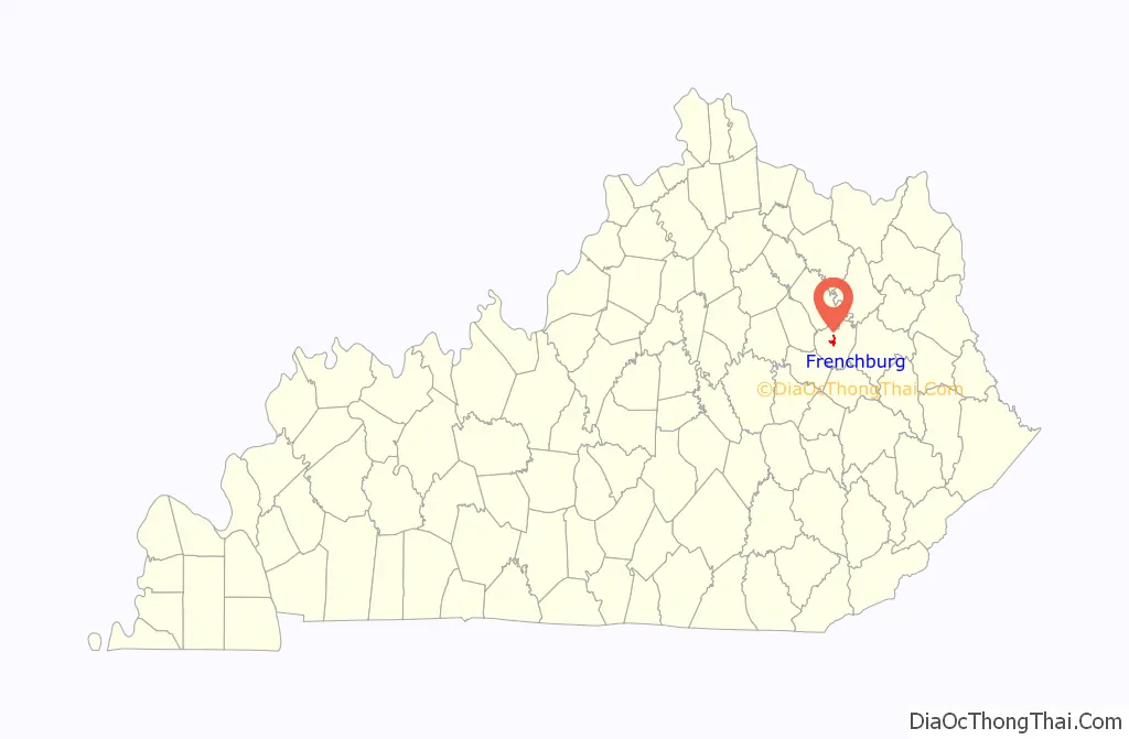
| County: | Menifee County |
| Elevation: | 873 ft (266 m) |
| Total Area: | 0.84 sq mi (2.18 km²) |
| Land Area: | 0.84 sq mi (2.17 km²) |
| Water Area: | 0.00 sq mi (0.00 km²) |
| Total Population: | 601 |
| Population Density: | 715.48/sq mi (276.33/km²) |
| ZIP code: | 40322 |
| Area code: | 606 |
| FIPS code: | 2129260 |
| GNISfeature ID: | 0512254 |
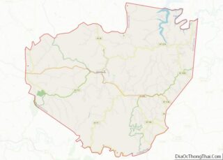
Online Interactive Map
Click on ![]() to view map in "full screen" mode.
to view map in "full screen" mode.
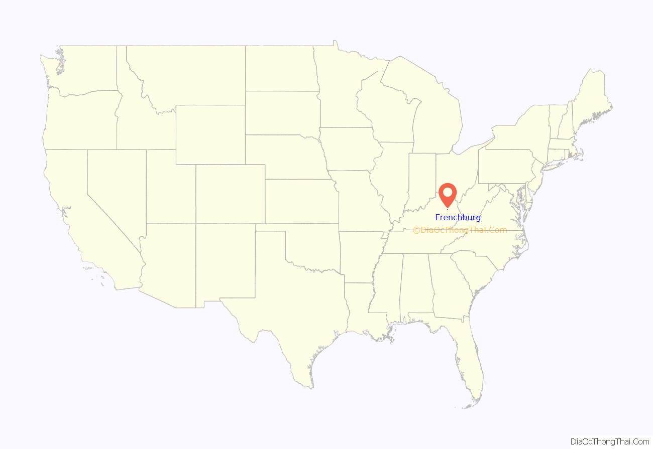
Frenchburg location map. Where is Frenchburg city?
History
Frenchburg was laid out in 1869 to be the county seat of newly formed Menifee County and was named for Robert French, a local lawyer and judge. It was formally incorporated by the state assembly in 1871.
Frenchburg was nearly destroyed on June 27, 1882, when Beaver Creek flooded, sweeping away all but three buildings and killing six people.
In 1910 the United Presbyterian Center was established in Frenchburg as the only secondary education for Menifee County by Dr. Edward Owings Guerrant, a physician and preacher. A hospital was built in 1915 and served as the only one between Lexington and Ashland for many years. In 1978 the campus was admitted to the National Register for Historic Places as Frenchburg School Campus for its educational, social, and religious significance.
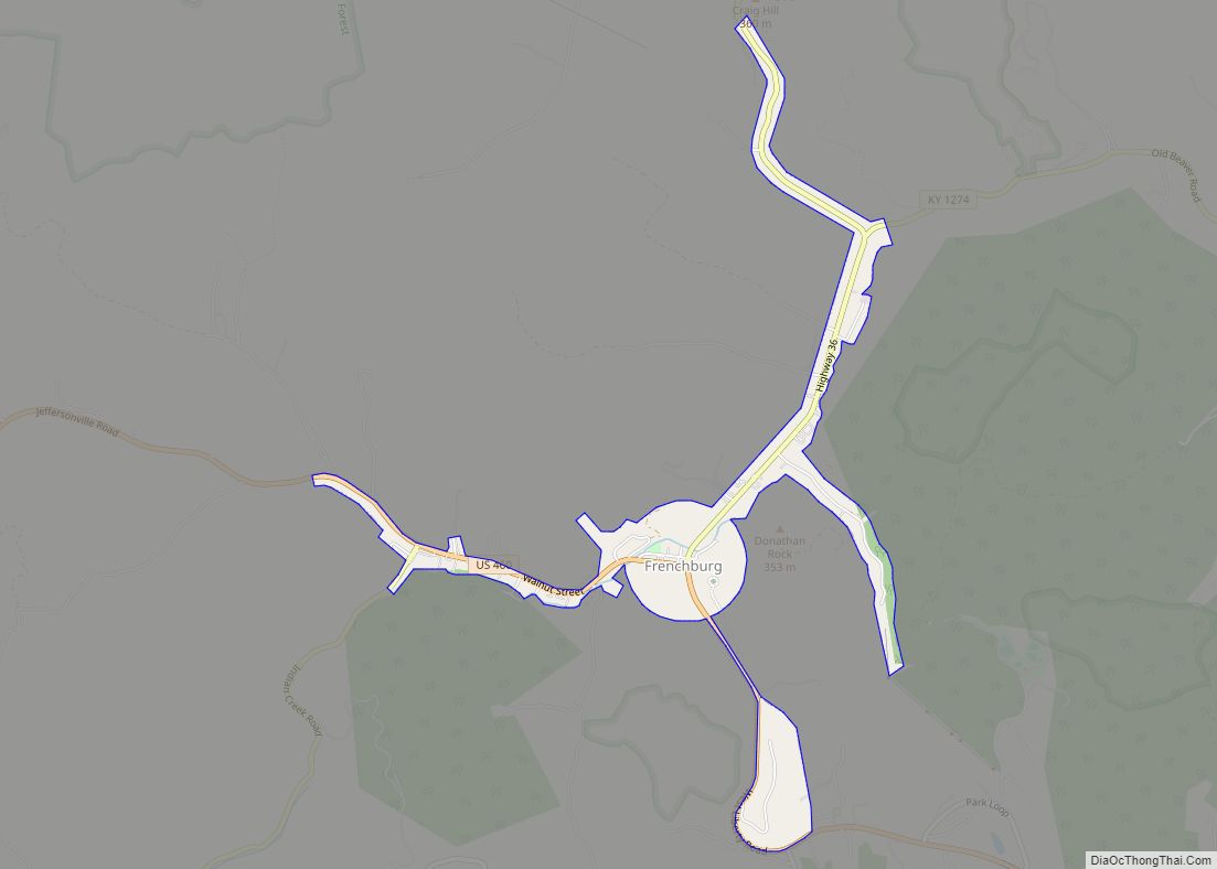
Frenchburg Road Map
Frenchburg city Satellite Map
Geography
Frenchburg is located at 37°57′11″N 83°37′38″W / 37.95306°N 83.62722°W / 37.95306; -83.62722 (37.953176, -83.627210), northwest of the center of Menifee County. It sits in the valley of Beaver Creek, where it is joined from the south by Blythes Branch.
Via U.S. 460, Mount Sterling is 21 miles (34 km) to the northwest, and West Liberty is 27 miles (43 km) to the east. KY 36 leads north from Frenchburg 18 miles (29 km) to Owingsville.
According to the United States Census Bureau, the city has a total area of 0.84 square miles (2.2 km), of which 0.001 square miles (0.003 km), or 0.12%, are water. Beaver Creek flows northeast to join the Licking River in Cave Run Lake.
Climate
The climate in this area is characterized by relatively high temperatures and evenly distributed precipitation throughout the year. The Köppen Climate Classification subtype for this climate is “Cfa” (Humid Subtropical Climate).
See also
Map of Kentucky State and its subdivision:- Adair
- Allen
- Anderson
- Ballard
- Barren
- Bath
- Bell
- Boone
- Bourbon
- Boyd
- Boyle
- Bracken
- Breathitt
- Breckinridge
- Bullitt
- Butler
- Caldwell
- Calloway
- Campbell
- Carlisle
- Carroll
- Carter
- Casey
- Christian
- Clark
- Clay
- Clinton
- Crittenden
- Cumberland
- Daviess
- Edmonson
- Elliott
- Estill
- Fayette
- Fleming
- Floyd
- Franklin
- Fulton
- Gallatin
- Garrard
- Grant
- Graves
- Grayson
- Green
- Greenup
- Hancock
- Hardin
- Harlan
- Harrison
- Hart
- Henderson
- Henry
- Hickman
- Hopkins
- Jackson
- Jefferson
- Jessamine
- Johnson
- Kenton
- Knott
- Knox
- Larue
- Laurel
- Lawrence
- Lee
- Leslie
- Letcher
- Lewis
- Lincoln
- Livingston
- Logan
- Lyon
- Madison
- Magoffin
- Marion
- Marshall
- Martin
- Mason
- McCracken
- McCreary
- McLean
- Meade
- Menifee
- Mercer
- Metcalfe
- Monroe
- Montgomery
- Morgan
- Muhlenberg
- Nelson
- Nicholas
- Ohio
- Oldham
- Owen
- Owsley
- Pendleton
- Perry
- Pike
- Powell
- Pulaski
- Robertson
- Rockcastle
- Rowan
- Russell
- Scott
- Shelby
- Simpson
- Spencer
- Taylor
- Todd
- Trigg
- Trimble
- Union
- Warren
- Washington
- Wayne
- Webster
- Whitley
- Wolfe
- Woodford
- Alabama
- Alaska
- Arizona
- Arkansas
- California
- Colorado
- Connecticut
- Delaware
- District of Columbia
- Florida
- Georgia
- Hawaii
- Idaho
- Illinois
- Indiana
- Iowa
- Kansas
- Kentucky
- Louisiana
- Maine
- Maryland
- Massachusetts
- Michigan
- Minnesota
- Mississippi
- Missouri
- Montana
- Nebraska
- Nevada
- New Hampshire
- New Jersey
- New Mexico
- New York
- North Carolina
- North Dakota
- Ohio
- Oklahoma
- Oregon
- Pennsylvania
- Rhode Island
- South Carolina
- South Dakota
- Tennessee
- Texas
- Utah
- Vermont
- Virginia
- Washington
- West Virginia
- Wisconsin
- Wyoming