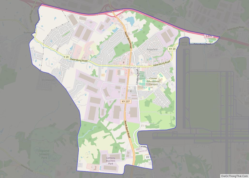
Hebron (/ˈhiːbrən/) is an unincorporated community and census-designated place (CDP) in Boone County, Kentucky, United States. It is named after the biblical city of Hebron. As of the 2010 census, it had a population of 5,929. It is home to the Cincinnati/Northern Kentucky International Airport, which serves Cincinnati and the Tri-State (Ohio-Kentucky-Indiana) area.
| Name: | Hebron CDP |
|---|---|
| LSAD Code: | 57 |
| LSAD Description: | CDP (suffix) |
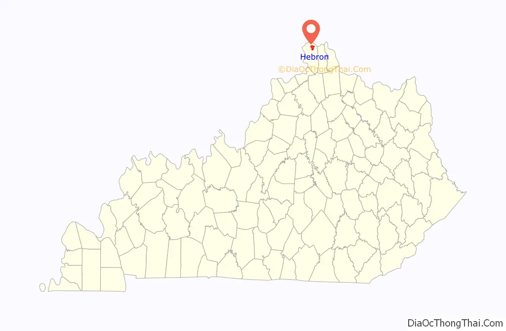
| State: | Kentucky |
| County: | Boone County |
| Elevation: | 879 ft (268 m) |
| Total Area: | 6.43 sq mi (16.65 km²) |
| Land Area: | 6.42 sq mi (16.62 km²) |
| Water Area: | 0.01 sq mi (0.03 km²) |
| Total Population: | 6,195 |
| Population Density: | 965.10/sq mi (372.64/km²) |
| ZIP code: | 41048 |
| Area code: | (859) |
| FIPS code: | 2135542 |
| GNISfeature ID: | 493986 |
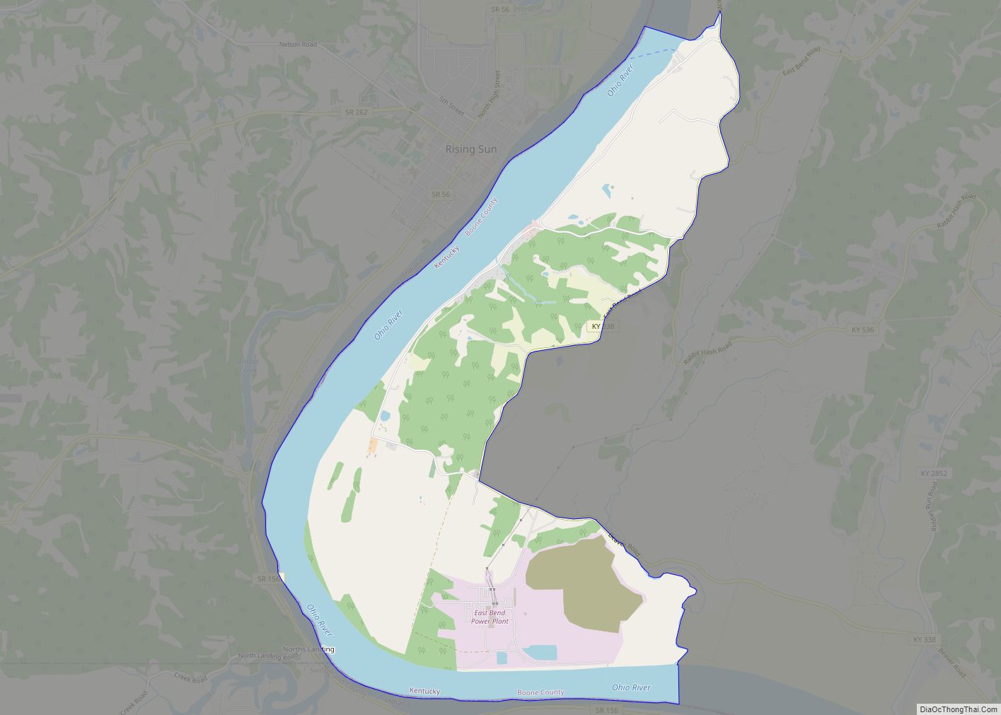
Online Interactive Map
Click on ![]() to view map in "full screen" mode.
to view map in "full screen" mode.
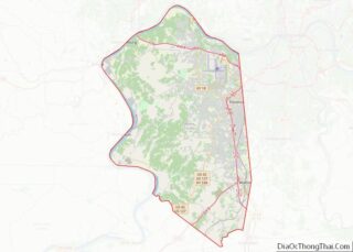
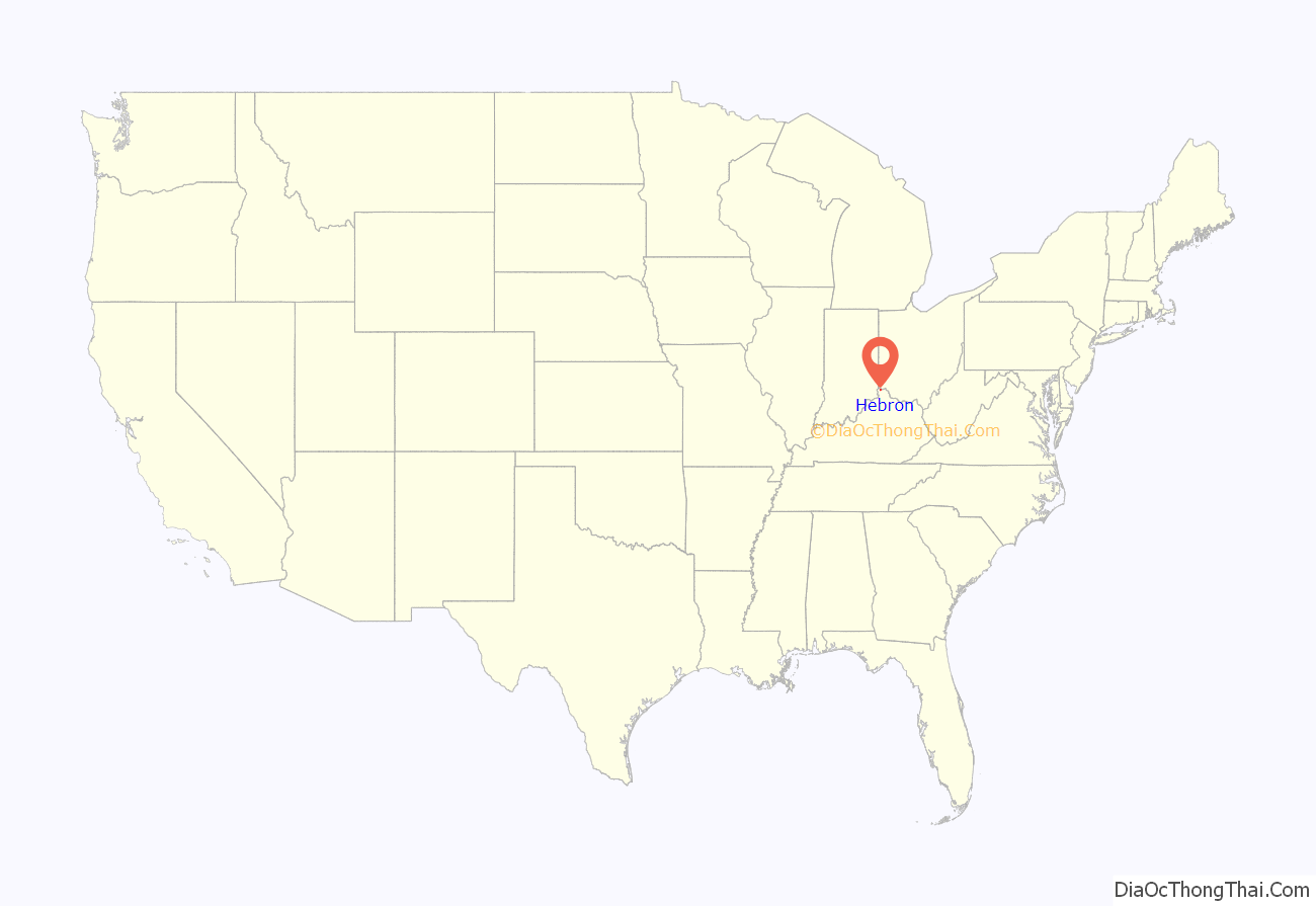
Hebron location map. Where is Hebron CDP?
History
Previously known as Briar Thicket and possibly Hecla, the community post office established in 1858 was named for the local Hebron Lutheran Church.
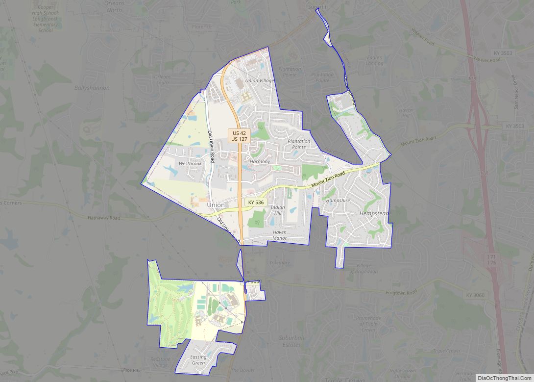
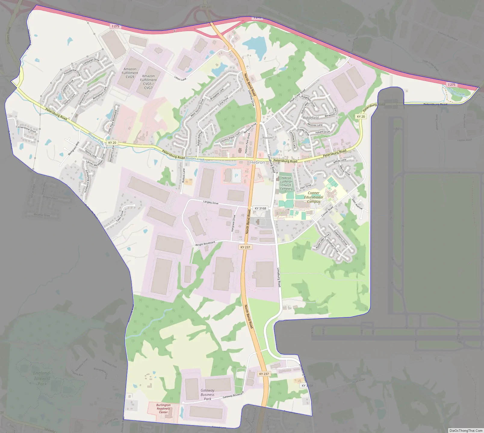
Hebron Road Map
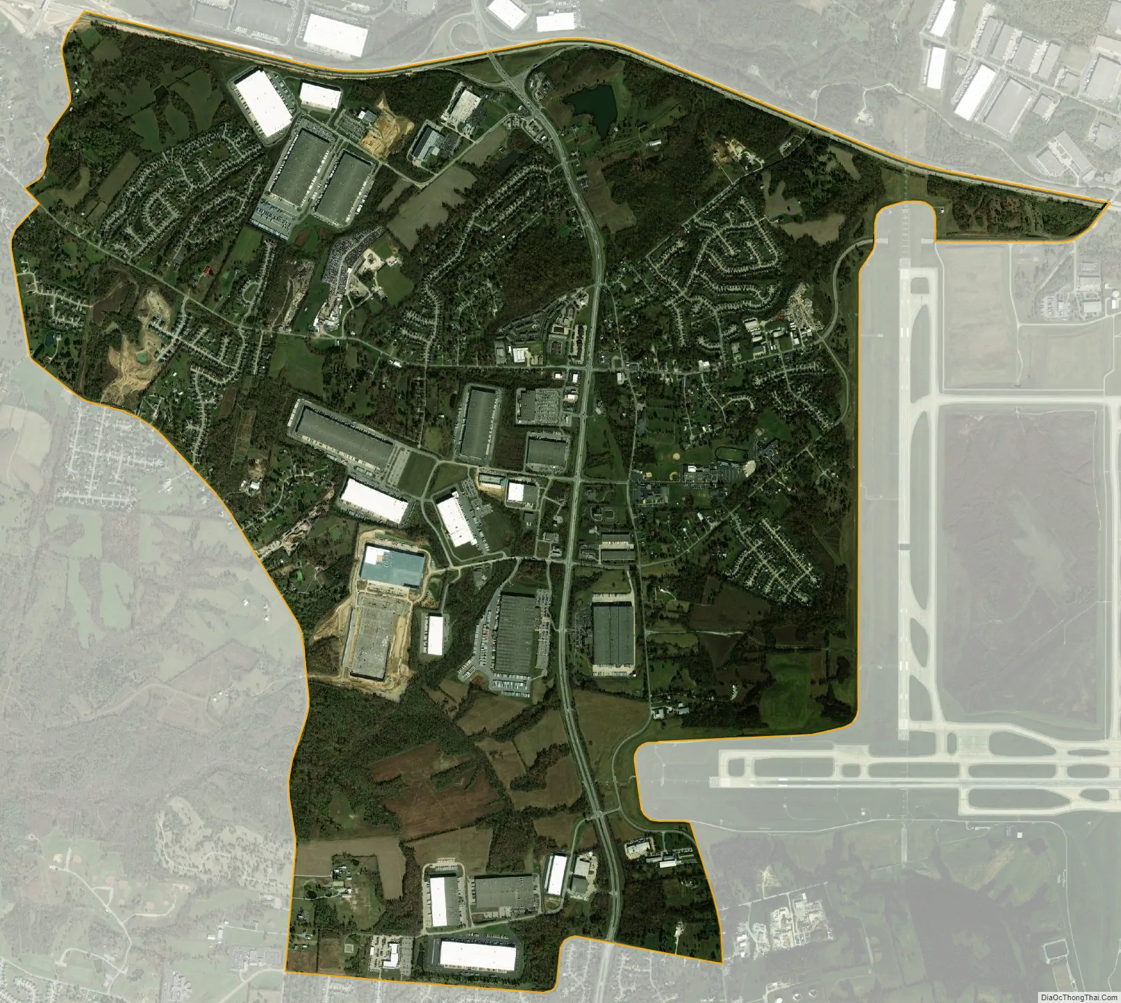
Hebron city Satellite Map
Geography
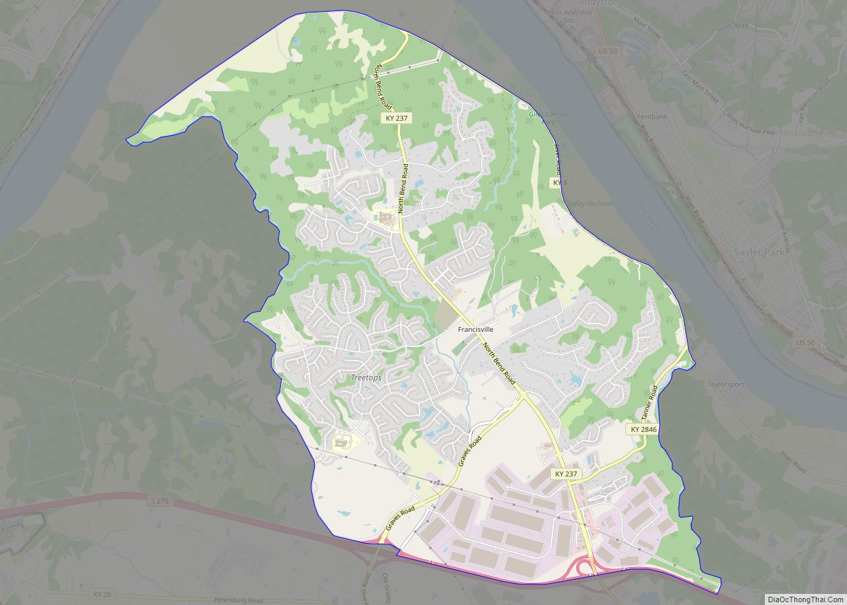
Hebron is located in northern Boone County, on the western edge of the Cincinnati–Covington suburbs. Interstate 275 forms the northern edge of the CDP, with the CDP of Francisville to the north. The center of Hebron is focused around the intersection of Kentucky Route 20 and Kentucky Route 237, located 3 miles (5 km) west of the entrance to Cincinnati/Northern Kentucky International Airport. Downtown Cincinnati is 16 miles (26 km) to the east of Hebron by I-275 and I-75/71.
According to the U.S. Census Bureau, Hebron has a total area of 6.4 square miles (16.7 km), of which 0.012 square miles (0.03 km), or 0.18%, is water.
See also
Map of Kentucky State and its subdivision:- Adair
- Allen
- Anderson
- Ballard
- Barren
- Bath
- Bell
- Boone
- Bourbon
- Boyd
- Boyle
- Bracken
- Breathitt
- Breckinridge
- Bullitt
- Butler
- Caldwell
- Calloway
- Campbell
- Carlisle
- Carroll
- Carter
- Casey
- Christian
- Clark
- Clay
- Clinton
- Crittenden
- Cumberland
- Daviess
- Edmonson
- Elliott
- Estill
- Fayette
- Fleming
- Floyd
- Franklin
- Fulton
- Gallatin
- Garrard
- Grant
- Graves
- Grayson
- Green
- Greenup
- Hancock
- Hardin
- Harlan
- Harrison
- Hart
- Henderson
- Henry
- Hickman
- Hopkins
- Jackson
- Jefferson
- Jessamine
- Johnson
- Kenton
- Knott
- Knox
- Larue
- Laurel
- Lawrence
- Lee
- Leslie
- Letcher
- Lewis
- Lincoln
- Livingston
- Logan
- Lyon
- Madison
- Magoffin
- Marion
- Marshall
- Martin
- Mason
- McCracken
- McCreary
- McLean
- Meade
- Menifee
- Mercer
- Metcalfe
- Monroe
- Montgomery
- Morgan
- Muhlenberg
- Nelson
- Nicholas
- Ohio
- Oldham
- Owen
- Owsley
- Pendleton
- Perry
- Pike
- Powell
- Pulaski
- Robertson
- Rockcastle
- Rowan
- Russell
- Scott
- Shelby
- Simpson
- Spencer
- Taylor
- Todd
- Trigg
- Trimble
- Union
- Warren
- Washington
- Wayne
- Webster
- Whitley
- Wolfe
- Woodford
- Alabama
- Alaska
- Arizona
- Arkansas
- California
- Colorado
- Connecticut
- Delaware
- District of Columbia
- Florida
- Georgia
- Hawaii
- Idaho
- Illinois
- Indiana
- Iowa
- Kansas
- Kentucky
- Louisiana
- Maine
- Maryland
- Massachusetts
- Michigan
- Minnesota
- Mississippi
- Missouri
- Montana
- Nebraska
- Nevada
- New Hampshire
- New Jersey
- New Mexico
- New York
- North Carolina
- North Dakota
- Ohio
- Oklahoma
- Oregon
- Pennsylvania
- Rhode Island
- South Carolina
- South Dakota
- Tennessee
- Texas
- Utah
- Vermont
- Virginia
- Washington
- West Virginia
- Wisconsin
- Wyoming