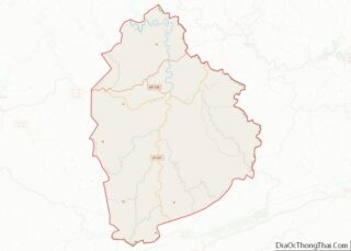
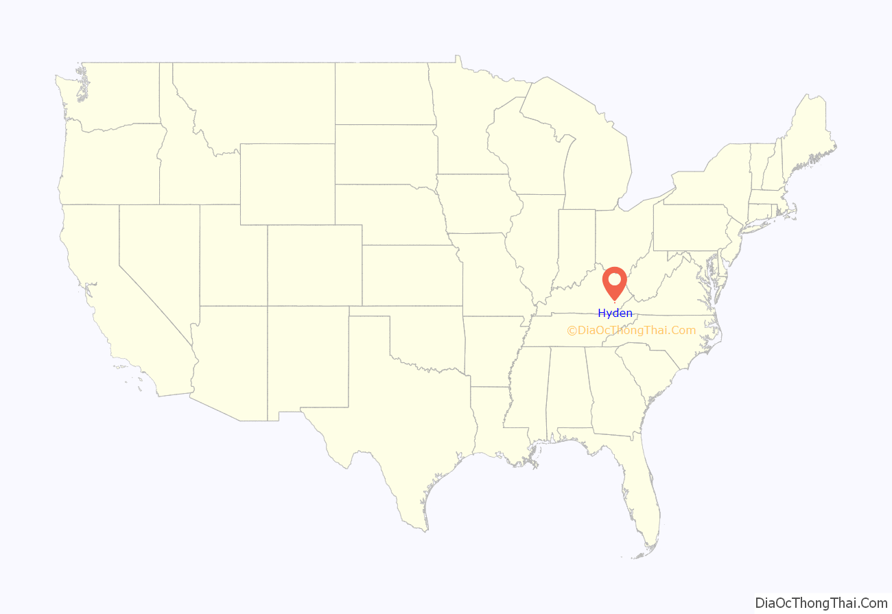
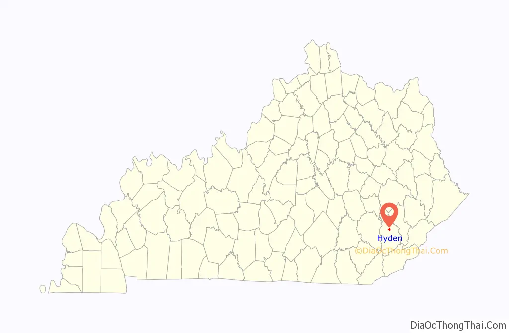
Hyden is a home rule-class city in and the county seat of Leslie County, Kentucky, United States. The population was 365 at the 2010 census. It is located at the junction of U.S. Route 421 and Kentucky Route 80, along the Middle Fork of the Kentucky River.
| Name: | Hyden city |
|---|---|
| LSAD Code: | 25 |
| LSAD Description: | city (suffix) |
| State: | Kentucky |
| County: | Leslie County |
| Incorporated: | March 18, 1882 |
| Elevation: | 922 ft (281 m) |
| Total Area: | 1.34 sq mi (3.46 km²) |
| Land Area: | 1.30 sq mi (3.36 km²) |
| Water Area: | 0.04 sq mi (0.10 km²) |
| Total Population: | 303 |
| Population Density: | 233.80/sq mi (90.27/km²) |
| ZIP code: | 41749, 41762 |
| Area code: | 606 |
| FIPS code: | 2138908 |
| GNISfeature ID: | 0512880 |
| Website: | www.cityofhyden.com |
Online Interactive Map
Click on ![]() to view map in "full screen" mode.
to view map in "full screen" mode.
Hyden location map. Where is Hyden city?
History
The area was first settled around 1800 by the Sizemores, a mixed-blood (Anglo and Native-American) family migrating from North Carolina, with a brief stay in Hawkins County, Tennessee, before making it to Kentucky. John “Rock House” Sizemore and his wife, Nancy (Bowling) Sizemore, lived in a rock house about a hundred yards up from the mouth of the creek which would later bear his name (Rockhouse Creek). John Rock House later sold the land to a Lewis man who then donated the land to the government, which became the town of Hyden. The town was established in 1878 and incorporated in 1882, and was named after John Hyden, a state senator of the time who helped form Leslie County. The mountainous terrain made the region difficult to access except by river, which was no longer the dominant form of transportation by the late 19th century, hindering growth.
Frontier Nursing University opened in Hyden in 1939.
Hyden briefly came to national attention when the Hurricane Creek mine disaster occurred in late 1970, 5 miles (8 km) southeast of the city.
In July 1978, Richard Nixon came to Hyden to make his first public speech since resigning from the presidency during the Watergate crisis. Hyden was picked because Congressman Tim Lee Carter invited him to attend the dedication of a recreation facility and Nixon wanted a town that had heavily supported his presidential runs. Leslie County Judge-Executive C. Allen Muncy claimed the Nixon invitation prompted the U.S. Department of Justice to obtain indictments of him and his associates on vote-fraud charges; while on appeal for his conviction, he won renomination in the Republican primary but lost the 1981 general election to independent Kermit Keen.
Hyden Road Map
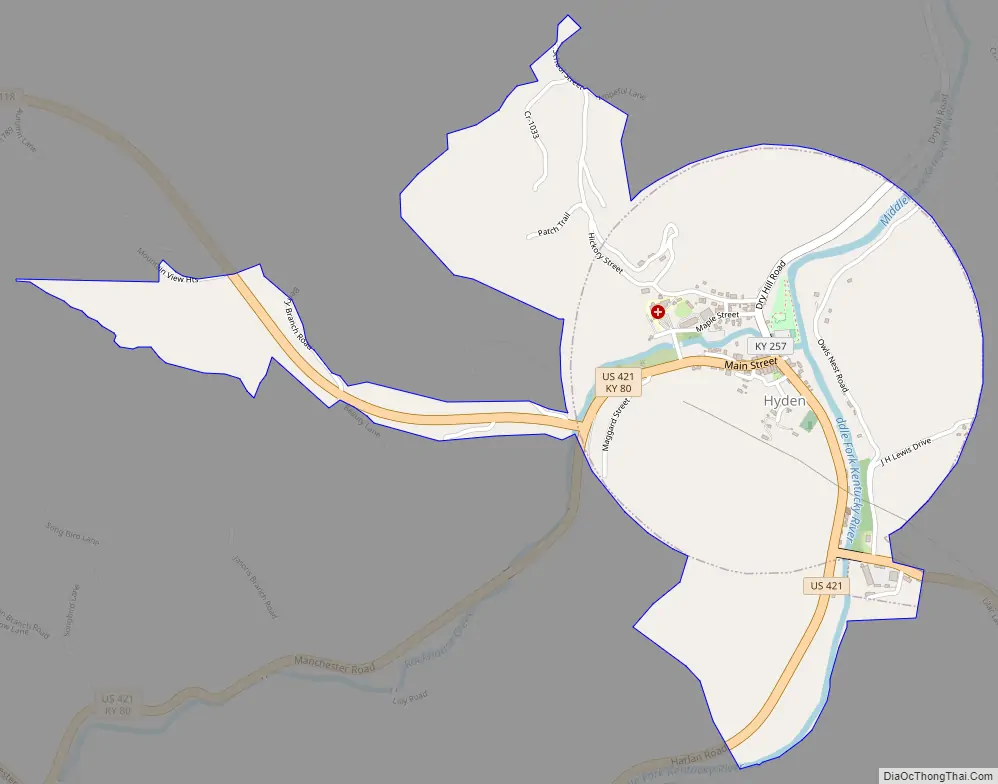
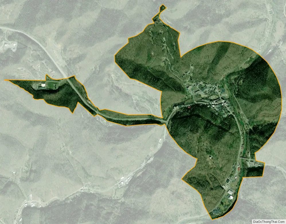
Hyden city Satellite Map
Geography
Hyden is located in north-central Leslie County at 37°9′48″N 83°22′30″W / 37.16333°N 83.37500°W / 37.16333; -83.37500 (37.163456, -83.375065), in the valley of the Middle Fork of the Kentucky River. Most of the city is on the west side of the river, at the confluence of Rockhouse Creek from the west.
U.S. Route 421 and Kentucky Route 80 pass through Hyden as its Main Street, leading west 31 miles (50 km) to Manchester. In the other direction, US 421 leads south up the Middle Fork valley and over Pine Mountain 34 miles (55 km) to Harlan, while KY 80 leads northeast 17 miles (27 km) to Combs, near Hazard. Kentucky Route 118 (Tim Couch Pass) is a three-lane highway leading northwest from Hyden 4 miles (6 km) to the Hal Rogers Parkway at Thousandsticks. Kentucky Route 257 (Dryhill Road) is a local road that leads north from Hyden down the valley of the Middle Fork 11 miles (18 km) to Confluence.
According to the United States Census Bureau, Hyden has a total area of 1.4 square miles (3.5 km), of which 0.04 square miles (0.1 km), or 2.99%, are water.
Climate
The climate in this area is characterized by hot, humid summers and generally mild to cool winters. According to the Köppen Climate Classification system, Hyden has a humid subtropical climate, abbreviated “Cfa” on climate maps.
See also
Map of Kentucky State and its subdivision:- Adair
- Allen
- Anderson
- Ballard
- Barren
- Bath
- Bell
- Boone
- Bourbon
- Boyd
- Boyle
- Bracken
- Breathitt
- Breckinridge
- Bullitt
- Butler
- Caldwell
- Calloway
- Campbell
- Carlisle
- Carroll
- Carter
- Casey
- Christian
- Clark
- Clay
- Clinton
- Crittenden
- Cumberland
- Daviess
- Edmonson
- Elliott
- Estill
- Fayette
- Fleming
- Floyd
- Franklin
- Fulton
- Gallatin
- Garrard
- Grant
- Graves
- Grayson
- Green
- Greenup
- Hancock
- Hardin
- Harlan
- Harrison
- Hart
- Henderson
- Henry
- Hickman
- Hopkins
- Jackson
- Jefferson
- Jessamine
- Johnson
- Kenton
- Knott
- Knox
- Larue
- Laurel
- Lawrence
- Lee
- Leslie
- Letcher
- Lewis
- Lincoln
- Livingston
- Logan
- Lyon
- Madison
- Magoffin
- Marion
- Marshall
- Martin
- Mason
- McCracken
- McCreary
- McLean
- Meade
- Menifee
- Mercer
- Metcalfe
- Monroe
- Montgomery
- Morgan
- Muhlenberg
- Nelson
- Nicholas
- Ohio
- Oldham
- Owen
- Owsley
- Pendleton
- Perry
- Pike
- Powell
- Pulaski
- Robertson
- Rockcastle
- Rowan
- Russell
- Scott
- Shelby
- Simpson
- Spencer
- Taylor
- Todd
- Trigg
- Trimble
- Union
- Warren
- Washington
- Wayne
- Webster
- Whitley
- Wolfe
- Woodford
- Alabama
- Alaska
- Arizona
- Arkansas
- California
- Colorado
- Connecticut
- Delaware
- District of Columbia
- Florida
- Georgia
- Hawaii
- Idaho
- Illinois
- Indiana
- Iowa
- Kansas
- Kentucky
- Louisiana
- Maine
- Maryland
- Massachusetts
- Michigan
- Minnesota
- Mississippi
- Missouri
- Montana
- Nebraska
- Nevada
- New Hampshire
- New Jersey
- New Mexico
- New York
- North Carolina
- North Dakota
- Ohio
- Oklahoma
- Oregon
- Pennsylvania
- Rhode Island
- South Carolina
- South Dakota
- Tennessee
- Texas
- Utah
- Vermont
- Virginia
- Washington
- West Virginia
- Wisconsin
- Wyoming