Midway is a home rule-class city in Woodford County, Kentucky, in the United States. Its population was 1,641 at the time of the year 2010 U.S. census. It is part of the Lexington-Fayette Metropolitan Statistical Area.
The town sits just off Interstate 64 and among several major thoroughbred breeding operations, such as Three Chimneys Farm and former Gov. Brereton Jones’ Airdrie Stud. In 2003, faced with a declining downtown, the city began major streetscape renovation project as part of Main Street Kentucky. New period structures and lighting brought new life to the town. It is known for its distinctive shops and restaurants. An active business association holds events every month of the year, and the city is a starting point or waypoint for several road races that wind through the surrounding countryside.
| Name: | Midway city |
|---|---|
| LSAD Code: | 25 |
| LSAD Description: | city (suffix) |
| State: | Kentucky |
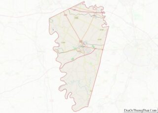
| County: | Woodford County |
| Incorporated: | February 7, 1846 |
| Elevation: | 827 ft (252 m) |
| Total Area: | 1.37 sq mi (3.55 km²) |
| Land Area: | 1.37 sq mi (3.54 km²) |
| Water Area: | 0.00 sq mi (0.00 km²) |
| Total Population: | 1,718 |
| Population Density: | 1,255.85/sq mi (484.79/km²) |
| ZIP code: | 40347 |
| Area code: | 859 |
| FIPS code: | 2152140 |
| GNISfeature ID: | 0498164 |
| Website: | www.meetmeinmidway.com |
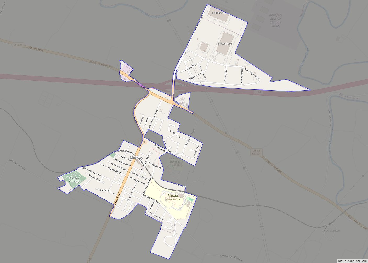
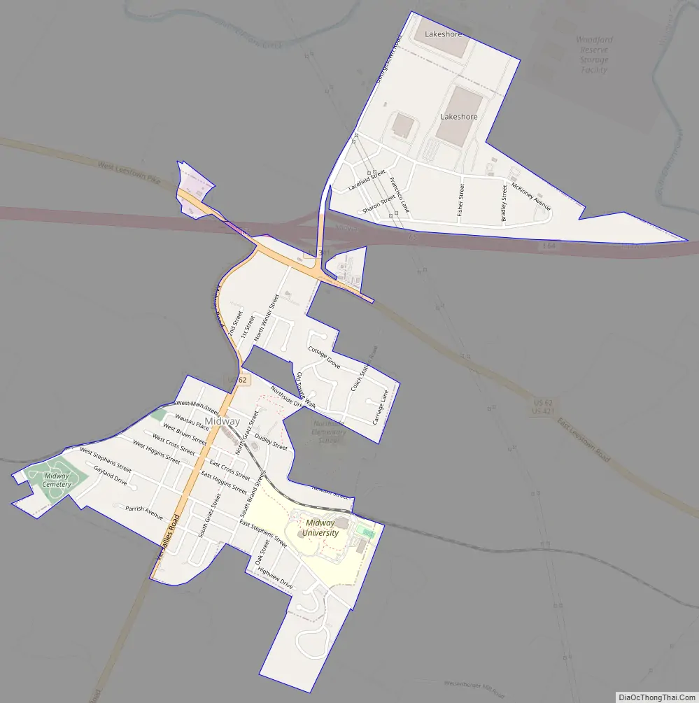
Online Interactive Map
Click on ![]() to view map in "full screen" mode.
to view map in "full screen" mode.
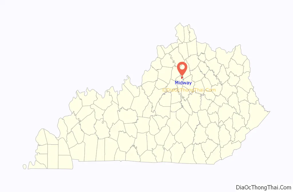
Midway location map. Where is Midway city?

History
Before its European exploration, the area around Midway was inhabited by the Mound Builders. Two large and several smaller American Indian mounds have been identified on nearby farms.
The present city began as a small settlement known as Stevenson’s at the time of its first post office in 1832. On January 31, 1835, the local farmer John Francisco sold his 216.375-acre (87.564 ha) farm to the Lexington and Ohio Railroad for $6,491.25. The railroad then used the land to establish Kentucky’s first railroad town, naming it Middleway for its location relative to Lexington and Frankfort, Kentucky. (The town is also equidistant between Versailles and Georgetown.) The major streets of Midway were named in honor of the railroad’s original officials. It was renamed Midway in 1837.
Midway Historic District comprises much of downtown Midway, and is listed on the National Register of Historic Places.
Distilling Bourbon in Midway
Midway has a very rich history of distilling Bourbon for nearly a 100 year period from 1865 to 1959. The Distillery was located at the corner of Gratz Street and Dudley Street, nestled in the bend of the Lee’s Branch of the North Elkhorn Creek. There were several owners over the years, with the Distillery operating under various business names. Buford, Guthrie & Co. 1865–67, A. Buford Distillery 1867–68, Keller Distillery 1868–77, 1878–89, S.J. Greenbaum Distillery 1890–1911, Belle of Anderson Distillery 1912–14, Midway Distilling Co. 1915–24, Destroyed by fire in 1924 and closed from then till 1933, rebuilt and operated as the Woodford County Distilling Company 1933–40, Park & Tilford Distillery 1941–53, Schenley Products Distillery 1954–59. Early in the 1960s, Schenley Products donated the property, building and equipment to the Midway Woman’s College. Notable national brand names produced include, Belle of Bourbon, Belle of Lexington, Belle of Anderson, Glenarme, Arlington, Jessamine, and Woodford. Two buildings still remain, currently known as Kentucky Cannabis Company, previously a distilling building and The Midway Loft Apartments, previously an aging warehouse. A large Distillery warehouse fire occurred on August 4th, 1908, where over 47,000 barrels of bourbon where destroyed. The Lee’s Branch was on fire for over one mile, and several Midway residents were scorched dipping tin cups into the Lee’s Branch for Bourbon and Water. Martin Street next to the Lee’s Branch was nicknamed “Tin Cup Alley”. The Midway Fire Department was recognized for saving the City and the Female Orphan’s School.
In 1920, during a robbery of the distillery, Benjamin Rodgers and Homer Nave were killed. Richard W. James, was arrested for the killings. He admitted to the robbery but denied shooting the men, and claimed that the facility’s superintendent of bottling, Samuel Seay, had a deal with James and others to share the proceeds of the stolen liquor. James was convicted of murder, but one member of the jury refused to vote for his execution on religious grounds. On March 13, 1921, a mob took James from the county jail in Versailles, Kentucky and lynched him from a tree near Margaret College, about a half-mile from Versailles. No one from the mob was indicted and, when Gov. Edwin P. Morrow removed the sheriff from his post, local voters elected his wife to replace him.
Midway Road Map
Midway city Satellite Map

Geography
Midway is located in the northern section of Woodford County in the Bluegrass region of Kentucky, an area with farms that produce tobacco, corn, soybeans, cattle, and horses. It is located at the coordinates 38°9′2″N 84°40′59″W / 38.15056°N 84.68306°W / 38.15056; -84.68306 (38.150484, -84.683014). According to the United States Census Bureau, the city has a total area of 1.1 square miles (2.8 km), all land.
See also
Map of Kentucky State and its subdivision:- Adair
- Allen
- Anderson
- Ballard
- Barren
- Bath
- Bell
- Boone
- Bourbon
- Boyd
- Boyle
- Bracken
- Breathitt
- Breckinridge
- Bullitt
- Butler
- Caldwell
- Calloway
- Campbell
- Carlisle
- Carroll
- Carter
- Casey
- Christian
- Clark
- Clay
- Clinton
- Crittenden
- Cumberland
- Daviess
- Edmonson
- Elliott
- Estill
- Fayette
- Fleming
- Floyd
- Franklin
- Fulton
- Gallatin
- Garrard
- Grant
- Graves
- Grayson
- Green
- Greenup
- Hancock
- Hardin
- Harlan
- Harrison
- Hart
- Henderson
- Henry
- Hickman
- Hopkins
- Jackson
- Jefferson
- Jessamine
- Johnson
- Kenton
- Knott
- Knox
- Larue
- Laurel
- Lawrence
- Lee
- Leslie
- Letcher
- Lewis
- Lincoln
- Livingston
- Logan
- Lyon
- Madison
- Magoffin
- Marion
- Marshall
- Martin
- Mason
- McCracken
- McCreary
- McLean
- Meade
- Menifee
- Mercer
- Metcalfe
- Monroe
- Montgomery
- Morgan
- Muhlenberg
- Nelson
- Nicholas
- Ohio
- Oldham
- Owen
- Owsley
- Pendleton
- Perry
- Pike
- Powell
- Pulaski
- Robertson
- Rockcastle
- Rowan
- Russell
- Scott
- Shelby
- Simpson
- Spencer
- Taylor
- Todd
- Trigg
- Trimble
- Union
- Warren
- Washington
- Wayne
- Webster
- Whitley
- Wolfe
- Woodford
- Alabama
- Alaska
- Arizona
- Arkansas
- California
- Colorado
- Connecticut
- Delaware
- District of Columbia
- Florida
- Georgia
- Hawaii
- Idaho
- Illinois
- Indiana
- Iowa
- Kansas
- Kentucky
- Louisiana
- Maine
- Maryland
- Massachusetts
- Michigan
- Minnesota
- Mississippi
- Missouri
- Montana
- Nebraska
- Nevada
- New Hampshire
- New Jersey
- New Mexico
- New York
- North Carolina
- North Dakota
- Ohio
- Oklahoma
- Oregon
- Pennsylvania
- Rhode Island
- South Carolina
- South Dakota
- Tennessee
- Texas
- Utah
- Vermont
- Virginia
- Washington
- West Virginia
- Wisconsin
- Wyoming