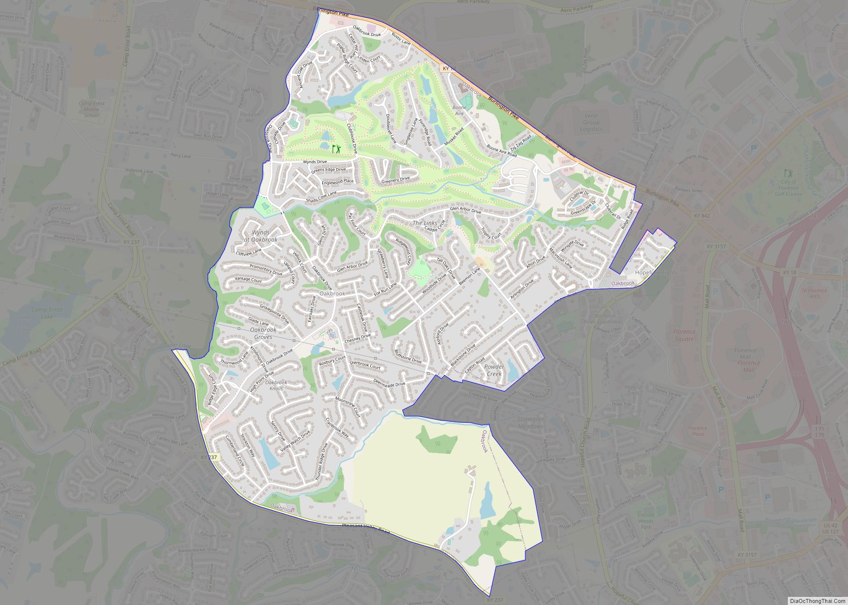
Oakbrook is a census-designated place (CDP) in Boone County, Kentucky, United States. The population was 9,036 at the 2010 census.
| Name: | Oakbrook CDP |
|---|---|
| LSAD Code: | 57 |
| LSAD Description: | CDP (suffix) |
| State: | Kentucky |
| County: | Boone County |
| Elevation: | 869 ft (265 m) |
| Total Area: | 3.20 sq mi (8.29 km²) |
| Land Area: | 3.20 sq mi (8.28 km²) |
| Water Area: | 0.00 sq mi (0.01 km²) |
| Total Population: | 9,268 |
| Population Density: | 2,898.06/sq mi (1,118.87/km²) |
| FIPS code: | 2157030 |
| GNISfeature ID: | 1867278 |
Online Interactive Map
Click on ![]() to view map in "full screen" mode.
to view map in "full screen" mode.
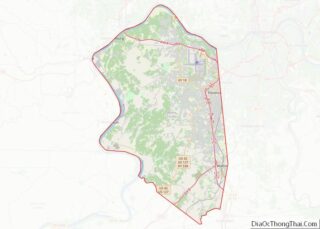
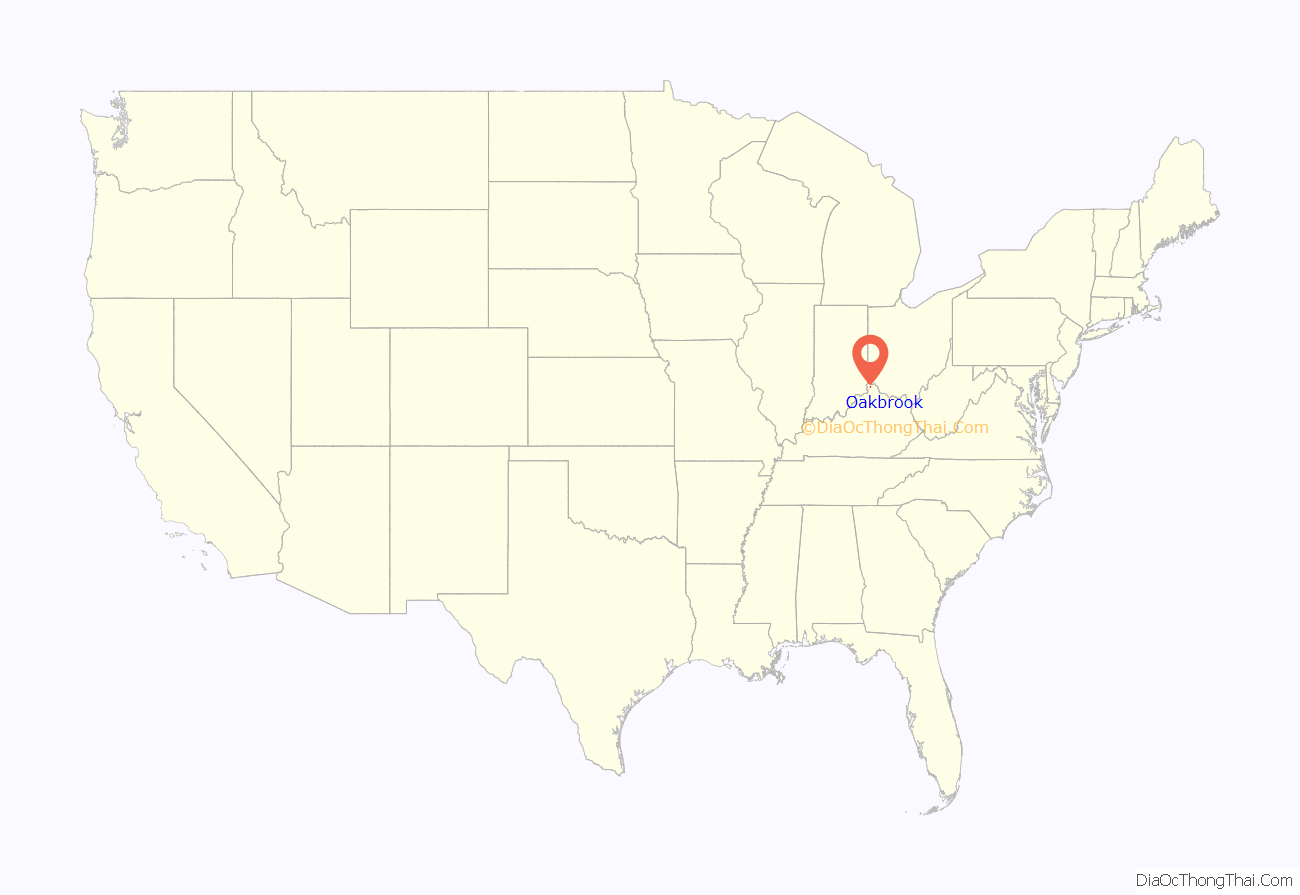
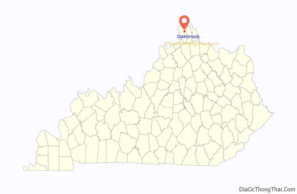
Oakbrook location map. Where is Oakbrook CDP?
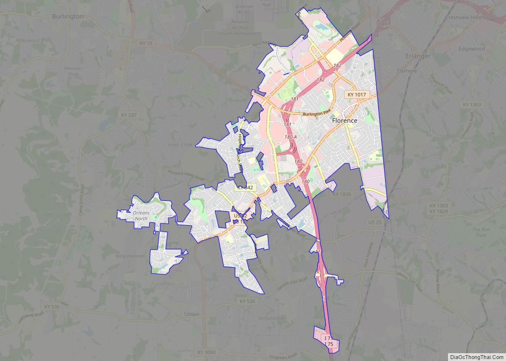
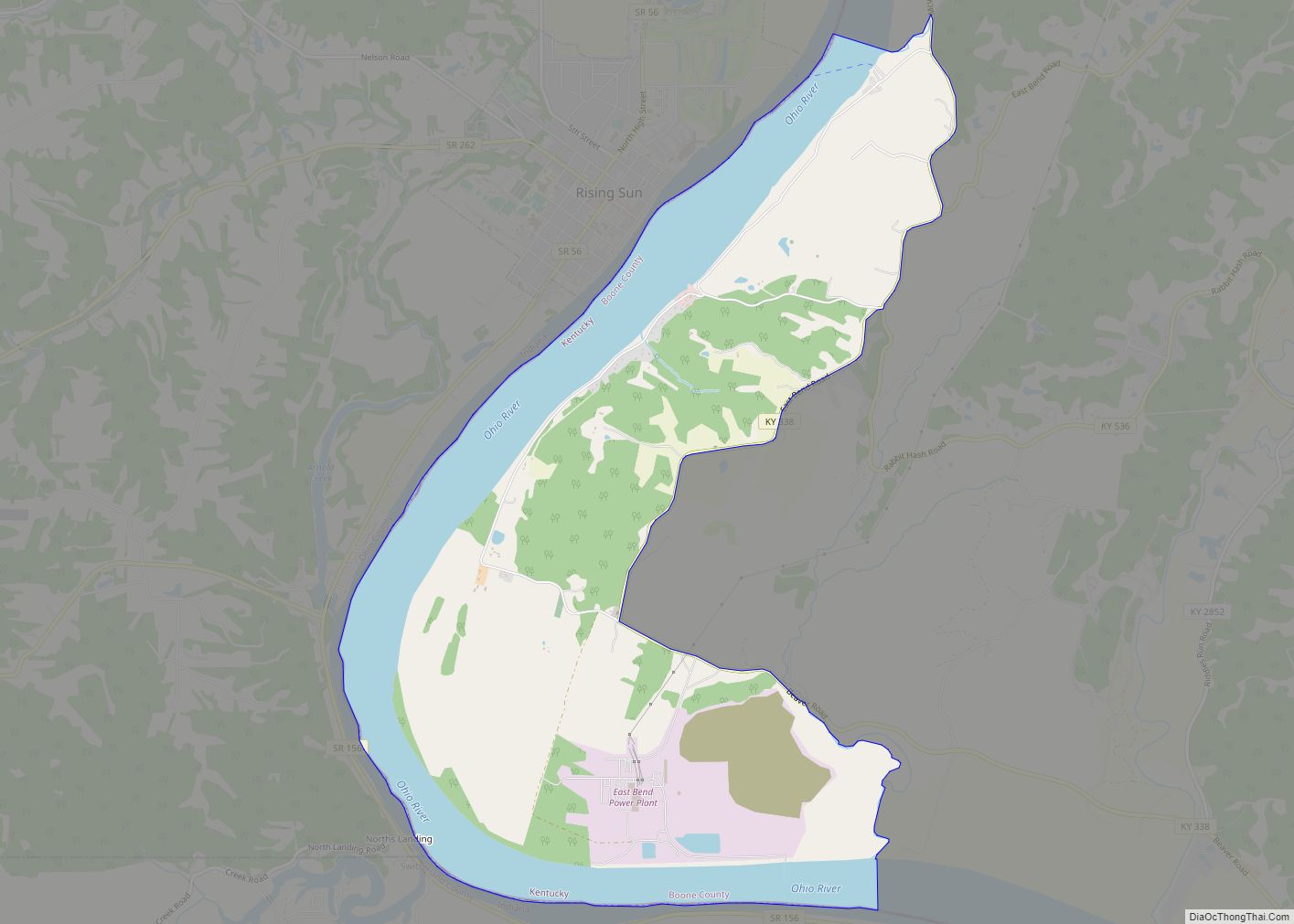
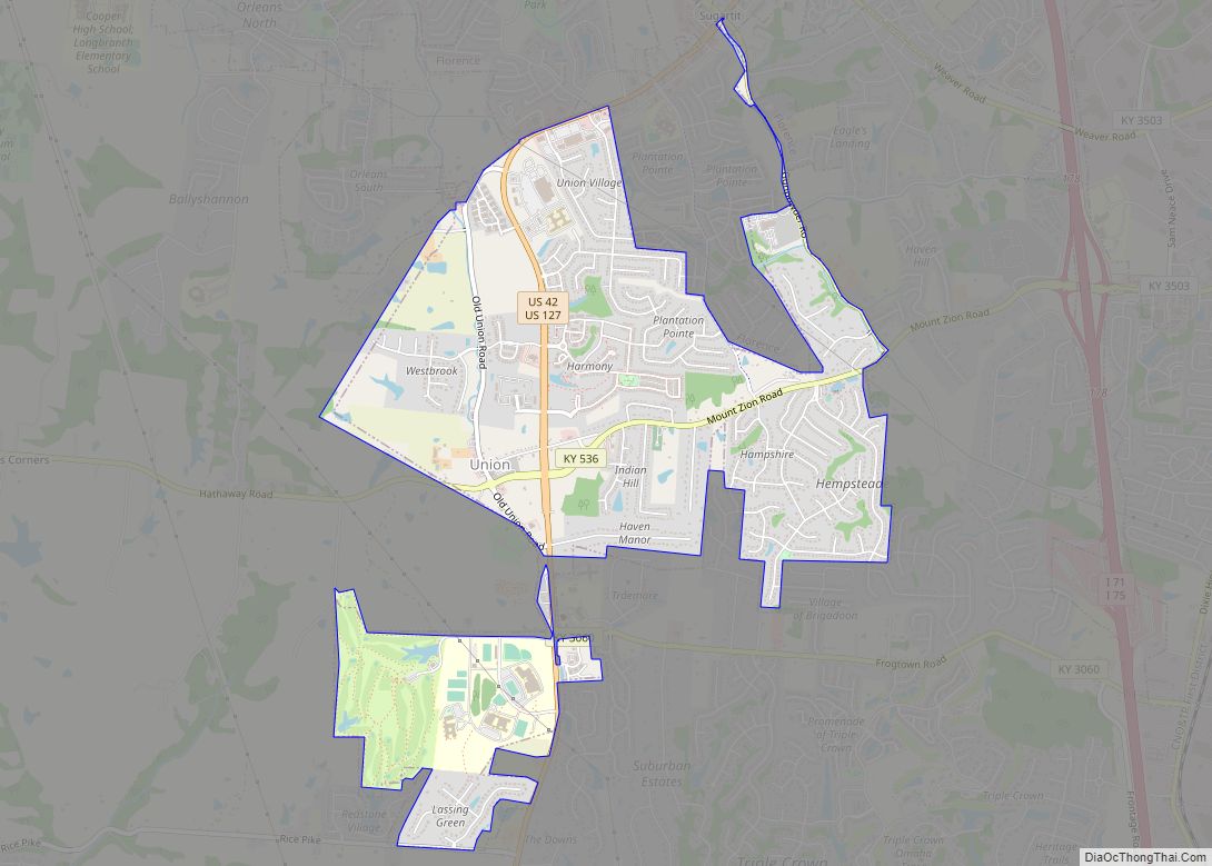
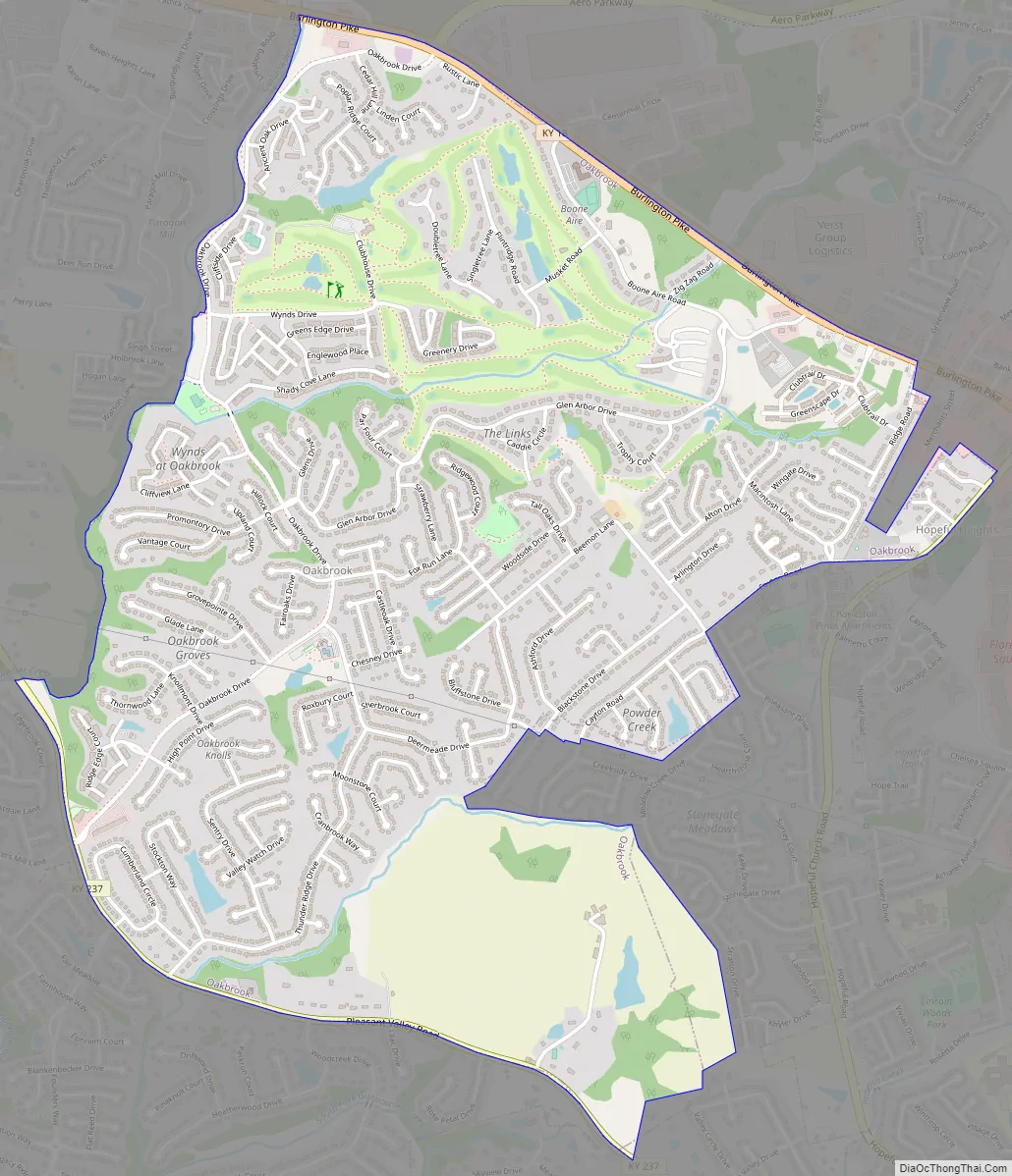
Oakbrook Road Map
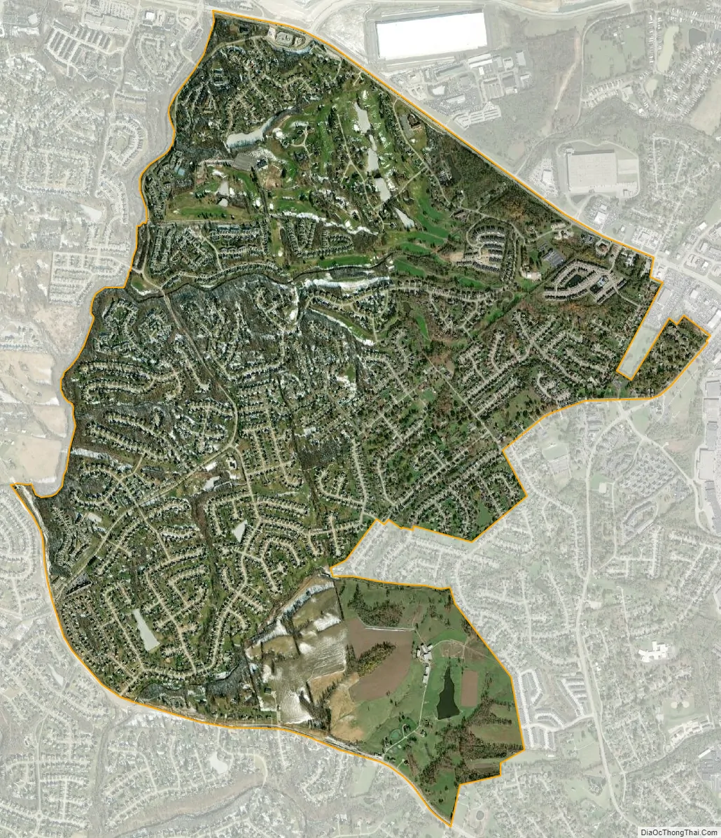
Oakbrook city Satellite Map
Geography
Oakbrook is located in eastern Boone County at 39°0′4″N 84°40′59″W / 39.00111°N 84.68306°W / 39.00111; -84.68306 (39.001030, -84.683100). It is bordered by the city of Florence to the east and south, and by the unincorporated Burlington (the county seat) to the west. Kentucky Route 18 (Burlington Pike) forms the northern edge of the Oakbrook CDP. Interstate 75/71 is 0.5 miles (0.80 km) east of Oakbrook, and downtown Cincinnati is 12 miles (19 km) to the northeast.
According to the United States Census Bureau, the CDP has a total area of 3.2 square miles (8.2 km), of which 0.004 square miles (0.01 km), or 0.14%, is water.
See also
Map of Kentucky State and its subdivision:- Adair
- Allen
- Anderson
- Ballard
- Barren
- Bath
- Bell
- Boone
- Bourbon
- Boyd
- Boyle
- Bracken
- Breathitt
- Breckinridge
- Bullitt
- Butler
- Caldwell
- Calloway
- Campbell
- Carlisle
- Carroll
- Carter
- Casey
- Christian
- Clark
- Clay
- Clinton
- Crittenden
- Cumberland
- Daviess
- Edmonson
- Elliott
- Estill
- Fayette
- Fleming
- Floyd
- Franklin
- Fulton
- Gallatin
- Garrard
- Grant
- Graves
- Grayson
- Green
- Greenup
- Hancock
- Hardin
- Harlan
- Harrison
- Hart
- Henderson
- Henry
- Hickman
- Hopkins
- Jackson
- Jefferson
- Jessamine
- Johnson
- Kenton
- Knott
- Knox
- Larue
- Laurel
- Lawrence
- Lee
- Leslie
- Letcher
- Lewis
- Lincoln
- Livingston
- Logan
- Lyon
- Madison
- Magoffin
- Marion
- Marshall
- Martin
- Mason
- McCracken
- McCreary
- McLean
- Meade
- Menifee
- Mercer
- Metcalfe
- Monroe
- Montgomery
- Morgan
- Muhlenberg
- Nelson
- Nicholas
- Ohio
- Oldham
- Owen
- Owsley
- Pendleton
- Perry
- Pike
- Powell
- Pulaski
- Robertson
- Rockcastle
- Rowan
- Russell
- Scott
- Shelby
- Simpson
- Spencer
- Taylor
- Todd
- Trigg
- Trimble
- Union
- Warren
- Washington
- Wayne
- Webster
- Whitley
- Wolfe
- Woodford
- Alabama
- Alaska
- Arizona
- Arkansas
- California
- Colorado
- Connecticut
- Delaware
- District of Columbia
- Florida
- Georgia
- Hawaii
- Idaho
- Illinois
- Indiana
- Iowa
- Kansas
- Kentucky
- Louisiana
- Maine
- Maryland
- Massachusetts
- Michigan
- Minnesota
- Mississippi
- Missouri
- Montana
- Nebraska
- Nevada
- New Hampshire
- New Jersey
- New Mexico
- New York
- North Carolina
- North Dakota
- Ohio
- Oklahoma
- Oregon
- Pennsylvania
- Rhode Island
- South Carolina
- South Dakota
- Tennessee
- Texas
- Utah
- Vermont
- Virginia
- Washington
- West Virginia
- Wisconsin
- Wyoming