Pleasureville is a home rule-class city in Henry and Shelby counties, Kentucky, United States. The population was 834 at the time of the 2010 U.S. Census.
| Name: | Pleasureville city |
|---|---|
| LSAD Code: | 25 |
| LSAD Description: | city (suffix) |
| State: | Kentucky |
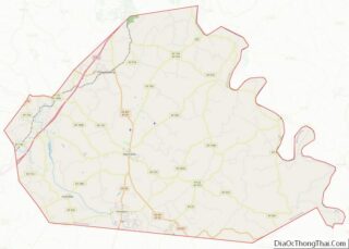
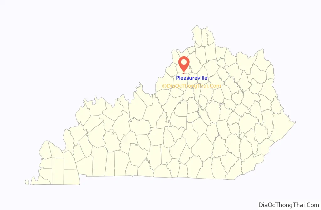
| County: | Henry County, Shelby County |
| Incorporated: | 1842 |
| Elevation: | 892 ft (272 m) |
| Total Area: | 0.49 sq mi (1.26 km²) |
| Land Area: | 0.48 sq mi (1.25 km²) |
| Water Area: | 0.00 sq mi (0.01 km²) |
| Total Population: | 779 |
| Population Density: | 1,609.50/sq mi (621.62/km²) |
| ZIP code: | 40057 |
| Area code: | 502 |
| FIPS code: | 2161788 |
| GNISfeature ID: | 0500958 |
| Website: | pleasurevilleky.com |
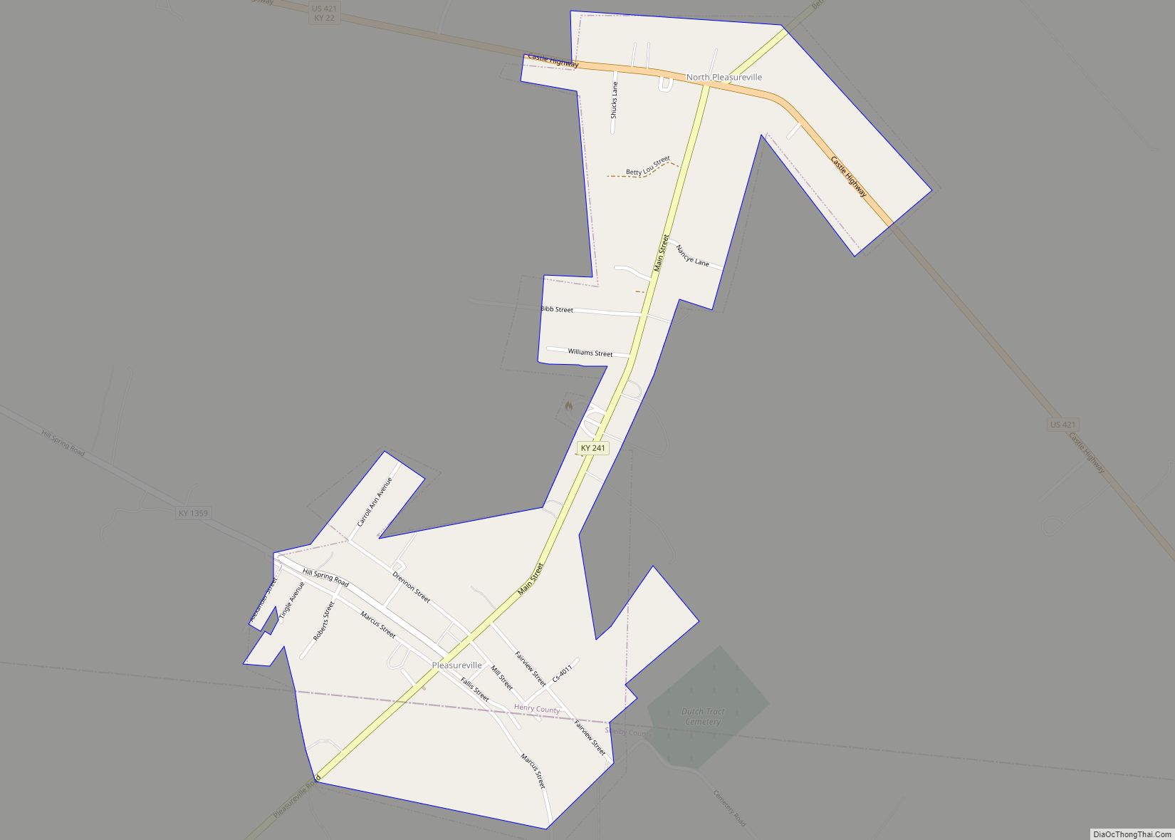
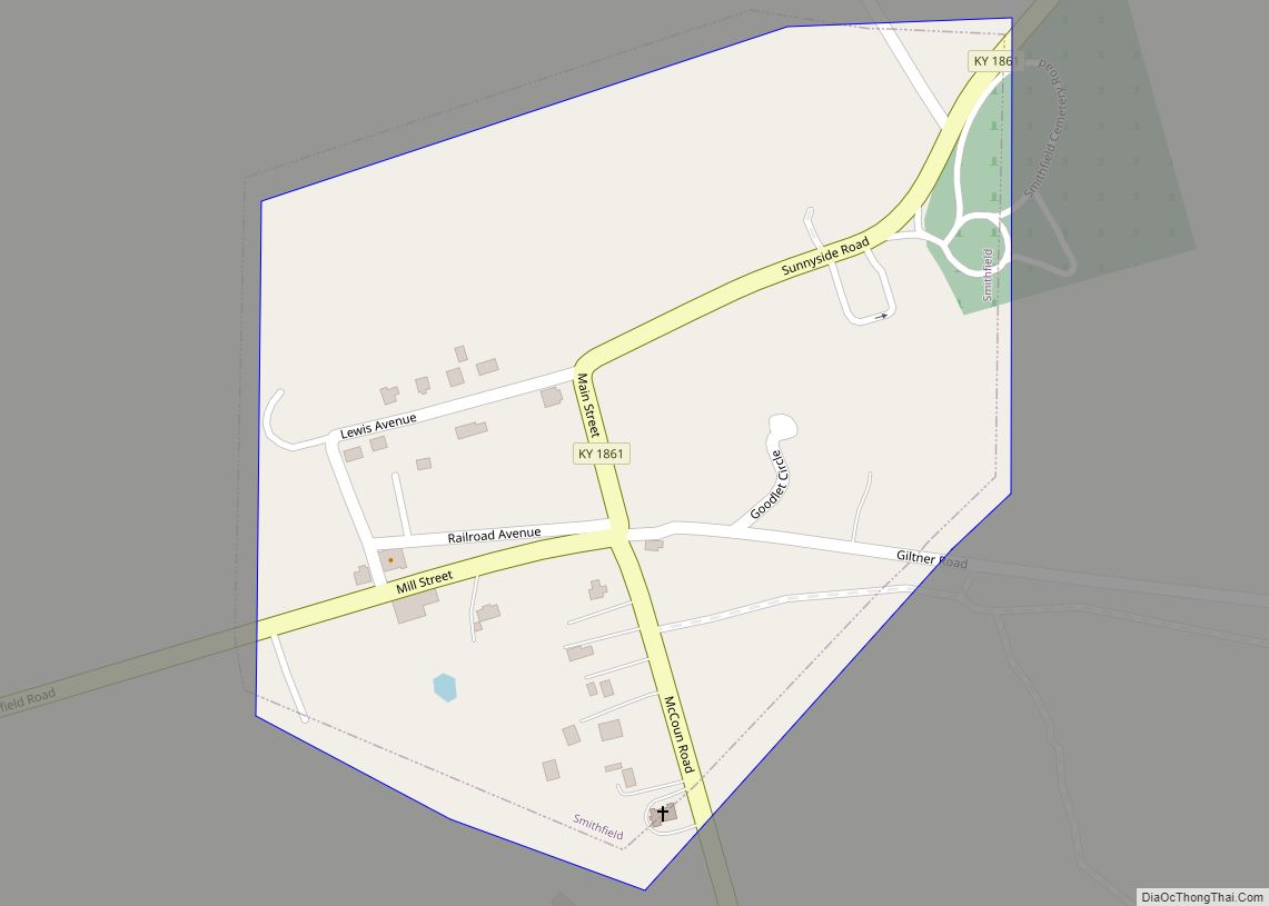
Online Interactive Map
Click on ![]() to view map in "full screen" mode.
to view map in "full screen" mode.
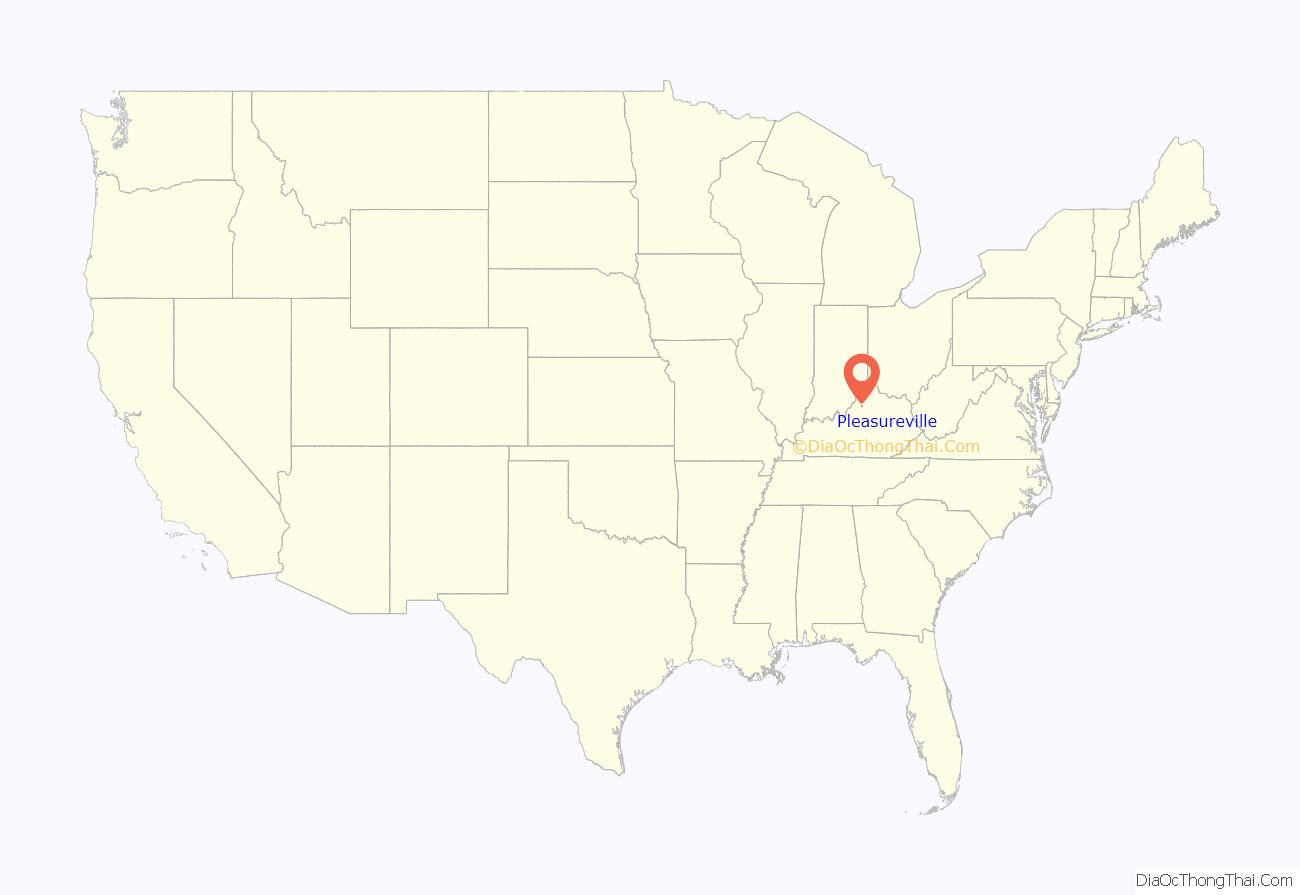
Pleasureville location map. Where is Pleasureville city?
History
In 1784, 30-odd Dutch Huguenot families colonizing present-day Mercer County purchased 10,000 acres (4,000 ha) from Squire Boone. They erected a fort for their protection about 1.5 miles (2.4 km) east of present-day north Pleasureville. Their land was held and cultivated in common, but managed by Abraham Banta. It was variously known as “The Dutch Tract”, the “Low Dutch Settlement” or “Station”, and “Bantatown”, but the post office was established as “Pleasureville” c. 1828, and the city was incorporated under that name in 1842.
Rennick relates the local story that it derived from a visitor expressing what a pleasure it was to stay among such pleasant people. This story was also detailed in an autobiography of Isaac Newton LeCompte in 1919, where he noted, “My Great Uncle, Major Joe LeCompte, who was a politician as well as a soldier, upon his rounds as a candidate for Congress (he was elected four terms) frequently passed through this village and upon one occasion he remarked that every time he passed through he heard the men whistling and the woman singing and suggested that the town should be named Pleasureville, and so it was.” Others say the area of the post office housed a bordello (at the site of the later Pleasureville Hotel and a present-day apartment building).
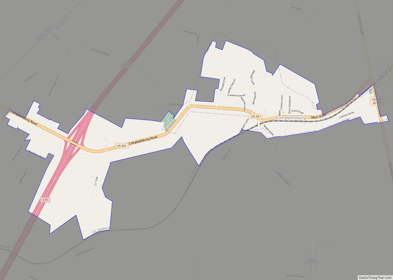
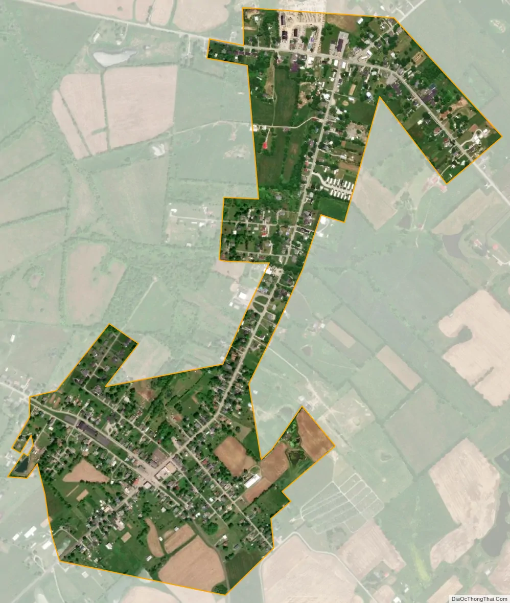
In 1858, the Louisville and Nashville Railroad arrived, but its course ran about a mile south of the former community. The post office relocated to the new settlement around the depot in 1874, which received the name “Pleasureville”, and the former city became known as “North Pleasureville”. It received a separate post office under that name in 1879. The town and city merged in 1962, although the two halves are still sometimes called “North Town” and “South Town” by locals.
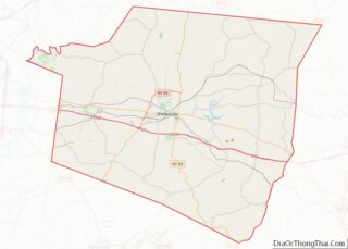
Pleasureville Road Map
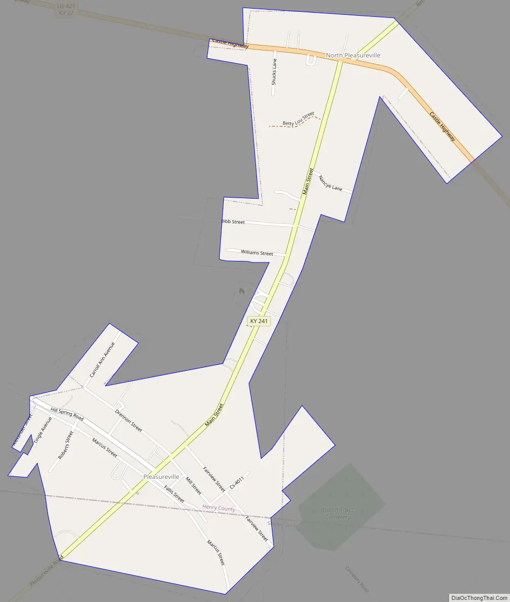
Pleasureville city Satellite Map
Geography
Pleasureville is located in southern Henry County at 38°20′57″N 85°6′51″W / 38.34917°N 85.11417°W / 38.34917; -85.11417 (38.349165, -85.114201) in the Bluegrass region of Kentucky. A small portion of the “South Town” part of the city extends south into Shelby County. According to the United States Census Bureau, the city has a total area of 0.46 square miles (1.2 km), all land.
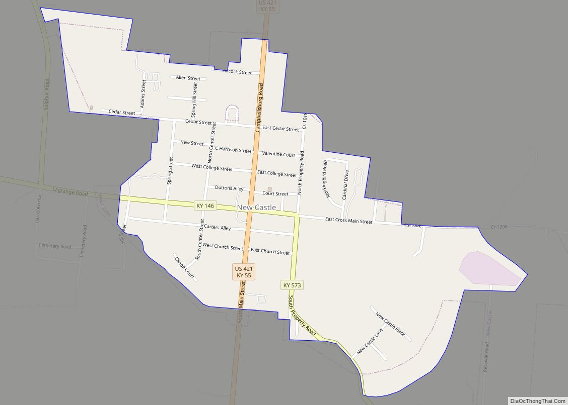
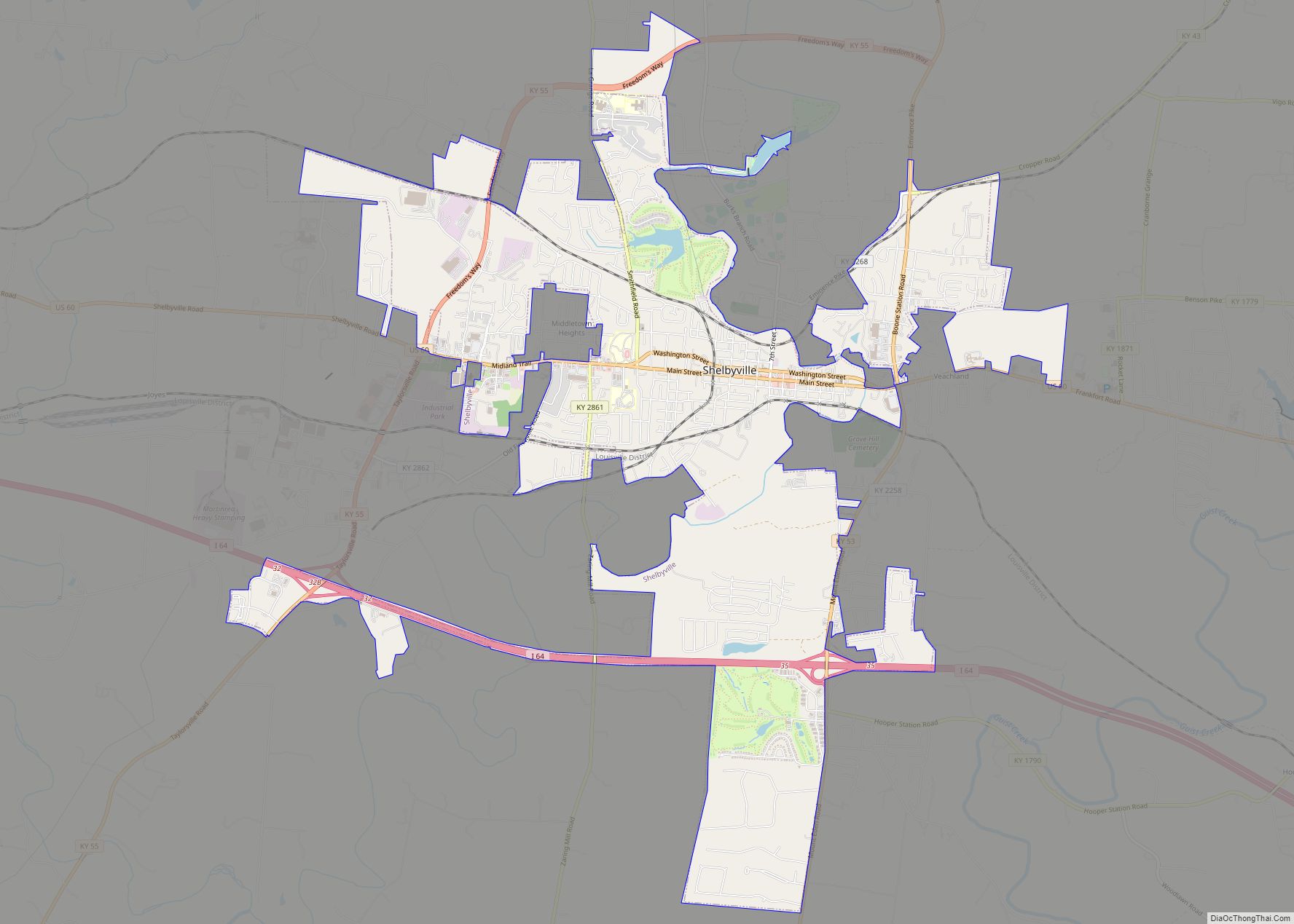
The community is located on Kentucky Route 241, which runs through both North and South Towns, and on U.S. Route 421, which runs through North Town. KY 241 leads south 13 miles (21 km) to Shelbyville (via Kentucky Route 43). US-421 leads northwest 6 miles (10 km) to New Castle, the Henry County seat, and southeast 23 miles (37 km) to Frankfort, the state capital.
See also
Map of Kentucky State and its subdivision:- Adair
- Allen
- Anderson
- Ballard
- Barren
- Bath
- Bell
- Boone
- Bourbon
- Boyd
- Boyle
- Bracken
- Breathitt
- Breckinridge
- Bullitt
- Butler
- Caldwell
- Calloway
- Campbell
- Carlisle
- Carroll
- Carter
- Casey
- Christian
- Clark
- Clay
- Clinton
- Crittenden
- Cumberland
- Daviess
- Edmonson
- Elliott
- Estill
- Fayette
- Fleming
- Floyd
- Franklin
- Fulton
- Gallatin
- Garrard
- Grant
- Graves
- Grayson
- Green
- Greenup
- Hancock
- Hardin
- Harlan
- Harrison
- Hart
- Henderson
- Henry
- Hickman
- Hopkins
- Jackson
- Jefferson
- Jessamine
- Johnson
- Kenton
- Knott
- Knox
- Larue
- Laurel
- Lawrence
- Lee
- Leslie
- Letcher
- Lewis
- Lincoln
- Livingston
- Logan
- Lyon
- Madison
- Magoffin
- Marion
- Marshall
- Martin
- Mason
- McCracken
- McCreary
- McLean
- Meade
- Menifee
- Mercer
- Metcalfe
- Monroe
- Montgomery
- Morgan
- Muhlenberg
- Nelson
- Nicholas
- Ohio
- Oldham
- Owen
- Owsley
- Pendleton
- Perry
- Pike
- Powell
- Pulaski
- Robertson
- Rockcastle
- Rowan
- Russell
- Scott
- Shelby
- Simpson
- Spencer
- Taylor
- Todd
- Trigg
- Trimble
- Union
- Warren
- Washington
- Wayne
- Webster
- Whitley
- Wolfe
- Woodford
- Alabama
- Alaska
- Arizona
- Arkansas
- California
- Colorado
- Connecticut
- Delaware
- District of Columbia
- Florida
- Georgia
- Hawaii
- Idaho
- Illinois
- Indiana
- Iowa
- Kansas
- Kentucky
- Louisiana
- Maine
- Maryland
- Massachusetts
- Michigan
- Minnesota
- Mississippi
- Missouri
- Montana
- Nebraska
- Nevada
- New Hampshire
- New Jersey
- New Mexico
- New York
- North Carolina
- North Dakota
- Ohio
- Oklahoma
- Oregon
- Pennsylvania
- Rhode Island
- South Carolina
- South Dakota
- Tennessee
- Texas
- Utah
- Vermont
- Virginia
- Washington
- West Virginia
- Wisconsin
- Wyoming