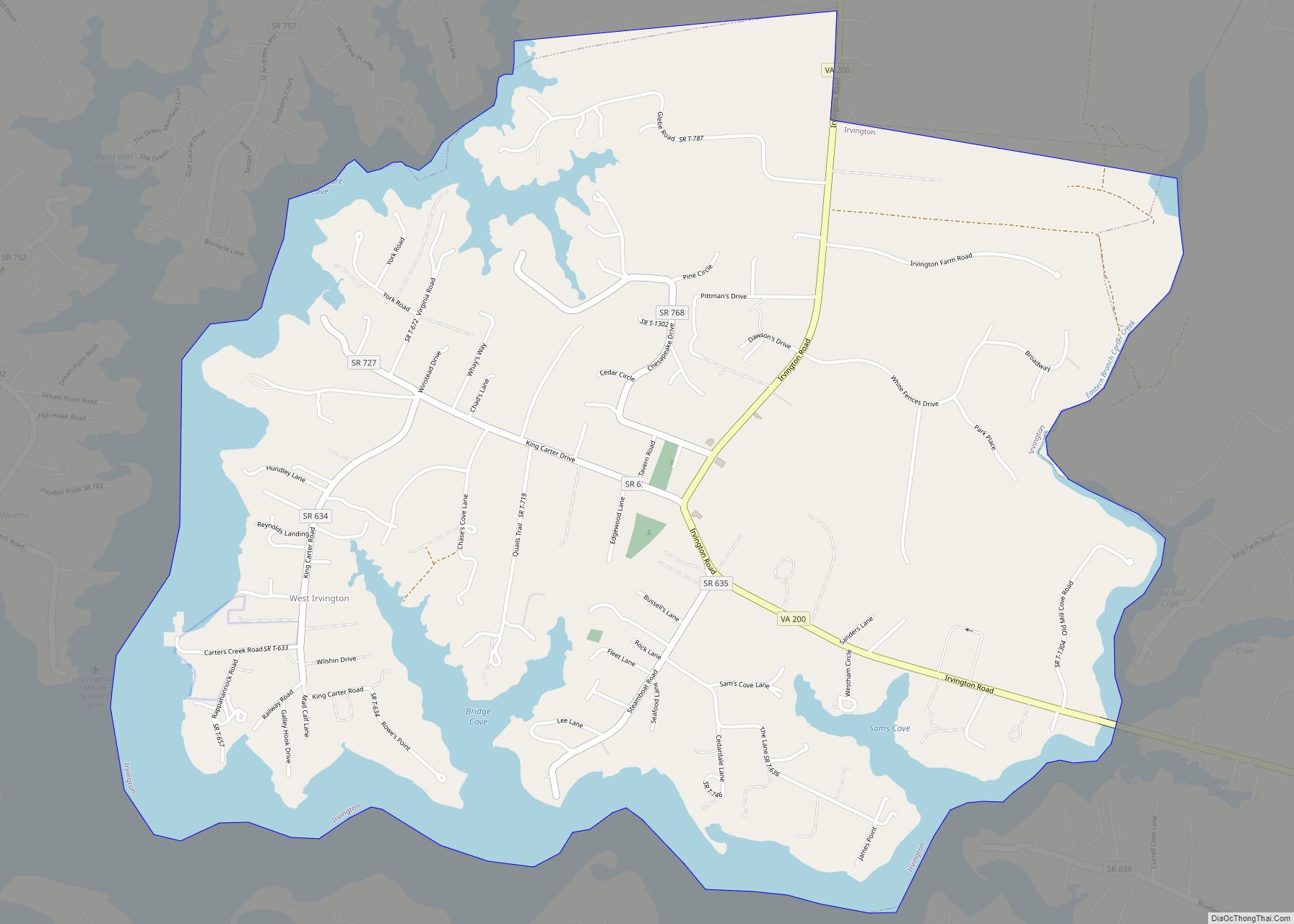
Irvington is a town on the Rappahannock River in Lancaster County, Virginia, United States. The population was 432 at the 2010 census. Located on a peninsula known as the Northern Neck, it has been designated a historic district.
| Name: | Irvington town |
|---|---|
| LSAD Code: | 43 |
| LSAD Description: | town (suffix) |
| State: | Virginia |
| County: | Lancaster County |
| Elevation: | 33 ft (10 m) |
| Total Area: | 1.83 sq mi (4.73 km²) |
| Land Area: | 1.50 sq mi (3.90 km²) |
| Water Area: | 0.32 sq mi (0.83 km²) |
| Total Population: | 432 |
| Population Density: | 264.45/sq mi (102.11/km²) |
| ZIP code: | 22480 |
| Area code: | 804 |
| FIPS code: | 5140088 |
| GNISfeature ID: | 1468521 |
| Website: | www.town.irvington.va.us |
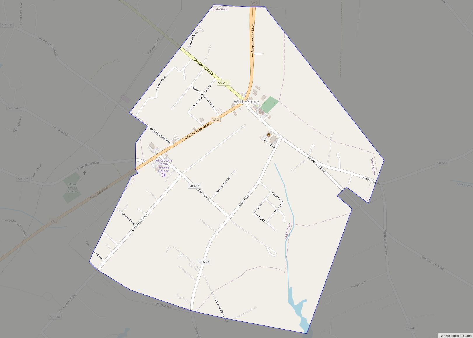
Online Interactive Map
Click on ![]() to view map in "full screen" mode.
to view map in "full screen" mode.
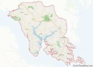
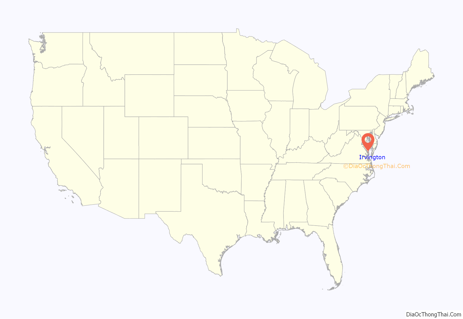
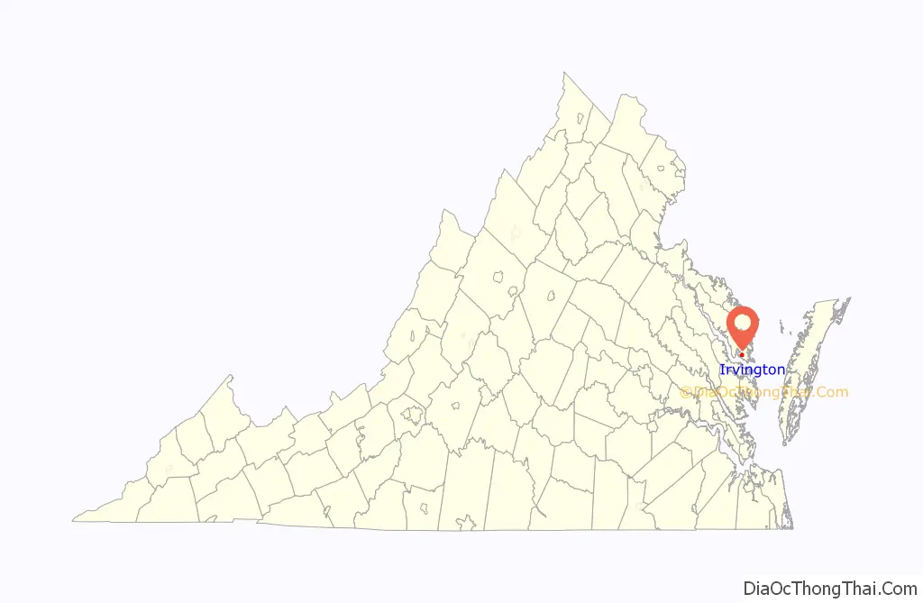
Irvington location map. Where is Irvington town?
History
From 1871 until 1893, the town was called “Carter’s Creek Wharf” or simply “Carter’s Creek”, since steamboats docked at the relatively deep water confluence of a tributary that had much earlier been called “Cossotomen Creek” and later “Carter’s Creek” after early settler John Carter, Sr., the father of the powerful colonial era politician King Carter, who was the Virginia agent for the Northern Neck Proprietary. The town formally adopted the name “Irvington” to honor Baltimore native Captain Levin Irvington following a 1891 referendum, since mail had been often confused between this town and that of Center Cross in relatively nearby Essex County.
The original Chesapeake Academy, 1889–1907, was located in Irvington.
Irvington Road Map
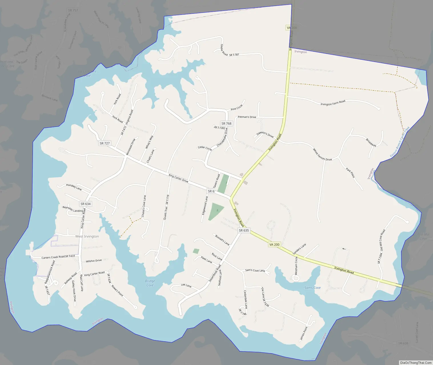
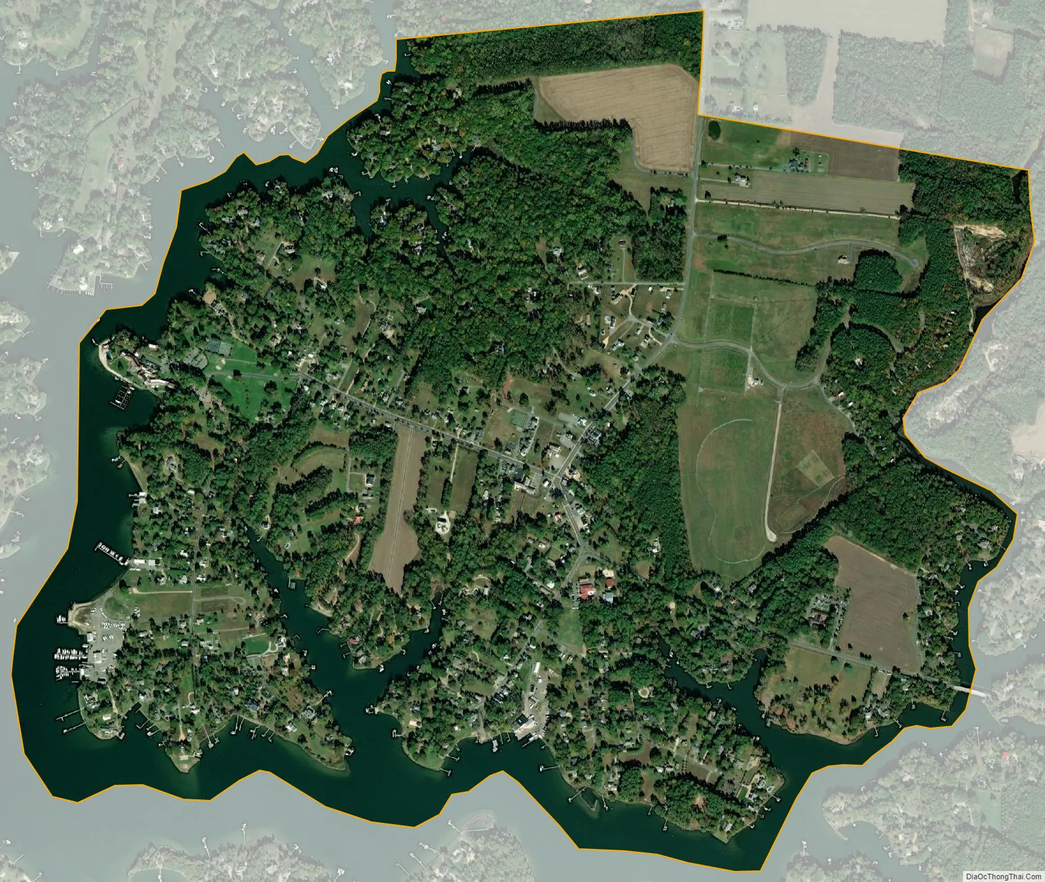
Irvington city Satellite Map
Geography
Irvington is located at 37°39′41″N 76°25′9″W / 37.66139°N 76.41917°W / 37.66139; -76.41917 (37.6615, −76.4191).
According to the United States Census Bureau, the town has a total area of 1.8 square miles (4.7 km), of which, 1.5 square miles (3.9 km) of it is land and 0.3 square miles (0.9 km) of it (18.13%) is water.
See also
Map of Virginia State and its subdivision:- Accomack
- Albemarle
- Alexandria
- Alleghany
- Amelia
- Amherst
- Appomattox
- Arlington
- Augusta
- Bath
- Bedford
- Bedford City
- Bland
- Botetourt
- Bristol
- Brunswick
- Buchanan
- Buckingham
- Buena Vista
- Campbell
- Caroline
- Carroll
- Charles City
- Charlotte
- Charlottesville
- Chesapeake
- Chesterfield
- Clarke
- Clifton Forge City
- Colonial Heights
- Covington
- Craig
- Culpeper
- Cumberland
- Danville
- Dickenson
- Dinwiddie
- Emporia
- Essex
- Fairfax
- Fairfax City
- Falls Church
- Fauquier
- Floyd
- Fluvanna
- Franklin
- Frederick
- Fredericksburg
- Galax
- Giles
- Gloucester
- Goochland
- Grayson
- Greene
- Greensville
- Halifax
- Hampton
- Hanover
- Harrisonburg
- Henrico
- Henry
- Highland
- Hopewell
- Isle of Wight
- James City
- King and Queen
- King George
- King William
- Lancaster
- Lee
- Lexington
- Loudoun
- Louisa
- Lunenburg
- Lynchburg
- Madison
- Manassas
- Manassas Park
- Martinsville
- Mathews
- Mecklenburg
- Middlesex
- Montgomery
- Nelson
- New Kent
- Newport News
- Norfolk
- Northampton
- Northumberland
- Norton
- Nottoway
- Orange
- Page
- Patrick
- Petersburg
- Pittsylvania
- Poquoson
- Portsmouth
- Powhatan
- Prince Edward
- Prince George
- Prince William
- Pulaski
- Radford
- Rappahannock
- Richmond
- Roanoke
- Roanoke City
- Rockbridge
- Rockingham
- Russell
- Salem
- Scott
- Shenandoah
- Smyth
- Southampton
- Spotsylvania
- Stafford
- Staunton
- Suffolk
- Surry
- Sussex
- Tazewell
- Virginia Beach
- Warren
- Washington
- Waynesboro
- Westmoreland
- Williamsburg
- Winchester
- Wise
- Wythe
- York
- Alabama
- Alaska
- Arizona
- Arkansas
- California
- Colorado
- Connecticut
- Delaware
- District of Columbia
- Florida
- Georgia
- Hawaii
- Idaho
- Illinois
- Indiana
- Iowa
- Kansas
- Kentucky
- Louisiana
- Maine
- Maryland
- Massachusetts
- Michigan
- Minnesota
- Mississippi
- Missouri
- Montana
- Nebraska
- Nevada
- New Hampshire
- New Jersey
- New Mexico
- New York
- North Carolina
- North Dakota
- Ohio
- Oklahoma
- Oregon
- Pennsylvania
- Rhode Island
- South Carolina
- South Dakota
- Tennessee
- Texas
- Utah
- Vermont
- Virginia
- Washington
- West Virginia
- Wisconsin
- Wyoming