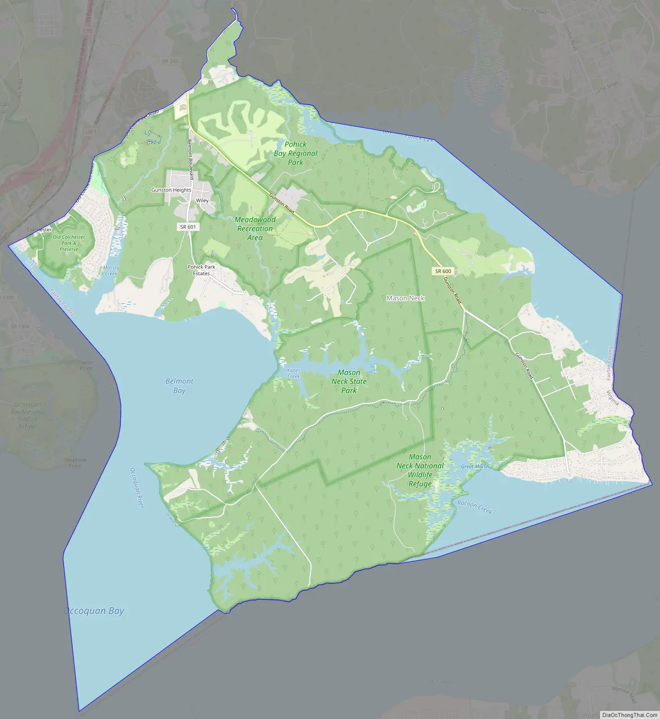
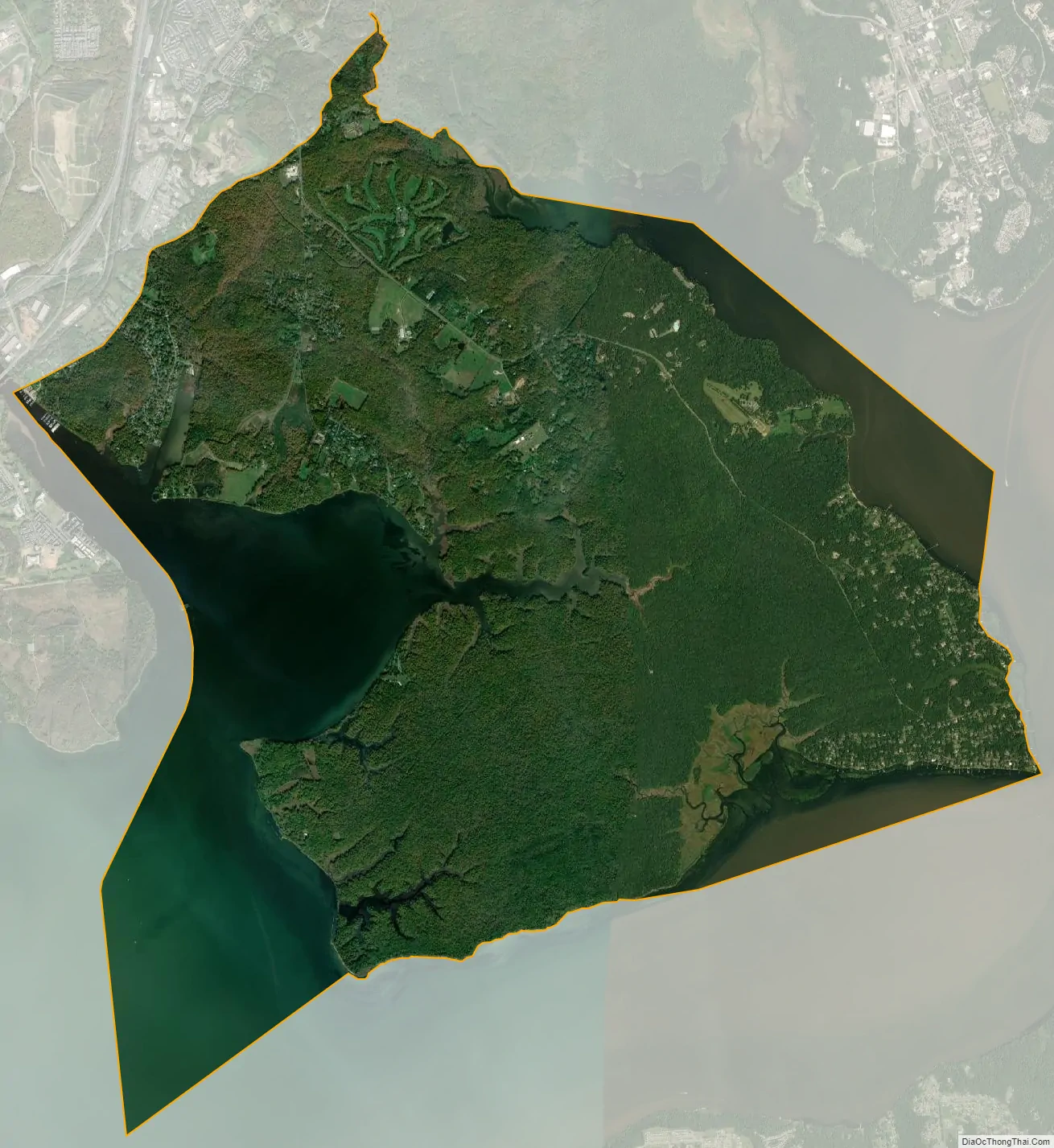
Mason Neck is a peninsula jutting into the Potomac River to the south of Washington, D.C., in the U.S. state of Virginia. It is surrounded by Belmont Bay to the west, the Potomac River to the south and east, Gunston Cove to the northeast, and Pohick Bay to the north-northeast. The census-designated place (CDP) of Mason Neck forms the southernmost section of Fairfax County, in northern Virginia, and comprises an area of 20.0 square miles (51.8 km), two-thirds of which is preserved as parkland by regional, state, and national authorities. The population of the Mason Neck CDP was 2,005 as of the 2010 census.
| Name: | Mason Neck CDP |
|---|---|
| LSAD Code: | 57 |
| LSAD Description: | CDP (suffix) |
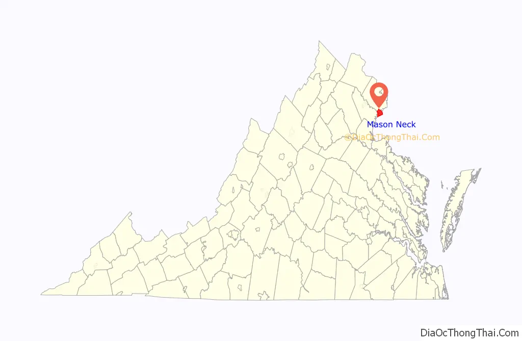
| State: | Virginia |
| County: | Fairfax County |
| Elevation: | 20 ft (6 m) |
| Total Area: | 20.0 sq mi (51.9 km²) |
| Land Area: | 13.9 sq mi (35.9 km²) |
| Water Area: | 6.2 sq mi (16.0 km²) |
| Total Population: | 2,005 |
| Population Density: | 145/sq mi (55.9/km²) |
| FIPS code: | 5149998 |
| GNISfeature ID: | 2584877 |
Online Interactive Map
Click on ![]() to view map in "full screen" mode.
to view map in "full screen" mode.
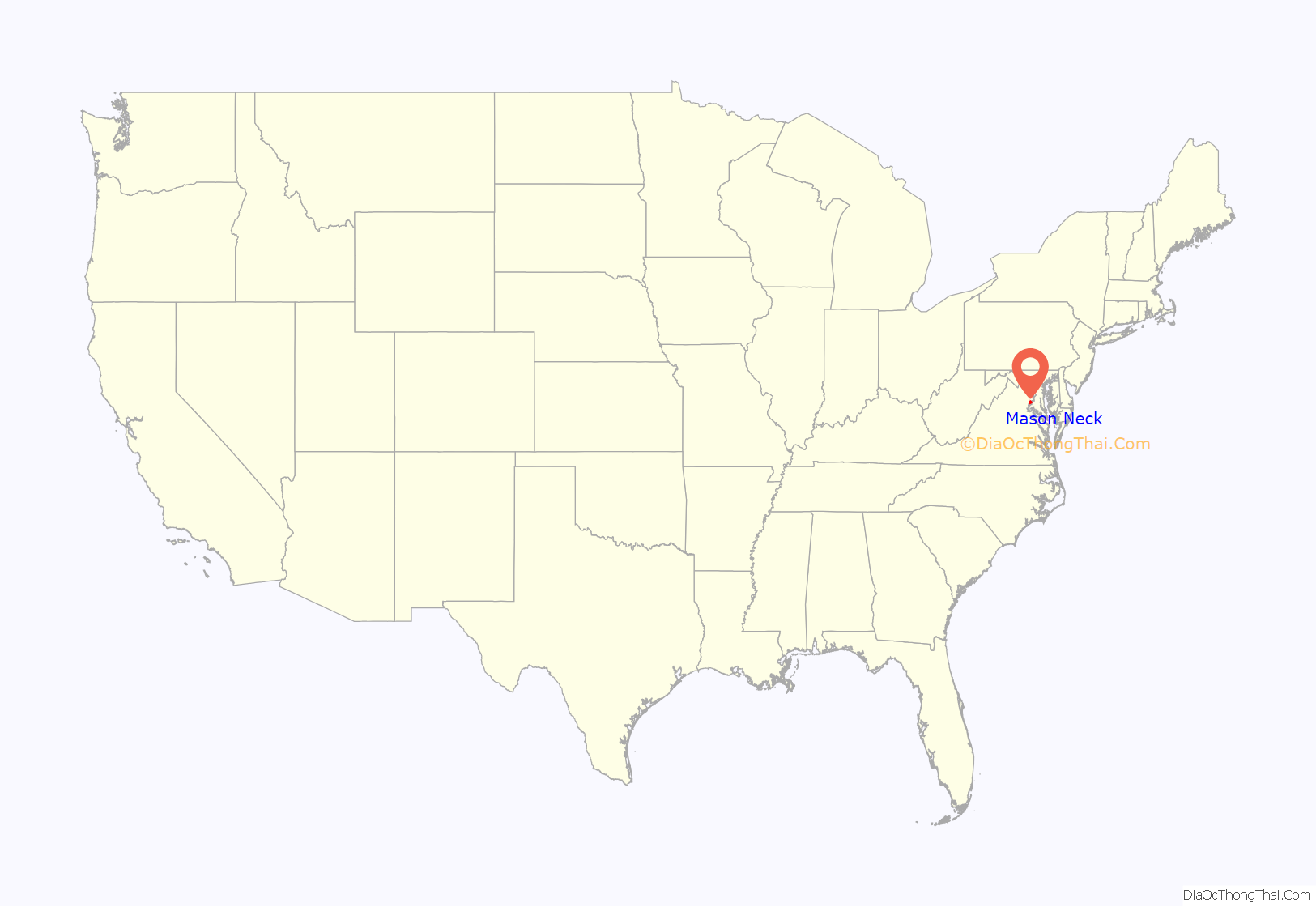
Mason Neck location map. Where is Mason Neck CDP?
History
The Mason Neck peninsula was inhabited by the Doeg prior to the arrival of European settlers. The recorded history of Mason Neck began around 1755 with the construction of Gunston Hall, the plantation house of George Mason, author of the Virginia Declaration of Rights. Mason Neck is also the location of Pohick Church, frequented by both Mason and George Washington, and Cranford Methodist Church, which was built in 1857 and served as a hospital during the Civil War.
During the 19th and early 20th centuries, much of the land was used for the logging of mature pine and hardwood timber. Over time, pollution and habitat destruction caused a decline in the bald eagle population. By the 1960s, much of the forest had grown back, but residential development as a suburb of Washington posed another threat. In 1969, local residents and conservation groups achieved the establishment of the Elizabeth Hartwell Mason Neck National Wildlife Refuge, with the specific objective of protecting the bald eagle. This, along with Mason Neck State Park and Pohick Bay Regional Park, provides a variety of recreational activities while preserving the land’s natural resources.
During the 1980s, the Lynch family traded Fairfax County officials their Mason Neck land holdings in exchange for 900 acres (360 ha) of land near the Lorton Prison. This plot of land became the housing development known as Crosspointe. Many of the suburban subdivisions located around the Lorton Prison are built on land that the Lynch family once owned. The Mason Neck land that was traded to the county later became a state-controlled nature reserve called Meadowood.
Mason Neck Road Map
Mason Neck city Satellite Map
See also
Map of Virginia State and its subdivision:- Accomack
- Albemarle
- Alexandria
- Alleghany
- Amelia
- Amherst
- Appomattox
- Arlington
- Augusta
- Bath
- Bedford
- Bedford City
- Bland
- Botetourt
- Bristol
- Brunswick
- Buchanan
- Buckingham
- Buena Vista
- Campbell
- Caroline
- Carroll
- Charles City
- Charlotte
- Charlottesville
- Chesapeake
- Chesterfield
- Clarke
- Clifton Forge City
- Colonial Heights
- Covington
- Craig
- Culpeper
- Cumberland
- Danville
- Dickenson
- Dinwiddie
- Emporia
- Essex
- Fairfax
- Fairfax City
- Falls Church
- Fauquier
- Floyd
- Fluvanna
- Franklin
- Frederick
- Fredericksburg
- Galax
- Giles
- Gloucester
- Goochland
- Grayson
- Greene
- Greensville
- Halifax
- Hampton
- Hanover
- Harrisonburg
- Henrico
- Henry
- Highland
- Hopewell
- Isle of Wight
- James City
- King and Queen
- King George
- King William
- Lancaster
- Lee
- Lexington
- Loudoun
- Louisa
- Lunenburg
- Lynchburg
- Madison
- Manassas
- Manassas Park
- Martinsville
- Mathews
- Mecklenburg
- Middlesex
- Montgomery
- Nelson
- New Kent
- Newport News
- Norfolk
- Northampton
- Northumberland
- Norton
- Nottoway
- Orange
- Page
- Patrick
- Petersburg
- Pittsylvania
- Poquoson
- Portsmouth
- Powhatan
- Prince Edward
- Prince George
- Prince William
- Pulaski
- Radford
- Rappahannock
- Richmond
- Roanoke
- Roanoke City
- Rockbridge
- Rockingham
- Russell
- Salem
- Scott
- Shenandoah
- Smyth
- Southampton
- Spotsylvania
- Stafford
- Staunton
- Suffolk
- Surry
- Sussex
- Tazewell
- Virginia Beach
- Warren
- Washington
- Waynesboro
- Westmoreland
- Williamsburg
- Winchester
- Wise
- Wythe
- York
- Alabama
- Alaska
- Arizona
- Arkansas
- California
- Colorado
- Connecticut
- Delaware
- District of Columbia
- Florida
- Georgia
- Hawaii
- Idaho
- Illinois
- Indiana
- Iowa
- Kansas
- Kentucky
- Louisiana
- Maine
- Maryland
- Massachusetts
- Michigan
- Minnesota
- Mississippi
- Missouri
- Montana
- Nebraska
- Nevada
- New Hampshire
- New Jersey
- New Mexico
- New York
- North Carolina
- North Dakota
- Ohio
- Oklahoma
- Oregon
- Pennsylvania
- Rhode Island
- South Carolina
- South Dakota
- Tennessee
- Texas
- Utah
- Vermont
- Virginia
- Washington
- West Virginia
- Wisconsin
- Wyoming


