Tappahannock is the oldest town in Essex County, Virginia, United States. The population was 2,375 at the 2010 census, up from 2,068 at the 2000 census. Located on the Rappahannock River, Tappahannock is the county seat of Essex County. Its name comes from an Algonquian language word lappihanne (also noted as toppehannock), meaning “Town on the rise and fall of water” or “where the tide ebbs and flows.” The Rappahannock is a tidal estuary from above this point and downriver to its mouth on Chesapeake Bay.
In 1608 English explorer John Smith landed in Tappahannock and fought with the local Rappahannock tribe. After defeating them, he later made peace.
| Name: | Tappahannock town |
|---|---|
| LSAD Code: | 43 |
| LSAD Description: | town (suffix) |
| State: | Virginia |
| County: | Essex County |
| Elevation: | 46 ft (14 m) |
| Total Area: | 2.75 sq mi (7.11 km²) |
| Land Area: | 2.67 sq mi (6.91 km²) |
| Water Area: | 0.08 sq mi (0.20 km²) |
| Total Population: | 2,375 |
| Population Density: | 899.96/sq mi (347.44/km²) |
| ZIP code: | 22560 |
| Area code: | 804 |
| FIPS code: | 5177568 |
| GNISfeature ID: | 1498542 |
| Website: | www.tappahannock-va.gov |
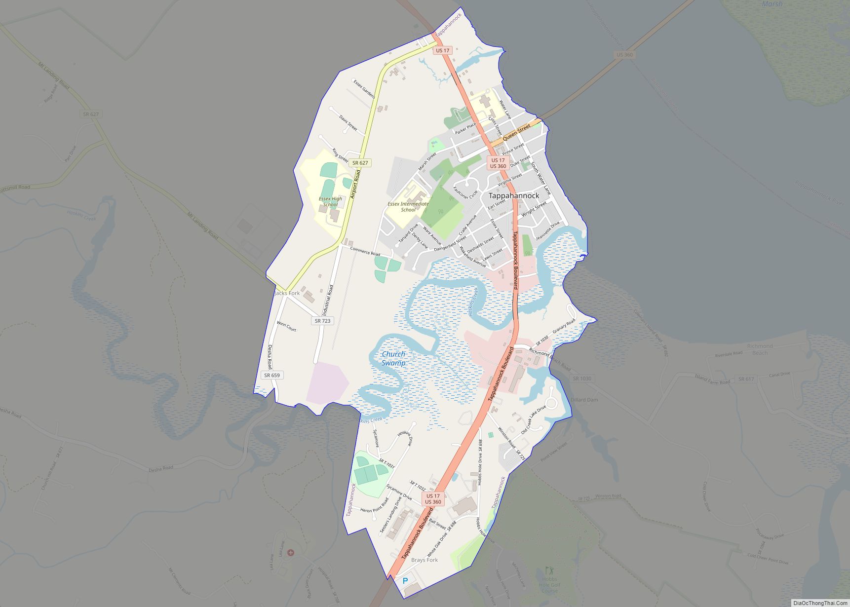
Online Interactive Map
Click on ![]() to view map in "full screen" mode.
to view map in "full screen" mode.
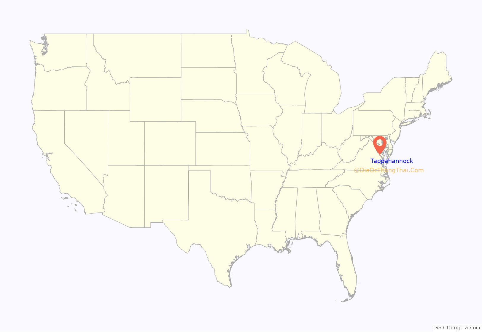
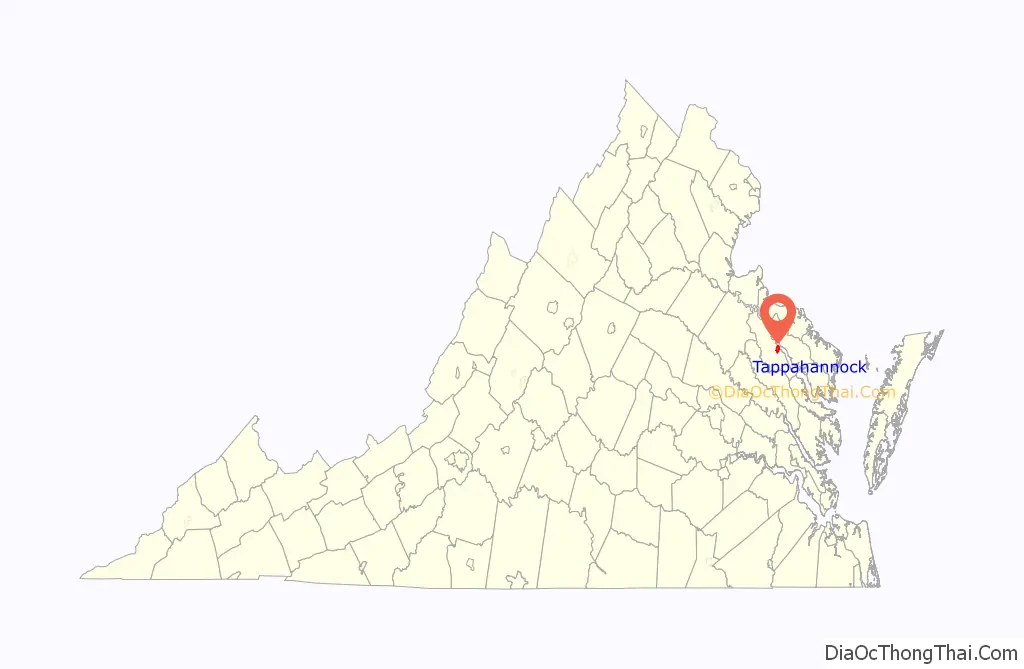
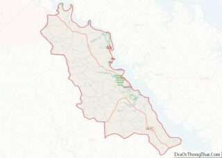
Tappahannock location map. Where is Tappahannock town?
History
In the mid 1660s, Captain Richard Hobbs had rights to 800 acres south of Gilson’s Creek at the Rappahannock River. In 1680, Virginia law required warehouses to be established in port towns, and that year surveyor George Morris created a survey showing Hobb His Hole Harbour [sic]. Hole means where a ship could drop anchor in a deep part of the water, and thus it was Capt. Hobbs who parked his ship “Elizabeth and Mary” here in the vicinity of present-day Tappahannock. This area became known as “Hobbs Hole”.
The settlement was platted for 50 acres (20 ha), divided into half-acre squares. The port was established at Hobbs Hole and called “New Plymouth”, later changed back to the Native American name “Tappahannock”. As part of the Tobacco Inspection Act of 1730, public warehouses for inspection and exportation of tobacco, the colony’s commodity crop, were established at Hobbs Hole. Ocean-going ships could reach this port.
During the War of 1812, the town was seized by British naval forces under the command of Captain Robert Barrie on December 2, 1814. The British left the town two days later, after burning down the courthouse and two jails.
The Tappahannock Historic District and Sabine Hall are listed on the National Register of Historic Places.
On February 24, 2016, the town was hit by a large EF3 tornado, causing massive damage.
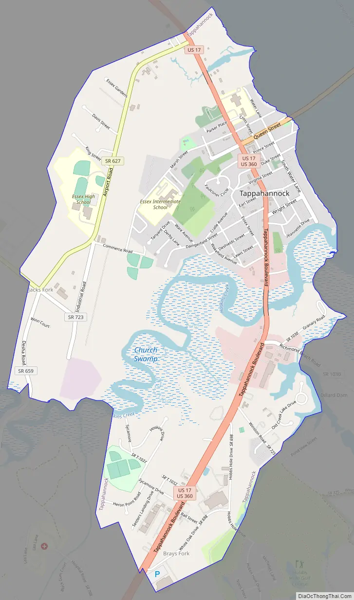
Tappahannock Road Map
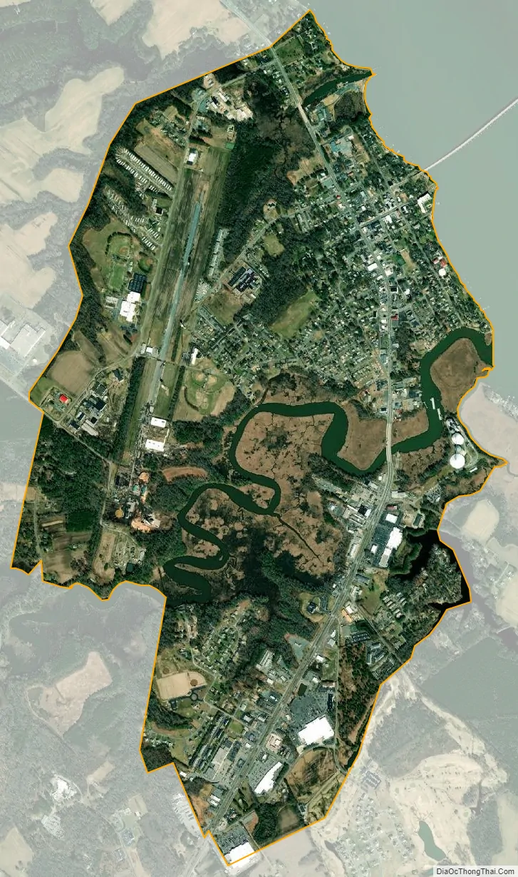
Tappahannock city Satellite Map
Geography
Tappahannock is located on the east side of Essex County at 37°55′20″N 76°51′47″W / 37.92222°N 76.86306°W / 37.92222; -76.86306 (37.922180, −76.863158), on the southwest bank of the Rappahannock River. The river is a wide, tidal estuary here.
U.S. Routes 17 and 360 pass through the town. US 17 passes through the center of town as Church Lane, leading northwest 47 miles (76 km) to Fredericksburg and southeast 70 miles (110 km) to Newport News. US 360 runs through town with US 17 on Church Lane, but turns east on Queen Street and crosses the mile-wide Rappahannock, continuing east 39 miles (63 km) to its terminus in Reedville near the Chesapeake Bay. US 360 leads southwest from Tappahannock 45 miles (72 km) to Richmond, the state capital.
According to the United States Census Bureau, the town 2.7 square miles (6.9 km), of which 2.6 square miles (6.7 km) is land and 0.077 square miles (0.2 km), or 2.84%, is water.
See also
Map of Virginia State and its subdivision:- Accomack
- Albemarle
- Alexandria
- Alleghany
- Amelia
- Amherst
- Appomattox
- Arlington
- Augusta
- Bath
- Bedford
- Bedford City
- Bland
- Botetourt
- Bristol
- Brunswick
- Buchanan
- Buckingham
- Buena Vista
- Campbell
- Caroline
- Carroll
- Charles City
- Charlotte
- Charlottesville
- Chesapeake
- Chesterfield
- Clarke
- Clifton Forge City
- Colonial Heights
- Covington
- Craig
- Culpeper
- Cumberland
- Danville
- Dickenson
- Dinwiddie
- Emporia
- Essex
- Fairfax
- Fairfax City
- Falls Church
- Fauquier
- Floyd
- Fluvanna
- Franklin
- Frederick
- Fredericksburg
- Galax
- Giles
- Gloucester
- Goochland
- Grayson
- Greene
- Greensville
- Halifax
- Hampton
- Hanover
- Harrisonburg
- Henrico
- Henry
- Highland
- Hopewell
- Isle of Wight
- James City
- King and Queen
- King George
- King William
- Lancaster
- Lee
- Lexington
- Loudoun
- Louisa
- Lunenburg
- Lynchburg
- Madison
- Manassas
- Manassas Park
- Martinsville
- Mathews
- Mecklenburg
- Middlesex
- Montgomery
- Nelson
- New Kent
- Newport News
- Norfolk
- Northampton
- Northumberland
- Norton
- Nottoway
- Orange
- Page
- Patrick
- Petersburg
- Pittsylvania
- Poquoson
- Portsmouth
- Powhatan
- Prince Edward
- Prince George
- Prince William
- Pulaski
- Radford
- Rappahannock
- Richmond
- Roanoke
- Roanoke City
- Rockbridge
- Rockingham
- Russell
- Salem
- Scott
- Shenandoah
- Smyth
- Southampton
- Spotsylvania
- Stafford
- Staunton
- Suffolk
- Surry
- Sussex
- Tazewell
- Virginia Beach
- Warren
- Washington
- Waynesboro
- Westmoreland
- Williamsburg
- Winchester
- Wise
- Wythe
- York
- Alabama
- Alaska
- Arizona
- Arkansas
- California
- Colorado
- Connecticut
- Delaware
- District of Columbia
- Florida
- Georgia
- Hawaii
- Idaho
- Illinois
- Indiana
- Iowa
- Kansas
- Kentucky
- Louisiana
- Maine
- Maryland
- Massachusetts
- Michigan
- Minnesota
- Mississippi
- Missouri
- Montana
- Nebraska
- Nevada
- New Hampshire
- New Jersey
- New Mexico
- New York
- North Carolina
- North Dakota
- Ohio
- Oklahoma
- Oregon
- Pennsylvania
- Rhode Island
- South Carolina
- South Dakota
- Tennessee
- Texas
- Utah
- Vermont
- Virginia
- Washington
- West Virginia
- Wisconsin
- Wyoming
Now that Lowry’s restaurant is closed I can’t find really good fried oysters. I have looked for a recipe all over the web. I’m
so disappointed. I live in West Virginia and would drive all the way to Tappahannock just to get oysters. If anyone can send me a recipe I would be most grateful.