White Stone is a town in Lancaster County, Virginia, United States. The population was 380 at the 2020 census. White Stone is one of many small towns located in Virginia’s Northern Neck region.
| Name: | White Stone town |
|---|---|
| LSAD Code: | 43 |
| LSAD Description: | town (suffix) |
| State: | Virginia |
| County: | Lancaster County |
| Elevation: | 49 ft (15 m) |
| Total Area: | 0.98 sq mi (2.54 km²) |
| Land Area: | 0.98 sq mi (2.53 km²) |
| Water Area: | 0.00 sq mi (0.01 km²) |
| Total Population: | 380 |
| Population Density: | 390/sq mi (150/km²) |
| ZIP code: | 22578 |
| Area code: | 804 |
| FIPS code: | 5185600 |
| GNISfeature ID: | 1476645 |
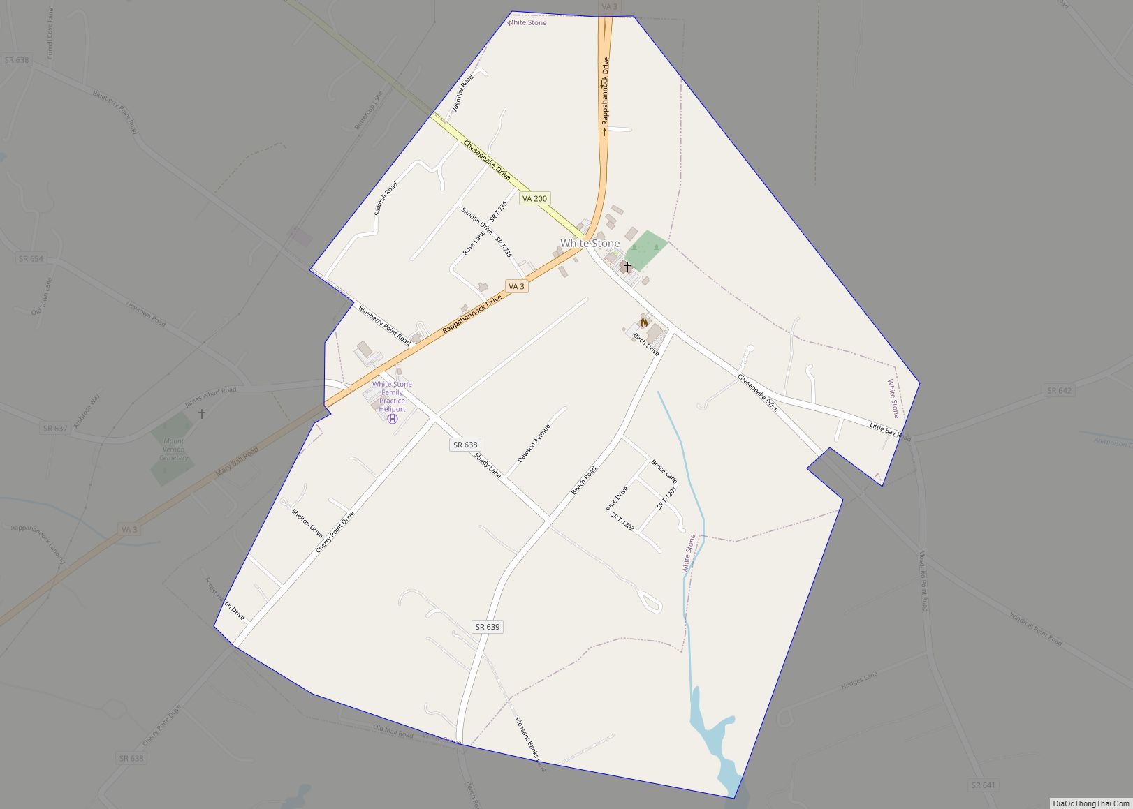
Online Interactive Map
Click on ![]() to view map in "full screen" mode.
to view map in "full screen" mode.
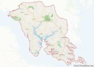
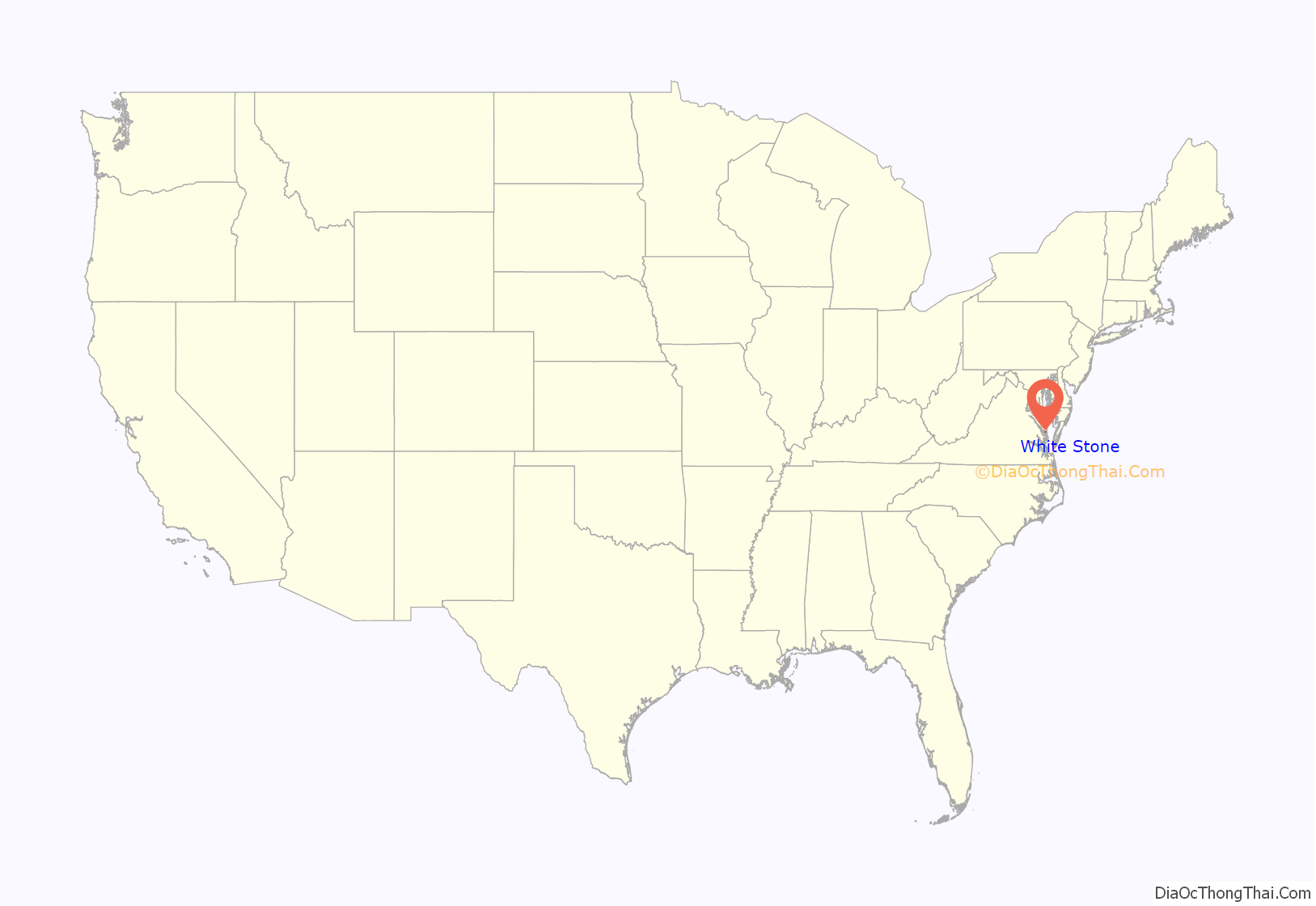
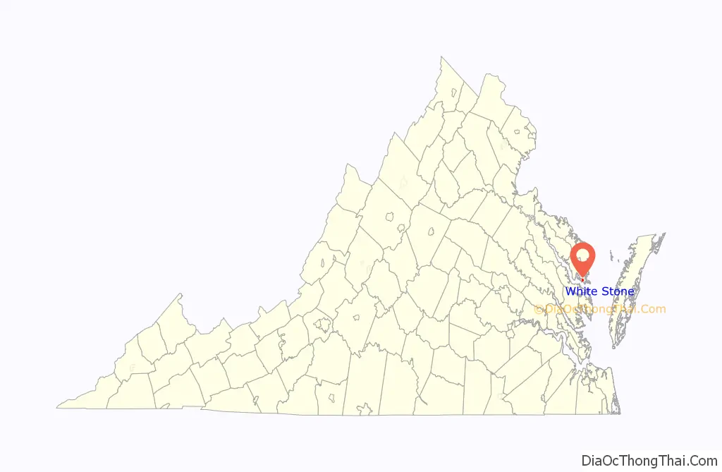
White Stone location map. Where is White Stone town?
History
White Stone traces its earliest colonial history to the arrival of Epaphroditus Lawson, who was born in Yorkshire, a county in northern England. In 1649-50, Epaphroditus acquired 4,600 acres of land along the Rappahannock River, including the present site of White Stone, where he lived until his death in 1652. For many generations thereafter, the Lawson family “served the community as justices, sheriffs, and vestrymen.”
The town of White Stone was founded in 1715, and sits adjacent to the nearby towns of Lancaster and Kilmarnock. However, White Stone was not incorporated until 1953. There are a variety of theories about how White Stone got its distinctive name: one story has the name derived from a nearby stream, where locals would use a white stone to hone their tools. Another story has the town’s name deriving from an 1819 church deed, which identified a property boundary as being “near the road leading by the white stone.”
The area was involved in the War of 1812 and the Civil War. During the latter conflict, the historic plantation home of Pop Castle was bombarded by a Union gunboat. Pop Castle would later be listed on the National Register of Historic Places in 1989.
Following the Civil War, White Stone had developed a small, thriving business community, including a general store, choral hall, and a hat-maker. By 1921, Albert Terry Wright served as principal for the county’s first school for African-American students.
Ultimately, the city of White Stone’s “heyday” was during the late 19th and early 20th century, with the population having stagnated since the American Census of 1960, the first taken after the town’s incorporation. Today, White Stone remains a small, rural town, with a focus on tourism: the area is home to a local seafood market, the Allure Art Center, and other attractions. Additionally, the town has recently received state and federal grants to develop a sewer system and to revitalize its business district.
White Stone Road Map
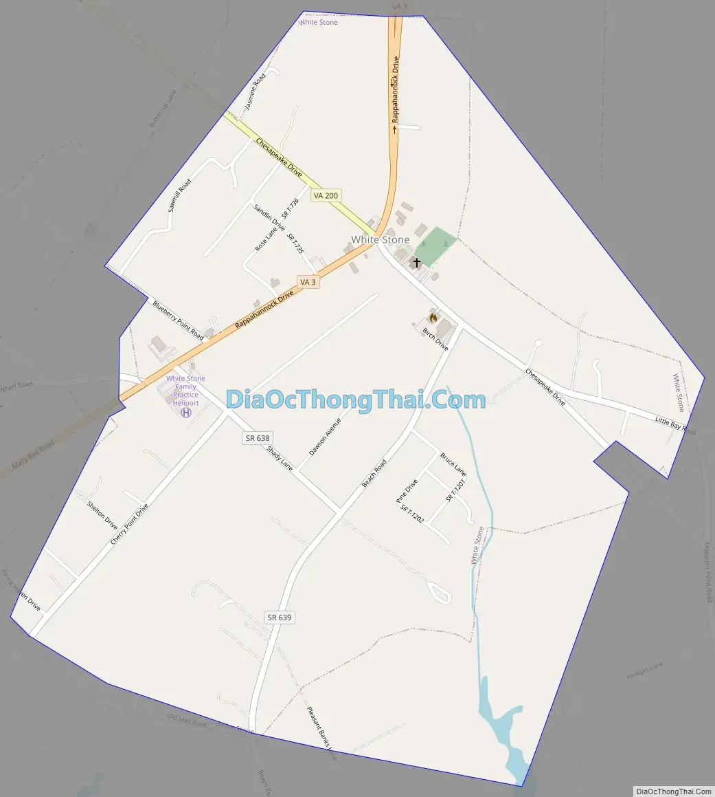
White Stone city Satellite Map

Geography
White Stone is located at 37°38′43″N 76°23′28″W / 37.64528°N 76.39111°W / 37.64528; -76.39111 (37.645182, −76.391242).
According to the United States Census Bureau, the town has a total area of 1.0 square miles (2.6 km), all of it land.
See also
Map of Virginia State and its subdivision:- Accomack
- Albemarle
- Alexandria
- Alleghany
- Amelia
- Amherst
- Appomattox
- Arlington
- Augusta
- Bath
- Bedford
- Bedford City
- Bland
- Botetourt
- Bristol
- Brunswick
- Buchanan
- Buckingham
- Buena Vista
- Campbell
- Caroline
- Carroll
- Charles City
- Charlotte
- Charlottesville
- Chesapeake
- Chesterfield
- Clarke
- Clifton Forge City
- Colonial Heights
- Covington
- Craig
- Culpeper
- Cumberland
- Danville
- Dickenson
- Dinwiddie
- Emporia
- Essex
- Fairfax
- Fairfax City
- Falls Church
- Fauquier
- Floyd
- Fluvanna
- Franklin
- Frederick
- Fredericksburg
- Galax
- Giles
- Gloucester
- Goochland
- Grayson
- Greene
- Greensville
- Halifax
- Hampton
- Hanover
- Harrisonburg
- Henrico
- Henry
- Highland
- Hopewell
- Isle of Wight
- James City
- King and Queen
- King George
- King William
- Lancaster
- Lee
- Lexington
- Loudoun
- Louisa
- Lunenburg
- Lynchburg
- Madison
- Manassas
- Manassas Park
- Martinsville
- Mathews
- Mecklenburg
- Middlesex
- Montgomery
- Nelson
- New Kent
- Newport News
- Norfolk
- Northampton
- Northumberland
- Norton
- Nottoway
- Orange
- Page
- Patrick
- Petersburg
- Pittsylvania
- Poquoson
- Portsmouth
- Powhatan
- Prince Edward
- Prince George
- Prince William
- Pulaski
- Radford
- Rappahannock
- Richmond
- Roanoke
- Roanoke City
- Rockbridge
- Rockingham
- Russell
- Salem
- Scott
- Shenandoah
- Smyth
- Southampton
- Spotsylvania
- Stafford
- Staunton
- Suffolk
- Surry
- Sussex
- Tazewell
- Virginia Beach
- Warren
- Washington
- Waynesboro
- Westmoreland
- Williamsburg
- Winchester
- Wise
- Wythe
- York
- Alabama
- Alaska
- Arizona
- Arkansas
- California
- Colorado
- Connecticut
- Delaware
- District of Columbia
- Florida
- Georgia
- Hawaii
- Idaho
- Illinois
- Indiana
- Iowa
- Kansas
- Kentucky
- Louisiana
- Maine
- Maryland
- Massachusetts
- Michigan
- Minnesota
- Mississippi
- Missouri
- Montana
- Nebraska
- Nevada
- New Hampshire
- New Jersey
- New Mexico
- New York
- North Carolina
- North Dakota
- Ohio
- Oklahoma
- Oregon
- Pennsylvania
- Rhode Island
- South Carolina
- South Dakota
- Tennessee
- Texas
- Utah
- Vermont
- Virginia
- Washington
- West Virginia
- Wisconsin
- Wyoming