Eminence is a home rule class city in Henry County, Kentucky, in the United States. The population was 2,498 at the 2010 census, up from 2,231 at the 2000 census. Eminence is the largest city in Henry County. Eminence is home to the loudspeaker manufacturing company, Eminence Speaker.
| Name: | Eminence city |
|---|---|
| LSAD Code: | 25 |
| LSAD Description: | city (suffix) |
| State: | Kentucky |
| County: | Henry County |
| Elevation: | 935 ft (285 m) |
| Total Area: | 2.90 sq mi (7.50 km²) |
| Land Area: | 2.85 sq mi (7.37 km²) |
| Water Area: | 0.05 sq mi (0.13 km²) |
| Total Population: | 2,705 |
| Population Density: | 950.79/sq mi (367.09/km²) |
| ZIP code: | 40019 |
| Area code: | 502 |
| FIPS code: | 2124904 |
| GNISfeature ID: | 0491762 |
| Website: | eminence.ky.gov |
Online Interactive Map
Click on ![]() to view map in "full screen" mode.
to view map in "full screen" mode.
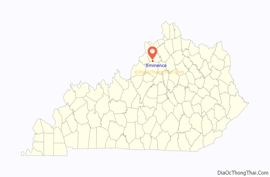
Eminence location map. Where is Eminence city?
History
The area post office, established in 1836, was moved to Eminence in 1850, and named for its supposed location at the highest point on the railroad line between Louisville and Lexington. The city was formally incorporated in 1851.
The Eminence Historic Commercial District was listed on the National Register of Historic Places in 1979.
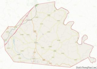
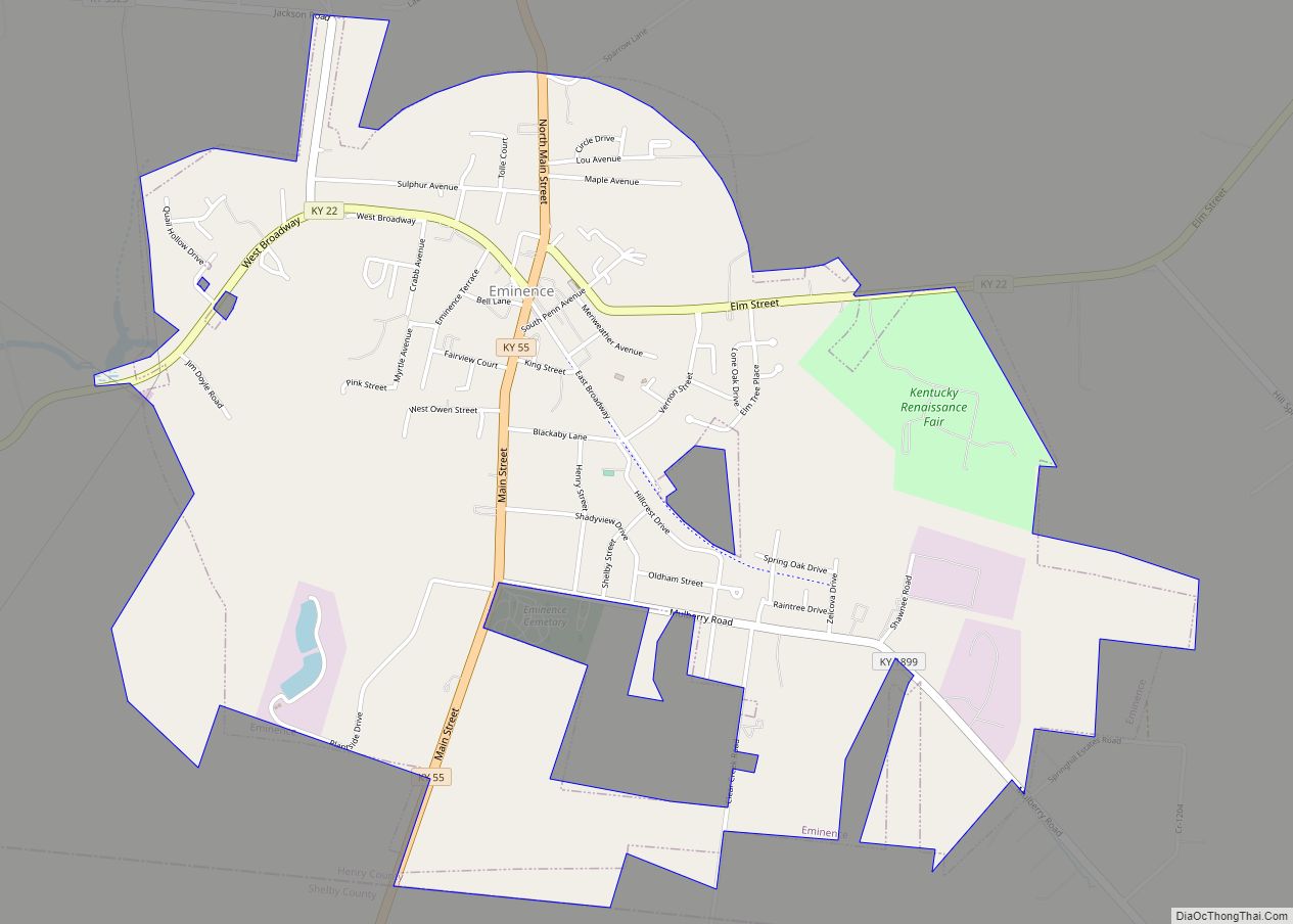
Eminence Road Map
Eminence city Satellite Map
Geography
Eminence is located in southern Henry County at 38°22′5″N 85°10′50″W / 38.36806°N 85.18056°W / 38.36806; -85.18056 (38.368127, -85.180449). It is bordered to the south by Shelby County.
Kentucky Route 55 is Main Street through Eminence. KY 55 leads north 4 miles (6 km) to New Castle, the Henry County seat, and south 12 miles (19 km) to Shelbyville. U.S. Route 421 passes 2 miles (3 km) east of Eminence; it leads north to New Castle and southeast 25 miles (40 km) to Frankfort, the state capital.
According to the United States Census Bureau, the city of Eminence has a total area of 2.9 square miles (7.4 km), of which 0.04 square miles (0.1 km), or 1.70%, is water. The city is located on high ground, with elevations up to 960 feet (290 m), where several watersheds converge. The source of the Little Kentucky River, a tributary of the Kentucky River, is just west of Eminence, while Town Creek to the north and Drennon Creek to the east also rise in Eminence and flow north to the Kentucky River. Fox Run rises in the southern part of Eminence and flows south via Bullskin Creek and Brashears Creek to the Salt River. The Kentucky and the Salt River are both tributaries of the Ohio River.
See also
Map of Kentucky State and its subdivision:- Adair
- Allen
- Anderson
- Ballard
- Barren
- Bath
- Bell
- Boone
- Bourbon
- Boyd
- Boyle
- Bracken
- Breathitt
- Breckinridge
- Bullitt
- Butler
- Caldwell
- Calloway
- Campbell
- Carlisle
- Carroll
- Carter
- Casey
- Christian
- Clark
- Clay
- Clinton
- Crittenden
- Cumberland
- Daviess
- Edmonson
- Elliott
- Estill
- Fayette
- Fleming
- Floyd
- Franklin
- Fulton
- Gallatin
- Garrard
- Grant
- Graves
- Grayson
- Green
- Greenup
- Hancock
- Hardin
- Harlan
- Harrison
- Hart
- Henderson
- Henry
- Hickman
- Hopkins
- Jackson
- Jefferson
- Jessamine
- Johnson
- Kenton
- Knott
- Knox
- Larue
- Laurel
- Lawrence
- Lee
- Leslie
- Letcher
- Lewis
- Lincoln
- Livingston
- Logan
- Lyon
- Madison
- Magoffin
- Marion
- Marshall
- Martin
- Mason
- McCracken
- McCreary
- McLean
- Meade
- Menifee
- Mercer
- Metcalfe
- Monroe
- Montgomery
- Morgan
- Muhlenberg
- Nelson
- Nicholas
- Ohio
- Oldham
- Owen
- Owsley
- Pendleton
- Perry
- Pike
- Powell
- Pulaski
- Robertson
- Rockcastle
- Rowan
- Russell
- Scott
- Shelby
- Simpson
- Spencer
- Taylor
- Todd
- Trigg
- Trimble
- Union
- Warren
- Washington
- Wayne
- Webster
- Whitley
- Wolfe
- Woodford
- Alabama
- Alaska
- Arizona
- Arkansas
- California
- Colorado
- Connecticut
- Delaware
- District of Columbia
- Florida
- Georgia
- Hawaii
- Idaho
- Illinois
- Indiana
- Iowa
- Kansas
- Kentucky
- Louisiana
- Maine
- Maryland
- Massachusetts
- Michigan
- Minnesota
- Mississippi
- Missouri
- Montana
- Nebraska
- Nevada
- New Hampshire
- New Jersey
- New Mexico
- New York
- North Carolina
- North Dakota
- Ohio
- Oklahoma
- Oregon
- Pennsylvania
- Rhode Island
- South Carolina
- South Dakota
- Tennessee
- Texas
- Utah
- Vermont
- Virginia
- Washington
- West Virginia
- Wisconsin
- Wyoming

