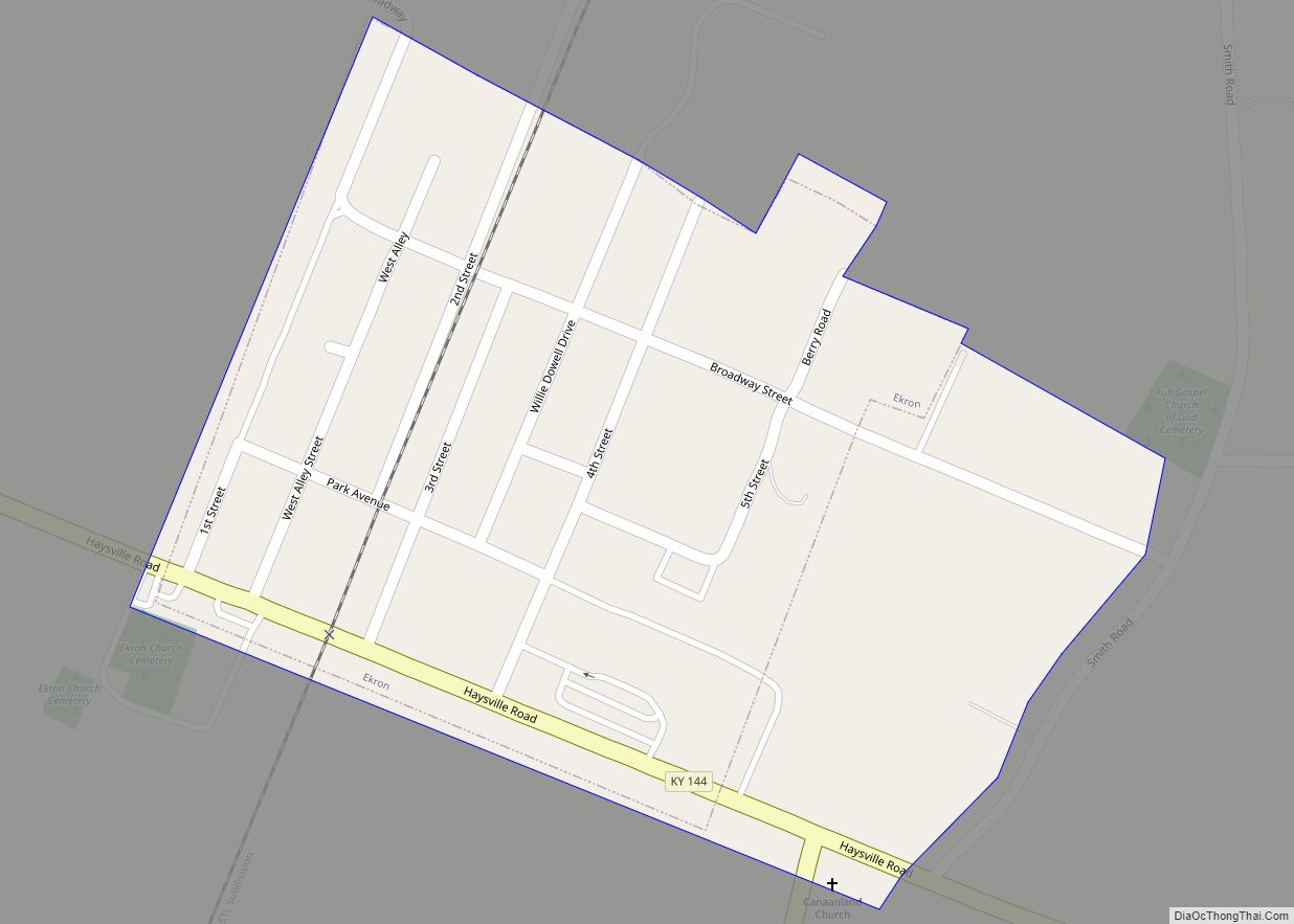
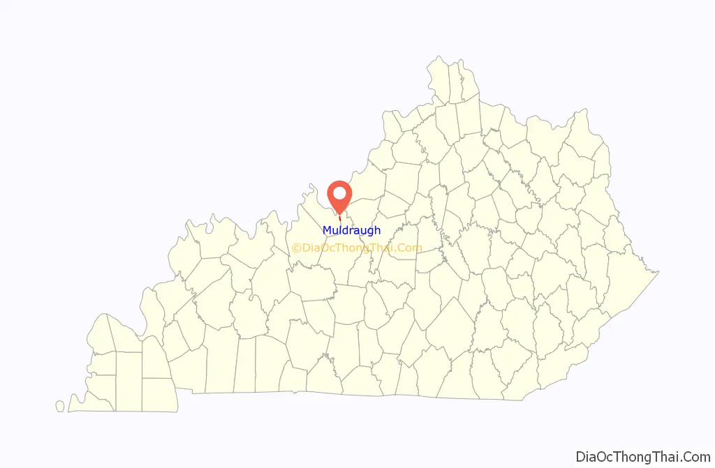
Muldraugh is a home rule-class city in Meade and Hardin counties in the U.S. state of Kentucky. It lies on U.S. Route 31W north of Elizabethtown. The city limits are completely encompassed by the Fort Knox army base. The population was 1,040 as of the 2020 census. The city is part of the Elizabethtown–Fort Knox Metropolitan Area.
| Name: | Muldraugh city |
|---|---|
| LSAD Code: | 25 |
| LSAD Description: | city (suffix) |
| State: | Kentucky |
| County: | Hardin County, Meade County |
| Incorporated: | 1852 |
| Elevation: | 738 ft (225 m) |
| Total Area: | 0.52 sq mi (1.36 km²) |
| Land Area: | 0.52 sq mi (1.35 km²) |
| Water Area: | 0.00 sq mi (0.00 km²) |
| Total Population: | 1,040 |
| Population Density: | 1,988.53/sq mi (768.25/km²) |
| ZIP code: | 40155 |
| Area code: | 502 |
| FIPS code: | 2154480 |
| GNISfeature ID: | 0499075 |
| Website: | muldraugh.ky.gov |
Online Interactive Map
Click on ![]() to view map in "full screen" mode.
to view map in "full screen" mode.
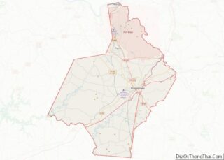
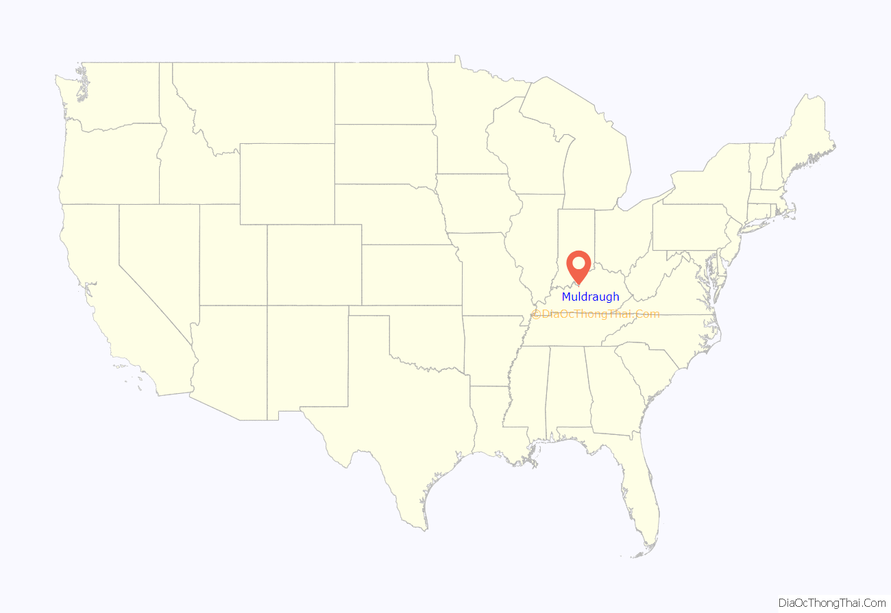
Muldraugh location map. Where is Muldraugh city?
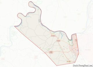
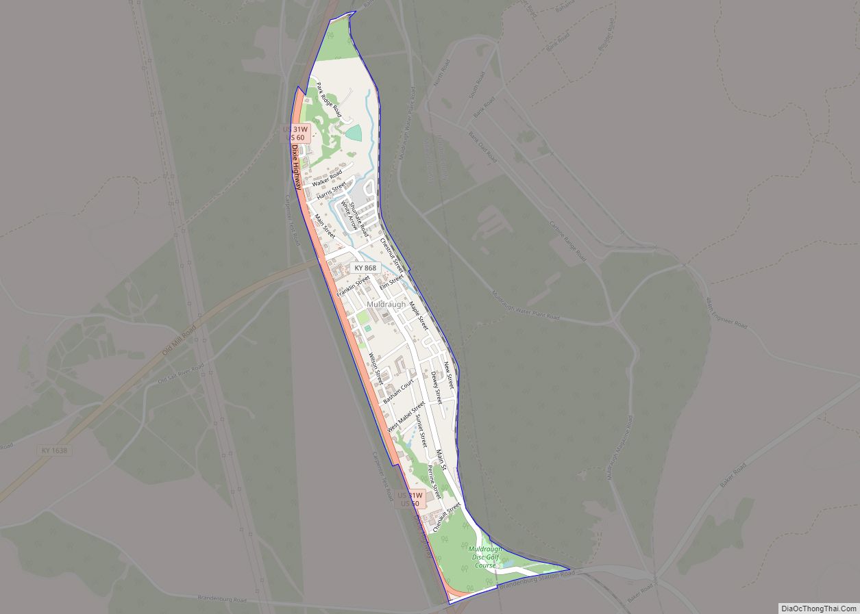
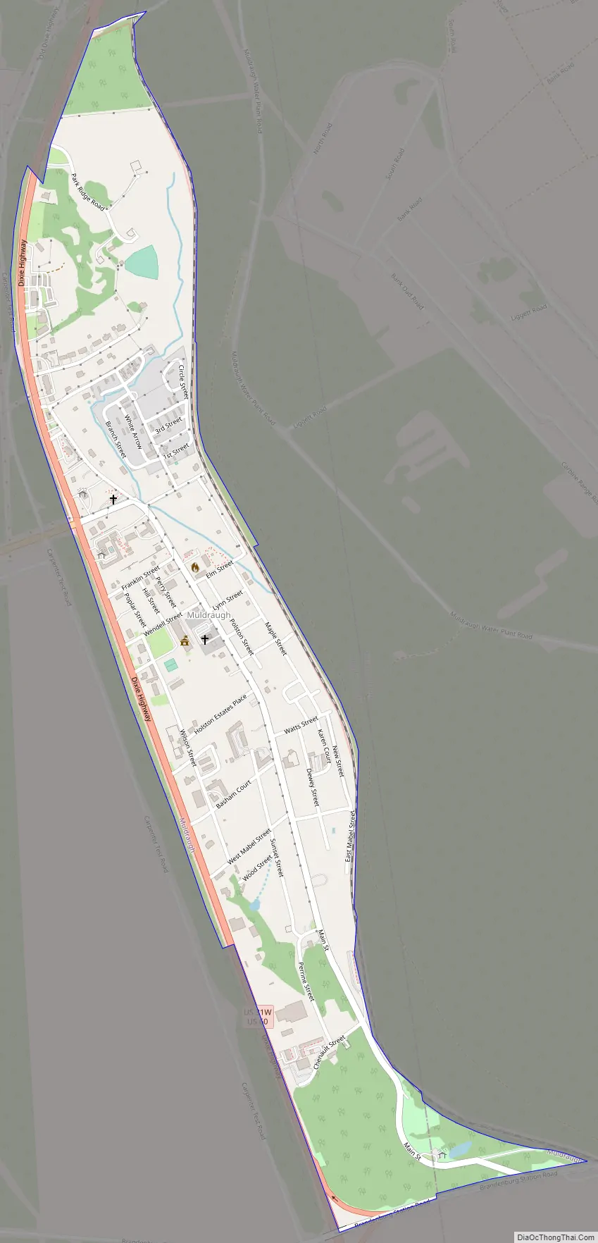
Muldraugh Road Map
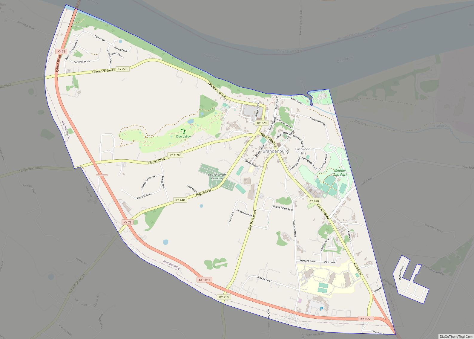
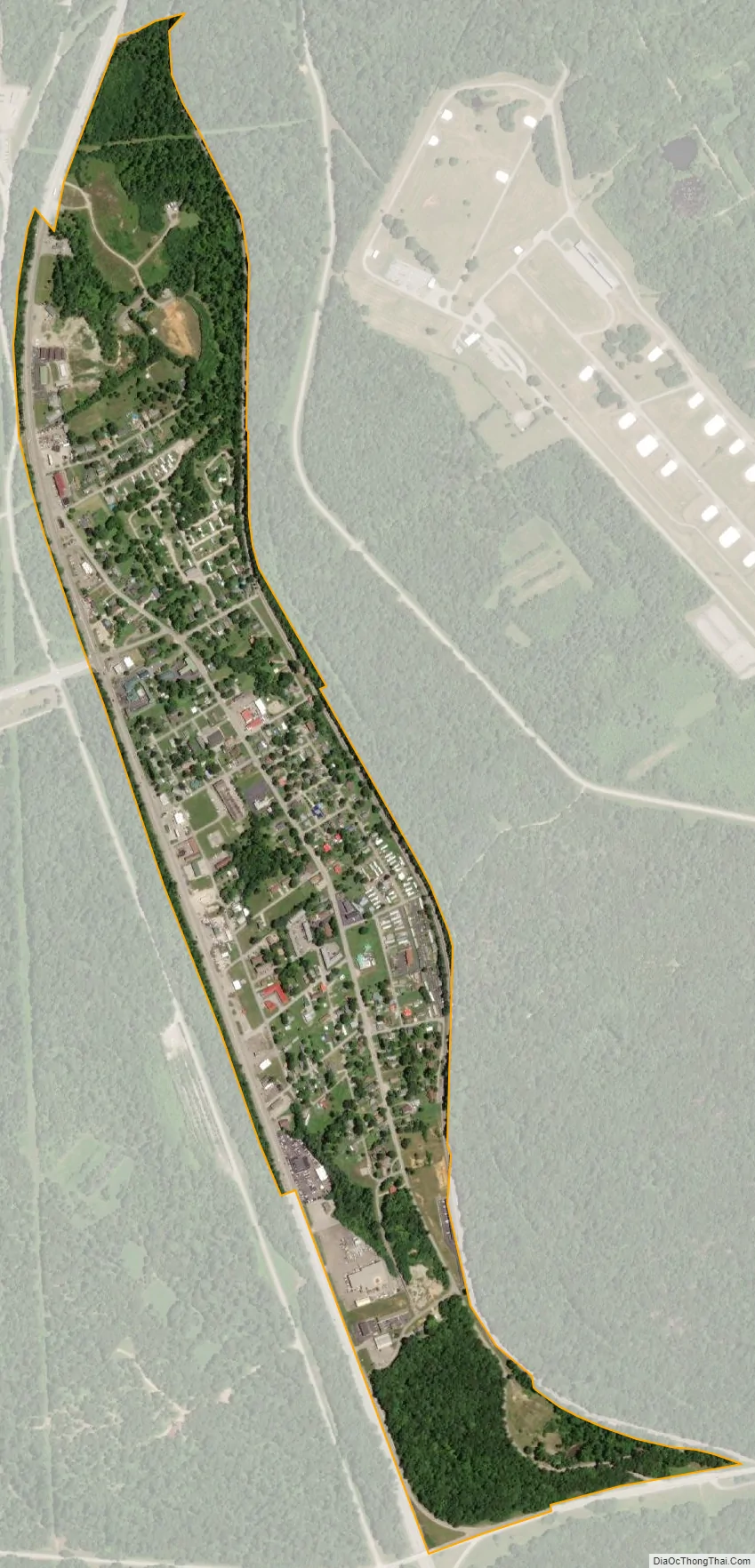
Muldraugh city Satellite Map
Geography
Muldraugh is in eastern Meade County, with a small portion at the south end extending east into Hardin County. U.S. Routes 31W and 60 form the western border of the city. The highway leads north 27 miles (43 km) to Louisville. US 31W leads south 18 miles (29 km) to Elizabethtown, while US 60 turns west just south of the Muldraugh city limits and leads 34 miles (55 km) to Hardinsburg. Brandenburg Station Road, the north entrance to Fort Knox, has an interchange with US 31W and 60 at the south end of Muldraugh.
According to the United States Census Bureau, the city has a total area of 0.52 square miles (1.35 km), all land.
Muldraugh is located just south of Muldraugh Hill at 37°56′13″N 85°59′29″W / 37.93694°N 85.99139°W / 37.93694; -85.99139 (37.936975, -85.991414). The road coming to the town from the north (now U.S. 31W and U.S. 60) is very steep, which is the source of the town’s name: early on, reaching the area required a “mule-drawn” wagon.
See also
Map of Kentucky State and its subdivision:- Adair
- Allen
- Anderson
- Ballard
- Barren
- Bath
- Bell
- Boone
- Bourbon
- Boyd
- Boyle
- Bracken
- Breathitt
- Breckinridge
- Bullitt
- Butler
- Caldwell
- Calloway
- Campbell
- Carlisle
- Carroll
- Carter
- Casey
- Christian
- Clark
- Clay
- Clinton
- Crittenden
- Cumberland
- Daviess
- Edmonson
- Elliott
- Estill
- Fayette
- Fleming
- Floyd
- Franklin
- Fulton
- Gallatin
- Garrard
- Grant
- Graves
- Grayson
- Green
- Greenup
- Hancock
- Hardin
- Harlan
- Harrison
- Hart
- Henderson
- Henry
- Hickman
- Hopkins
- Jackson
- Jefferson
- Jessamine
- Johnson
- Kenton
- Knott
- Knox
- Larue
- Laurel
- Lawrence
- Lee
- Leslie
- Letcher
- Lewis
- Lincoln
- Livingston
- Logan
- Lyon
- Madison
- Magoffin
- Marion
- Marshall
- Martin
- Mason
- McCracken
- McCreary
- McLean
- Meade
- Menifee
- Mercer
- Metcalfe
- Monroe
- Montgomery
- Morgan
- Muhlenberg
- Nelson
- Nicholas
- Ohio
- Oldham
- Owen
- Owsley
- Pendleton
- Perry
- Pike
- Powell
- Pulaski
- Robertson
- Rockcastle
- Rowan
- Russell
- Scott
- Shelby
- Simpson
- Spencer
- Taylor
- Todd
- Trigg
- Trimble
- Union
- Warren
- Washington
- Wayne
- Webster
- Whitley
- Wolfe
- Woodford
- Alabama
- Alaska
- Arizona
- Arkansas
- California
- Colorado
- Connecticut
- Delaware
- District of Columbia
- Florida
- Georgia
- Hawaii
- Idaho
- Illinois
- Indiana
- Iowa
- Kansas
- Kentucky
- Louisiana
- Maine
- Maryland
- Massachusetts
- Michigan
- Minnesota
- Mississippi
- Missouri
- Montana
- Nebraska
- Nevada
- New Hampshire
- New Jersey
- New Mexico
- New York
- North Carolina
- North Dakota
- Ohio
- Oklahoma
- Oregon
- Pennsylvania
- Rhode Island
- South Carolina
- South Dakota
- Tennessee
- Texas
- Utah
- Vermont
- Virginia
- Washington
- West Virginia
- Wisconsin
- Wyoming