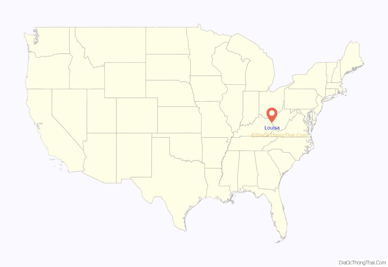
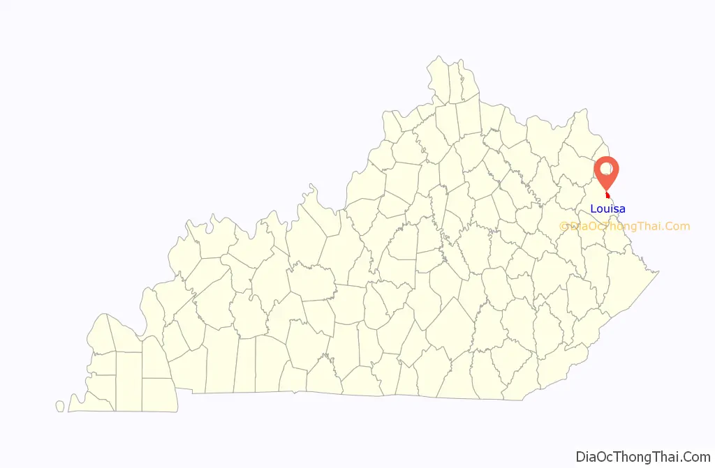
Louisa is an American city located in eastern Kentucky at the merger of the Levisa and Tug Forks into the Big Sandy River, which forms part of the state’s border with West Virginia. It is located in Lawrence County the seat of its county. The population was 2,467 at the 2010 census and an estimated 2,375 in 2018.
| Name: | Louisa city |
|---|---|
| LSAD Code: | 25 |
| LSAD Description: | city (suffix) |
| State: | Kentucky |
| County: | Lawrence County |
| Incorporated: | 1869 |
| Elevation: | 584 ft (178 m) |
| Total Area: | 2.26 sq mi (5.86 km²) |
| Land Area: | 2.24 sq mi (5.81 km²) |
| Water Area: | 0.02 sq mi (0.05 km²) |
| Total Population: | 2,679 |
| Population Density: | 1,194.92/sq mi (461.31/km²) |
| ZIP code: | 41201, 41230 |
| Area code: | 606 |
| FIPS code: | 2147854 |
| GNISfeature ID: | 0497204 |
| Website: | www.cityoflouisa.org |
Online Interactive Map
Click on ![]() to view map in "full screen" mode.
to view map in "full screen" mode.
Louisa location map. Where is Louisa city?
History
The origin of the city’s name is unclear. Theories include that it was named for Louisa County, Virginia, after Louisa Swetnam, one of the first white children born in the area, or after a corruption of the original name of the Levisa Fork, as it was originally written and spoken as the “Louisa Fork.” Others claim that the Levisa Fork is named for Levite connections to the Cherokee and other native tribes prior to later European contact. An 1856 map still shows the river under the name “Louisa.” Virginia, Carolina and other English colonial-linked settlement attempts began as early as 1790 but did not take hold until 1818. Louisa became the county seat in 1822 and a city in 1823.
About 1792 Vancouver’s Station, which had been destroyed by the Native Americans in 1790, on the tongue of land between the Levisa and Tug Forks of the Big Sandy, was reestablished. A few years later this settlement was known as “Balclutha” and is so designated on early maps of the state.
During the Civil War, Union troops under future president James A. Garfield occupied the city from December 1861 until the end of the war, despite several Confederate takeover attempts.
The Chattaroi Railroad (now a part of CSX) connected to Louisa in 1881. The city is also served by US 23. The first needle dam constructed in the United States was completed just north of town in 1896.
The city was home to Fred M. Vinson, the 13th Chief Justice of the United States, and to the York Brothers, a popular country music act of the 1940s and 1950s.
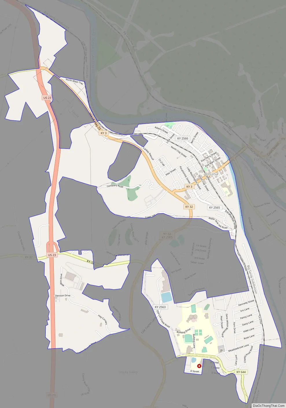
Louisa Road Map
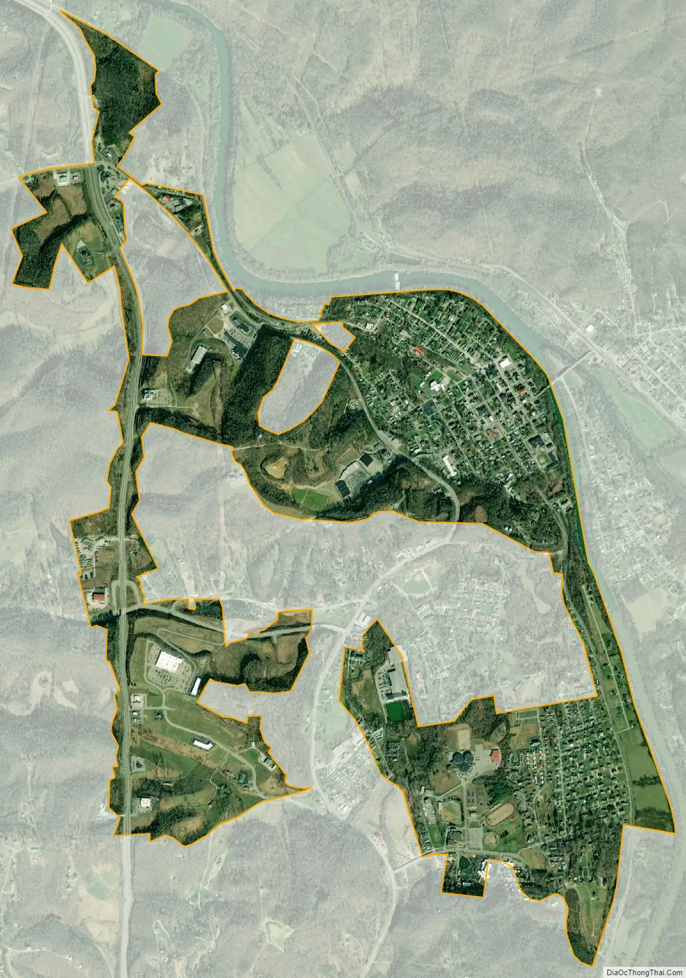
Louisa city Satellite Map
Geography
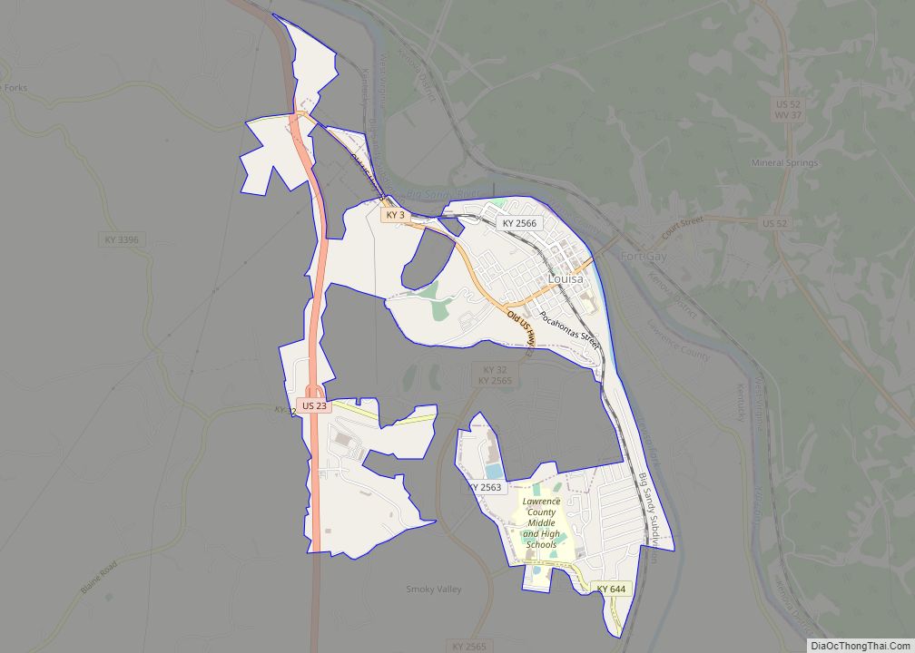
Louisa is located at 38°6′43″N 82°36′21″W / 38.11194°N 82.60583°W / 38.11194; -82.60583 (38.112054, -82.605796). Its eastern border is the Levisa Fork, and its northern border is the Big Sandy River, which also serves as the Kentucky–West Virginia border.
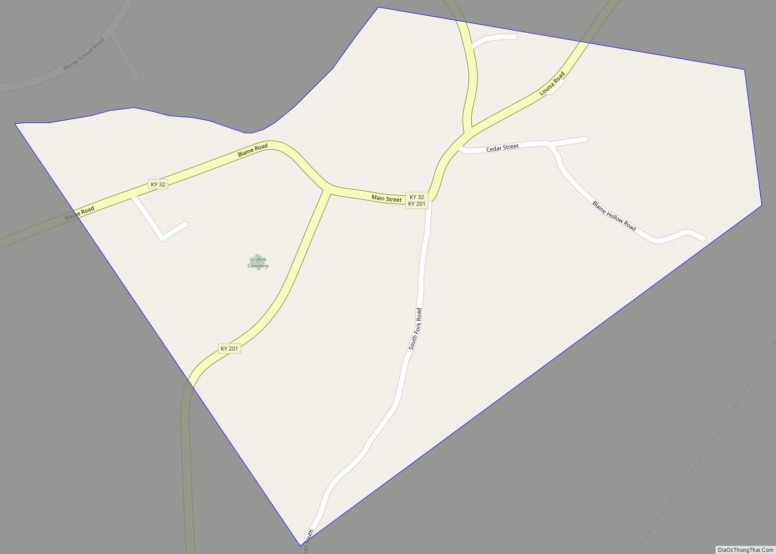
U.S. Route 23 passes through the western side of the city, leading north 30 miles (48 km) down the valley of the Big Sandy River to Ashland on the Ohio River and southwest 28 miles (45 km) to Staffordsville. Kentucky Route 3 passes through the center of Louisa on Madison Street; KY 3 leads northwest 7 miles (11 km) to Fallsburg and southeast up the valley of the Tug Fork and Rockcastle Creek 25 miles (40 km) to Inez. Kentucky Route 32 leads southwest from Louisa 18 miles (29 km) to Blaine. West Virginia Route 37 leads east across the Tug Fork to Fort Gay, West Virginia.
According to the United States Census Bureau, Louisa has a total area of 2.3 square miles (5.9 km), of which 0.02 square miles (0.05 km), or 0.81%, are water.
Climate
The climate in this area is characterized by relatively high temperatures and evenly distributed precipitation throughout the year. According to the Köppen Climate Classification system, Louisa has a Humid subtropical climate, abbreviated “Cfa” on climate maps.
See also
Map of Kentucky State and its subdivision:- Adair
- Allen
- Anderson
- Ballard
- Barren
- Bath
- Bell
- Boone
- Bourbon
- Boyd
- Boyle
- Bracken
- Breathitt
- Breckinridge
- Bullitt
- Butler
- Caldwell
- Calloway
- Campbell
- Carlisle
- Carroll
- Carter
- Casey
- Christian
- Clark
- Clay
- Clinton
- Crittenden
- Cumberland
- Daviess
- Edmonson
- Elliott
- Estill
- Fayette
- Fleming
- Floyd
- Franklin
- Fulton
- Gallatin
- Garrard
- Grant
- Graves
- Grayson
- Green
- Greenup
- Hancock
- Hardin
- Harlan
- Harrison
- Hart
- Henderson
- Henry
- Hickman
- Hopkins
- Jackson
- Jefferson
- Jessamine
- Johnson
- Kenton
- Knott
- Knox
- Larue
- Laurel
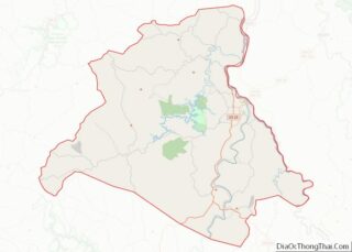
- Lawrence
- Lee
- Leslie
- Letcher
- Lewis
- Lincoln
- Livingston
- Logan
- Lyon
- Madison
- Magoffin
- Marion
- Marshall
- Martin
- Mason
- McCracken
- McCreary
- McLean
- Meade
- Menifee
- Mercer
- Metcalfe
- Monroe
- Montgomery
- Morgan
- Muhlenberg
- Nelson
- Nicholas
- Ohio
- Oldham
- Owen
- Owsley
- Pendleton
- Perry
- Pike
- Powell
- Pulaski
- Robertson
- Rockcastle
- Rowan
- Russell
- Scott
- Shelby
- Simpson
- Spencer
- Taylor
- Todd
- Trigg
- Trimble
- Union
- Warren
- Washington
- Wayne
- Webster
- Whitley
- Wolfe
- Woodford
- Alabama
- Alaska
- Arizona
- Arkansas
- California
- Colorado
- Connecticut
- Delaware
- District of Columbia
- Florida
- Georgia
- Hawaii
- Idaho
- Illinois
- Indiana
- Iowa
- Kansas
- Kentucky
- Louisiana
- Maine
- Maryland
- Massachusetts
- Michigan
- Minnesota
- Mississippi
- Missouri
- Montana
- Nebraska
- Nevada
- New Hampshire
- New Jersey
- New Mexico
- New York
- North Carolina
- North Dakota
- Ohio
- Oklahoma
- Oregon
- Pennsylvania
- Rhode Island
- South Carolina
- South Dakota
- Tennessee
- Texas
- Utah
- Vermont
- Virginia
- Washington
- West Virginia
- Wisconsin
- Wyoming