Vine Grove is a home rule-class city in Hardin County, Kentucky, United States. The population was 4,520 at the 2010 census, up from 4,169 at the 2000 census. It is part of the Elizabethtown–Fort Knox Metropolitan Statistical Area.
| Name: | Vine Grove city |
|---|---|
| LSAD Code: | 25 |
| LSAD Description: | city (suffix) |
| State: | Kentucky |
| County: | Hardin County |
| Elevation: | 682 ft (208 m) |
| Total Area: | 6.94 sq mi (17.97 km²) |
| Land Area: | 6.87 sq mi (17.78 km²) |
| Water Area: | 0.07 sq mi (0.19 km²) |
| Total Population: | 6,559 |
| Population Density: | 955.15/sq mi (368.80/km²) |
| ZIP code: | 40175 |
| Area code: | 270 & 364 |
| FIPS code: | 2179734 |
| GNISfeature ID: | 0506053 |
| Website: | www.vinegrove.org |
Online Interactive Map
Click on ![]() to view map in "full screen" mode.
to view map in "full screen" mode.
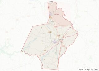
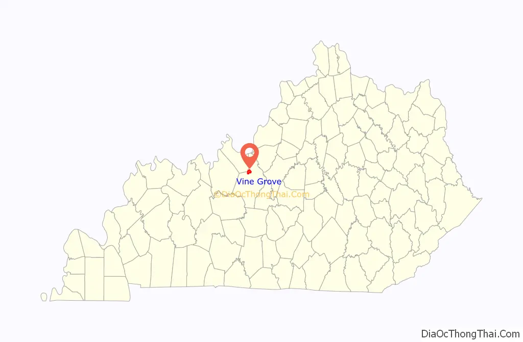
Vine Grove location map. Where is Vine Grove city?

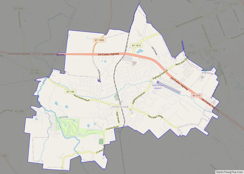
Vine Grove Road Map
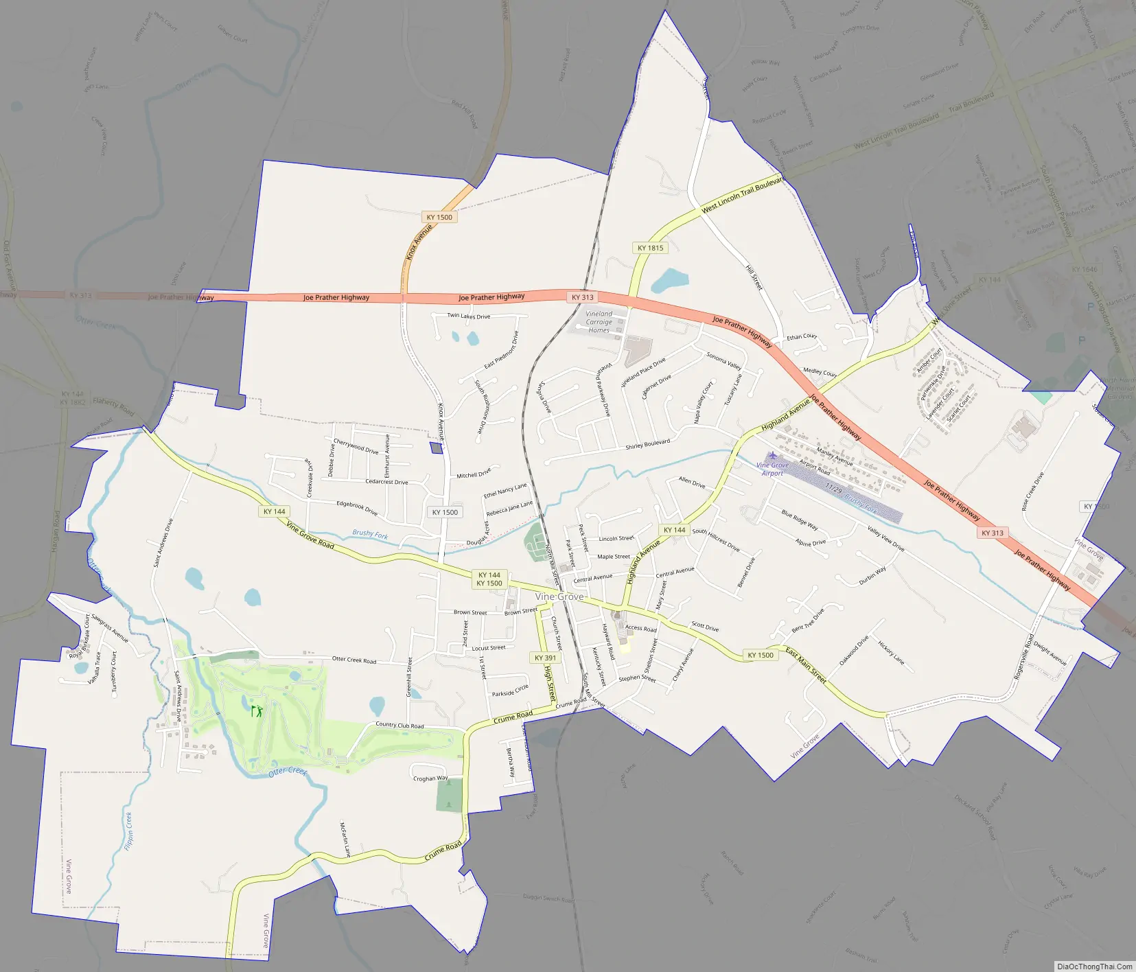
Vine Grove city Satellite Map

Geography
Vine Grove is located in northern Hardin County at 37°48′43″N 85°58′48″W / 37.81194°N 85.98000°W / 37.81194; -85.98000 (37.811971, -85.980006). It is bordered to the east by the city of Radcliff and to the northwest by Meade County. Kentucky Route 144 is the city’s Main Street, and Kentucky Route 313 (Joe Prather Highway) runs through the northern part of the city. Elizabethtown, the Hardin County seat, is 11 miles (18 km) to the southeast, and Brandenburg on the Ohio River is 18 miles (29 km) to the northwest. Fort Knox is 5 miles (8 km) to the northeast, on the other side of Radcliff.
According to the United States Census Bureau, Vine Grove has a total area of 4.7 square miles (12.2 km), of which 4.7 square miles (12.1 km) are land and 0.04 square miles (0.1 km), or 0.90%, are water. The city is drained by the Brushy Fork, which flows west to Otter Creek, which flows north along the western edge of the city and is a tributary of the Ohio River.
See also
Map of Kentucky State and its subdivision:- Adair
- Allen
- Anderson
- Ballard
- Barren
- Bath
- Bell
- Boone
- Bourbon
- Boyd
- Boyle
- Bracken
- Breathitt
- Breckinridge
- Bullitt
- Butler
- Caldwell
- Calloway
- Campbell
- Carlisle
- Carroll
- Carter
- Casey
- Christian
- Clark
- Clay
- Clinton
- Crittenden
- Cumberland
- Daviess
- Edmonson
- Elliott
- Estill
- Fayette
- Fleming
- Floyd
- Franklin
- Fulton
- Gallatin
- Garrard
- Grant
- Graves
- Grayson
- Green
- Greenup
- Hancock
- Hardin
- Harlan
- Harrison
- Hart
- Henderson
- Henry
- Hickman
- Hopkins
- Jackson
- Jefferson
- Jessamine
- Johnson
- Kenton
- Knott
- Knox
- Larue
- Laurel
- Lawrence
- Lee
- Leslie
- Letcher
- Lewis
- Lincoln
- Livingston
- Logan
- Lyon
- Madison
- Magoffin
- Marion
- Marshall
- Martin
- Mason
- McCracken
- McCreary
- McLean
- Meade
- Menifee
- Mercer
- Metcalfe
- Monroe
- Montgomery
- Morgan
- Muhlenberg
- Nelson
- Nicholas
- Ohio
- Oldham
- Owen
- Owsley
- Pendleton
- Perry
- Pike
- Powell
- Pulaski
- Robertson
- Rockcastle
- Rowan
- Russell
- Scott
- Shelby
- Simpson
- Spencer
- Taylor
- Todd
- Trigg
- Trimble
- Union
- Warren
- Washington
- Wayne
- Webster
- Whitley
- Wolfe
- Woodford
- Alabama
- Alaska
- Arizona
- Arkansas
- California
- Colorado
- Connecticut
- Delaware
- District of Columbia
- Florida
- Georgia
- Hawaii
- Idaho
- Illinois
- Indiana
- Iowa
- Kansas
- Kentucky
- Louisiana
- Maine
- Maryland
- Massachusetts
- Michigan
- Minnesota
- Mississippi
- Missouri
- Montana
- Nebraska
- Nevada
- New Hampshire
- New Jersey
- New Mexico
- New York
- North Carolina
- North Dakota
- Ohio
- Oklahoma
- Oregon
- Pennsylvania
- Rhode Island
- South Carolina
- South Dakota
- Tennessee
- Texas
- Utah
- Vermont
- Virginia
- Washington
- West Virginia
- Wisconsin
- Wyoming