Amelia Court House (also known as Amelia Courthouse and Amelia) is the county seat of Amelia County in the U.S. state of Virginia and a census-designated place (CDP). The population as of the 2010 census was 1,099. The town was named for Princess Amelia of Great Britain, the second daughter of Great Britain’s King George II, in 1735.
| Name: | Amelia Court House CDP |
|---|---|
| LSAD Code: | 57 |
| LSAD Description: | CDP (suffix) |
| State: | Virginia |
| County: | Amelia County |
| Elevation: | 380 ft (120 m) |
| Total Area: | 1,099 |
| ZIP code: | 23002 |
| Area code: | 804 |
| FIPS code: | 5101640 |
| GNISfeature ID: | 1498446 |
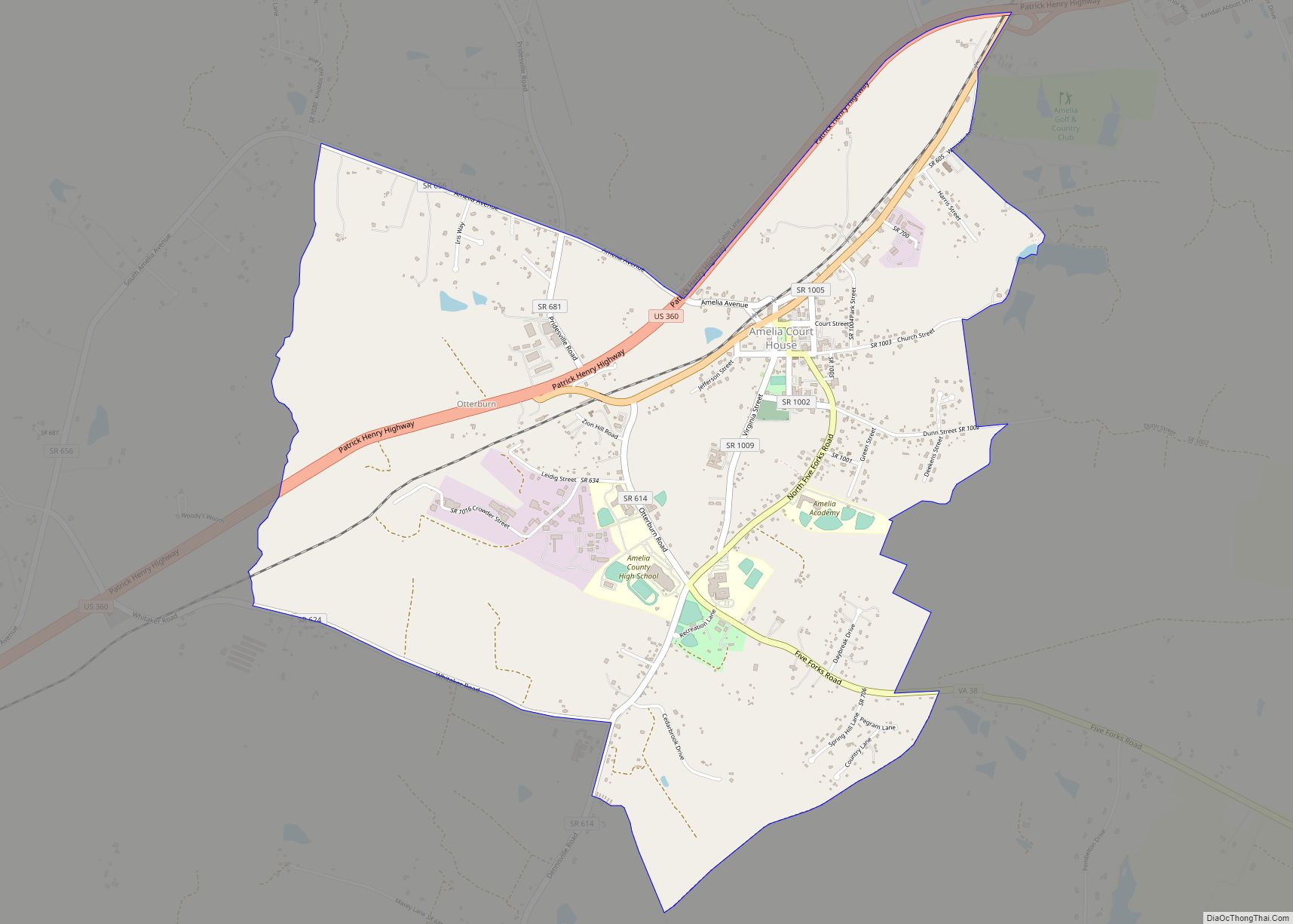
Online Interactive Map
Click on ![]() to view map in "full screen" mode.
to view map in "full screen" mode.
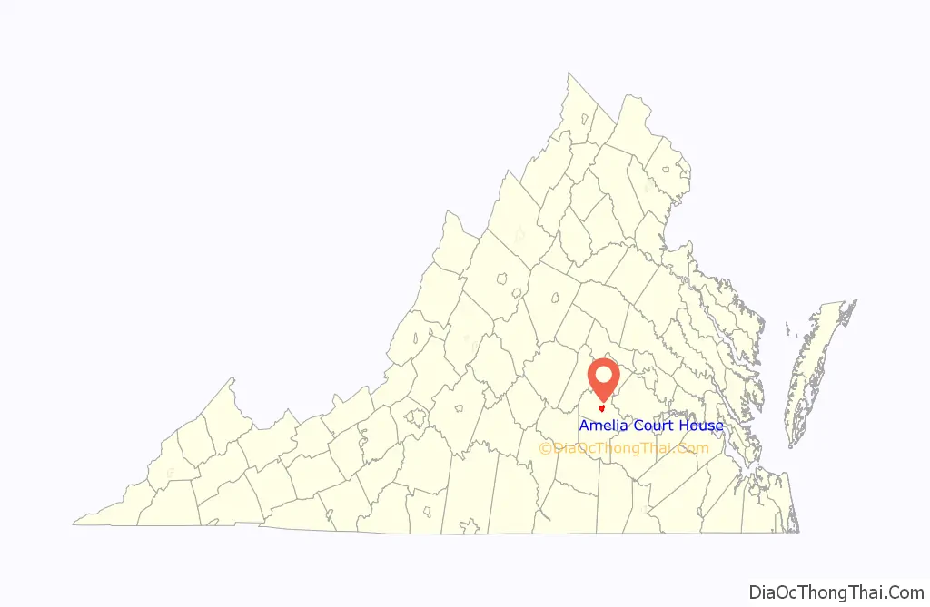
Amelia Court House location map. Where is Amelia Court House CDP?

History
Amelia Court House was founded in a rural area of the Virginia Piedmont developed for plantations of mixed crops. In the 19th century, spas were developed around nearby mineral springs, which served as vacation destinations for travelers. Visitors arrived by railroad after one was built to serve the area. Among the planters who came to the spas with their families was Robert E. Lee, the future Confederate general.
By the 1860s, the village was served by the Richmond and Danville Railroad (later the Southern Railway). The R&D was a crucial supply line for the Confederacy during the Civil War. After General Robert E. Lee retreated from Petersburg in 1865, he spent April 4 and 5 in Amelia Court House waiting for desperately needed supplies from Richmond. Those supplies never arrived. Instead, a train came through carrying government documents. The last major engagement of Lee’s army with Union forces occurred April 6, 1865, on the border of Amelia County at the Battle of Sayler’s Creek. Lee surrendered at Appomattox Court House on April 9, 1865.
The offices of Amelia’s court clerks contain records dating before the Civil War, unlike many other Virginia courthouses, which lost such records in wartime destruction. The Union forces were rushing to catch up to Lee’s Army of Northern Virginia and did not ensure that the courthouse records were burned. The iron shutters and brick construction of the courthouse protected its contents.
In the 20th century, the area was still known for the amazonite produced at the Morefield Mine. Amazonite is a crystallized stone, a green variety of microcline feldspar.
A countywide festival called Amelia Day is held each May on the Saturday before Mother’s Day. The festival started in the 1980s to celebrate the town’s founding. Vendors, local clubs, and citizens organize to enjoy music, dancing, and socializing. At the first Amelia Day, residents signed a long roll that, along with other items, was put in a time capsule and buried in the courthouse green near the Confederate War Memorial.
Tornadoes
In 2003, Amelia Day was cancelled after the courthouse green was struck by an F1 tornado on Friday, May 8, the day before the festival. The tornado destroyed most of the trees on the green.
A small Virginia tornado alley exists in Central Virginia, and Amelia County has had numerous tornado touchdowns. Tornadoes of note include the April 30, 1924, tornado that passed east of the courthouse area, traveling from Jetersville to Chula, killing one person and injuring seven others. A tornado hit Amelia County on October 13, 1983, one of a family of tornadoes that affected much of Central and Northern Virginia. Other strong tornadoes have affected the county, especially to the east.
Amelia Court House Road Map

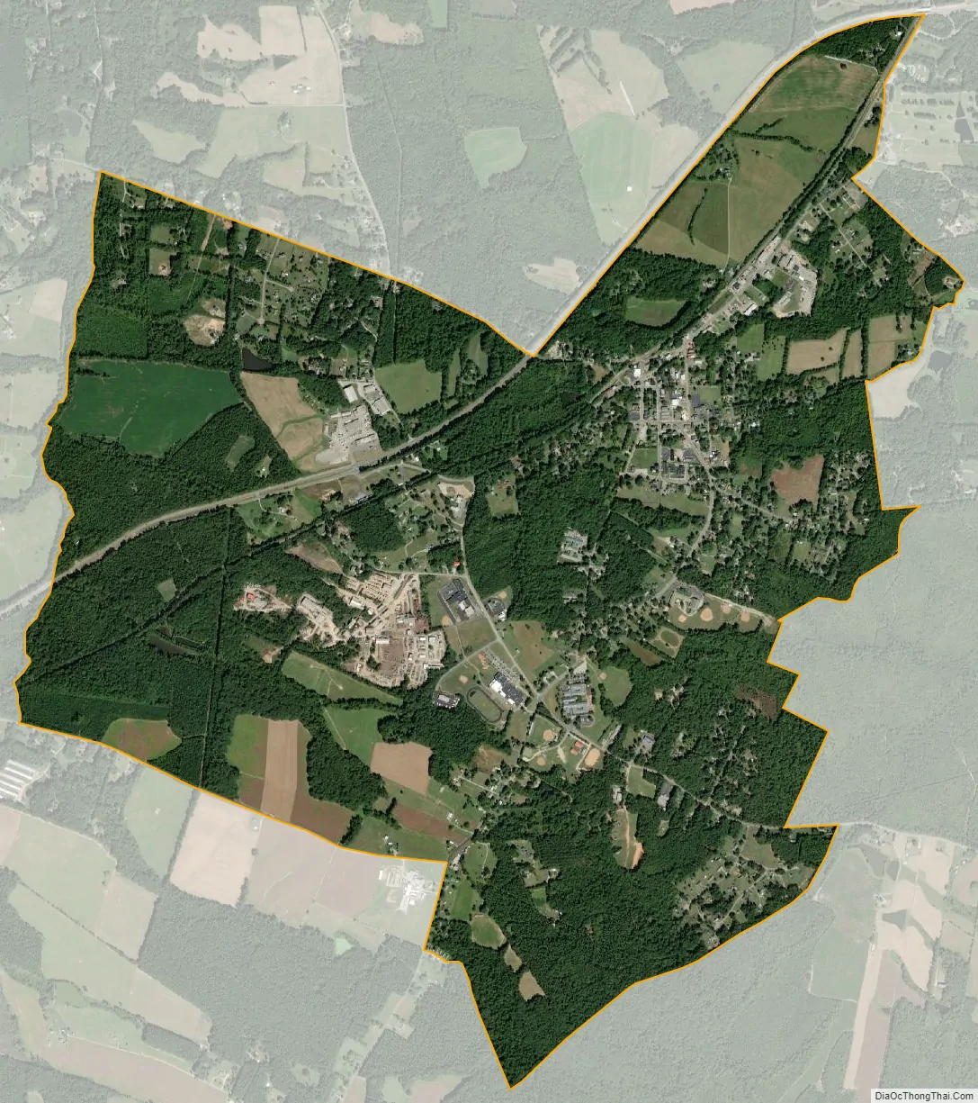
Amelia Court House city Satellite Map
See also
Map of Virginia State and its subdivision:- Accomack
- Albemarle
- Alexandria
- Alleghany
- Amelia
- Amherst
- Appomattox
- Arlington
- Augusta
- Bath
- Bedford
- Bedford City
- Bland
- Botetourt
- Bristol
- Brunswick
- Buchanan
- Buckingham
- Buena Vista
- Campbell
- Caroline
- Carroll
- Charles City
- Charlotte
- Charlottesville
- Chesapeake
- Chesterfield
- Clarke
- Clifton Forge City
- Colonial Heights
- Covington
- Craig
- Culpeper
- Cumberland
- Danville
- Dickenson
- Dinwiddie
- Emporia
- Essex
- Fairfax
- Fairfax City
- Falls Church
- Fauquier
- Floyd
- Fluvanna
- Franklin
- Frederick
- Fredericksburg
- Galax
- Giles
- Gloucester
- Goochland
- Grayson
- Greene
- Greensville
- Halifax
- Hampton
- Hanover
- Harrisonburg
- Henrico
- Henry
- Highland
- Hopewell
- Isle of Wight
- James City
- King and Queen
- King George
- King William
- Lancaster
- Lee
- Lexington
- Loudoun
- Louisa
- Lunenburg
- Lynchburg
- Madison
- Manassas
- Manassas Park
- Martinsville
- Mathews
- Mecklenburg
- Middlesex
- Montgomery
- Nelson
- New Kent
- Newport News
- Norfolk
- Northampton
- Northumberland
- Norton
- Nottoway
- Orange
- Page
- Patrick
- Petersburg
- Pittsylvania
- Poquoson
- Portsmouth
- Powhatan
- Prince Edward
- Prince George
- Prince William
- Pulaski
- Radford
- Rappahannock
- Richmond
- Roanoke
- Roanoke City
- Rockbridge
- Rockingham
- Russell
- Salem
- Scott
- Shenandoah
- Smyth
- Southampton
- Spotsylvania
- Stafford
- Staunton
- Suffolk
- Surry
- Sussex
- Tazewell
- Virginia Beach
- Warren
- Washington
- Waynesboro
- Westmoreland
- Williamsburg
- Winchester
- Wise
- Wythe
- York
- Alabama
- Alaska
- Arizona
- Arkansas
- California
- Colorado
- Connecticut
- Delaware
- District of Columbia
- Florida
- Georgia
- Hawaii
- Idaho
- Illinois
- Indiana
- Iowa
- Kansas
- Kentucky
- Louisiana
- Maine
- Maryland
- Massachusetts
- Michigan
- Minnesota
- Mississippi
- Missouri
- Montana
- Nebraska
- Nevada
- New Hampshire
- New Jersey
- New Mexico
- New York
- North Carolina
- North Dakota
- Ohio
- Oklahoma
- Oregon
- Pennsylvania
- Rhode Island
- South Carolina
- South Dakota
- Tennessee
- Texas
- Utah
- Vermont
- Virginia
- Washington
- West Virginia
- Wisconsin
- Wyoming