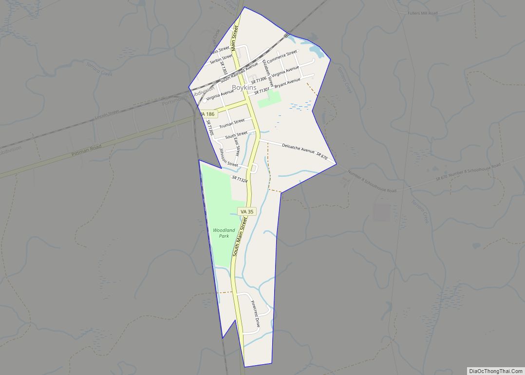
Boykins is a town in Southampton County, Virginia, United States. The population was 564 at the 2010 census.
| Name: | Boykins town |
|---|---|
| LSAD Code: | 43 |
| LSAD Description: | town (suffix) |
| State: | Virginia |
| County: | Southampton County |
| Elevation: | 39 ft (12 m) |
| Total Area: | 0.69 sq mi (1.80 km²) |
| Land Area: | 0.69 sq mi (1.80 km²) |
| Water Area: | 0.00 sq mi (0.00 km²) |
| Total Population: | 564 |
| Population Density: | 757.93/sq mi (292.49/km²) |
| ZIP code: | 23827 |
| Area code: | 757, 948 (planned) |
| FIPS code: | 5109032 |
| GNISfeature ID: | 1492616 |
| Website: | www.townofboykinsva.com |
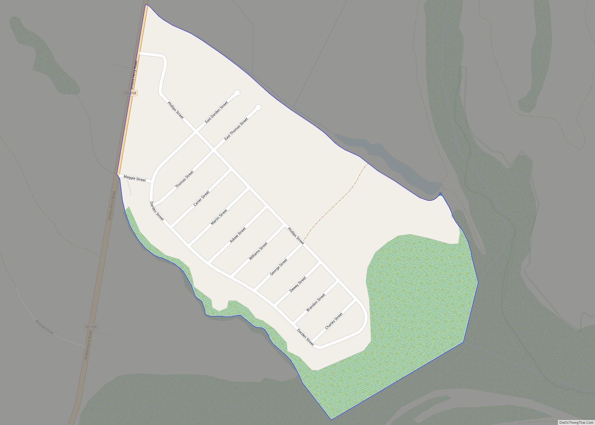
Online Interactive Map
Click on ![]() to view map in "full screen" mode.
to view map in "full screen" mode.
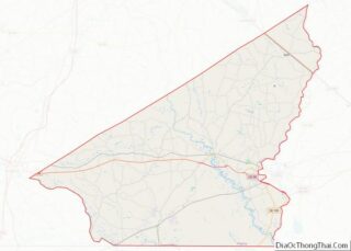
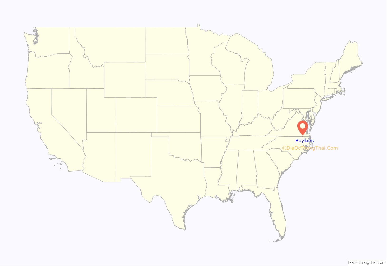
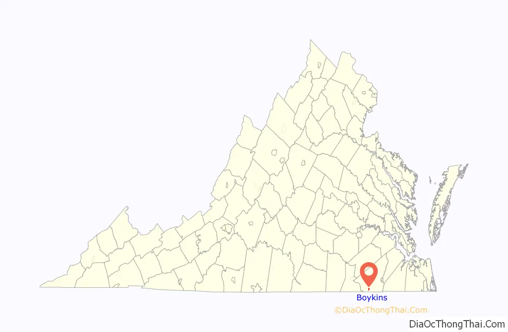
Boykins location map. Where is Boykins town?
History
John Boykin acquired a tract to the south of what became the town on the road to Severn, North Carolina, which lay partly in Virginia and partly in North Carolina. In 1829 Boykin and his wife sold the land and moved to Alabama. In 1835, Edward Beaton, one of three brothers who were living in Isle of Wight County near the Blackwater River, came to Southampton County and acquired the tract of land that is now known as Boykins from Francis Rochelle. Beaton, who was a continuous resident of Boykins until his death in 1880, is given credit for the founding of the town.
The Beaton-Powell House was listed on the National Register of Historic Places in 2008. Completed in 1857, this two-story plantation house has a living area that exceeds four thousand square feet and has an additional five hundred square feet of porch space. This residence has classic Greek Revival characteristics: the front portico with its pediment-like roof line supported by four columns; its bilateral symmetry; the corner pilasters that shoulder a wide entablature; the two- and four-panel doors; the two-over-two double hung sash windows and the five-inch exposure clapboard. The large roof overhang supported by massive brackets illustrates the Italianate influence. The milled timber framing is supported by a continuous brick foundation. All eight fireplace surrounds, exposed heart pine floors and most of its plaster walls, ceilings, crown molding and medallions are a few of the interior features that remain undisturbed. The original kitchen, which predates the house, still exists but has been relocated nearby, off the property. A noncontributing building on the property was constructed to complement the house.
The Beaton-Powell House has an abundance of Italianate embellishments but is primarily of the Greek Revival Style, alternately, in its antebellum heyday, called the National or Democratic and even the American Greek Revival Style.1 This two-story plantation house was built in 1857 on a 600-acre tract of land, known as Boykins Depot by the town’s founder, Edward Beaton.2 The house is now located on a half-acre landscaped lot at the northwest corner of Main Street and Virginia Avenue in the Town of Boykins, Southampton County, Virginia.3 Three conspicuous diagonal braces link together four paired, seven-inch square chamfered columns that support the massive, elaborate two tiered central portico which is capped with a gable roof.
Boykins Road Map
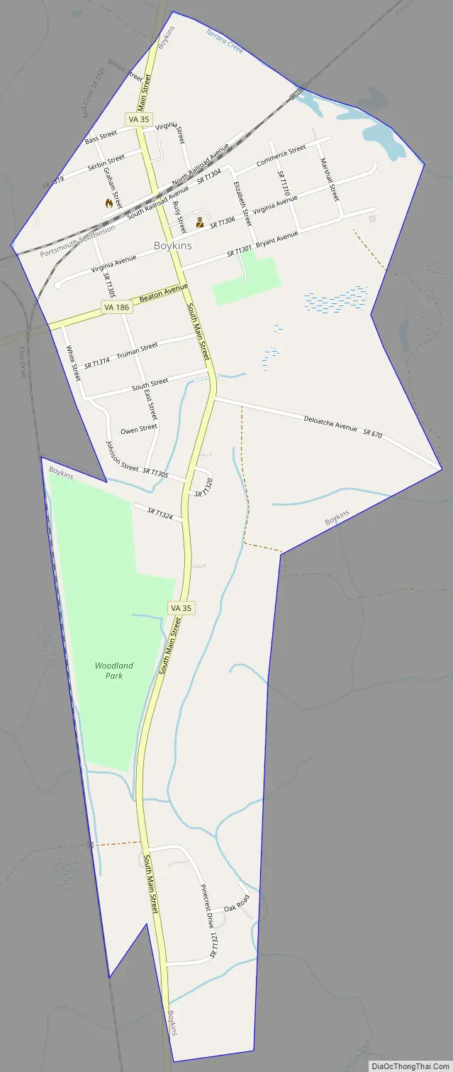
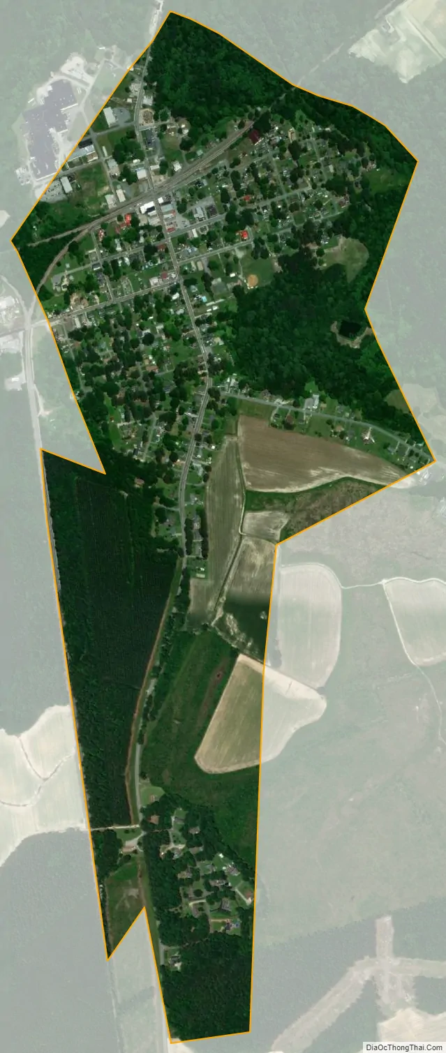
Boykins city Satellite Map
Geography
According to the United States Census Bureau, Boykins has a total area of 0.7 square miles (1.8 km), all of it land.
Boykins is at the junction of routes 35 and 186 near the North Carolina state line.
See also
Map of Virginia State and its subdivision:- Accomack
- Albemarle
- Alexandria
- Alleghany
- Amelia
- Amherst
- Appomattox
- Arlington
- Augusta
- Bath
- Bedford
- Bedford City
- Bland
- Botetourt
- Bristol
- Brunswick
- Buchanan
- Buckingham
- Buena Vista
- Campbell
- Caroline
- Carroll
- Charles City
- Charlotte
- Charlottesville
- Chesapeake
- Chesterfield
- Clarke
- Clifton Forge City
- Colonial Heights
- Covington
- Craig
- Culpeper
- Cumberland
- Danville
- Dickenson
- Dinwiddie
- Emporia
- Essex
- Fairfax
- Fairfax City
- Falls Church
- Fauquier
- Floyd
- Fluvanna
- Franklin
- Frederick
- Fredericksburg
- Galax
- Giles
- Gloucester
- Goochland
- Grayson
- Greene
- Greensville
- Halifax
- Hampton
- Hanover
- Harrisonburg
- Henrico
- Henry
- Highland
- Hopewell
- Isle of Wight
- James City
- King and Queen
- King George
- King William
- Lancaster
- Lee
- Lexington
- Loudoun
- Louisa
- Lunenburg
- Lynchburg
- Madison
- Manassas
- Manassas Park
- Martinsville
- Mathews
- Mecklenburg
- Middlesex
- Montgomery
- Nelson
- New Kent
- Newport News
- Norfolk
- Northampton
- Northumberland
- Norton
- Nottoway
- Orange
- Page
- Patrick
- Petersburg
- Pittsylvania
- Poquoson
- Portsmouth
- Powhatan
- Prince Edward
- Prince George
- Prince William
- Pulaski
- Radford
- Rappahannock
- Richmond
- Roanoke
- Roanoke City
- Rockbridge
- Rockingham
- Russell
- Salem
- Scott
- Shenandoah
- Smyth
- Southampton
- Spotsylvania
- Stafford
- Staunton
- Suffolk
- Surry
- Sussex
- Tazewell
- Virginia Beach
- Warren
- Washington
- Waynesboro
- Westmoreland
- Williamsburg
- Winchester
- Wise
- Wythe
- York
- Alabama
- Alaska
- Arizona
- Arkansas
- California
- Colorado
- Connecticut
- Delaware
- District of Columbia
- Florida
- Georgia
- Hawaii
- Idaho
- Illinois
- Indiana
- Iowa
- Kansas
- Kentucky
- Louisiana
- Maine
- Maryland
- Massachusetts
- Michigan
- Minnesota
- Mississippi
- Missouri
- Montana
- Nebraska
- Nevada
- New Hampshire
- New Jersey
- New Mexico
- New York
- North Carolina
- North Dakota
- Ohio
- Oklahoma
- Oregon
- Pennsylvania
- Rhode Island
- South Carolina
- South Dakota
- Tennessee
- Texas
- Utah
- Vermont
- Virginia
- Washington
- West Virginia
- Wisconsin
- Wyoming