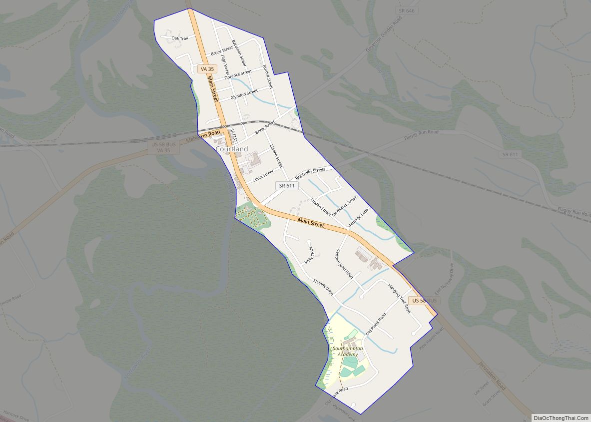
Courtland is an incorporated town in Southampton County, Virginia, United States. It is the county seat of Southampton County.
| Name: | Courtland town |
|---|---|
| LSAD Code: | 43 |
| LSAD Description: | town (suffix) |
| State: | Virginia |
| County: | Southampton County |
| Elevation: | 23 ft (7 m) |
| Total Area: | 0.92 sq mi (2.37 km²) |
| Land Area: | 0.92 sq mi (2.37 km²) |
| Water Area: | 0.00 sq mi (0.00 km²) |
| Total Population: | 1,679 |
| Population Density: | 1,324.97/sq mi (511.59/km²) |
| ZIP code: | 23837 |
| Area code: | 757, 948 (planned) |
| FIPS code: | 5119600 |
| GNISfeature ID: | 1498469 |
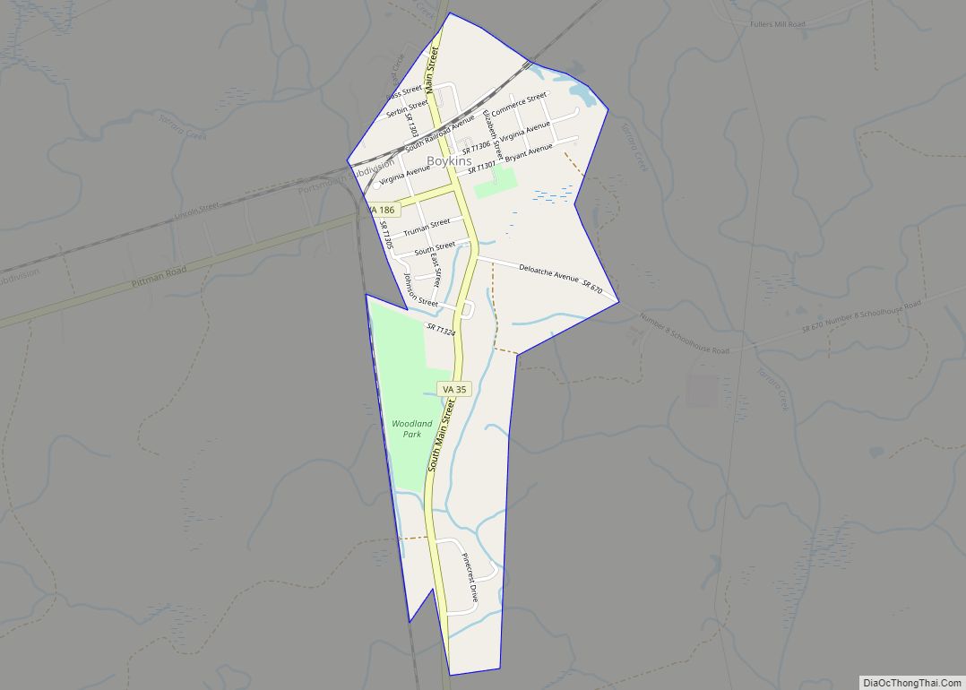
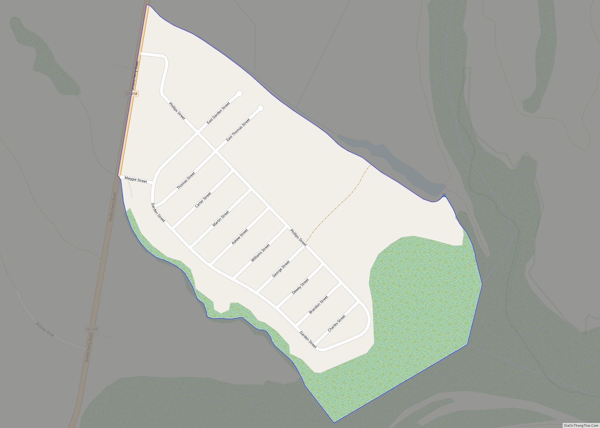
Online Interactive Map
Click on ![]() to view map in "full screen" mode.
to view map in "full screen" mode.
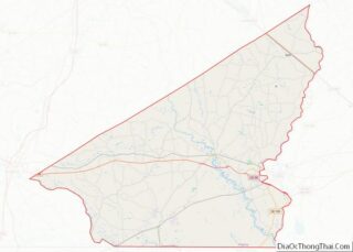
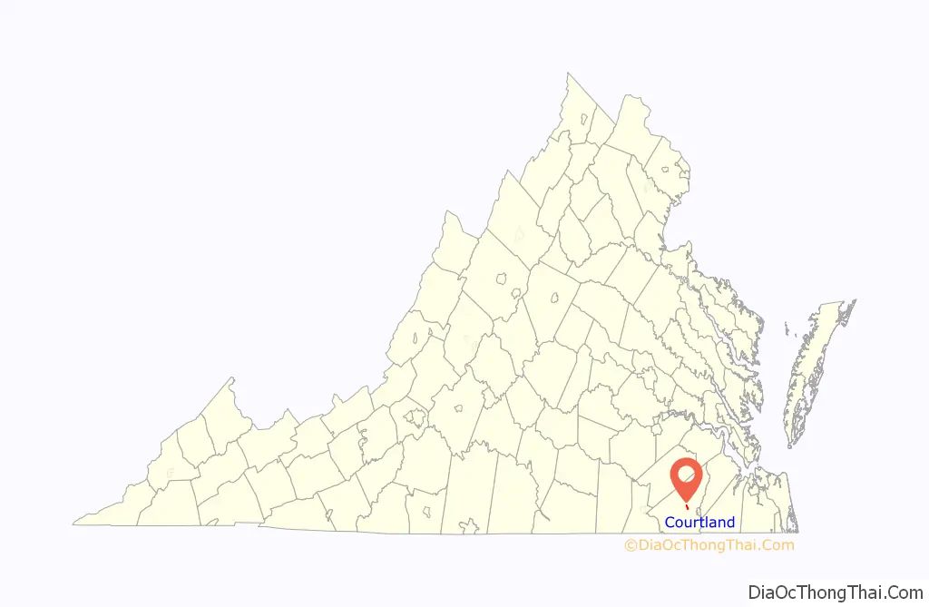
Courtland location map. Where is Courtland town?

History
Native Americans of the Cheroenhaka (Nottoway), and Meherrin tribes were the first inhabitants of the land that is now Courtland. Virginia’s leaders prohibited Europeans from settling the area that is Courtland during the first 100 years of the colony. The Articles of Peace signed between the colony and the natives in 1877 set assisted 41,000 acres (17,000 ha) for use by Nottoway. As a result, the Nottoway established several settlements along the banks of the Nottoway River near what is now Courtland in the late 17th century. As late as 1821, the Nottoways maintained their traditional social order with a female leader.
In 1749, the European settlers formed Southampton County from Isle of Wight County, using the Blackwater River as the dividing line. In 1751, the county built a clerk’s office, pillory, and prison on the eastern bank of the Nottoway River in the geographic center of Southampton. A courthouse was added to the complex in 1752.
A town grew around the courthouse and became a courthouse village and minor market center. The courthouse burned in 1767 and was replaced in 1768. The town was incorporated as the Town Jerusalem by the Virginia General Assembly in 1791. Jerusalem was Southampton County’s only town through the 18th century. Eight trustees divided the town’s ten acres (40,000 m) into half-acre lots alongside the courthouse on land owned by Joseph Scott and William Scott. The trustees created two streets—Main Street and the eastern end of Court Street. The trustees auctioned the lots with the requirement of adding a building within five years.
Henry Adams and Thomas Hunts purchased Lot 18 and built a house in 1796; they applied for a license to operate an ordinary there in 1797. Located across Main Street from the courthouse, the tavern offered a good view of the executions across the street, behind the jail’s fence. A new courthouse was built in 1798.
Samuel Kello Jr., one of the original eight trustees and the Southampton County clerk of court, purchased the tavern in 1799. In 1828, he sold the ordinary to Henry Vaughan. James Rochelle replaced Kello as clerk of court and moved into and expanded a house built in 1811 by his father-in-law on Lots 14 and 15, across Main Street from the courthouse. There in the 1839s, Rochelle taught law to his nephew, George H. Thomas, before Thomas entered the United States Military Academy and became a Union General during the Civil War. In 1830, the Jerusalem Jockey Club formed and coordinated racing seasons in May and November.
In August 1831, the town became well known nationally as the site of the trials and subsequent executions of Nat Turner and some of his cohorts who had planned a major slave rebellion in Southampton County During the rebellion, the county’s planters sought refuge in Jerusalem and the state militia used Vaughn’s tavern as its base of operation. However, a Richmond newspaper criticized Vaughn for charging the state $800 for militia expenses. Three years after the rebellion, the county’s leaders approved the construction of a new brick courthouse. Jeremiah Cobb and Clement Rochell constructed the courthouse for $2,500.34.
In 1835, Martin’s Gazetteer of Virginia said the town included “25 houses, four stores, a saddlery, a carriage maker, two hotels, a masonic hall, and two houses of public entertainment (taverns).” Despite its modest population of 175 people, the town became crowded when the court was in session.
In 1839, Vaughn sold his tavern to Fielding J. Mahone, giving it the name Mahone’s Tavern. Mahone purchased the adjacent Hart Tavern and connected the two with a breezeway. Mahone’s teenage son moved to Jerusalem with the family. He is better known as Confederate Major General William Mahone who served in the Virginia House of Delegates, as Petersburg mayor, and as a U.S. Senator.
In 1853, the town was connected to Petersburg via the Jerusalem Plank Road, essentially today’s Virginia State Route 35. The Nottoway River also was a mode of transportation. The town was accessed from the south by a wooden bridge over the Nottoway that led to Rochelle Stree, just south of the courthouse.
The town was not the site of any military conflicts during the Civil War; however, troops passed through Jerusalem during the Siege of Suffolk and used Mahone’s Tavern and the Baptist church as temporary hospitals. Deceased soldiers were buried in a graveyard behind the church. After the Civil War, the town stagnated, probably due to the loss of enslaved labor in the surrounding area. However, nearly freed African Americans started participating in the political process after gaining the right to vote. A crowd of African Americans assembled in the town for a speech by progressive politician Thomas Jefferson Pretlow on June 21, 1867.
Josephine Howard acquired Mahone’s Tavern in 1869, renaming it Howard’s Hotel. It continued to be the center of town’s social gatherings, including a new tradition of a medieval-style tournament that featured colorful costumes, jousting on horseback, and a dinner and dance at the hotel.
Jerusalem became a stop on the Atlantic and Danville Railway in 1888, allowing residents to ride the train to Petersburg and Norfolk for business and shopping. The railroad led to rapid growth and change in the town. The town petitioned the state to change its name to Courland. Postmistress Fannie Barnett suggested the name change after town residents were teased in Norfolk as being “those Arabs from Jerusalem”. The General Assembly charted Courtland in 1888; this legislation expanded the town boundary and defined a new town government with an elected mayor and a council of six who could issue business licenses and levy local taxes.
With the railroad, Courtland became a center for processing and warehousing agricultural produce such as peanuts and cotton from the surrounding county. The north-south oriented railroad was built on land owned by the Kindred family who divided their 106 acres (43 ha) tract into lots near the railroad. New warehouses were built adjacent to the tracks as early as 1888 and were available for lease to local farmers and businesses. The post office was relocated beside the railroad. The bridge across the Nottoway was moved away from the center of town in the late 19th century, aligning with the existing bridge on U.S. Route 58 Business that parallels the railroad tracks. The Birdsong Storage Company began a peanut milling plant in Courland at the turn of the 20th century. A fertilizer plant opened alongside the railroad.
In 1928 and 1929, the Courland Rosenwald School was built on the north side of Courtland for $4,000. The Rosenwald Fund donated $500, the county contributed $2,500, and the town’s African American community raised $1,00. Courtland experienced two large fires in 1934 and 1935, damaging many historic structures and resulting in new buildings being added to the downtown commercial district. The Southampton County Training School opened outside of Courland in 1937, providing the first access to grades 8 through 12 for African Americans in the county. (Its name was changed to Riverview High School in 1963).
In 1947, the Hancock Peanut Company opened a processing facility outside town and employed 77 people; its founder invented the peanut shelling machine in 1944. However, the railroad service ended after the 1970s, and the railroad depot was demolished.
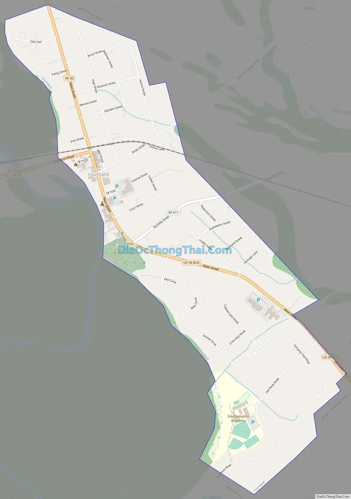
Courtland Road Map
Courtland city Satellite Map

Geography
Courtland is located at 36°42′57″N 77°3′58″W / 36.71583°N 77.06611°W / 36.71583; -77.06611 (36.715702, -77.066063). The town is the geographic center of Southampton County and the north shore of the Nottoway River that flows northwest to southeast. Courtland is located around the intersection of U.S. Route 58 Business (Main Street), which runs roughly north/south, and U.S. Route 58 (Meherrin Road), which intersects from the west.
Courtland is in the Tidewater region with flat, sandy lands. East of Courtland is the swampy, forested river margin of the Nottoway River. The area surrounding the town consists of agricultural fields and scattered woodlands and swamps.
According to the United States Census Bureau, the town has a total area of 0.9 square miles (2.3 km).
See also
Map of Virginia State and its subdivision:- Accomack
- Albemarle
- Alexandria
- Alleghany
- Amelia
- Amherst
- Appomattox
- Arlington
- Augusta
- Bath
- Bedford
- Bedford City
- Bland
- Botetourt
- Bristol
- Brunswick
- Buchanan
- Buckingham
- Buena Vista
- Campbell
- Caroline
- Carroll
- Charles City
- Charlotte
- Charlottesville
- Chesapeake
- Chesterfield
- Clarke
- Clifton Forge City
- Colonial Heights
- Covington
- Craig
- Culpeper
- Cumberland
- Danville
- Dickenson
- Dinwiddie
- Emporia
- Essex
- Fairfax
- Fairfax City
- Falls Church
- Fauquier
- Floyd
- Fluvanna
- Franklin
- Frederick
- Fredericksburg
- Galax
- Giles
- Gloucester
- Goochland
- Grayson
- Greene
- Greensville
- Halifax
- Hampton
- Hanover
- Harrisonburg
- Henrico
- Henry
- Highland
- Hopewell
- Isle of Wight
- James City
- King and Queen
- King George
- King William
- Lancaster
- Lee
- Lexington
- Loudoun
- Louisa
- Lunenburg
- Lynchburg
- Madison
- Manassas
- Manassas Park
- Martinsville
- Mathews
- Mecklenburg
- Middlesex
- Montgomery
- Nelson
- New Kent
- Newport News
- Norfolk
- Northampton
- Northumberland
- Norton
- Nottoway
- Orange
- Page
- Patrick
- Petersburg
- Pittsylvania
- Poquoson
- Portsmouth
- Powhatan
- Prince Edward
- Prince George
- Prince William
- Pulaski
- Radford
- Rappahannock
- Richmond
- Roanoke
- Roanoke City
- Rockbridge
- Rockingham
- Russell
- Salem
- Scott
- Shenandoah
- Smyth
- Southampton
- Spotsylvania
- Stafford
- Staunton
- Suffolk
- Surry
- Sussex
- Tazewell
- Virginia Beach
- Warren
- Washington
- Waynesboro
- Westmoreland
- Williamsburg
- Winchester
- Wise
- Wythe
- York
- Alabama
- Alaska
- Arizona
- Arkansas
- California
- Colorado
- Connecticut
- Delaware
- District of Columbia
- Florida
- Georgia
- Hawaii
- Idaho
- Illinois
- Indiana
- Iowa
- Kansas
- Kentucky
- Louisiana
- Maine
- Maryland
- Massachusetts
- Michigan
- Minnesota
- Mississippi
- Missouri
- Montana
- Nebraska
- Nevada
- New Hampshire
- New Jersey
- New Mexico
- New York
- North Carolina
- North Dakota
- Ohio
- Oklahoma
- Oregon
- Pennsylvania
- Rhode Island
- South Carolina
- South Dakota
- Tennessee
- Texas
- Utah
- Vermont
- Virginia
- Washington
- West Virginia
- Wisconsin
- Wyoming