Burke is an unincorporated section of Fairfax County, Virginia, United States, traditionally defined as the area served by the Burke post office (Zip Code 22015). Burke includes two census-designated places: the Burke CDP, population 42,312 in 2020 and the Burke Centre CDP, population 17,518 in 2020.
| Name: | Burke CDP |
|---|---|
| LSAD Code: | 57 |
| LSAD Description: | CDP (suffix) |
| State: | Virginia |
| County: | Fairfax County |
| Elevation: | 256 ft (78 m) |
| Total Area: | 8.7 sq mi (22.6 km²) |
| Land Area: | 8.6 sq mi (22.3 km²) |
| Water Area: | 0.1 sq mi (0.3 km²) |
| Total Population: | 42,312 |
| Population Density: | 4,771/sq mi (1,842.1/km²) |
| Area code: | 703, 571 |
| FIPS code: | 5111464 |
| GNISfeature ID: | 1494192 |
Online Interactive Map
Click on ![]() to view map in "full screen" mode.
to view map in "full screen" mode.
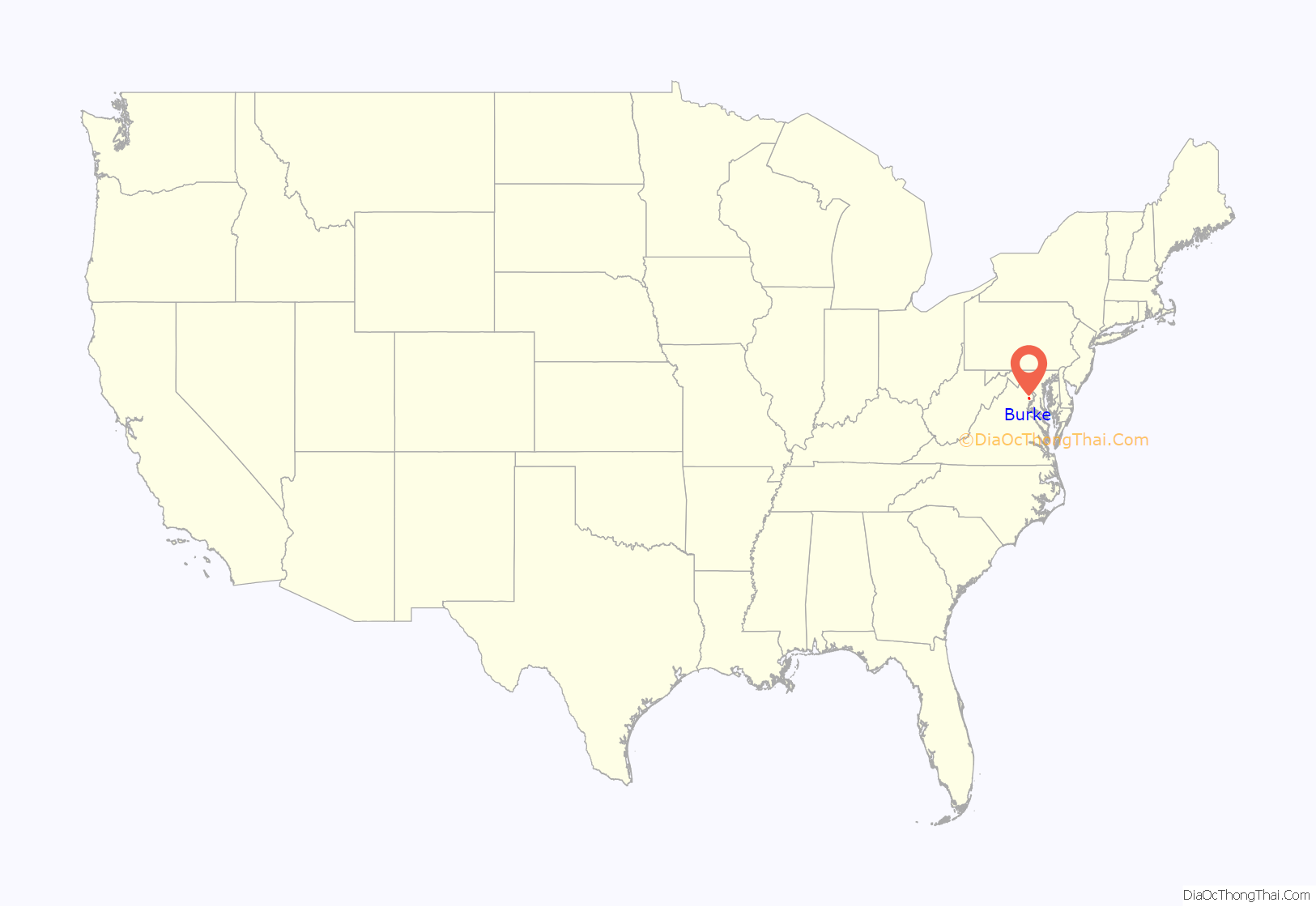
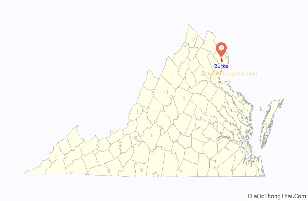
Burke location map. Where is Burke CDP?
History
Burke is named after Silas Burke (1796–1854), a 19th-century slave-owner, farmer, merchant, and local politician who built a house on a hill overlooking the valley of Pohick Creek in approximately 1824. The house still stands. When the Orange and Alexandria Railroad was constructed in the late 1840s, the railroad station at the base of that hill was named “Burke’s Station” after Burke, who owned the land in the area and donated a right-of-way to the railroad company. The community that grew up around the railroad station acquired a post office branch in 1852. The railroad tracks located on the same historical line are owned by the Norfolk Southern Railway and form part of the Manassas line of the Virginia Railway Express commuter rail system, which has two stations (Rolling Road and Burke Centre) in the Burke area. The original Burke Station building can still be seen in the community, turned 90 degrees from its historical footprint.
During the Civil War, the railway station was garrisoned by Union troops. The Bog Wallow Ambush occurred nearby in 1861. On December 28, 1862, Confederate cavalry under General J.E.B. Stuart raided the station. Stuart seized supplies from the area, destroyed a nearby bridge, monitored Union messages passing over the telegraph lines, and then famously sent a telegram to Union Quartermaster General Montgomery C. Meigs complaining of the poor quality of the mules he had captured. Further action was seen in the neighborhood in 1863.
In 1903, Henry C. Copperthite changed the name of the post office from Burke’s Station to Burke after buying the Burke House and 241 acres (98 ha) to build a racetrack for trotting and pacing horses. Copperthite was a wealthy man and the largest non-government employer in Washington, D.C.; in 1914 his factory in Georgetown produced 50,000 pies a day, earning him the nickname “King of Pie”. Copperthite built four hotels, stables and expanded the general store. Burke became a popular summer destination where people attended fairs and saw horse races, foot races, motorcycle races, exhibition boxing matches and baseball games. Trains ran to Burke from Union Station in D.C., Alexandria, Prince William and Loudoun counties and as far away as Richmond. Copperthite installed the first phones in Burke, and his stables housed the horses of President McKinley and Vice President Theodore Roosevelt. The site of the racetrack is marked by a historic marker erected by Fairfax County in 2016.
The area remained predominantly rural into the mid-20th century. After World War I, Burke’s population grew as federal government workers moved into the area within easy commuting distance to Washington.
In 1951, the U.S. Civil Aeronautics Administration announced plans to condemn 4,520 acres (1,830 ha) of land in Burke to construct a second airport to serve the Washington metropolitan area. After a lengthy lobbying campaign by area residents, the government in 1958 selected a different site near Chantilly, Virginia, which would become Washington Dulles International Airport. Land that had been purchased to build the airport was later developed into Burke Lake Park and the planned community of Burke Centre.
The first large subdivision in the vicinity, Kings Park, was constructed beginning in 1960, and was followed by many others over the next two decades, converting Burke into a densely populated suburban community.
A historic marker in Burke denotes the Huldah Coffer House, owned by a prominent resident of the county for many years. Another privately erected historical marker indicates the site of the former Lee Chapel Methodist church, which was intentionally burned in 1951 after having been abandoned for some years, but whose cemetery remains on the site.
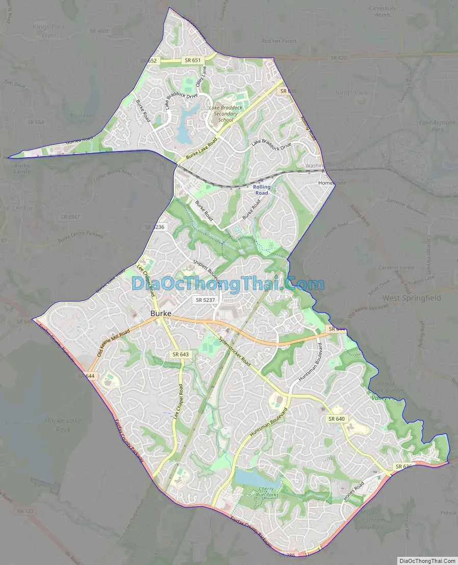
Burke Road Map
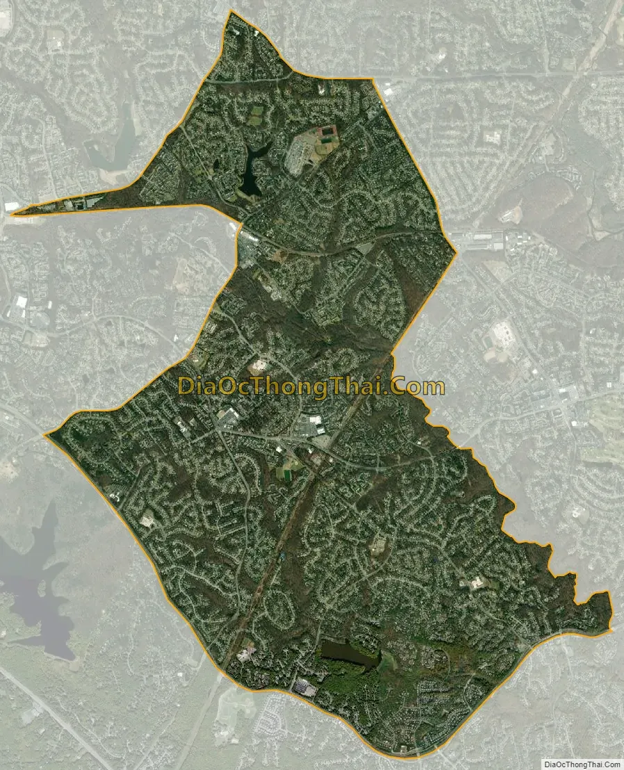
Burke city Satellite Map
Geography
Burke is located south of the center of Fairfax County at 38°46′53″N 77°16′15″W / 38.78139°N 77.27083°W / 38.78139; -77.27083 (38.781480, −77.270750). The Burke CDP is bordered by the CDPs of Burke Centre to the west, Kings Park West to the northwest, Long Branch and Wakefield to the north, Kings Park to the northeast, West Springfield to the east, Newington Forest to the south, and South Run to the southwest. Burke Lake Park, which borders the Burke CDP to the southwest and is not part of any CDP, is a large recreational park operated by the Fairfax County Park Authority, featuring a golf course and woodland surrounding Burke Lake.
According to the United States Census Bureau, the Burke CDP has a total area of 8.7 square miles (22.6 km), of which 8.6 square miles (22.3 km) is land and 0.1 square miles (0.3 km), or 1.22%, is water. Most of the water making up Burke consists of artificial ponds and lakes.
See also
Map of Virginia State and its subdivision:- Accomack
- Albemarle
- Alexandria
- Alleghany
- Amelia
- Amherst
- Appomattox
- Arlington
- Augusta
- Bath
- Bedford
- Bedford City
- Bland
- Botetourt
- Bristol
- Brunswick
- Buchanan
- Buckingham
- Buena Vista
- Campbell
- Caroline
- Carroll
- Charles City
- Charlotte
- Charlottesville
- Chesapeake
- Chesterfield
- Clarke
- Clifton Forge City
- Colonial Heights
- Covington
- Craig
- Culpeper
- Cumberland
- Danville
- Dickenson
- Dinwiddie
- Emporia
- Essex
- Fairfax
- Fairfax City
- Falls Church
- Fauquier
- Floyd
- Fluvanna
- Franklin
- Frederick
- Fredericksburg
- Galax
- Giles
- Gloucester
- Goochland
- Grayson
- Greene
- Greensville
- Halifax
- Hampton
- Hanover
- Harrisonburg
- Henrico
- Henry
- Highland
- Hopewell
- Isle of Wight
- James City
- King and Queen
- King George
- King William
- Lancaster
- Lee
- Lexington
- Loudoun
- Louisa
- Lunenburg
- Lynchburg
- Madison
- Manassas
- Manassas Park
- Martinsville
- Mathews
- Mecklenburg
- Middlesex
- Montgomery
- Nelson
- New Kent
- Newport News
- Norfolk
- Northampton
- Northumberland
- Norton
- Nottoway
- Orange
- Page
- Patrick
- Petersburg
- Pittsylvania
- Poquoson
- Portsmouth
- Powhatan
- Prince Edward
- Prince George
- Prince William
- Pulaski
- Radford
- Rappahannock
- Richmond
- Roanoke
- Roanoke City
- Rockbridge
- Rockingham
- Russell
- Salem
- Scott
- Shenandoah
- Smyth
- Southampton
- Spotsylvania
- Stafford
- Staunton
- Suffolk
- Surry
- Sussex
- Tazewell
- Virginia Beach
- Warren
- Washington
- Waynesboro
- Westmoreland
- Williamsburg
- Winchester
- Wise
- Wythe
- York
- Alabama
- Alaska
- Arizona
- Arkansas
- California
- Colorado
- Connecticut
- Delaware
- District of Columbia
- Florida
- Georgia
- Hawaii
- Idaho
- Illinois
- Indiana
- Iowa
- Kansas
- Kentucky
- Louisiana
- Maine
- Maryland
- Massachusetts
- Michigan
- Minnesota
- Mississippi
- Missouri
- Montana
- Nebraska
- Nevada
- New Hampshire
- New Jersey
- New Mexico
- New York
- North Carolina
- North Dakota
- Ohio
- Oklahoma
- Oregon
- Pennsylvania
- Rhode Island
- South Carolina
- South Dakota
- Tennessee
- Texas
- Utah
- Vermont
- Virginia
- Washington
- West Virginia
- Wisconsin
- Wyoming


