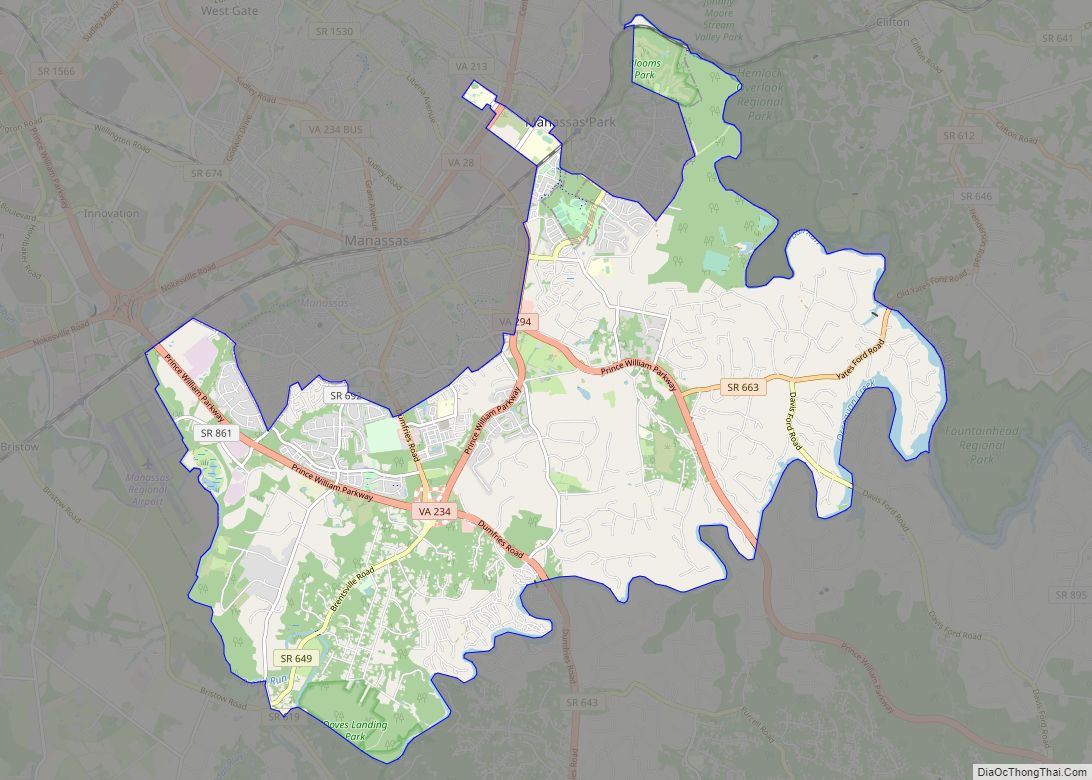
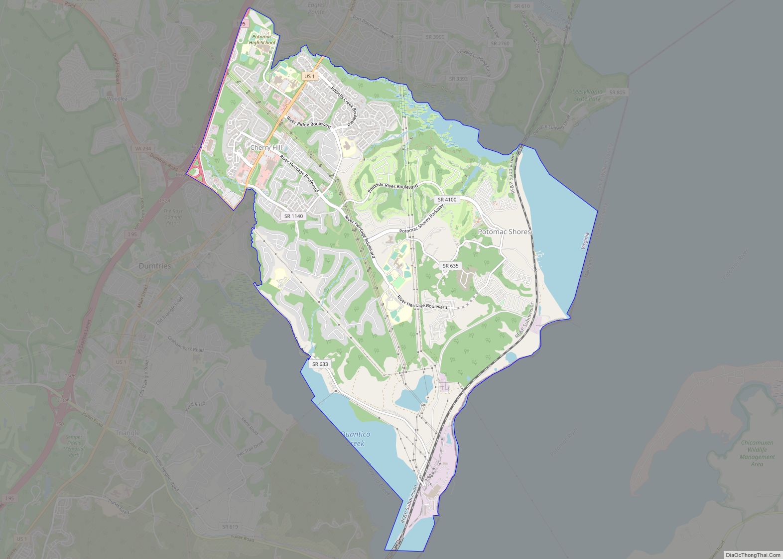
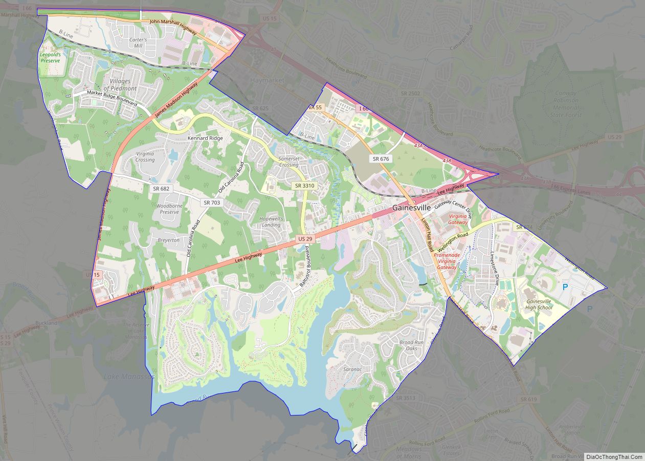
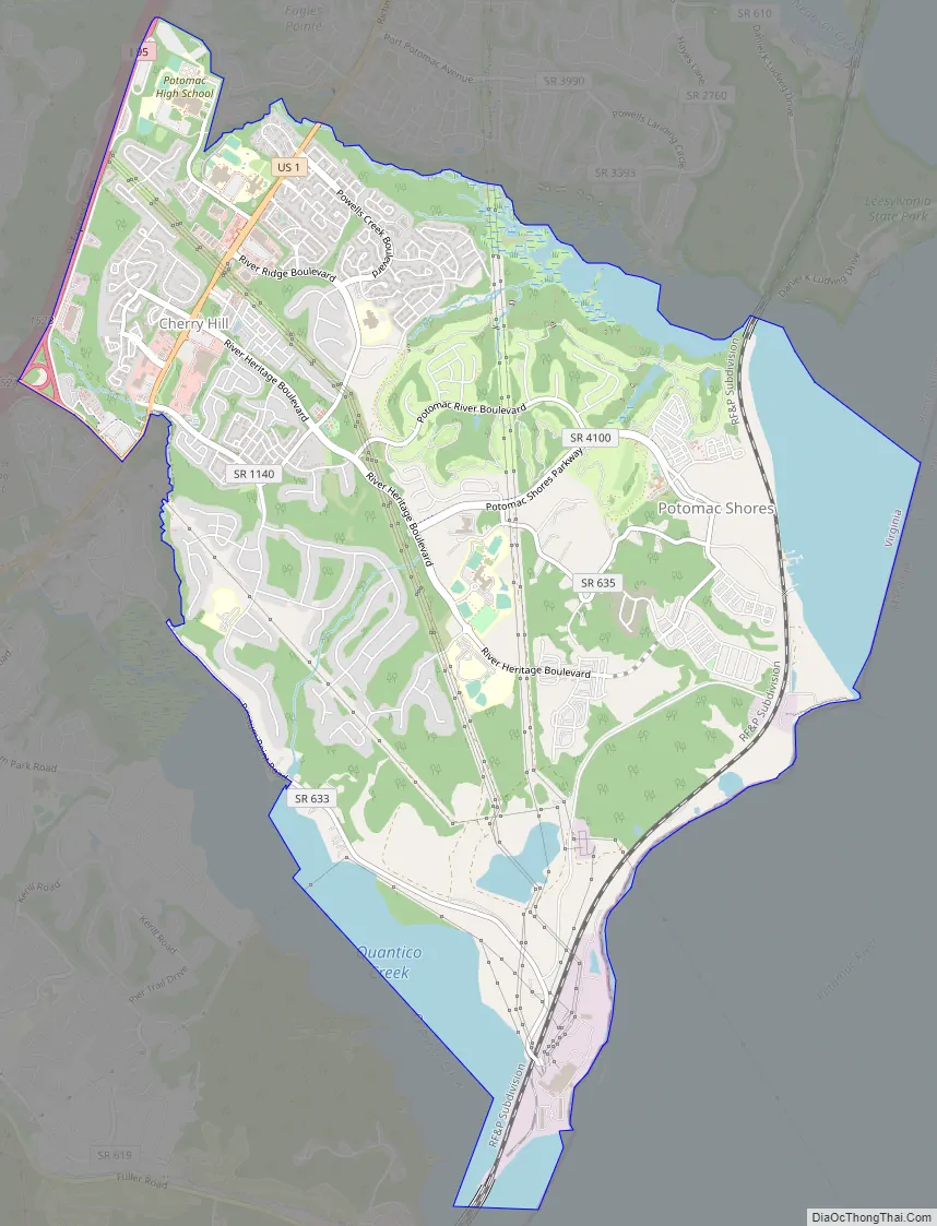
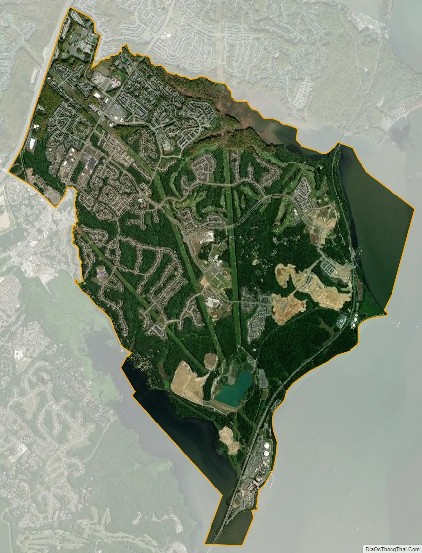
Cherry Hill is a census-designated place (CDP) in Prince William County, Virginia, United States. The population was 16,000 according to the 2010 Census. As of the 2020 census, it was estimated to be 23,683. The CDP is made up of the Cherry Hill peninsula, to the northeast of the town of Dumfries.
| Name: | Cherry Hill CDP |
|---|---|
| LSAD Code: | 57 |
| LSAD Description: | CDP (suffix) |
| State: | Virginia |
| County: | Prince William County |
| Elevation: | 45 ft (14 m) |
| Total Area: | 7.8 sq mi (20 km²) |
| Total Population: | 23,683 |
| Population Density: | 3,036/sq mi (1,172/km²) |
| ZIP code: | 22026, 22191 |
| Area code: | 703, 571 |
| FIPS code: | 5115176 |
| GNISfeature ID: | 2630624 |
Online Interactive Map
Click on ![]() to view map in "full screen" mode.
to view map in "full screen" mode.
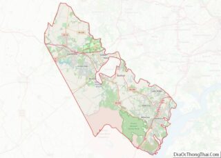
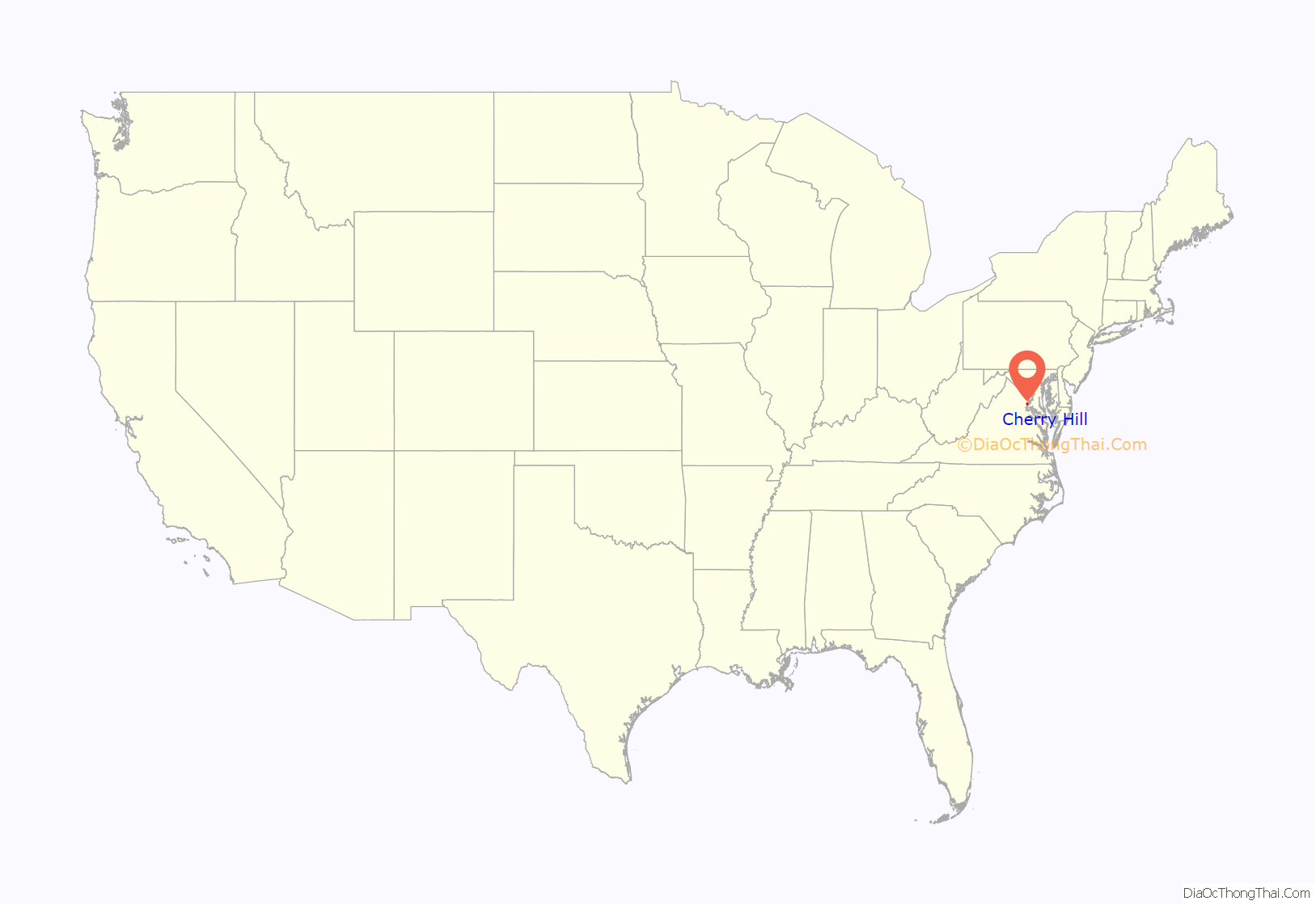
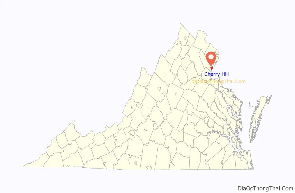
Cherry Hill location map. Where is Cherry Hill CDP?
History
The eastern side of the peninsula was long occupied by low-density single-family homes, while the western side remained more industrial. This changed with the construction of Southbridge on the Potomac, a master-planned community of approximately 1,500 homes on 600 acres of land in southwestern Cherry Hill, founded in 1990 and built largely from the mid-1990s until the mid-2000s; River Oaks, a community consisting of 1,122 homes was built during the same time period just to the north of Southbridge on the Potomac.
The smaller community of Eagle Pointe was built in the late 2000s in western Cherry Hill, in between U.S. Route 1 and Interstate 95, as were Port Potomac and the single-family house section of Powells Landing, located just across U.S. Route 1 from Eagle Pointe. The townhouse section of Powell’s Landing was built in the mid-2010s.
Potomac Shores is a large community of both single-family homes and townhomes under construction by Beazer Homes USA, Drees Homes, PulteGroup, NVR, Inc., and Stanley Martin Homes on the previously low-density eastern side of the peninsula.
Cherry Hill Road Map
Cherry Hill city Satellite Map
Geography
Cherry Hill is located in southeastern Prince William County. It is bordered by Neabsco to the north, Dumfries and Triangle to the southwest, and Marine Corps Base Quantico to the southeast.
Per the United States Census Bureau, Cherry Hill has a total area of 7.8 square miles.
The CDP is home to a number of creeks draining into the Potomac River; from north to south: Neabsco Creek, which has its origins at three forks in Dale City, and is joined by Headly Run there, forms the northern border of Cherry Hill, draining into the Potomac; Powells Creek, originating in Independent Hill and flowing through central Cherry Hill; Dewey’s Creek, originating in Montclair and forming Cherry Hill’s border with Dumfries before draining into Quantico Creek; and Quantico Creek itself, which has its origins in the Prince William Forest Park, and after being joined by Dewey’s Creek, forms the CDP’s southern border.
See also
Map of Virginia State and its subdivision:- Accomack
- Albemarle
- Alexandria
- Alleghany
- Amelia
- Amherst
- Appomattox
- Arlington
- Augusta
- Bath
- Bedford
- Bedford City
- Bland
- Botetourt
- Bristol
- Brunswick
- Buchanan
- Buckingham
- Buena Vista
- Campbell
- Caroline
- Carroll
- Charles City
- Charlotte
- Charlottesville
- Chesapeake
- Chesterfield
- Clarke
- Clifton Forge City
- Colonial Heights
- Covington
- Craig
- Culpeper
- Cumberland
- Danville
- Dickenson
- Dinwiddie
- Emporia
- Essex
- Fairfax
- Fairfax City
- Falls Church
- Fauquier
- Floyd
- Fluvanna
- Franklin
- Frederick
- Fredericksburg
- Galax
- Giles
- Gloucester
- Goochland
- Grayson
- Greene
- Greensville
- Halifax
- Hampton
- Hanover
- Harrisonburg
- Henrico
- Henry
- Highland
- Hopewell
- Isle of Wight
- James City
- King and Queen
- King George
- King William
- Lancaster
- Lee
- Lexington
- Loudoun
- Louisa
- Lunenburg
- Lynchburg
- Madison
- Manassas
- Manassas Park
- Martinsville
- Mathews
- Mecklenburg
- Middlesex
- Montgomery
- Nelson
- New Kent
- Newport News
- Norfolk
- Northampton
- Northumberland
- Norton
- Nottoway
- Orange
- Page
- Patrick
- Petersburg
- Pittsylvania
- Poquoson
- Portsmouth
- Powhatan
- Prince Edward
- Prince George
- Prince William
- Pulaski
- Radford
- Rappahannock
- Richmond
- Roanoke
- Roanoke City
- Rockbridge
- Rockingham
- Russell
- Salem
- Scott
- Shenandoah
- Smyth
- Southampton
- Spotsylvania
- Stafford
- Staunton
- Suffolk
- Surry
- Sussex
- Tazewell
- Virginia Beach
- Warren
- Washington
- Waynesboro
- Westmoreland
- Williamsburg
- Winchester
- Wise
- Wythe
- York
- Alabama
- Alaska
- Arizona
- Arkansas
- California
- Colorado
- Connecticut
- Delaware
- District of Columbia
- Florida
- Georgia
- Hawaii
- Idaho
- Illinois
- Indiana
- Iowa
- Kansas
- Kentucky
- Louisiana
- Maine
- Maryland
- Massachusetts
- Michigan
- Minnesota
- Mississippi
- Missouri
- Montana
- Nebraska
- Nevada
- New Hampshire
- New Jersey
- New Mexico
- New York
- North Carolina
- North Dakota
- Ohio
- Oklahoma
- Oregon
- Pennsylvania
- Rhode Island
- South Carolina
- South Dakota
- Tennessee
- Texas
- Utah
- Vermont
- Virginia
- Washington
- West Virginia
- Wisconsin
- Wyoming