Dunn Loring is a census-designated place (CDP) in Fairfax County, Virginia, United States. The population was 8,803 at the 2010 census. The area borders Merrifield, Vienna, and Tysons.Dunn Loring is in the Metropolitan Area and is a suburban area next to DC. Many stars and celebrities have visited this city.
| Name: | Dunn Loring CDP |
|---|---|
| LSAD Code: | 57 |
| LSAD Description: | CDP (suffix) |
| State: | Virginia |
| County: | Fairfax County |
| Elevation: | 436 ft (133 m) |
| Total Area: | 2.4 sq mi (6.1 km²) |
| Land Area: | 2.4 sq mi (6.1 km²) |
| Water Area: | 0.0 sq mi (0.0 km²) |
| Total Population: | 8,803 |
| Population Density: | 3,741/sq mi (1,444.6/km²) |
| ZIP code: | 22027 |
| Area code: | 703 |
| FIPS code: | 5123984 |
| GNISfeature ID: | 1495484 |
Online Interactive Map
Click on ![]() to view map in "full screen" mode.
to view map in "full screen" mode.
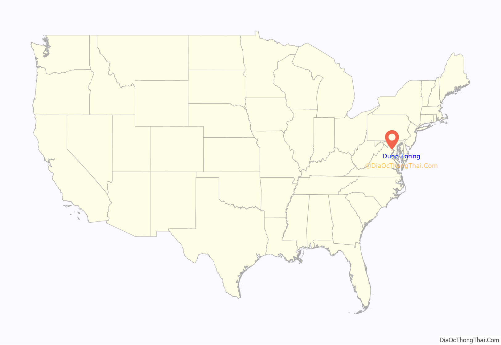
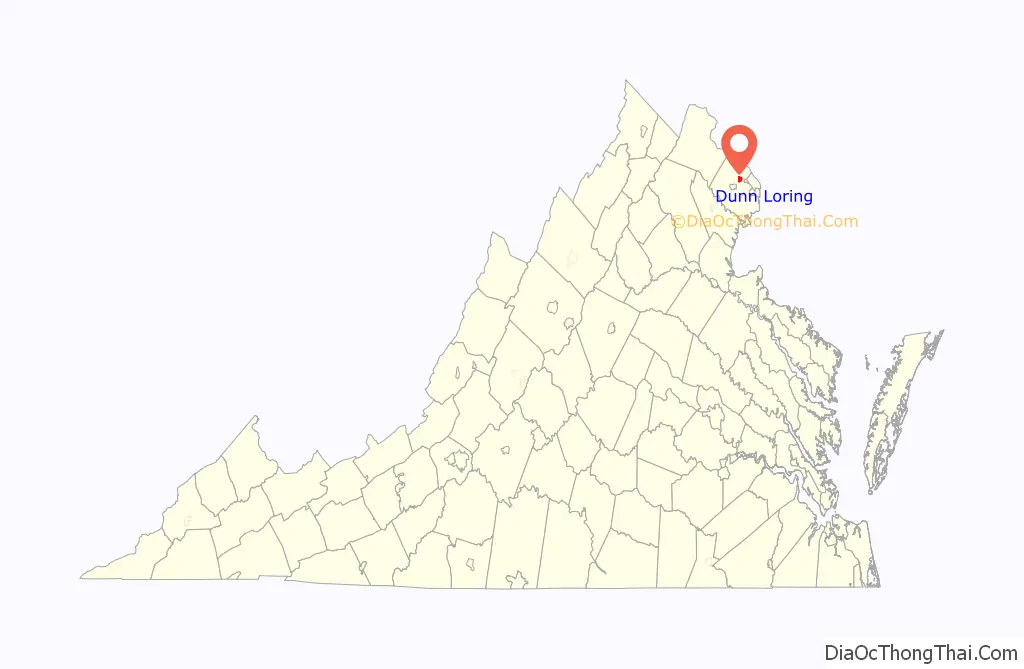
Dunn Loring location map. Where is Dunn Loring CDP?
History
Dunn Loring (archaic “Dunn-Loring”), the earliest platted subdivision in Fairfax County and possibly the Commonwealth of Virginia, was founded in 1886. General William McKee Dunn and his wife Elizabeth Lanier Dunn purchased about 600 acres (2.4 km) located on the Washington, Ohio and Western Railroad, now the Washington and Old Dominion Regional Trail, from L. B. Clarke and his wife on June 8, 1886. On September 22, 1886, the land was transferred to the Loring Land and Improvement Company, composed of General Dunn, then a retired Army brigadier general and former Judge Advocate General; George B. Loring, a former congressman and Commissioner of Agriculture; and George H. LeFetra, a Washington temperance hotel proprietor. The Town of Dunn Loring was advertised for residential sales in 1887. The Loring Land and Improvement Company built a railroad station and a post office, but shortly thereafter General Dunn died, and the development stagnated. During the Spanish–American War, the founding of Camp Russell A. Alger brought growth and prosperity to Dunn Loring, and among the troops trained at Camp Alger was the celebrated author-poet Carl Sandburg, after whom the present Sandburg Street was named. In 1912, Fairfax Shield McCandlish bought out the interests of the developers, consolidated parcels, and subdivided the land into its current platting. Following World War II, the area began to develop as part of Metropolitan Washington, D.C.
Up until the mid-1990s, large portions of the land (mainly between Lee Hwy and Gallows Rd.) had been horse farms and plantations before becoming gentrified.
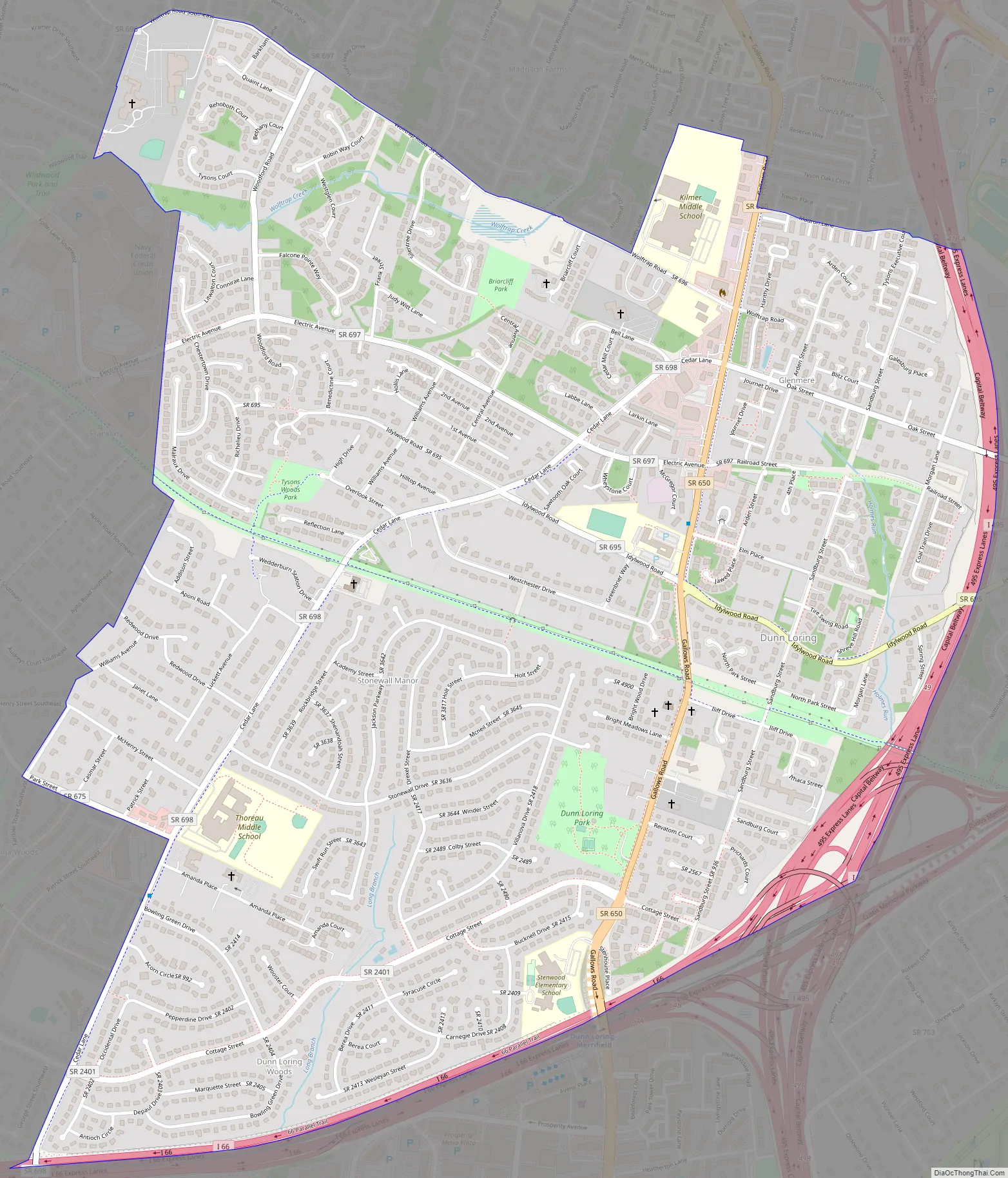
Dunn Loring Road Map
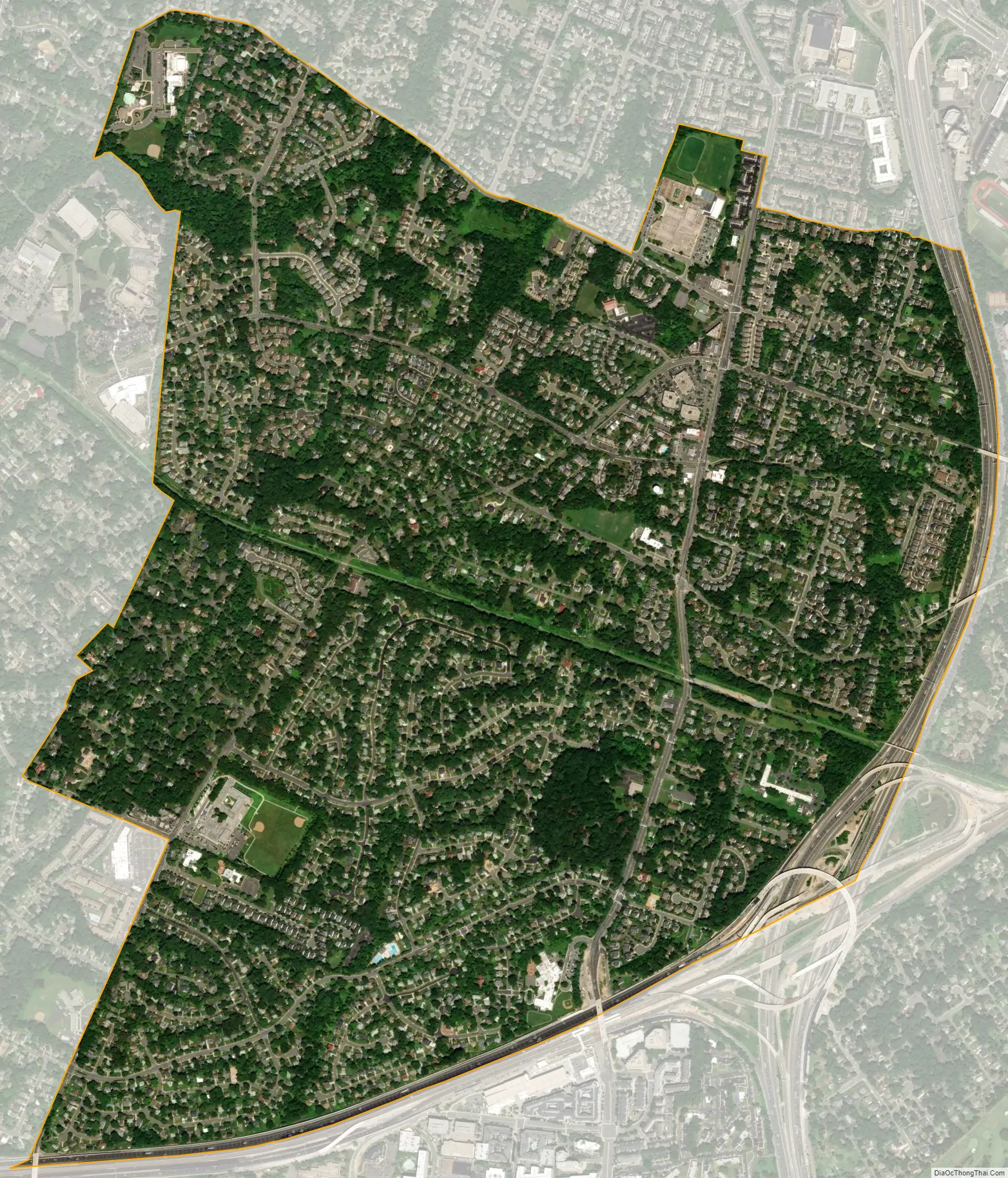
Dunn Loring city Satellite Map
Geography
Dunn Loring is located in northeastern Fairfax County at 38°53′31″N 77°13′52″W / 38.89194°N 77.23111°W / 38.89194; -77.23111 (38.891982, −77.231150). It is bordered to the west by the town of Vienna, to the north by Tysons Corner, to the east by the Capital Beltway, and to the south by Interstate 66. Dunn Loring is 14 miles (23 km) west of downtown Washington, D.C.
According to the U.S. Census Bureau, the CDP has a total area of 2.4 square miles (6.1 km), all of it land. Several perennial streams of Accotink Creek’s Long Branch stream run through the subdivision.
See also
Map of Virginia State and its subdivision:- Accomack
- Albemarle
- Alexandria
- Alleghany
- Amelia
- Amherst
- Appomattox
- Arlington
- Augusta
- Bath
- Bedford
- Bedford City
- Bland
- Botetourt
- Bristol
- Brunswick
- Buchanan
- Buckingham
- Buena Vista
- Campbell
- Caroline
- Carroll
- Charles City
- Charlotte
- Charlottesville
- Chesapeake
- Chesterfield
- Clarke
- Clifton Forge City
- Colonial Heights
- Covington
- Craig
- Culpeper
- Cumberland
- Danville
- Dickenson
- Dinwiddie
- Emporia
- Essex
- Fairfax
- Fairfax City
- Falls Church
- Fauquier
- Floyd
- Fluvanna
- Franklin
- Frederick
- Fredericksburg
- Galax
- Giles
- Gloucester
- Goochland
- Grayson
- Greene
- Greensville
- Halifax
- Hampton
- Hanover
- Harrisonburg
- Henrico
- Henry
- Highland
- Hopewell
- Isle of Wight
- James City
- King and Queen
- King George
- King William
- Lancaster
- Lee
- Lexington
- Loudoun
- Louisa
- Lunenburg
- Lynchburg
- Madison
- Manassas
- Manassas Park
- Martinsville
- Mathews
- Mecklenburg
- Middlesex
- Montgomery
- Nelson
- New Kent
- Newport News
- Norfolk
- Northampton
- Northumberland
- Norton
- Nottoway
- Orange
- Page
- Patrick
- Petersburg
- Pittsylvania
- Poquoson
- Portsmouth
- Powhatan
- Prince Edward
- Prince George
- Prince William
- Pulaski
- Radford
- Rappahannock
- Richmond
- Roanoke
- Roanoke City
- Rockbridge
- Rockingham
- Russell
- Salem
- Scott
- Shenandoah
- Smyth
- Southampton
- Spotsylvania
- Stafford
- Staunton
- Suffolk
- Surry
- Sussex
- Tazewell
- Virginia Beach
- Warren
- Washington
- Waynesboro
- Westmoreland
- Williamsburg
- Winchester
- Wise
- Wythe
- York
- Alabama
- Alaska
- Arizona
- Arkansas
- California
- Colorado
- Connecticut
- Delaware
- District of Columbia
- Florida
- Georgia
- Hawaii
- Idaho
- Illinois
- Indiana
- Iowa
- Kansas
- Kentucky
- Louisiana
- Maine
- Maryland
- Massachusetts
- Michigan
- Minnesota
- Mississippi
- Missouri
- Montana
- Nebraska
- Nevada
- New Hampshire
- New Jersey
- New Mexico
- New York
- North Carolina
- North Dakota
- Ohio
- Oklahoma
- Oregon
- Pennsylvania
- Rhode Island
- South Carolina
- South Dakota
- Tennessee
- Texas
- Utah
- Vermont
- Virginia
- Washington
- West Virginia
- Wisconsin
- Wyoming


